Barnum Island, New York | |
---|---|
Coordinates: 40°36′19″N73°38′51″W / 40.60528°N 73.64750°W | |
Country | United States |
State | New York |
County | Nassau County, New York |
Town | Hempstead |
Area | |
• Total | 1.24 sq mi (3.21 km2) |
• Land | 0.86 sq mi (2.24 km2) |
• Water | 0.37 sq mi (0.97 km2) |
Elevation | 0 ft (0 m) |
Population (2020) | |
• Total | 2,590 |
• Density | 2,994.22/sq mi (1,155.44/km2) |
Time zone | UTC-5 (EST) |
• Summer (DST) | UTC-4 (EDT) |
ZIP code | 11558 |
Area code | 516 |
FIPS code | 36-04550 |
GNIS feature ID | 1867393 |
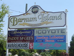
Barnum Island is a hamlet and census-designated place (CDP) in Nassau County, New York, United States. The population was 2,590 at the 2020 census. It occupies the eastern portion of an island situated between Long Island and Long Beach. That island, previously known in its entirety as Hog Island, consists entirely of the communities of Barnum Island and Island Park.
Barnum Island is an unincorporated area of the Town of Hempstead. Most of Barnum Island is separated from the Village of Island Park by the LIRR's Long Beach Branch rail line to Long Beach.
Barnum Island has its own fire district and school district, but is under contract with the Village of Island Park for fire and education services for its residents. Barnum Island is included in the Island Park School District and ZIP code (11558).
The E.F. Barrett Power Station is located within the hamlet.
Previously called Hog Island, after the feral pigs introduced by early European explorers to the Native Americans, it was later renamed for Sarah Ann Baldwin Barnum. It was also sometimes called Jekyl Island, after the name of the development company that bought it from the county. [2] [3]
Between 1851 and 1870, Sarah Ann's husband Peter owned large parcels of land on Long Island, though his primary business was a Manhattan clothier. Sarah Ann arranged the purchase of Hog Island for use as a "poor farm" – a self-supporting almshouse, a social innovation for that period, and the island was renamed in her honor. [4] [5]
Local lore connects the island's name to P.T. Barnum, the circus impresario, but this is incorrect, and likely due to confusion between "PT" and "PC" (Peter C.). [4]
The county discontinued the almshouse and sold the island to the Jekyl Island Realty Company in 1898 for $40,000. The company renamed it Jekyl Island. The island changed hands several times in 1909, Jekyl sold it to a syndicate of developers for $120,000, who in turn sold it for $650,000 in 1911. (There may have been an interim sale in 1910 as well.) [6] [7] [8] Minimal development at that time included construction of several canals, before work was abandoned. One of those canals divides the Harbor Isle section from Island Park.
New developers bought the island in 1921, and started building about 10,000 properties built in the 700 acre Island Park section in the center of the island starting in 1922. [2] [8] It was in use as a summer resort by 1925., [8] Island Park was incorporated as a village in 1926.
The rest of the island remains unincorporated, with the western portion known as Harbor Island, and the eastern portion retaining the name Barnum Island. However, all three make up the original Hog Island/Barnum Island, and are part of the Town of Hempstead.
The entire island was flooded with two to eight feet of water and sewage by Hurricane Sandy. [9]
Barnum Island is located at 40°36′19″N73°38′51″W / 40.60528°N 73.64750°W (40.605203, -73.647403). [10]
According to the United States Census Bureau, the CDP has a total area of 1.3 square miles (3.4 km2), of which 0.9 square miles (2.3 km2) is land and 0.4 square miles (1.0 km2) (28.24%) is water.[ citation needed ]
Census | Pop. | Note | %± |
---|---|---|---|
2020 | 2,590 | — | |
U.S. Decennial Census [11] |
As of the census [12] of 2020, there were 2,590 people, 1,062 housing units, and 958 households residing in the CDP. The population density was 2,877.7 inhabitants per square mile (1,111.1/km2). There were 1,062 housing units at an average density of 1,180 per square mile (460/km2). The racial makeup of the CDP was 68.03% White, 2.97% African American, 0.73% Native American, 6.06% Asian, 0.00% Pacific Islander, 9.22% from other races, and 9.53% from two or more races. Hispanic or Latino of any race were 19.45% of the population.
There were 958 households, out of which 58.9% were married couples living together, 11.1% had a female householder with no spouse present, and 28.0% had a male householder with no spouse present.
In the CDP, the population was spread out, with 6.2% under the age of 5, 18.0% under the age of 18, 82.0% was 18 years or older and 19.9% who were 65 years of age or older. The median age was 47 years. For every 100 females, there were 148.2 males.
The median income for a household in the CDP was $102,955. About 7.9% of the population were below the poverty line, including 19.9% of those under age 18 and 3.9% of those age 65 or over.
Nunley's Ferris wheel, formerly located at Nunley's Carousel and Amusement Park on the Baldwin-Freeport, New York border, is now located in Barnum Island, in Baldwin, New York. Nassau County purchased Nunley's Carousel in 1995, restored it, and reopened it in 2009 at the Cradle of Aviation Museum in Garden City, New York. Other Nunley's rides and games were sold at auction after the park closed in 1995 and are now scattered all over the country. [13]
Charlotte Park is a census-designated place (CDP) in Charlotte County, Florida, United States. The population was 2,667 at the 2020 census. It is part of the Sarasota-Bradenton-Punta Gorda Combined Statistical Area.
Heʻeia is a census-designated place comprising several neighborhoods located in the City & County of Honolulu and the Koʻolaupoko District on the island of Oʻahu north of Kāneʻohe. In Hawaiian the words heʻe ʻia mean "washed away", alluding to a victory achieved by the populace against others from leeward Oʻahu, aided by a tsunami that washed the combatants off the shore.
Kaumakani is a census-designated place (CDP) in Kauaʻi County, Hawaiʻi, United States. The population was 749 at the 2010 census, up from 607 at the 2000 census.
Harwich Port is a small affluent seaside community and census-designated place (CDP) situated along the Nantucket Sound in the town of Harwich in Barnstable County, Massachusetts, United States. It is named after the port of Harwich in Essex, England. As of the 2010 census, the CDP had a population of 1,644. It is a popular vacation spot on Cape Cod and is home to the Wychmere Beach Club and the Allen Harbor Yacht Club. Also, one of its popular mottos is "Three Harbors, One Port," referencing to Saquatucket, Wychmere, and Allen Harbor, which are all located in Harwich Port. Well known residents include Bill O'Brien, former head coach and general manager of the Houston Texans.
Reserve is a census-designated place (CDP) in Sheridan County, Montana, United States. The population was 23 at the 2010 census.
Baldwin is a hamlet located in the Town of Hempstead in Nassau County, on Long Island, New York, United States. It had a population of 33,919 in 2020.
Baldwin Harbor is a hamlet and former census-designated place (CDP) in the Town of Hempstead, in Nassau County, on Long Island, in New York, United States. It was created concomitant with the 1990 United States Census from the southernmost portions of the neighboring hamlet of Baldwin. As of the 2010 census, it had a population of 8,102.
East Atlantic Beach is a hamlet and census-designated place (CDP) in Nassau County, New York, United States. The population was 2,049 at the 2010 census. The unincorporated hamlet is governed by the Town of Hempstead, one of three towns in Nassau County.
Harbor Isle is a hamlet and census-designated place (CDP) in the Town of Hempstead in Nassau County, New York, United States. The population was 1,301 at the 2010 census.
West Hempstead is a hamlet and census-designated place (CDP) in the Town of Hempstead in Nassau County, on Long Island, in New York, United States. The population was 19,835 at the time of the 2020 census. It is an unincorporated area in the Town of Hempstead and is represented by Councilman Edward Ambrosino.
Centerport is a hamlet and census-designated place (CDP) in Suffolk County, New York, United States, on the notably affluent North Shore of Long Island, historically known as the Gold Coast. Formerly known as Little Cow Harbor in about 1700, as Centerport in 1836, and as Centerport after 1895, the name refers to its geographic position midway between the east and west boundaries of the town of Huntington.
Mount Sinai is a hamlet and census-designated place (CDP) located within the Town of Brookhaven, in Suffolk County, New York, United States. The population was 12,118 at the 2010 census. The hamlet is located on the North Shore of Long Island.
Northwest Harbor is a hamlet and census-designated place (CDP) in the Town of East Hampton, Suffolk County, New York, United States. The population was 3,317 at the 2010 census.
Springs is a census-designated place (CDP) roughly corresponding to the hamlet by the same name in the Town of East Hampton in Suffolk County, New York, United States, on the South Fork of Long Island. As of the 2010 United States Census, the CDP population was 6,592.
West Bay Shore is a hamlet and census-designated place (CDP) in the Town of Islip, Suffolk County, New York, United States. Its population was 4,648 at the 2010 census.
Port Ewen is a hamlet in Ulster County, New York, United States. The population was 3,678 at the 2020 census. Port Ewen is in the Town of Esopus, south of Kingston, along U.S. Route 9W.
Christie is a census-designated place (CDP) in Adair County, Oklahoma, United States. The population was 218 at the 2010 census, a 31.3 percent increase over the figure of 166 recorded in 2000.
Oak Grove is an unincorporated community in Clackamas County, Oregon, United States, in the Portland metropolitan area. For statistical purposes, the United States Census Bureau has defined Oak Grove as a census-designated place (CDP). The census definition of the area may not precisely correspond to local understanding of the area with the same name. The population was 16,629 at the 2010 census.
Freeland is an unincorporated community and census-designated place (CDP) on Whidbey Island in Island County, Washington, United States. At the time of the 2010 census the population was 7,812. The town received its name based on its origins as a socialist commune in the early 1900s: in the eyes of its founders, the land of the town was literally to be free for all people. Some of the first settlers were veterans of a prior experiment in socialism, the nearby Equality Colony.
Greenwich is a census-designated place (CDP) in Fairfield County, Connecticut, United States. It is one of several CDPs within the town of Greenwich and corresponds to the historic municipal center of the town and surrounding residential and commercial areas. As of the 2010 census, the population of the Greenwich CDP was 12,942, out of 61,171 in the entire town.