Muttontown, New York

Last updated

Muttontown, New York
Incorporated Village of Muttontown
Muttontown Village Hall Complex, Muttontown, Long Island, New York August 29, 2021 B.jpg
The Muttontown Village Hall Complex in 2021.
Nassau County New York incorporated and unincorporated areas Muttontown highlighted.svg
Location in Nassau County and the state of New York.
Location map Long Island.png
Red pog.svg
Muttontown, New York
Location on Long Island
USA New York location map.svg
Red pog.svg
Muttontown, New York
Location within the state of New York
Coordinates: 40°49′20″N73°31′37″W / 40.82222°N 73.52694°W / 40.82222; -73.52694
Country Flag of the United States.svg  United States
State Flag of New York.svg  New York
County Nassau
Town Oyster Bay
Incorporated 1931
Named for The area's historic use as a mutton (sheep) pasture
Government
   Mayor James Ligouri
   Deputy Mayor Sudha Prasad
Area
[1]
  Total6.06 sq mi (15.69 km2)
  Land6.06 sq mi (15.69 km2)
  Water0.00 sq mi (0.00 km2)
Elevation
285 ft (87 m)
Population
 (2020)
  Total3,512
  Density579.82/sq mi (223.87/km2)
Time zone UTC-5 (Eastern (EST))
  Summer (DST) UTC-4 (EDT)
Zip Codes
11545, 11732, 11753, 11771, 11791
Area codes 516, 363
FIPS code 36-49330
GNIS feature ID0958224
Website www.muttontownny.gov

Muttontown is a village located within the Town of Oyster Bay in Nassau County, on Long Island, in New York, United States. The population was 3,497 at the 2010 census. it is part of the Greater Oyster Bay area anchored by Oyster Bay.

Contents

History

The area historically was inhabited my the Matinecock Native Americans, and European colonists began to settle in the area during the 1600s. [2] During colonial times, the area was used to raise sheep for wool and meat. [2]

Muttontown incorporated as a village in 1931. [2] The name of the village stems from its former use as pasturage for sheep. [2]

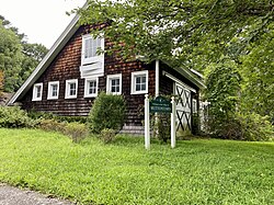
Zog of Albania bought the local Knollwood Estate in 1951, but sold it in 1955. The Benjamin Moore Estate was listed on the National Register of Historic Places in 1979. [3]

In 2007, a Muttontown couple was arrested after it was discovered that they had enslaved women from Indonesia as house servants. [4] [5] [6] [7] [8] The resulting trial saw Varsha and Mahender Sabhnani – the couple – being indicted on federal charges for involuntary servitude and keeping slaves. [7] [8] [9]

Geography

U.S. Census map of Muttontown. Muttontown-ny-map.gif
U.S. Census map of Muttontown.

According to the United States Census Bureau, the village has a total area of 6.1 square miles (16 km2), all land. [10]

The village lost some territory between the 2000 and 2010 censuses to Syosset. [11]

Demographics

Historical population
CensusPop.Note
1940 335
1950 38214.0%
1960 1,265231.2%
1970 2,08164.5%
1980 2,72530.9%
1990 3,02411.0%
2000 3,41212.8%
2010 3,4972.5%
2020 3,5120.4%
U.S. Decennial Census [12]

As of the census [13] of 2000, there were 3,412 people, 1,022 households, and 920 families residing in the village. The population density was 560.5 inhabitants per square mile (216.4/km2). There were 1,048 housing units at an average density of 172.1 per square mile (66.4/km2). The racial makeup of the village was 79.92% White, 1.82% African American, 16.00% Asian, 0.21% from other races, and 2.05% from two or more races. Hispanic and Latino of any race were 2.29% of the population.

There were 1,022 households, out of which 47.6% had children under the age of 18 living with them, 83.6% were married couples living together, 3.5% had a female householder with no husband present, and 9.9% were non-families. 7.4% of all households were made up of individuals, and 2.5% had someone living alone who was 65 years of age or older. The average household size was 3.34 and the average family size was 3.49.

In the village, the population was spread out, with 29.9% under the age of 18, 5.7% from 18 to 24, 23.4% from 25 to 44, 31.1% from 45 to 64, and 9.8% who were 65 years of age or older. The median age was 40 years. For every 100 females, there were 95.3 males. For every 100 females age 18 and over, there were 91.7 males.

The median income for a household in the village was in excess of $200,000. Males had a median income of $100,000 versus $53,846 for females. The per capita income for the village was $88,020. About 2.0% of families and 3.4% of the population were below the poverty line, including 1.8% of those under age 18 and 4.5% of those age 65 or over.

In 2009, Muttontown was ranked one of the wealthiest towns in America by BusinessWeek . [14]

Education

Muttontown is served by the Jericho Union Free School District, the Locust Valley Central School District, the Oyster Bay–East Norwich Central School District, and the Syosset Central School District. [15] As such, students who attend public schools and reside in Muttontown attend school in one of these four districts depending on where they live in the village. [15]

Notable people

Related Research Articles

<span class="mw-page-title-main">Nassau County, New York</span> County in New York, United States

Nassau County is an affluent inner suburban county located on Long Island, immediately to the east of New York City. As of the 2020 United States census, Nassau County's population was 1,395,774, making it the sixth-most populous county in New York State, and reflecting an increase of 56,242 (+4.2%) from the 1,339,532 residents enumerated at the 2010 census. Its county seat is Mineola, while the county's largest town is Hempstead.

<span class="mw-page-title-main">Bayville, New York</span> Village in New York, United States

Bayville is a village located in the Town of Oyster Bay in Nassau County, on the North Shore of Long Island, in New York, United States. The population was 6,669 at the 2010 census.

<span class="mw-page-title-main">Centre Island, New York</span> Village in New York, United States

Centre Island is a village located within the Town of Oyster Bay in Nassau County, on Long Island, in New York, United States. Its population was 410 as of the 2010 census.

<span class="mw-page-title-main">Cove Neck, New York</span> Village in New York, United States

Cove Neck is a village located within the Town of Oyster Bay in Nassau County, on the North Shore of Long Island, in New York. The population was 286 at the 2010 census.

<span class="mw-page-title-main">East Hills, New York</span> Village in New York, United States

East Hills is a village in Nassau County, on the North Shore of Long Island, in New York, United States. It is considered part of the Greater Roslyn area, which is anchored by the Incorporated Village of Roslyn. The population was 6,955 at the 2010 census.

<span class="mw-page-title-main">Hewlett Neck, New York</span> Village in New York, United States

Hewlett Neck is a village in the Town of Hempstead in Nassau County, on Long Island, in New York, United States. The population was 445 at the time of the 2010 census.

<span class="mw-page-title-main">Jericho, New York</span> Hamlet and census-designated place in New York, United States

Jericho is a hamlet and census-designated place (CDP) in Nassau County, New York, United States, on the North Shore of Long Island, approximately 29 miles (47 km) east of Midtown Manhattan. Its population was 13,567 as of the U.S. 2010 Census.

<span class="mw-page-title-main">Laurel Hollow, New York</span> Village in New York, United States

Laurel Hollow is a village in the Town of Oyster Bay in Nassau County, on the North Shore of Long Island, in New York, United States. The population was 1,952 at the 2010 census. According to Bloomberg BusinessWeek, Laurel Hollow was the eighth wealthiest town in America.

<span class="mw-page-title-main">Locust Valley, New York</span> Hamlet and census-designated place in New York, US

Locust Valley is a hamlet and census-designated place (CDP) located in the Town of Oyster Bay in Nassau County, on the North Shore of Long Island, in New York, United States. The population was 3,406 at the 2010 census.

<span class="mw-page-title-main">Massapequa Park, New York</span> Village in New York, United States

Massapequa Park is an incorporated village located within the southern portion of the Town of Oyster Bay in Nassau County, on the South Shore of Long Island, in New York. The population was 17,008 at the 2010 census.

<span class="mw-page-title-main">Mill Neck, New York</span> Village in New York, United States

Mill Neck is a village in the Town of Oyster Bay in Nassau County, on the North Shore of Long Island, in New York, United States. The population was 997 at the 2010 census.

<span class="mw-page-title-main">Old Brookville, New York</span> Village in New York, United States

Old Brookville is a village located within the Town of Oyster Bay in Nassau County, on the North Shore of Long Island, in New York, United States. The village population was 2,020 at the time of the 2020 census.

<span class="mw-page-title-main">Oyster Bay Cove, New York</span> Village in New York, United States

Oyster Bay Cove is a village located within the Town of Oyster Bay in Nassau County, on Long island, in New York. The population was 2,197 at the 2010 census. it is part of the Greater Oyster Bay area anchored by Oyster Bay.

<span class="mw-page-title-main">Roslyn, New York</span> Village in the United States

Roslyn is a village in the Town of North Hempstead in Nassau County, on the North Shore of Long Island, in New York, United States. It is the Greater Roslyn area's anchor community. The population was 2,770 at the 2010 census.

<span class="mw-page-title-main">South Farmingdale, New York</span> Hamlet and census-designated place in New York, United States

South Farmingdale is a hamlet and census-designated place (CDP) in the Town of Oyster Bay in Nassau County, on the South Shore of Long Island, in New York, United States. It is considered part of the Greater Farmingdale area, which is anchored by Farmingdale. The population of the CDP was 14,345 at the 2020 census.

<span class="mw-page-title-main">Syosset, New York</span> Hamlet and census-designated place in New York, United States

Syosset is a hamlet and census-designated place in the Town of Oyster Bay, in Nassau County, on the North Shore of Long Island, in New York, United States. The population was 19,259 at the 2020 census.

<span class="mw-page-title-main">Woodbury, Nassau County, New York</span> Hamlet and census-designated place in New York, United States

Woodbury is a hamlet and census-designated place (CDP) located within the Town of Oyster Bay in Nassau County, on Long Island, in New York, United States. The population was 8,907 at the 2010 census.

<span class="mw-page-title-main">Hampton Bays, New York</span> Hamlet and census-designated place in New York, United States

Hampton Bays is a hamlet and census-designated place (CDP) in the Town of Southampton in Suffolk County, on Long Island, in New York. It is considered as part of the region of Long Island known as The Hamptons. The population was 13,603 at the 2010 census.

<span class="mw-page-title-main">Oyster Bay (hamlet), New York</span> Hamlet and census-designated place in New York, United States

Oyster Bay is a hamlet and census-designated place (CDP) within the town of Oyster Bay on the North Shore of Long Island in Nassau County in the state of New York, United States. The hamlet is also the site of a station on the Oyster Bay Branch of the Long Island Rail Road and the eastern termination point of that branch of the railroad.

<span class="mw-page-title-main">Oyster Bay, New York</span> Town in New York, United States

The Town of Oyster Bay is the easternmost of the three towns which make up Nassau County, New York, United States. Part of the New York metropolitan area, it is the only town in Nassau County to extend from the North Shore to the South Shore of Long Island. As of the 2020 census, it had a population of 301,332.

References

  1. "ArcGIS REST Services Directory". United States Census Bureau. Retrieved September 20, 2022.
  2. 1 2 3 4 Winsche, Richard (October 1, 1999). The History of Nassau County Community Place-Names. Interlaken, New York: Empire State Books. ISBN   978-1557871541.
  3. "National Register Information System". National Register of Historic Places . National Park Service. March 13, 2009.
  4. "Opinion | Opening Our Eyes to Slavery". The New York Times. December 23, 2007. ISSN   0362-4331 . Retrieved May 28, 2023.
  5. Vitello, Paul (May 16, 2007). "Couple Held Two Servants Captive for Years, U.S. Says". The New York Times. ISSN   0362-4331 . Retrieved May 28, 2023.
  6. Vitello, Paul (December 3, 2007). "From Stand in Long Island Slavery Case, a Snapshot of a Hidden U.S. Problem". The New York Times. ISSN   0362-4331 . Retrieved May 28, 2023.
  7. 1 2 Konigsberg, Eric (June 23, 2008). "Couple's Downfall Is Culminating in Sentencing in Long Island Slavery Case". The New York Times. ISSN   0362-4331 . Retrieved May 28, 2023.
  8. 1 2 "USDOJ: US Attorney's Office - Eastern District of New York". www.justice.gov. Retrieved May 28, 2023.
  9. Riley, John (March 26, 2010). "'Slave' Case Convictions Stand". Newsday . pp. A26 via ProQuest.
  10. "US Gazetteer files: 2010, 2000, and 1990". United States Census Bureau. February 12, 2011. Retrieved April 23, 2011.
  11. "New York: 2010" (PDF). 2010. p. III-6. Retrieved October 1, 2021.
  12. "Census of Population and Housing". Census.gov. Retrieved June 4, 2015.
  13. "U.S. Census website". United States Census Bureau . Retrieved January 31, 2008.
  14. "The Wealthiest Towns in America: Muttontown, N.Y." p. 15. Part of: Gopal, Prashant (March 17, 2009). "Where the Rich (Still) Live". Bloomberg Businessweek . Retrieved December 29, 2010.
  15. 1 2 "Long Island Index: Interactive Map". www.longislandindexmaps.org. Retrieved August 9, 2021.
  16. Woollard, Deidre. "Chad Pennington in Muttontown, Estate of the Day". Luxist. Retrieved August 27, 2011.