Rockland County, New York

Last updated

Rockland County
Hook Mountain Nov2015.jpg
The Hudson River looking southward from Hook Mountain State Park
Flag of Rockland County, New York.svg
Seal of Rockland County, New York.png
Map of New York highlighting Rockland County.svg
Location within the U.S. state of New York
New York in United States.svg
New York's location within the U.S.
Coordinates: 41°09′N74°02′W / 41.15°N 74.03°W / 41.15; -74.03
CountryFlag of the United States.svg United States
StateFlag of New York.svg  New York
FoundedFebruary 23, 1798;226 years ago (1798-02-23) [1]
Named for Its rocky terrain
Seat New City
Largest town Ramapo
Government
  County ExecutiveEd Day (R)
Area
  Total199.34 sq mi (516.3 km2)
  Land173.55 sq mi (449.5 km2)
  Water25.79 sq mi (66.8 km2)  13%
Population
 (2020)
  Total338,329 [2]
  Estimate 
(2022) [3]
339,022
Time zone UTC−5 (Eastern)
  Summer (DST) UTC−4 (EDT)
Area code 845
Congressional district 17th
Website www.rocklandcountyny.gov
Rockland County, New York
Interactive map of Rockland County, New York

Rockland County is the second-southernmost county on the west side of the Hudson River in the U.S. state of New York, after Richmond County. It is part of the New York metropolitan area. As of the 2020 U.S. census, the county's population is 338,329, [4] making it the state's third-most densely populated county outside New York City after Nassau and neighboring Westchester Counties. The county seat and largest hamlet is New City. [5] Rockland County is accessible via the New York State Thruway, which crosses the Hudson to Westchester at the Tappan Zee Bridge ten exits up from the NYC border, as well as the Palisades Parkway five exits up from the George Washington Bridge. The county's name derives from "rocky land", as the area has been aptly described, largely due to the Hudson River Palisades. The county is part of the Hudson Valley region of the state.

Contents

Rockland County is the smallest county by area in New York outside New York City. It comprises five towns and nineteen incorporated villages, with numerous unincorporated villages (sixteen) and hamlets. Rockland County is designated as a Preserve America Community, and nearly a third of the county's area is parkland. The county has the largest Jewish population percentage of any U.S. county, at 31.4%, or 90,000 residents. [6] Rockland also ranked 80th on the list of highest-income counties by median household income in the United States, with a median household income of $82,534 according to the 2010 census.

History

Henry Hudson's Halve Maen (Half Moon) on the Hudson River Half Moon in Hudson.jpg
Henry Hudson's Halve Maen (Half Moon) on the Hudson River
The Carson McCullers House in South Nyack SouthNyackNY CarsonMcCullersHouse.jpg
The Carson McCullers House in South Nyack
DeWint House (circa 1700) is the oldest home in Rockland County DeWint House Tappan.JPG
DeWint House (circa 1700) is the oldest home in Rockland County
Historic Rockland County Courthouse in New City RocklandCountyCourthouse.jpg
Historic Rockland County Courthouse in New City
The territory of the Lenape in present-day southern New York, New Jersey, and eastern sections of Delaware and Pennsylvania Lenapehoking.png
The territory of the Lenape in present-day southern New York, New Jersey, and eastern sections of Delaware and Pennsylvania

The area that became Rockland County was originally inhabited by Algonquian-speaking Native Americans, including Munsees and Lenape. The Tappan tribe had a particularly noteworthy presence in the area, extending from present-day Nyack, south to Sparkill and Tappan, down the Hackensack River valley through present-day Bergen County, New Jersey, and also along the Palisades and Hudson River shore all the way to present-day Edgewater, New Jersey.

In 1609, Henry Hudson was the first major Dutch explorer to arrive in the area. Hudson, thinking he had found the legendary "Northwest Passage", sailed on the Half Moon up the river that would one day bear his name, and sailing through present-day Haverstraw before exploring north in present-day Albany.

In the years before 1664 when the area was formally a Dutch colony called New Netherland, present-day Rockland did not have formal European settlements. However, individuals did explore the area and made transactions with Tappan tribe for land with the idea that it could have future use. For example, in 1640, Dutch Captain David Pietersz. de Vries purchased from natives the area where the Sparkill Creek flows into the Hudson River.

In 1664, the British Crown assumed control of New Netherland from the Dutch. In June 1664, the Berkeley-Carteret land grant established the colony of New Jersey, dividing present-day Rockland and Bergen Counties into separate political areas. The northern border of New Jersey was placed in a straight line from the Delaware River at present-day Port Jervis to the Hudson River at 41 degrees even North latitude, where the Palisades Cliffs pause and give way to Sneden's Landing in Orangetown. The state line remains there to this day, though various disagreements along the exact border were had over the years.

In the 1670s, permanent Dutch settlers began to arrive with land grants, starting with the Tappan area. [7] These settlers were eager to escape "city life", moving from Manhattan to Rockland. A number of unique, Dutch-style red sandstone houses still stand, and many place names in the county reveal their Dutch origin.

In 1683, when the Duke of York (who became King James II of England) established the first 12 counties of New York, [8] present-day Rockland County was part of Orange County, known then as "Orange County South of the Mountains". Orangetown was created at the same time under a royal grant, originally encompassing all of modern Rockland County. Around this time, as the English began to colonize Nyack and Tappan, the Native Americans began to leave Rockland in search of undisturbed land further north. [7]

The natural barrier of the Ramapo Mountains and the size of the county made carrying out governmental activities difficult. At one point, two governments were active, one on each side of the Ramapo Mountains, so Rockland split off from Orange in 1798 to form its own county. [1] That same year, the county seat was transferred from Tappan to New City, where a new courthouse was built.

Haverstraw was separated from Orangetown in 1719, and became a town in 1788; it included the present-day Clarkstown, Ramapo, and Stony Point. Clarkstown and Ramapo became towns in 1791, followed by Stony Point in 1865.

During the American Revolution, when control of the Hudson River was viewed by the British as strategic to dominating the American territories, Rockland had skirmishes at Haverstraw, Nyack, and Piermont, and significant military engagements at the Battle of Stony Point, where General "Mad" Anthony Wayne earned his nickname. George Washington had headquarters for a time at John Suffern's tavern, the later site of the village of Suffern. British Major John André met with American traitor Benedict Arnold near Stony Point to buy the plans for the fortifications at West Point. André was captured with the plans in Tarrytown on his way back to the British lines; he was brought to Tappan for trial in the Tappan church, found guilty, hanged, and buried nearby. Still another important chapter in the story of the Revolution was written on May 5, 1783, when General Washington received Sir Guy Carleton at the DeWint House, where they discussed terms of a peace treaty. Two days later, Washington visited Sir Guy aboard a British war vessel H.M.S Perseverance. [9] On this day, the king's navy fired its first salute to the flag of the United States of America.

In the decades following the Revolution, Rockland became popular for its stone and bricks. Many buildings in New York City were built with bricks made in Rockland. These products, however, required quarrying in land that many later believed should be set aside as a preserve. Many unsuccessful efforts were made to turn much of the Hudson Highlands on the northern tip of the county into a forest preserve. Union Pacific Railroad president E. H. Harriman, though, donated land and large sums of money for the purchase of properties in the area of Bear Mountain. Bear Mountain/Harriman State Park became a reality in 1910 when Harriman's widow donated his lands to the state, and by 1914, more than an estimated one million people a year were coming to the park. After World War I, Rockland County became the most important sausage-making hub in New York. [10] [11] [12]

In 1911, Letchworth Village, an institution for the mentally disabled opened in Rockland County near Thiells. The institution gained national infamy in 1972, when an investigation by Geraldo Rivera revealed the patients there to having been housed in neglectful conditions. Letchworth closed in 1996.

Rockland remained semirural until the 1950s, when the Palisades Interstate Parkway, Tappan Zee Bridge, and other major arteries were built. In the decades that followed, the county became a maturely developed suburb of New York City. As people moved up from the five boroughs (particularly the Bronx in the early years) the population flourished from 89,276 in 1950 to 338,329 in 2020.

Geography

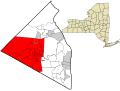
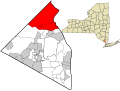
Rockland County lies just north of the New Jersey-New York border, west of Westchester County (across the Hudson River), and south of Orange County. Its east border is formed by the Tappan Zee portion of the Hudson River. [13] The county's terrain ranges from 1,283 ft (391 m) ASL on Rockhouse Mountain (northwest of Lake Welch) [14] to approaching sea level along the Hudson River. According to the US Census Bureau, the county has a total area of 199.34 sq mi (516.3 km2), of which 173.55 sq mi (449.5 km2) are land and 25.79 sqmi (66.80 km2) (13%) are covered by water. [15] It is the state's smallest county outside the five boroughs of New York City.

About 30% of Rockland County is devoted to parkland, belonging to either the five towns, incorporated villages, the state, or the county. These parks provide walking and hiking trails, ballfields, dog runs, historic sites, ponds, streams, salt marshes, and equestrian trails. Some popular state parks include Bear Mountain State Park on the northernmost tip of the county, Harriman State Park, also along the county's northern boundary, and Nyack Beach State Park along the Hudson River, with trails connecting to Rockland Lake State Park. The county hosts numerous public and private golf courses, with the towns of Orangetown, Ramapo, Stony Point, and Haverstraw all operating public golf courses within their towns. The Palisades Interstate Park Commission operates two golf courses in Rockland Lake State Park. Notable private courses in the county include Paramount Country Club, Manhattan Woods Golf Course (designed by PGA great Gary Player), and Rockland Country Club (Sparkill).

Ramapo Torne in Harriman State Park, part of the Ramapo Mountains Ramapo Torne.jpg
Ramapo Torne in Harriman State Park, part of the Ramapo Mountains
Overlooking Rockland County with NYC skyline in far background Clarkstown NY Landscape.JPG
Overlooking Rockland County with NYC skyline in far background
Pine Meadow Lake in Harriman State Park Pine Meadow Lake.jpg
Pine Meadow Lake in Harriman State Park
Haverstraw along the Hudson River Haverstraw NY Skyline.JPG
Haverstraw along the Hudson River

Adjacent counties

Lakes

Climate

Climate data for New City, NY (1991-2020 Averages)
MonthJanFebMarAprMayJunJulAugSepOctNovDecYear
Mean daily maximum °F (°C)37.5
(3.1)
40.7
(4.8)
48.5
(9.2)
61
(16)
71.1
(21.7)
79.6
(26.4)
84.5
(29.2)
82.7
(28.2)
76.1
(24.5)
64.1
(17.8)
53
(12)
42.6
(5.9)
61.8
(16.6)
Mean daily minimum °F (°C)20.9
(−6.2)
22.6
(−5.2)
29.7
(−1.3)
40.2
(4.6)
49.9
(9.9)
59.2
(15.1)
64.3
(17.9)
62.7
(17.1)
55.4
(13.0)
44
(7)
34.5
(1.4)
27.2
(−2.7)
42.6
(5.9)
Average precipitation inches (mm)3.59
(91)
2.69
(68)
4.09
(104)
3.92
(100)
3.72
(94)
4.76
(121)
4.32
(110)
4.81
(122)
4.45
(113)
4.44
(113)
3.84
(98)
4.19
(106)
48.82
(1,240)
Average dew point °F (°C)19.5
(−6.9)
19.9
(−6.7)
25.5
(−3.6)
35.6
(2.0)
47.7
(8.7)
58.3
(14.6)
63.6
(17.6)
62.9
(17.2)
56.7
(13.7)
45.3
(7.4)
33.6
(0.9)
25.9
(−3.4)
41.2
(5.1)
Mean daily daylight hours 9.610.71213.414.515.114.813.812.511.19.99.312.2
Source 1: PRISM [16]
Source 2: weather-us.com [17]

Demographics

Historical population
CensusPop.Note
1800 6,353
1810 7,75822.1%
1820 8,83713.9%
1830 9,3886.2%
1840 11,97527.6%
1850 16,96241.6%
1860 22,49232.6%
1870 25,21312.1%
1880 27,6909.8%
1890 35,16227.0%
1900 38,2988.9%
1910 46,87322.4%
1920 45,548−2.8%
1930 59,59930.8%
1940 74,26124.6%
1950 89,27620.2%
1960 136,80353.2%
1970 229,90368.1%
1980 259,53012.9%
1990 265,4752.3%
2000 286,7538.0%
2010 311,6878.7%
2020 338,3298.5%
2022 (est.)339,0220.2%
US Decennial Census [18]
1790-1960 [19] 1900-1990 [20]
1990-2000 [21] 2010, 2019 [2]

2020 census

As of the 2020 United States Census, [22] 338,329 people and 100,438 households were residing in the county. The population density was 1,950 people per square mile (750 people/km2). The 107,002 housing units averaged 617 units per square mile (238/km2).

Rockland County Demographics
Racial demographics of Rockland according to 2020 US Census Bureau data: [23]
RacePercentage
White (Whites of non-Hispanic origin: 62.7%)77.9%
Hispanics and Latinos (of any race)18.4%
Black 13.1%
Asian 6.2%
Multiracial 2.1%
American Indian and Alaska Native persons 0.6%
Native Hawaiian and Other Pacific Islander persons 0.1%

Of the 107,002 households, 38% had children under the age of 18 living with them, 63% were married couples living together, 10% had a female householder with no husband present, and 23% were not families. Around 19% of households were made up of individuals, and 8% had someone living alone who was 65 or older. The average household size was 3.0 and the average family size was 3.5.

The county's age distribution was 28.4% under 18, 8% from 18 to 24, 28% from 25 to 44, 24.30% from 45 to 64, and 12% who were 65 or older. The median age was 36 years. For every 100 women, there were 95 men. For every 100 women age 18 and over, there were 91 men.

The median income for a household was $93,024 and for a family was $80,000. Males had a median income of $58,000 versus $39,000 for females. The per capita income for the county was $39,286. The mean, or average, income for a family in Rockland County is $73,500 according to the 2004 census. About 6% of families and 12.5% of the population were below the poverty line, including 14% of those under age 18 and 8% of those age 65 or over.

2000 census

As of the 2000 United States Census, [24] 286,753 people, 92,675 households, and 70,989 families were residing in the county. The population density was 1,652 people per square mile (638 people/km2). The 94,973 housing units averaged 547 units per square mile (211/km2). Residents live closer together than the census numbers indicate, as 30% of the county is reserved as parkland. About 9% of residents reported speaking Spanish at home, 5% Yiddish, 3% French-based creole, 1.5% Italian, 1.3% Tagalog, 1.3% Hebrew, 1.2% French, and 1% Russian. Other languages spoken at home by at least 1000 people include Malayalam, Korean, Chinese, German, and Polish.

Orthodox Jewish community

As of 2017, the Orthodox Jewish and Hasidic Jewish communities are 15 percent of the population in Rockland County. [25]

Education

Blue ribbon School Logo United States Department of Education Blue Ribbon School Logo.jpg
Blue ribbon School Logo
Cherry Lane Elementary School Cherry Lane School.JPG
Cherry Lane Elementary School

The county is home to several Blue Ribbon School of Excellence Award winners, awarded by the U.S. Department of Education:

School districts

School districts include: [26]

High schools

Colleges and universities

The county is home to several colleges and universities:

Transportation

Tappan Zee Bridge Mario Cuomo Bridge Overhead.jpg
Tappan Zee Bridge

The Governor Mario M. Cuomo Bridge, commonly called the Tappan Zee Bridge, connects South Nyack in Rockland County and Tarrytown in Westchester County across the Hudson River in the Lower Hudson Valley of New York. The old bridge was replaced with a new span in 2017. [28] [29]

Major highways

The county is served by several major highways, including Interstate 87/287 (the New York Thruway), opening from Suffern to Yonkers in 1955. The old Tappan Zee Bridge opened the same year, connecting Rockland and Westchester, allowing Rockland County's population to grow rapidly. The Palisades Interstate Parkway, a project of master planner Robert Moses, and built between 1947 and 1958, connects the county directly to the George Washington Bridge due south. The Garden State Parkway opened in 1955, connecting New Jersey to I-87/287.

For further information

Bus

Hybrid electric bus operated by Transport of Rockland TOR Bus.JPG
Hybrid electric bus operated by Transport of Rockland

The Transport of Rockland operates several local bus routes throughout the county, and the express bus Hudson Link routes to city centers and train stations in Tarrytown and White Plains in Westchester County. TOR provides connections to other neighborhood bus operations – Minitrans [32] and connections to private commuter lines, Rockland Coaches and Short Line providing service to northern New Jersey and New York City.

Transportation map RocklandBusMap.pdf
Transportation map

Railroad

NJ Transit/Metro-North Railroad operates the Port Jervis Line, which stops at the Suffern Railroad Station and Sloatsburg Station, and the Pascack Valley Line, whose stops include Pearl River, Nanuet, and Spring Valley. in their respective hamlets and village of the same name. Connections on this line are available at Secaucus for service to Penn Station in Midtown Manhattan and service to the Meadowlands Sports Complex in East Rutherford, New Jersey. The southern terminus of both lines is Hoboken Terminal in New Jersey, where connections can be made to several NJ Transit bus lines, ferries, and PATH trains to New York City.

Until 1958, Rockland County's eastern side was served by the New York Central Railroad's passenger service on the West Shore Railroad from Weehawken, New Jersey, opposite midtown Manhattan up through Tappan, West Nyack, Congers, and Haverstraw, on to the West Hudson shore cities of Newburgh, Kingston, and Albany. The service ran to West Haverstraw, in the north of the until 1959. [33] [34] The Erie Railroad ran train service on the Northern Branch through the southeastern corner of the county to Nyack up to 1966. [35]

Ferry

NY Waterway operates a ferry service between Haverstraw and Ossining in Westchester County for the Metropolitan Transportation Authority. Commuters take the Transport of Rockland's Ferry Express route to the Haverstraw ferry terminal for service to Metro-North's Hudson Line service to Grand Central Terminal. Ferry service is typically suspended in the colder months when the Hudson River freezes over, and commuters must take shuttle buses across the Tappan Zee Bridge.

Airports

Nearby airports include:

Law, government, and politics

All of Rockland County falls within the 17th Congressional District, along with central and western Westchester County. The district is represented by Congressman Mike Lawler.

United States House of Representatives
Name
Party
Mike Lawler
Republican


The county of Rockland is represented as follows in the New York State Senate as of 2023: [36] [37]

Rockland County Senate Members
Name
Party
Bill Weber
Republican
Peter Harckham
Democrat


The county of Rockland is represented as follows in the New York State Assembly as of 2023:

Rockland County Assembly Members
Name
Party
Kenneth P. Zebrowski
Democrat
John W. McGowan
Republican
Karl A. Brabenec
Republican
Christopher Eachus
Democrat

Rockland County government is led by a county executive. Republican Ed Day was first elected in 2013 and re-elected in 2017 & 2021. The previous county executive was Republican C. Scott Vanderhoef, who was re-elected in 2009 to his fifth four-year term. Day is the third county executive in Rockland history, with Vanderhoef having defeated the incumbent, John T. Grant (D), in 1993. Prior to 1985, Rockland County did not have a county executive.

Rockland County has a county legislature made up of 17 members, elected from single-member districts. [38] The Chairman of the Legislature is Democrat Jay Hood Jr. As of November 2023, the legislators are: [39] [40]

Rockland County Legislators
DistrictLegislatorPartyArea Represented
1
Douglas J. JobsonRepublican Stony Point
2
Paul C ClearyDemocrat West Haverstraw
3
Jay Hood Jr. ChairDemocrat Haverstraw
4
Itamar YegerDemocrat Wesley Hills
5
Lon M. Hofstein Minority LeaderRepublican New City
6
Alden H. Wolfe Majority LeaderDemocrat Suffern
7
Philip Soskin Deputy Majority LeaderDemocrat Monsey
8
Toney L. EarlDemocrat Hillcrest
9
Raymond Sheridan IIIRepublican Pearl River
10
Beth DavidsonDemocrat West Nyack
11
Will KennellyRepublican Congers
12
Jesse MalowitzDemocrat Airmont
13
Aron B. WiederDemocrat Monsey
14
Aney Paul Vice ChairDemocrat Nanuet
15
Joel FriedmanDemocrat Chestnut Ridge
16
Thomas F. Diviny Deputy Minority LeaderRepublican Pearl River
17
Dana StilleyDemocrat Sparkill

Town governments

The five towns of Rockland County are led by town supervisors and town boards. The villages encompassed in the towns are led by mayors and village trustees.
As of the November 2023 elections, the town supervisors are:

Rockland County Town Supervisors
Town
Supervisor
Party
Clarkstown
George A. Hoehmann
Republican
Haverstraw
Howard T. Phillips Jr.
Democrat
Orangetown
Teresa M. Kenny
Republican
Ramapo
Michael Specht
Democrat
Stony Point
Jim Monaghan
Republican

County courts

Rockland County Courthouse, New City RocklandCountyCourthouse.jpg
Rockland County Courthouse, New City

There are three types of general trial courts in Rockland County: the New York Supreme Court, the County Court, and the Justice Courts. The Supreme Court is the trial level court of the New York State Unified Court System, which presents some confusion as the Supreme Court is the highest court of appeals in the federal system, as well as in most states (the Court of Appeals is the highest court in New York). The Supreme Court has broad authority over all categories of cases, both civil and criminal. Generally, the Supreme Court in Rockland County hears civil cases involving claims in excess of $25,000. While the Supreme Court has jurisdiction over criminal cases in most counties, this is handled by the County Courts. In Rockland, however, the Supreme Court does exercise jurisdiction over some criminal cases.

The County Court is inferior to the Supreme Court and is authorized to hear criminal cases that have occurred in the county as well as limited jurisdiction over civil cases. The County Court handles felony cases exclusively and shares jurisdiction with the town and village justice courts on misdemeanor cases and other minor offenses and violations. The County Court's jurisdiction on civil cases is limited to those involving less than $25,000.

Each of the towns and 15 of the villages have Justice Courts, which mostly hear routine traffic ticket cases, especially from the New York State Thruway and the Palisades Interstate Parkway. They also handle drunk driving charges, lower-level criminal misdemeanor matters, and occasionally perform arraignment on felonies (most felony proceedings are heard in County Court). These courts generally handle the highest volume of cases.

Law enforcement

On March 1, 2024, Deirdre Smith was sworn in as the first female officer to serve as chief of detectives for Rockland County. [41]

National politics

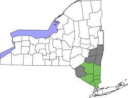
Like most of the Hudson Valley, Rockland County historically voted Republican but in recent years has usually voted Democratic. Between 1892 and 1992, Rockland County was won only three times by Democrats in presidential elections– in Lyndon B. Johnson's landslide victory in 1964, Franklin D. Roosevelt's landslide in 1936 (in which it was the only New York City suburb to vote Democratic), and Woodrow Wilson's first campaign in 1912, when Republicans were fractured into two tickets. Rockland shifted Democratic in 1992, and has since voted Republican just once, in 2004 for George W. Bush. Despite this shift, national elections have remained close in Rockland County compared to in neighboring Westchester County, which has delivered dependable Democratic victories since the 1990s.

Rockland County has not voted for a nationwide popular vote loser since 1976, tied for the longest streak in the country with St. Joseph County, Indiana, and Caddo Parish, Louisiana. In 2016 and 2000, it voted for Hillary Clinton and Al Gore, respectively, both of whom won the popular vote but lost the Electoral College.

United States presidential election results for Rockland County, New York [42] [43]
Year Republican  /  Whig Democratic Third party
No.%No.%No.%
2020 73,18648.56%75,80250.30%1,7141.14%
2016 60,91145.09%69,34251.33%4,8343.58%
2012 57,42846.07%65,79352.78%1,4241.14%
2008 61,75246.71%69,54352.61%8980.68%
2004 65,13049.63%64,19148.91%1,9101.46%
2000 48,44139.51%69,53056.72%4,6193.77%
1996 40,39535.99%63,12756.24%8,7197.77%
1992 49,60840.72%56,75946.59%15,46412.69%
1988 63,82556.83%47,63442.42%8420.75%
1984 70,02060.88%44,68738.85%3110.27%
1980 59,06856.26%35,27733.60%10,64810.14%
1976 52,08751.30%48,67347.93%7800.77%
1972 64,75364.29%35,77135.52%1960.19%
1968 40,88049.07%36,94844.35%5,4796.58%
1964 26,18736.15%46,17363.74%820.11%
1960 33,10754.81%27,17845.00%1130.19%
1956 34,04971.04%13,88128.96%00.00%
1952 27,65764.39%15,08435.12%2120.49%
1948 20,66157.83%13,06636.57%2,0015.60%
1944 19,47159.00%13,43740.72%910.28%
1940 20,04056.77%14,89742.20%3621.03%
1936 15,58348.56%15,87649.47%6311.97%
1932 13,96349.90%13,34747.70%6722.40%
1928 15,73260.34%9,76937.47%5712.19%
1924 11,91560.92%5,64028.84%2,00410.25%
1920 11,16966.10%5,05729.93%6713.97%
1916 5,04152.19%4,46946.27%1491.54%
1912 2,22124.55%4,24146.87%2,58628.58%
1908 4,85752.64%3,93742.67%4334.69%
1904 4,28348.99%4,24648.57%2132.44%
1900 4,18750.16%4,02148.17%1391.67%
1896 4,33656.95%3,00239.43%2763.62%
1892 2,90941.01%3,78953.42%3955.57%
1888 3,01341.83%3,93954.69%2513.48%
1884 2,59340.26%3,69757.40%1512.34%
1880 2,68843.96%3,41555.86%110.18%
1860 1,41037.31%2,36962.69%00.00%
1856 66821.34%1,52648.74%93729.93%

Sports

Clover Stadium, home of the New York Boulders Provident Bank Ballpark.JPG
Clover Stadium, home of the New York Boulders

Media

Health

According to Scorecard.org, which integrates data from different sources including the United States Environmental Protection Agency (EPA), in 2002, Rockland County ranked among the worst 10% in the United States in terms of air releases. [53] Recent EPA statistics show that a total of 66 presently active Rockland County facilities are currently regulated. [54] In Scorecard's list of Top 10 polluters from 2002, the Lovett generating station in Tompkins Cove is the top polluter, releasing 1,523,339 pounds of toxic emissions. [55] Studies were released in 2000 and in 2004 by the Clean Air Task Force to study the impacts of power plant emissions in the United States. This data for Rockland County shows that a total of $2,150,800 was paid in compensation for numerous illnesses caused by power plant pollution, including asthma attacks, heart attacks and death. [56] The Lovett generating station was closed and dismantled prior to 2014. From 2015 to 2018, the Haverstraw Quarry owned and managed by CRH Tilcon and Oldcastle Materials was heavily fined for air and water pollution, including over-blasting, over-excavating, non-viable use of its NESCO unhealthy dust suppression systems and lethal dust & water runoffs into protected waterways. In the period from 2017 to 2020, Suez experienced instances of discolored water and odor complaints. During 2020, the Rockland County Health Dept. and New York State Department of Environmental Conservation (NYSDEC) Conservationfound/investigated and informed Suez of untreated polluted water at Tilcon operated discharge points at a stream that flows into Lake DeForest. After discovery, Tilcon stopped pumping the waste. [57] [58] Higher cancer rates in Rockland County as compared to Manhattan associate towards drinking water quality, aging drink water infrastructure/storm drain runoff concerns. [59] [60] [61]

Recently, COVID-19 pandemic was first confirmed to have reached Rockland County on March 6, 2020. [62] After the areas of Spring Valley and Monsey were identified as having the highest infection rates, County Executive Ed Day requested that state emergency management declare those areas a closed containment zone. [63] As of July 4, 2021, there are a total of 47,027 COVID-19 cases and 966 deaths. [64] At 14,450 cases per 100,000, Rockland had the greatest density of COVID-19 cases of any New York county. 47% of the population and 58% of the eligible population (aged 12 and over) have been vaccinated. [65] The Orthodox Jewish community, the largest in the country, have some of the lowest vaccination rates in the state; Monsey's is the lowest in the state, at 17.8%, as of June 15, 2021. [66]

News reports confirmed that the first known case of polio in the United States in a decade was discovered in Rockland County in July 2022. [67] [68]

Solar field

In 2014, Clarkstown created a first-of-its-kind in New York State 2.3-megawatt solar system consisting of about 4,300 panels on top of a closed, highly regulated, flat shadeless 13-acre section of the former garbage landfill in West Nyack. The unit is sized to generate 3 million kilowatt-hours annually – enough power to supply about 200 homes, that provides one-third of the electric needs of the Town of Clarkstown government. The Clarkstown solar field project is at the maximum size that is currently allowed by New York State. The installation was projected to save taxpayers as much as $4 million over 30 years by reducing the amount of the town's annual electric bill – which is about $2 million and produce 10 percent of all the electricity that O&R gets through solar power. The project was installed in summer 2014, coming online in October. [69] [70] [71]

Municipalities

County map, with town and village boundaries Map of Rockland County.png
County map, with town and village boundaries

Paul W. Adler, the chairperson of the Rockland County's Jewish Community Relations Council, said in a 1997 New York Times article that "There are two reasons villages get formed in Rockland. One is to keep the Hasidim out and the other is to keep the Hasidim in." [72]

Administrative divisions of New York
There are five towns in Rockland County. The most populous is Ramapo at 148,919, while the least populous is Stony Point, at 14,655, according to the 2020 US Census.
There are eighteen incorporated villages in Rockland County after the April, 2022, dissolution of the Village of South Nyack, twelve of which are located at least partially in the town of Ramapo, and none of which are in Stony Point.
There are seventeen Census-designated places and seven Hamlets within the five towns of Rockland County.

Towns

Washington Avenue Soldier's Monument in Ramapo Suffern Soldier's Monument.jpg
Washington Avenue Soldier's Monument in Ramapo

Clarkstown is divided into 4 wards [73] for the purposes of municipal representation

Villages

Census-designated places

Hamlets

Defunct communities

Points of interest

Educational and cultural

Commercial and entertainment

Parks

See also

Related Research Articles

<span class="mw-page-title-main">Clarkstown, New York</span> Town in New York, United States

Clarkstown is a town in Rockland County, New York, United States. The town is on the eastern border of the county, located north of the town of Orangetown, east of the town of Ramapo, south of the town of Haverstraw, and west of the Hudson River. As of the 2020 census, the town had a total population of 86,855. The hamlet of New City, the county seat of Rockland County, is also the seat of town government and of the Clarkstown Police Department, the county sheriff's office, and the county correctional facility. New City makes up about 41.47% of the town's population.

<span class="mw-page-title-main">Nanuet, New York</span> Census-designated place in New York, United States

Nanuet is a hamlet and census-designated place in the town of Clarkstown, Rockland County, New York, United States. The third largest hamlet in Clarkstown, it is located north of Pearl River, south of New City, east of Spring Valley, and west of West Nyack. It is located midway between Manhattan and Bear Mountain, 19 miles (31 km) north and south of each respectively; and 2 miles (3 km) north of the New Jersey border. It has one of three Rockland County stations on New Jersey Transit's Pascack Valley Line. The population of Nanuet was 17,882 at the 2010 census.

<span class="mw-page-title-main">New City, New York</span> Census-designated place in New York, United States

New City is a hamlet and census-designated place in the town of Clarkstown, Rockland County, New York, United States, part of the New York Metropolitan Area. An affluent suburb of New York City, the hamlet is located 18 miles (29 km) north of the city at its closest point, Riverdale, Bronx. Within Rockland County, New City is located north of Bardonia, northeast of Nanuet, east of New Square and New Hempstead, south of Garnerville and the village of Haverstraw, and west of Congers. New City's population was 35,101 at the 2020 census, making it the 14th most populous CDP/hamlet in the state of New York.

<span class="mw-page-title-main">Nyack, New York</span> Village in New York, United States

Nyack is a village located primarily in the town of Orangetown in Rockland County, New York, United States. Incorporated in 1872, it retains a very small western section in Clarkstown. The village had a population of 7,265 as of the 2020 census. It is a suburb of New York City lying approximately 15 miles (24 km) north of the Manhattan boundary near the west bank of the Hudson River, situated north of South Nyack, east of Central Nyack, south of Upper Nyack, and southeast of Valley Cottage.

<span class="mw-page-title-main">Orangetown, New York</span> Town in New York, United States

Orangetown is a town in Rockland County, New York, United States, located in the southeastern part of the county. It is northwest of New York City, north of New Jersey, east of the town of Ramapo, south of the town of Clarkstown, and west of the Hudson River. The population was 48,655 at the 2020 census.

<span class="mw-page-title-main">Piermont, New York</span> Village in New York, United States

Piermont is a village incorporated in 1847 in Rockland County, New York, United States. Piermont is in the town of Orangetown, located north of the hamlet of Palisades, east of Sparkill, and south of Grand View-on-Hudson, on the west bank of the Hudson River. The population was 2,517 at the 2020 census. Woody Allen set The Purple Rose of Cairo, a fictional film within The Purple Rose of Cairo (1984) in Piermont.

<span class="mw-page-title-main">Ramapo, New York</span> Town in New York, United States

Ramapo is a town in Rockland County, New York, United States. It was originally formed as New Hampstead, in 1791, and became Ramapo in 1828. It shares its name with the Ramapo River. As of the 2020 census, Ramapo had a total population of 148,919, making it the most populous town in New York outside of Long Island. If all towns in New York were cities, Ramapo would be the 12th-largest city in the state of New York.

<span class="mw-page-title-main">Haverstraw, New York</span> Town in New York, United States

Haverstraw is a town in Rockland County, New York, United States, located north of the Town of Clarkstown and the Town of Ramapo; east of Orange County; south of the Town of Stony Point; and west of the Hudson River. The town runs from the west to the east border of the county in its northern section. The population was 39,087 at the 2020 census.

<span class="mw-page-title-main">Interstate 287</span> Interstate Highway in New Jersey and New York

Interstate 287 (I-287) is an auxiliary Interstate Highway in the US states of New Jersey and New York. It is a partial beltway around New York City, serving northern New Jersey and the counties of Rockland and Westchester in New York. I-287, which is signed north–south in New Jersey and east–west in New York, follows a roughly horseshoe-shaped route from the New Jersey Turnpike (I-95) in Edison, New Jersey, clockwise to the New England Thruway (I-95) in Rye, New York, for 98.72 miles (158.87 km). Through New Jersey, I-287 runs west from its southern terminus in Edison through suburban areas. In Bridgewater Township, the freeway takes a more northeasterly course, paralleled by US Route 202 (US 202). The northernmost part of I-287 in New Jersey passes through mountainous surroundings. After crossing into New York at Suffern, I-287 turns east on the New York State Thruway (I-87) and runs through Rockland County. After crossing the Hudson River on the Tappan Zee Bridge, I-287 splits from I-87 near Tarrytown and continues east through Westchester County on the Cross-Westchester Expressway until it reaches the New England Thruway. Within New Jersey, I-287 is maintained by the New Jersey Department of Transportation (NJDOT), and, within New York, it is maintained by the New York State Thruway Authority (NYSTA).

<span class="mw-page-title-main">Rockland Lake State Park</span> State park in New York, United States

Rockland Lake State Park is a 1,133-acre (4.59 km2) state park located in the hamlets of Congers and Valley Cottage in the eastern part of the Town of Clarkstown in Rockland County, New York, United States. The park is located on a ridge of Hook Mountain above the west bank of the Hudson River. Included within the park is the 256-acre (1.04 km2) Rockland Lake.

<span class="mw-page-title-main">Area codes 845 and 329</span> Telephone area code in New York state

Area codes 845 and 329 are telephone area codes in the North American Numbering Plan (NANP) for the U.S. state of New York. The numbering plan area comprises the mid- and lower Hudson Valley, specifically Orange, Putnam, Rockland, and Ulster counties, and parts of Columbia, Delaware, Dutchess, Greene, and Sullivan counties.

<span class="mw-page-title-main">New York State Route 59</span> State highway in Rockland County, New York, US

New York State Route 59 (NY 59) is an east–west state highway in southern Rockland County, New York, in the United States. The route extends for 14.08 miles (22.66 km) from NY 17 in Hillburn to U.S. Route 9W (US 9W) in Nyack. In Suffern, it has a concurrency with US 202 for 0.05 miles (0.08 km). NY 59 runs parallel to the New York State Thruway its entire route. The routing of NY 59 became a state highway in 1911 and was signed as NY 59 in the late 1920s.

<span class="mw-page-title-main">New York State Route 304</span> State highway in Rockland County, New York, US

New York State Route 304 (NY 304), also known as "Rockland County Clerk Paul Piperato Memorial Highway", as well as Pearl Street for its first half a mile and Main Street for other parts, is a north–south state highway located in central Rockland County, New York, in the United States. The 10.38-mile (16.70 km) route begins at the New Jersey–New York border in Pearl River and ends at an intersection with U.S. Route 9W (US 9W) in the community of Congers. The route is a main route through Rockland County, intersecting NY 59 and indirectly connecting to the New York State Thruway and the Palisades Interstate Parkway (PIP) in Nanuet. NY 304 has three distinct sections: a freeway that extends from Pearl River to Nanuet, an at-grade section between Nanuet and New City, and a surface bypass linking New City to Haverstraw.

<span class="mw-page-title-main">New York State Route 303</span> State highway in Rockland County, New York, US

New York State Route 303 (NY 303) is a north–south state highway in eastern Rockland County, New York, in the United States. It begins at the New Jersey state line in the hamlet of Tappan and runs generally northward for 10.92 miles (17.57 km) to an intersection with U.S. Route 9W (US 9W) in Clarkstown. The route has connections to the Palisades Interstate Parkway and the New York State Thruway, the latter carrying Interstate 87 (I-87) and I-287. NY 303 was assigned as part of the 1930 renumbering of state highways in New York, and only minor realignments have occurred since that time.

<span class="mw-page-title-main">County Route 33 (Rockland County, New York)</span> County road in Rockland County, New York, US

County Route 33 is a 12.7 miles (20.4 km) south–north county route in the central part of Rockland County, New York. Prior to 1970, portions of CR 33 were designated as the old route of New York State Route 304. Today, CR 33 serves as an alternative route for NY 304 from Pearl River to New City where NY 304 ends at US 9W. North of New City, CR 33 serves as an alternative route for the US 9W/US 202 multiplex in northern Rockland County.

<span class="mw-page-title-main">County Route 106 (Rockland County, New York)</span> Highway in Rockland County, New York

County Route 106 (CR 106) is a 7.8-mile (12.6 km) east–west county route in Rockland County, New York, in the United States. It serves as an eastward continuation of Kanawauke Road, extending from the Orange County line to U.S. Route 9W (US 9W) and US 202 in Stony Point via Harriman State Park. CR 106 intersects with several county highways in Rockland County along the way. The route was only one of two in Rockland County to keep its numbering from Orange County, with the other being CR 72. CR 106 had one spur route, CR 106A, which was recently decommissioned.

The recorded history of Rockland County, New York begins on February 23, 1798, when the county was split off from Orange County, New York and formed as its own administrative division of the state of New York. It is located 6 miles (9.7 km) north-northwest of New York City, and is part of the New York Metropolitan Area. The county seat is the hamlet of New City. The name comes from rocky land, an early description of the area given by settlers. Rockland is New York's southernmost county west of the Hudson River. It is suburban in nature, with a considerable amount of scenic designated parkland. Rockland County does not border any of the New York City boroughs, but is only 9.5 miles (15.3 km) north of Manhattan at the counties' two respective closest points

<span class="mw-page-title-main">Sparkill Creek</span> River in New Jersey, United States

Sparkill Creek, is a tributary of the Hudson River in Rockland County, New York and Bergen County, New Jersey in the United States. It flows through the Sparkill Gap in the Hudson Palisades, which was created by a fault line which provided the only sea-level break in the Palisades.

<span class="mw-page-title-main">Eugene Levy (politician)</span> American politician (1926–1990)

Eugene Levy was a member of the New York State Senate for the 38th District covering all of Rockland County and parts of Orange County, New York. He was elected to the New York State Senate in 1984, where he remained for three terms.

<span class="mw-page-title-main">Section 1 (NYSPHSAA)</span> High school athletic league in New York

Section 1 is a high school athletic organization that is one of the eleven sections of the New York State Public High School Athletic Association (NYSPHSAA). It is made up of high schools from around the southern portion of the Hudson Valley. The section offers "modified athletics" administration covering grades 7-9 middle school competition in area middle schools. Schools will sometimes compete with other schools outside of the section in tournaments or invitationals. The section is further divided into leagues based on mostly location but also the size of the school. The schools in the section compete with each other over the course of three seasons, fall, winter, and spring.

References

  1. 1 2 Sullivan, James; Williams, Melvin E.; Conklin, Edwin P.; Fitzpatrick, Benedict, eds. (1927). "Chapter II. Rockland County.". History of New York State, 1523–1927 (PDF). Vol. 2. New York City, Chicago: Lewis Historical Publishing Co. p. 421. hdl:2027/mdp.39015019994048. Wikidata   Q114149636.
  2. 1 2 "QuickFacts Rockland County, New York". United States Census Bureau . Retrieved March 31, 2018.
  3. "QuickFacts: Rockland County, New York". Census.gov. Retrieved July 7, 2023.
  4. "QuickFacts Rockland County, New York". United States Census Bureau. Retrieved August 26, 2021.
  5. "Find a County". National Association of Counties. Retrieved June 7, 2011.
  6. "Rockland County". New York State. Retrieved January 4, 2019.
  7. 1 2 "County of Rockland, New York :: Home". Co.rockland.ny.us. Archived from the original on March 11, 2012. Retrieved February 3, 2013.
  8. "History and Facts of New York Counties". February 16, 2019.
  9. "RocklandHistory.org". www.rocklandhistory.org.
  10. "Italian Food Center". Italian Food Center.
  11. "Italian Fest Returns To Blauvelt". Pearl River, NY Patch. August 3, 2018.
  12. "Event and Party Photos: On the Town (August 2011)". July 5, 2011.
  13. "Rockland County". Rockland County.
  14. "Rockhouse Mountain - Peakbagger.com". www.peakbagger.com.
  15. "2010 Census Gazetteer Files". US Census Bureau. August 22, 2012. Archived from the original on May 19, 2014. Retrieved January 7, 2015.
  16. "PRISM Climate Group, Oregon State University" . Retrieved August 9, 2021.
  17. "Climate and monthly weather forecast New City, NY" . Retrieved December 4, 2022.
  18. "US Decennial Census". US Census Bureau. Retrieved July 10, 2019.
  19. "Historical Census Browser". University of Virginia Library. Retrieved January 7, 2015.
  20. "Population of Counties by Decennial Census: 1900 to 1990". US Census Bureau. Retrieved January 7, 2015.
  21. "Census 2000 PHC-T-4. Ranking Tables for Counties: 1990 and 2000" (PDF). US Census Bureau. Retrieved January 7, 2015.
  22. "U.S. Census Quickfacts". US Census Bureau. Retrieved October 10, 2021.
  23. "Rockland County QuickFacts from the US Census Bureau". Quickfacts.census.gov. Retrieved September 11, 2021.
  24. "U.S. Census website". US Census Bureau. Retrieved January 31, 2008.
  25. Hellman, Gershon (November 15, 2017). "Will Ed Day's Victory in Rockland County Hurt the Orthodox Community?". Ami . No. 342. pp. 48–50.
  26. "2020 census - school district reference map: Rockland County, NY" (PDF). U.S. Census Bureau . Retrieved July 21, 2022. - Text list
  27. "Home Page - Nanuet Union Free School District". www.nanuetsd.org.
  28. Saeed, Khurram; Juva-Brown, Theresa (December 17, 2012). "It's official: State picks builder for new Tappan Zee Bridge". Copyright © 2012 www.lohud.com. All rights reserved. Retrieved January 9, 2013.
  29. "Governor Mario M. Cuomo Bridge" . Retrieved July 16, 2013.
  30. "2014 New York Laws :: HAY - Highway :: Article 12 - (340-A - 345-A) STATE ROUTES :: 343-C - Portion of state highway system in the county of Rockland to be designated as". Justia Law.
  31. "NY State Senate Bill S6221". NY State Senate. April 15, 2021.
  32. "Minitrans". Town.clarkstown.ny.us. Archived from the original on May 15, 2016. Retrieved February 3, 2013.
  33. "Comments On The West Shore from James Knecht". Nyc.railfan.net. Retrieved January 19, 2018.
  34. "New York Central Railroad, Table 50". Official Guide of the Railways. 92 (7). National Railway Publication Company. December 1959.
  35. "COMMUTERS LOSE BID TO KEEP ERIE TRAINS", The New York Times, p. 58, October 3, 1966, retrieved June 7, 2010
  36. "NY Senate District 38". NY State Senate.
  37. "NY Senate District 39". NY State Senate.
  38. "County of Rockland, New York :: Elected Officials". rocklandgov.com.
  39. "County of Rockland, New York :: Contact County Legislature". rocklandgov.com.
  40. Legislative District Maps
  41. Lieberman, Steve (March 4, 2024) Deidre Smith Named Rockland DA's Chief of Detectives, First Woman to Hold Post, lohud.com. Retrieved March 13, 2024.
  42. Leip, David. "Atlas of US Presidential Elections". uselectionatlas.org. Retrieved November 12, 2020.
  43. "2020 Presidential Election Results". The New York Times . November 3, 2020. Retrieved December 1, 2020.
  44. "Nyack Baseball: Rich in History and Tradition". Nyack-Piermont, NY Patch. February 28, 2012.
  45. "The Journal News | lohud.com | Westchester, Rockland, Putnam news". The Journal News.
  46. "WRCR AM 1700 – RADIO UNSCRIPTED!". www.wrcr.com.
  47. [undefined://www.lefthudson.com/ "Unsplash Home"]. STACKOVERFLOW MASKODING. January 26, 2022.
  48. "Internet Radio: Rockland World Radio". www.rocklandworldradio.com.
  49. "Nyack News and Views". Nyack News and Views.
  50. http://www.rocklandreviewnews.com/ [ bare URL ]
  51. "The Hook". The Hook.
  52. "Rockland County's Best Magazine". www.bestlocalmag.com. Archived from the original on October 22, 2008. Retrieved January 12, 2022.
  53. "Rockland County's general pollution report card". Scorecard.goodguide.com. October 28, 2003. Retrieved February 3, 2013.
  54. "Envirofacts Rockland county data sheet". Oaspub.epa.gov. December 22, 2008. Retrieved February 3, 2013.
  55. "Scorecard's Top ten polluters". Scorecard.goodguide.com. Retrieved February 3, 2013.
  56. "Clean Air Task Force interactive map". Catf.us. January 1, 1979. Archived from the original on March 3, 2012. Retrieved February 3, 2013.
  57. "NYS Dept. of Health visits Rockland amidst Suez Water complaints". News 12 - Westchester.
  58. Matsuda, Akiko. "DEC cites Tilcon on Haverstraw Quarry". The Journal News.
  59. D'Onofrio, Michael. "Haverstraw: Dust, noise are facts of life with Tilcon as neighbor". The Journal News.
  60. "State DEC Issues Violation Against Haverstraw Quarry". North Rockland Daily Voice. November 30, 2015.
  61. "Division of Mineral Resources Statewide Contacts - NYS Dept. of Environmental Conservation". www.dec.ny.gov.
  62. Taliaferro, Lanning (March 23, 2020). "Coronavirus Cases In Rockland Triple, 5 Dead: Update". Patch.com . Retrieved July 4, 2021.
  63. Cutler, Nancy; Brum, Robert; Lieberman, Steve (April 2, 2020). "Coronavirus: Rockland county executive demands containment zone; see map of cases". The Journal News .
  64. "JHU COVID-19 Dashboard". Johns Hopkins University. July 4, 2021. Retrieved July 4, 2020.
  65. "New York Coronavirus Map and Case Count". The New York Times . July 4, 2021. ISSN   0362-4331 . Retrieved July 4, 2021.
  66. Reich, Aaron (June 15, 2021). "Ultra-Orthodox zip codes have some of New York's worst vaccination rates". The Jerusalem Post . Retrieved July 4, 2021.
  67. Meko, Hurubie (July 21, 2022). "First Polio Case in Nearly a Decade Is Detected in New York State". NY Times . Retrieved August 12, 2022. A case of polio has been identified in an unvaccinated adult man in Rockland County, officials said.
  68. Sun, Lena H.; Johnson, Mark (July 21, 2022). "Unvaccinated man in Rockland County, N.Y., diagnosed with polio". Washington Post . Retrieved August 12, 2022. The first U.S. case of polio in nearly a decade has been confirmed in an unvaccinated individual in Rockland County, N.Y., local and state health officials announced Thursday.
  69. "Clarkstown Turns Old Landfill Into Solar Energy Field". Rockland Times. July 8, 2014. Retrieved July 10, 2019.
  70. "Supervisor Hoehmann Invited to Speak in Arlington, VA About Clarkstown's Solar Field". The Rockland County Times. March 17, 2017.
  71. "Supervisor Bio".
  72. Berger, Joseph. "Growing Pains for a Rural Hasidic Enclave." The New York Times . January 13, 1997.
  73. "Clarkstown Ward Districts" (PDF).
  74. Westfair Online
  75. Randall, Mike (April 29, 2022) "Discrimination Settlement Will Cost Rockland Bakery $850K", lohud.com. Retrieved September 8, 2023.
  76. Rockland Bakery. (n.d.). Our History. Retrieved March 30, 2020, from www.rocklandbakery.com

Further reading