When counties were established in the Province of New York in 1683, the present Broome County was part of the enormous Albany County, including the northern part of New York State as well as all of the present State of Vermont and, in theory, extending westward to the Pacific Ocean. This county was reduced in size on July 3, 1766, by the creation of Cumberland County, and further on March 16, 1770, by the creation of Gloucester County, both containing territory now in Vermont.
On March 12, 1772, what was left of Albany County was split into three parts, one remaining under the name Albany County. One of the other pieces, Tryon County, contained the western portion (and thus, since no western boundary was specified, theoretically still extended west to the Pacific). The eastern boundary of Tryon County was approximately five miles west of the present city of Schenectady, and the county included the western part of the Adirondack Mountains and the area west of the West Branch of the Delaware River. The area then designated as Tryon County now is organized as 37 counties of New York State. The county was named for William Tryon, colonial governor of New York.
In the years prior to 1776, most of the Loyalists in Tryon County fled to Canada. In 1784, following the peace treaty that ended the American Revolutionary War, the name of Tryon County was changed to Montgomery County, for General Richard Montgomery, who had captured several places in Canada and died attempting to capture the city of Quebec, thus replacing the name of the hated British governor.
On March 28, 1806, Broome County was formed by splitting several towns off from Tioga County.[3] At the time, this included all of Broome County's current area, as well as the then-named town of Tioga (renamed the town of Owego in 1813) and the town of Berkshire. Small portions of land were lost to Cortland County and Tompkins County in 1815 and 1817, respectively.[4] The towns of Owego and Berkshire were returned to Tioga County on March 21, 1822, establishing the present-day boundaries of Broome County.[4][5]
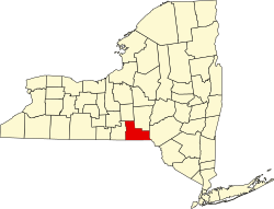
Geography
A skyline view of the city of Binghamton, New York, June 6, 2023, from the First Ward neighborhood.
Broome County lies on the southern line of New York. Its southern border abuts the northern boundary of the state of Pennsylvania. The Susquehanna River flows southward through the eastern part of the county, enters Susquehanna County in Pennsylvania, then re-enters Broome and flows northwestward to meet the Chenango River at Binghamton. The combined flow moves west-southwestward into Tioga County to the west. The West Branch Delaware River flows southward along the lower portion of the county's east border, delineating that portion of the border between Broome and Delaware counties.[6]
The county's western portion is hilly, with wide valleys that accommodate Binghamton and its suburbs. In the northern portion, Interstate 81 traverses a wide glacial valley. The eastern part of the county is much more rugged, as the land rises to the Catskill Mountains. The terrain generally slopes to the west.[7] The county's highest point is in the southeast of the county, a U.S. National Geodetic Surveybenchmark known as Slawson atop an unnamed hill in the Town of Sanford. It is approximately 2,087 feet (636m)[8] above sea level.[9] An area due east on the Delaware County line in Oquaga Creek State Park also lies within the same elevation contour line. The lowest point is 864 feet (263m) above sea level, along the Susquehanna River, at the Pennsylvania state line.
The county has a total area of 716 square miles (1,850km2), of which 706 square miles (1,830km2) is land and 9.7 square miles (25km2) (1.4%) is water.[10]
Broome County, New York – Racial and ethnic composition Note: the US Census treats Hispanic/Latino as an ethnic category. This table excludes Latinos from the racial categories and assigns them to a separate category. Hispanics/Latinos may be of any race.
There were 80,749 households, out of which 28.20% had children under the age of 18 living with them, 47.60% were married couples living together, 10.80% had a female householder with no husband present, and 37.80% were non-families. 31.00% of all households were made up of individuals, and 12.40% had someone living alone who was 65 years of age or older. The average household size was 2.37 and the average family size was 2.97.
The county population contained 23.00% under the age of 18, 11.00% from 18 to 24, 26.80% from 25 to 44, 22.80% from 45 to 64, and 16.40% who were 65 years of age or older. The median age was 38 years. For every 100 females there were 93.20 males. For every 100 females age 18 and over, there were 89.90 males.
The median income for a household in the county was $35,347, and the median income for a family was $45,422. Males had a median income of $34,426 versus $24,542 for females. The per capita income for the county was $19,168. About 8.80% of families and 12.80% of the population were below the poverty line, including 15.90% of those under age 18 and 7.20% of those age 65 or over.
For the past few decades, Broome County has been a swing county. Since 1964 the county has selected Democratic and Republican party candidates at approximately the same rate in national elections (as of 2024). The more recent elections had favored the Democratic candidate, until Donald Trump carried the county in 2016, the first Republican to win the county since Ronald Reagan in 1984. Joe Biden carried Broome with 50.5% of the vote in 2020. In 2024, the county went for Democrat Kamala Harris, although she only managed to carry it by a 379-vote plurality.[27] In Broome County, Democratic strength comes primarily from Binghamton and its suburbs, such as Johnson City and Endicott, while Republicans dominate the outer, rural parts of the county.
United States presidential election results for Broome County, New York[28]
Broome County's offices are housed in the Edwin L. Crawford County Office Building of Government Plaza located at 60 Hawley Street in Downtown Binghamton.
The Broome County Legislature consists of 15 members.[30] The 15 legislature members are elected from individual districts. As of 2024, there are 9 Republicans and 6 Democrats.
School resource officers contracted through the DA's office [39]
Broome County Government Security Division (NYS peace officers with quasi-law enforcement status, including powers of arrest and carrying firearms. They are located at county property, as well as county events.)
Additionally, the 536-bed Broome County Jail is operated by the Broome County sheriff's office.[41]
The Broome County Law Enforcement Academy facilitates the New York State-mandated basic course for police officers, which includes over 700 hours of instruction. All municipal police officers and deputy sheriffs within Broome County attend this academy. In addition, oftentimes officers from outside Greater Binghamton attend the academy. The academy frequently hosts officers from the Elmira-Corning area, Syracuse metropolitan area, and other regions within New York State.[42]
Education
The primary institutes of higher education in Broome County include:
John Ducey (b. 1969), actor, born in Broome County
Barzillai Gray (1824–1918), judge, born in Broome County
Robert Harpur (1731–1825), colonial teacher, politician, pioneer, for whom Harpur College (now Binghamton University) was named, settled at Harpursville
This page is based on this Wikipedia article Text is available under the CC BY-SA 4.0 license; additional terms may apply. Images, videos and audio are available under their respective licenses.