Chenango Forks, New York

Last updated
Chenango Forks, New York
USA New York location map.svg
Red pog.svg
Chenango Forks
Coordinates: 42°14′08″N75°50′54″W / 42.23556°N 75.84833°W / 42.23556; -75.84833 Coordinates: 42°14′08″N75°50′54″W / 42.23556°N 75.84833°W / 42.23556; -75.84833
Country United States
State New York
County Broome
Towns Chenango, Barker
Elevation
915 ft (279 m)
Time zone UTC-5 (Eastern (EST))
  Summer (DST) UTC-4 (EDT)
ZIP code
13746 [1]
Area code 607
GNIS feature ID946482 [2]

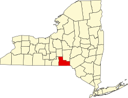
Chenango Forks is a hamlet located in Broome County, New York, United States. [2] The community is situated partly in the town of Chenango and partly in the town of Barker.

Chenango Forks in the early 1900s Chenango Forks, NY early 1900s.jpg
Chenango Forks in the early 1900s

Chenango Forks is approximately 9 miles (14 km) north of Binghamton on Route 12 and is at the confluence of the Chenango and Tioughnioga rivers. Chenango Valley State Park is southwest of the hamlet. Chenango Forks is a few miles from the border of Chenango County. [ citation needed ]

Chenango Forks is part of the Greater Binghamton Metropolitan Statistical Area.

The Chenango Canal Prism and Lock 107 was listed on the National Register of Historic Places in 2010. [3]

Related Research Articles

<span class="mw-page-title-main">Chenango, New York</span> Town in New York, United States

Chenango is a town in Broome County, New York, United States. The population was 10,983 at the 2020 census.

<span class="mw-page-title-main">Colesville, New York</span> Town in New York, United States

Colesville is a town in Broome County, New York, United States. The population was 4,877 at the 2020 census.

<span class="mw-page-title-main">Conklin, New York</span> Town in New York, United States

Conklin is a town in Broome County, New York, United States. Per the 2020 census, the population was 5,008.

<span class="mw-page-title-main">Port Dickinson, New York</span> Village in New York, United States

Port Dickinson is a village in Broome County, New York, United States. The population was 1,641 at the 2010 census. It is part of the Binghamton Metropolitan Statistical Area.

<span class="mw-page-title-main">Vestal, New York</span> Town in Broome County, New York, US

Vestal is a town within Broome County in the Southern Tier of New York, United States, and lies between the Susquehanna River and the Pennsylvania border. As of the 2020 census, the population was 29,110.

Coventry is a town in Chenango County, New York, United States. The population was 1,655 at the 2010 census. The town is named after Coventry, Connecticut, by settlers from New England. Coventry is in the southern part of Chenango County and is northeast of Binghamton.

<span class="mw-page-title-main">Guilford, New York</span> Town in New York, United States

Guilford is a town in Chenango County, New York, United States. The town is on the eastern border of the county. The population was 2,922 at the 2010 census.

Smithville is a town in Chenango County, New York, United States. The population was 1,330 at the 2010 census. The town is at the western border of Chenango County, west of the city of Norwich.

<span class="mw-page-title-main">Jay, New York</span> Town in New York, United States

Jay is a town in Essex County, New York, United States. The population was 2,506 at the 2010 census. The town is named after John Jay, governor of New York when the town was formed.

<span class="mw-page-title-main">Earlville, New York</span> Village in New York, United States

Earlville is a village in Chenango County, New York, United States. The population was 872 at the 2010 census. The village is named after Jonas Earl, a canal commissioner.

<span class="mw-page-title-main">Binghamton (town), New York</span> Town in New York, United States

Binghamton is a town in Broome County, New York, United States. The population was 4,623 at the 2020 census. The town is named after an early developer, William Bingham.

Afton is a village in Chenango County, New York, United States. The population was 822 at the 2010 census. The village is named after the poem "Sweet Afton" by Scottish poet Robert Burns, referring to the River Afton in Ayrshire, Scotland.

<span class="mw-page-title-main">Greene (village), New York</span> Village in New York, United States

Greene is a village in Chenango County, New York, United States. The population was 1,580 at the 2010 census. The village is named after General Nathanael Greene. It is within the town of Greene and is northeast of Binghamton.

<span class="mw-page-title-main">Oxford (village), New York</span> Village in New York, United States

Oxford is a village in Chenango County, New York, United States. The population was 1,450 at the 2010 census. The village is named after Oxford, Massachusetts, the hometown of the landowner.

<span class="mw-page-title-main">Oxford, New York</span> Town in New York, United States

Oxford is a town in Chenango County, New York, United States. The town contains a village also named Oxford. Oxford is an interior town in the south-central part of the county, southwest of the city of Norwich. At the 2010 census the town population was 3,901. The name derives from that of the native town of an early landowner from New England

<span class="mw-page-title-main">Smyrna, New York</span> Town in New York, United States

Smyrna is a town in Chenango County, New York, United States. The population was 1,280 at the 2010 census. Smyrna is named after a coastal city in ancient Greece, nowadays modern Izmir in Turkey.

<span class="mw-page-title-main">Chenango River</span> River in New York, United States

The Chenango River is a 90-mile-long (140 km) tributary of the Susquehanna River in central New York in the United States. It drains a dissected plateau area in upstate New York at the northern end of the Susquehanna watershed.

<span class="mw-page-title-main">Chenango Canal</span> United States historic place

The Chenango Canal was a towpath canal in central New York in the United States which linked the Susquehanna River to the Erie Canal. Built and operated in the mid-19th century, it was 97 miles long and for much of its course followed the Chenango River, along New York State Route 12 from Binghamton on the south end to Utica on the north. It operated from 1834 to 1878 and provided a significant link in the water transportation system of the northeastern U.S. until supplanted by the region's developing railroad network.

<span class="mw-page-title-main">New York State Route 319</span> Former highway in New York

New York State Route 319 (NY 319) was a state highway in Chenango County, New York, in the United States. It was 5.47 miles (8.80 km) long and connected the hamlet of Preston to the nearby city of Norwich. The route began in the hamlet at an intersection with three county-maintained highways and proceeded eastward through the town of Preston to downtown Norwich, where it terminated at an intersection with NY 12.

Rockdale is a hamlet in the town of Guilford, Chenango County, New York, United States. It is located on the Unadilla River, a southward-flowing tributary of the Susquehanna River.

References

  1. "Chenango Forks ZIP Code". zipdatamaps.com. 2022. Retrieved November 11, 2022.
  2. 1 2 "Chenango Forks". Geographic Names Information System . United States Geological Survey, United States Department of the Interior.
  3. "National Register Information System". National Register of Historic Places . National Park Service. March 13, 2009.