Union, New York

Last updated
Union, New York
Endicott-Johnson Workers Arch, approximately 250' east of intersection of Bridge, Endicott (Broome County, New York).jpg
Village of Endicott
Town of Union NY Locator Map.png
Map highlighting Union's location within Broome County.
USA New York location map.svg
Red pog.svg
Union
Location within the state of New York
Coordinates: 42°6′53″N76°1′18″W / 42.11472°N 76.02167°W / 42.11472; -76.02167
Country United States
State New York
County Broome
Established1791
Government
  Type Town Council
   Town Supervisor Richard Materese (Town Supervisor) [1]
   Town Council
Members' List
Area
[2]
  Total36.02 sq mi (93.30 km2)
  Land35.47 sq mi (91.86 km2)
  Water0.56 sq mi (1.44 km2)  1.49%
Elevation
981 ft (299 m)
Population
 (2010)
  Total56,346
  Estimate 
(2016) [3]
54,790
  Density1,544.82/sq mi (596.45/km2)
Time zone UTC-5 (EST)
  Summer (DST) UTC-4 (EDT)
FIPS code 36-007-76056
GNIS feature ID0979572
Website www.townofunion.com

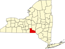
Union is a town in Broome County, New York, United States. As of the 2010 census, the town had a total population of 56,346. [4] The name derives from the town having served as a rendezvous for the Sullivan Expedition.

Contents

The town is in the south-central part of the county, west of Binghamton. The communities of Union form the western suburbs of Binghamton. Two communities, the villages of Johnson City and Endicott, along with Binghamton, make up the "Triple Cities."

History

The region was first settled by Americans/Europeans circa 1782.

During the American Revolution, detachments of soldiers were sent through this region with the intent of attacking natives who were friendly to the British. Documented attacks on native villages in present-day Binghamton, Vestal, and Choconut Township, Pennsylvania, indicate that many natives were killed in these incursions in 1779. Of particular note are the advances of General Poor and General Sullivan, each leading troops on separate fronts. Their soldiers reunited at the site of Union, hence the name.

The town of Union was established in 1791, while in Tioga County before the creation of Broome County. The town, a "mother town" of the county, was later reduced in size by the formation of other towns, the first being the town of Owego (then called the "Town of Tioga") in 1800, followed by Lisle (1801), Greene (1808, now in Chenango County), Vestal (1823), and Maine (1848).

Geography

According to the United States Census Bureau, the town of Union has a total area of 36.0 square miles (93.2 km2), of which 35.4 square miles (91.8 km2) is land and 0.54 square miles (1.4 km2), or 1.49%, is water. [4]

Union is on the north side of the Susquehanna River.

New York State Route 17 crosses from the north to the south side of the Susquehanna in Union. New York State Route 26 and New York State Route 38B intersect by Union Center. NY-26 connects Union to the town of Vestal on the south side of the Susquehanna River. New York State Route 17C is an east–west highway in the south part of Union.

Demographics

Historical population
CensusPop.Note
1820 2,037
1830 2,1224.2%
1840 3,16549.2%
1850 2,143−32.3%
1860 2,092−2.4%
1870 2,53821.3%
1880 2,5962.3%
1890 2,7114.4%
1900 5,707110.5%
1910 9,48666.2%
1920 25,651170.4%
1930 42,57966.0%
1940 50,19517.9%
1950 55,67610.9%
1960 64,42315.7%
1970 64,4900.1%
1980 61,179−5.1%
1990 59,786−2.3%
2000 56,266−5.9%
2010 56,3460.1%
2018 (est.)53,251 [3] −5.5%
U.S. Decennial Census [5]

As of the census [6] of 2000, there were 56,298 people, 24,538 households, and 14,551 families residing in the town. The population density was 1,600.8 inhabitants per square mile (618.1/km2). There were 26,507 housing units at an average density of 753.7 per square mile (291.0/km2). The racial makeup of the town was 92.72% White, 2.45% African American, 0.17% Native American, 2.68% Asian, 0.03% Pacific Islander, 0.58% from other races, and 1.38% from two or more races. Hispanic or Latino of any race were 1.53% of the population.

There were 24,538 households, out of which 26.1% had children under the age of 18 living with them, 45.0% were married couples living together, 10.9% had a female householder with no husband present, and 40.7% were non-families. 34.5% of all households were made up of individuals, and 13.6% had someone living alone who was 65 years of age or older. The average household size was 2.24 and the average family size was 2.90.

In the town, the population was spread out, with 21.9% under the age of 18, 8.4% from 18 to 24, 28.5% from 25 to 44, 22.4% from 45 to 64, and 18.9% who were 65 years of age or older. The median age was 40 years. For every 100 females, there were 90.1 males. For every 100 females age 18 and over, there were 86.8 males.

The median income for a household in the town was $34,101, and the median income for a family was $46,170. Males had a median income of $35,891 versus $24,120 for females. The per capita income for the town was $20,077. About 8.3% of families and 11.3% of the population were below the poverty line, including 16.4% of those under age 18 and 6.0% of those age 65 or over.

Communities and locations in the Town of Union

See also

Related Research Articles

<span class="mw-page-title-main">Broome County, New York</span> County in New York, United States

Broome County is a county in the U.S. state of New York. As of the 2020 United States census, the county had a population of 198,683. Its county seat is Binghamton. The county was named for John Broome, the state's lieutenant governor when Broome County was created.

<span class="mw-page-title-main">Binghamton, New York</span> City in New York, United States

Binghamton is a city in the U.S. state of New York, and serves as the county seat of Broome County. Surrounded by rolling hills, it lies in the state's Southern Tier region near the Pennsylvania border, in a bowl-shaped valley at the confluence of the Susquehanna and Chenango Rivers. Binghamton is the principal city and cultural center of the Binghamton metropolitan area, home to a quarter million people. The city's population, according to the 2020 census, is 47,969.

<span class="mw-page-title-main">Chenango, New York</span> Town in New York, United States

Chenango is a town in Broome County, New York, United States. The population was 10,983 at the 2020 census.

<span class="mw-page-title-main">Colesville, New York</span> Town in New York, United States

Colesville is a town in Broome County, New York, United States. The population was 4,877 at the 2020 census.

<span class="mw-page-title-main">Conklin, New York</span> Town in New York, United States

Conklin is a town in Broome County, New York, United States. Per the 2020 census, the population was 5,008.

<span class="mw-page-title-main">Endicott, New York</span> Village in New York, United States

Endicott is a village in Broome County, New York, United States. The population was 13,392 at the 2010 census. It is part of the Binghamton Metropolitan Statistical Area. The village is named after Henry B. Endicott, a founding member of the Endicott Johnson Corporation shoe manufacturing company, who founded the community as the "Home of the Square Deal".

<span class="mw-page-title-main">Endwell, New York</span> Census-designated place in New York, United States

Endwell is a hamlet located in the town of Union in Broome County, New York, United States. Its population was 11,446 at the 2010 census.

<span class="mw-page-title-main">Johnson City, New York</span> Village in New York, United States

Johnson City is a village in Broome County, New York, United States. The population was 15,174 at the 2010 census. It is part of the Binghamton Metropolitan Statistical Area.

<span class="mw-page-title-main">Kirkwood, New York</span> Town in New York, United States

Kirkwood is a town in Broome County, New York, United States. The population was 5,495 at the 2020 census. The town is named after James P. Kirkwood, who was an engineer responsible for constructing the local railroad.

<span class="mw-page-title-main">Maine, New York</span> Town in New York, United States

Maine is a town in Broome County, New York, United States. The population was 5,377 at the 2010 census.

<span class="mw-page-title-main">Sanford, New York</span> Town in New York, United States

Sanford is a town in Broome County, New York, United States. The population was 2,407 at the 2010 census.

<span class="mw-page-title-main">Vestal, New York</span> Town in Broome County, New York, US

Vestal is a town within Broome County in the Southern Tier of New York, United States, and lies between the Susquehanna River and the Pennsylvania border. As of the 2020 census, the population was 29,110. Vestal is on the southern border of the county, and serves as a western suburb of the city of Binghamton. The town is home to the main campus of Binghamton University.

<span class="mw-page-title-main">Binghamton (town), New York</span> Town in New York, United States

Binghamton is a town in Broome County, New York, United States. The population was 4,623 at the 2020 census. The town is named after an early developer, William Bingham.

<span class="mw-page-title-main">Windsor, New York</span> Town in New York, United States

Windsor is a town in Broome County, New York, United States. The population was 5,804 at the 2020 census.

<span class="mw-page-title-main">Afton, New York</span> Town in New York, United States

Afton is a town in Chenango County, New York, United States. The population was 2,851 at the 2010 census. Afton is situated in the southeast corner of the county and lies wholly within the original Township of Clinton. It was formed from the town of Bainbridge on November 18, 1857, and derives its name from Afton Water, a small river in the parish of New Cumnock, Ayrshire, Scotland, immortalized by the poet Robert Burns. It is bounded on the north by Bainbridge and Coventry, on the east by Delaware County, and on the west and south by Broome County.

<span class="mw-page-title-main">Norwich (town), New York</span> Town in New York, United States

Norwich is a town in Chenango County, New York, United States. The population was 3,998 at the 2010 census.

Nichols is a town in Tioga County, New York, United States. The town contains a village also called Nichols. The town is on the south border of both the county and the state. The town is halfway between Binghamton and Elmira. The population was 2,357 at the 2020 census. The town is named after Colonel Nichols, an early landowner.

<span class="mw-page-title-main">Owego, New York</span> Town in Tioga County, New York, US

Owego is a town in Tioga County, New York, United States. The population was 18,728 at the 2020 census. The name is derived from the Iroquois word Ahwaga, meaning "where the valley widens".

<span class="mw-page-title-main">New York State Route 17C</span> State highway in New York, US

New York State Route 17C (NY 17C) is a state highway in the Southern Tier of New York in the United States. Its western terminus is at an intersection with NY 34 in Waverly, Tioga County while its eastern terminus is at an intersection with U.S. Route 11 (US 11) in Binghamton, Broome County. The route runs concurrently with NY 96 for a block in Owego and for a few blocks with NY 26 in Endicott.

<span class="mw-page-title-main">Binghamton metropolitan area</span> Metropolitan statistical area in New York, United States

The Binghamton Metropolitan Statistical Area, also called Greater Binghamton or the Triple Cities, is a region of southern Upstate New York in the Northeastern United States, anchored by Binghamton. The MSA encompasses Broome and Tioga counties, which together had a population of 247,138 as of the 2020 census. From 1963 to 1983, the MSA also included neighboring Susquehanna County in Pennsylvania, part of which still falls in the Binghamton, NY–PA Urban Area. In addition to these three counties, the greater region includes parts of Delaware and Chenango counties in New York; portions of Cortland and Otsego counties in New York and Wayne County, Pennsylvania are sometimes considered part of the region as well. Using the definition of a 30-mile radius from Binghamton, the population as of the 2010 census is 317,331.

References

  1. 1 2 3 4 5 "Supervisor and Town Council". townofunion.com. Town of Union. Retrieved June 17, 2019.
  2. "2016 U.S. Gazetteer Files". United States Census Bureau. Retrieved Jul 4, 2017.
  3. 1 2 "Population and Housing Unit Estimates" . Retrieved June 17, 2019.
  4. 1 2 "Geographic Identifiers: 2010 Demographic Profile Data (G001): Union town, Broome County, New York". U.S. Census Bureau, American Factfinder. Archived from the original on February 12, 2020. Retrieved February 4, 2014.
  5. "Census of Population and Housing". Census.gov. Retrieved June 17, 2019.
  6. "American FactFinder". United States Census Bureau. Archived from the original on 2015-02-05. Retrieved 2008-01-31.

42°09′13″N76°00′7″W / 42.15361°N 76.00194°W / 42.15361; -76.00194