Endicott, New York

Last updated

Endicott, New York
Endicott Post Office.JPG
Endicott Post Office
Nickname: 
The Magic City [1]
Village of Endicott NY Locator Map.png
Map highlighting Endicott's location within Broome County.
USA New York location map.svg
Red pog.svg
Endicott
Location within the state of New York
Coordinates: 42°6′11″N76°3′17″W / 42.10306°N 76.05472°W / 42.10306; -76.05472
CountryUnited States
State New York
County Broome
Town Union
Incorporated1906;118 years ago (1906)
Area
[2]
  Total3.20 sq mi (8.28 km2)
  Land3.19 sq mi (8.27 km2)
  Water0.00 sq mi (0.01 km2)
Elevation
840 ft (256 m)
Population
 (2020)
  Total13,667
  Density4,278.96/sq mi (1,652.18/km2)
Time zone UTC-5 (Eastern (EST))
  Summer (DST) UTC-4 (EDT)
ZIP codes
13760, 13761, 13763
Area code 607
FIPS code 36-24515
GNIS feature ID0949657
Website www.endicottny.com

Endicott is a village in Broome County, New York, United States. The population was 13,392 at the 2010 census. [3] It is part of the Binghamton Metropolitan Statistical Area. The village is named after Henry B. Endicott, a founding member of the Endicott Johnson Corporation shoe manufacturing company, who founded the community as the "Home of the Square Deal".

Contents

The village of Endicott is in the town of Union and is west of the city of Binghamton. The community is served by the Greater Binghamton Airport/Edwin A. Link Field. It is part of the "Triple Cities", along with Binghamton and Johnson City.

History

The village of Endicott was originally made up of two distinct villages: Union village (now the historic business district at the intersection of NYS Route 26 and NYS Route 17C), incorporated in 1892, and Endicott (whose center was along Washington Avenue and North Street), which was incorporated in 1906. Union was a market town along the Susquehanna River settled in the 1790s, serving the farming area between Binghamton and Owego. Endicott, on the other hand, was originally a company town constructed for and by the Endicott Johnson Corporation, which grew to become the largest shoe company in the world by World War I. [1] [4] Growing out of a large tract of farmland, Endicott was known as a boomtown, and as a result acquired the nickname The Magic City. [1] As the two villages had grown so much that there was no longer any physical distinction between them, Union village was merged into Endicott in 1921.

The Endicott Johnson Corporation

The Endicott Johnson Corporation grew out of the Lester Brothers Boot and Shoe Company which began in Binghamton in 1854. In 1890, Lester Brothers moved their business west to a nearby rural area, which in 1892, was incorporated as the village of Lestershire and in 1916, became Johnson City. Financial problems in 1890 forced the sale of the company to a creditor and fellow shoemaker, Henry Bradford Endicott of Massachusetts, who founded the Endicott Shoe Company and in 1899, made factory foreman George F. Johnson his partner. The village of Endicott is named after Henry B. Endicott.

George F. Johnson was a brilliant businessman and under his direction the Endicott Shoe Company became very prosperous very quickly. His early adoption of a new machine that could stitch "uppers" to "lowers" was the key to his success, meaning that for the first time in history unskilled labor could manufacture shoes. (Prior to this, shoes were made to individual order by skilled cobblers. People who couldn't afford this bought used shoes, and had cobblers regularly replace the soles and heels as they wore out, until the uppers disintegrated.)

The orders pouring in made expansion of the shoe company necessary. The next parcel of inexpensive, level land along the railroad and safely above the flood plain was a forested area around what is now the intersection of North Street and Washington Avenue in what is now Endicott. What was by then the Endicott-Johnson Corporation purchased this land and several large tracts around it and built a number of state-of-the-art factories along the railroad line. Anticipating population growth, the company also surveyed and laid out the current street pattern of most of Endicott north of Main Street, so in this sense, Endicott was a "planned community". However, because of an initial lack of housing, from 1900 to 1910 most workers commuted on a horse-drawn streetcar line connecting Johnson City to Endicott along the current route of New York State Route 17C.

Endicott grew and flourished due to massive numbers of immigrants who came to the area to work for "EJ", predominantly from southern and eastern Europe. "Which way EJ?" was said to be what they asked immigration officials at Ellis Island in New York City, but it is far more likely that they had already memorized the addresses of relatives or friends living in Endicott. The company also maintained recruiting sites in Italy and the Balkans in the early part of the 20th century. Endicott-Johnson's employment in the region reached a peak of about 20,000 in the early 1920s.

In an innovative and far-sighted policy, George F. Johnson made sections of the company's land holdings outside the factory district available to workers to build homes on, with financing provided by the company, and title reverting to the worker when the loan was paid off. Along with extensive company-provided recreational facilities and medical clinics (unheard of at the time and decades before government took over these responsibilities), this "Square Deal" of the early 20th century is commemorated by stone arches erected by the workers in 1920 across Route 17C (Main Street) at the entrances to Endicott and Johnson City.

Endicott-Johnson was hurt by the Depression of the 1930s, but since shoes were a necessity, did better than other manufacturing sectors of the economy. Orders for shoes from the military in World War II in the 1940s propelled employment over the peak attained in the early 1920s. Unfortunately, the management of Endicott-Johnson after the death of George F. Johnson in 1948, couldn't cope with a more affluent era in the 1950s and 1960s when footwear became mainly a fashion business in the United States. More importantly, little if any money was invested in improving the original 1900 manufacturing technology, which meant that foreign countries could make the same shoes at a lower price. Loss of market share resulted in the closing and sale of the Endicott factories.

IBM

Endicott is best known as the "Birthplace of IBM". [5] [6] The Computing-Tabulating-Recording Company (CTR) was founded in Endicott on June 16, 1911, via the consolidation of the International Time Recording Company (ITR), The Tabulating Machine Company, Computing Scale Company, and Bundy Time Recording. These companies used a technology invented by Herman Hollerith whereby stiff paper cards with holes in a systematic pattern, called punched cards, could be "read" by machines via electrical contact.

The Computing-Tabulating-Recording Company changed its name to International Business Machines Corporation (IBM) in 1924. The formation of what soon became IBM consolidated some of the major companies in the industrial time-keeping business, but its new chief executive Thomas J. Watson realized that data processing had far greater potential than just workers punching a time clock. A great motivator of salesmen, Watson sent them to a new territory of banks, corporations, and government agencies, where they explained how a database of IBM punched cards and data processing with IBM sorting machines would enable them to answer questions in a day or two that they were never even able to ask because of the months of clerk time that would have been required. By the 1930s IBM was the leading company in the world in electromechanical data processing and had contracts with a number of government agencies, notably the original Social Security contract.

Encouraged by George F. Johnson, who saw Endicott as the world's first industrial "park" with a "Square Deal" for everyone, IBM began building a factory complex just to the east of the Endicott-Johnson factories. The factory complex centered at North Street and McKinley Avenue expanded rapidly in the late 1930s and early 1940s. Endicott was the original location of all IBM manufacturing, research, and development from the early 1920s through World War II.

The outbreak of World War II and the subsequent mobilization of the economy and the induction of 12 million young men into the military resulted in a demand for more data processing work from IBM. Every soldier in World War II had an "IBM Card" in his file. Several of the IBM factories in Endicott were converted to arms production during World War II, notably the production of sidearms (pistols).

After World War II, IBM concentrated on electronic data processing, a significant departure from its previously very prosperous business of electromechanical data processing. IBM's engineers and workers in Endicott provided reliable and cost-effective computers to government agencies, banks, and large corporations in the 1950s. This information revolution transformed the American and world economies, and made IBM one of the world's most successful corporations of the second half of the 20th century.

The expansion of IBM-Endicott beginning in the 1940s resulted in some residential development north and west of the original Endicott street grid, but its major effect was the transformation of the then semi-rural sites of Endwell (to the immediate east) and Vestal (to the immediate south) into the large residential areas they are today. IBM employment in the region peaked at approximately 16,000 in the mid-1980s.

IBM's own expansion in this period was the construction of large research and development centers in the Glendale section of the town of Union (3 miles (5 km) to the west, now occupied by State of New York offices) and in Owego (9 miles (14 km) to the west, now owned by Lockheed Martin). By the mid-1960s, most IBM workers in the region worked at these sites. A circuit board fabricating plant was built on North Street adjacent to the original factory complex in the mid-1960s.

After the Second World War, IBM corporate headquarters moved to Armonk, New York, and new research and manufacturing sites were established throughout the United States and overseas. In 2002, IBM sold the aging Endicott manufacturing site to local investors. IBM now leases several buildings in the complex, and employment is currently estimated at 600–800. These jobs are entirely in research and development, and there is no longer any manufacturing at IBM-Endicott.

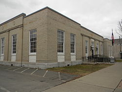
There are six properties or districts in Endicott that are listed on the National Register of Historic Places. These include two carousels. For more information, see National Register of Historic Places listings in Broome County, New York.

The Triple Cities College, a branch of Syracuse University, was started in Endicott in 1946, using buildings donated by IBM and Endicott-Johnson. The college became Harpur College once it was adopted into the SUNY system, and moved to its present location in Vestal, where it is now known as Binghamton University (BU). BU has seen rapid expansion from 2000 onward and now has a secondary campus in downtown Binghamton. While originally associated with BU, the Cider Mill Playhouse now serves as an independent community theatre in Endicott.

The county-run EnJoie Golf Course in Endicott was home of the PGA Tour's B.C. Open. Originally held annually in September, the tournament attracted golf's biggest names, from Arnold Palmer to Tiger Woods. In 2000, the tournament was moved to June, which left it competing with the British Open for players and coverage. The tournament ended its 30+ year run on the PGA in July 2006. In July 2007, Endicott hosted the first Dick's Sporting Goods Open, a Champions Tour stop.

Geography

The village is on the north side of the Susquehanna River and the Southern Tier Expressway (NYS Route 17).

Endicott is located at 42°6′11″N76°3′17″W / 42.10306°N 76.05472°W / 42.10306; -76.05472 (42.103074, −76.054687). [7]

According to the United States Census Bureau, the village has a total area of 3.2 square miles (8.3 km2), of which 0.004 square miles (0.01 km2), or 0.13%, is water. [3]

Demographics

Historical population
CensusPop.Note
1910 2,408
1920 9,500294.5%
1930 16,23170.9%
1940 17,7029.1%
1950 20,05013.3%
1960 18,775−6.4%
1970 16,556−11.8%
1980 14,457−12.7%
1990 13,531−6.4%
2000 13,038−3.6%
2010 13,3922.7%
2020 13,6672.1%
U.S. Decennial Census [8]

As of the census [9] of 2010, there were 13,392 people, 6,058 households, and 2,994 families residing in the village. The population density was 4,198.1 inhabitants per square mile (1,620.9/km2). There were 6,719 housing units at an average density of 2,106.3 per square mile (813.2/km2). The racial makeup of the village was 86.64% White, 6.96% African American, 0.21% Native American, 1.75% Asian, 0.13% Pacific Islander, 0.98% from other races, and 3.32% from two or more races. Hispanic or Latino of any race were 4.44% of the population.

There were 6,058 households, out of which 23.2% had children under the age of 18 living with them, 28.1% were married couples living together, 15.7% had a female householder with no husband present, and 50.6% were non-families. 41.1% of all households were made up of individuals, and 13.1% had someone living alone who was 65 years of age or older. The average household size was 2.14 and the average family size was 2.91.

In the village, the population was spread out, with 21.3% under the age of 18, 9.8% from 18 to 24, 26.9% from 25 to 44, 26.1% from 45 to 64, and 15.9% who were 65 years of age or older. The median age was 38 years. For every 100 females, there were 93.4 males. For every 100 females age 18 and over, there were 91.0 males.

The median income for a household in the village was $32,599, and the median income for a family was $46,761. Males had a median income of $34,572 versus $30,888 for females. The per capita income for the village was $20,603. About 16.2% of families and 21.0% of the population were below the poverty line, including 34.0% of those under age 18 and 13.7% of those age 65 or over.

In the early 20th century, Italians flocked to Endicott due to the opportunity for jobs in the Endicott-Johnson shoe factories. [10] The Italians settled on the North Side of the village. Today the North Side of the village is recognized as Little Italy, and still has a large Italian population.

Pollution

For much of its history, IBM dumped tons of industrial solvents, used to clean computer parts, down drains. The solvents also leached from leaky pipes into the ground for years before environmental rules required that such "spills" be reported. [11]

IBM used liquid cleaning agents in circuit board assembly operation for more than two decades, and six spills and leaks were recorded, including one leak in 1979 of 4,100 gallons from an underground tank. These left behind volatile organic compounds in Endicott's soil and aquifer. Trace elements of volatile organic compounds have been identified in Endicott's drinking water, but the levels are within regulatory limits. Also, from 1980, IBM has pumped out 78,000 gallons of chemicals, including trichloroethane, freon, benzene and perchloroethene to the air and allegedly caused several cancer cases among the townspeople. IBM Endicott has been identified by the Department of Environmental Conservation as the major source of pollution, though traces of contaminants from a local dry cleaner and other polluters were also found. Despite the amount of pollutant, state health officials could not verify whether air or water pollution in Endicott has actually caused any health problems. According to city officials, tests show that the water is safe to drink.

In 2002, scientists discovered a large underground chemical plume, which was releasing toxic gases into homes and offices in a 350-acre (1.4 km2) swath south of the plant. The main chemical was the liquid cleaning agent trichloroethylene (TCE), which has been linked to cancer and other illnesses. [12]

Following an initial feasibility assessment, in 2008, the National Institute for Occupational Safety and Health (NIOSH) began a health study of former IBM Endicott employees to determine if they are more likely to develop certain types of cancer than the general public. NIOSH estimated the cost of the study at $3.1 million. [13] The scope of the study was later expanded to include kidney failure among the employees and birth defects among their children. The study found lower total deaths and cancer deaths than would have been expected from the general population. [14]

Since the plume has been discovered, methods including warming the ground area and pulling tainted ground water have decreased the size and intensity of the plume. The Village of Endicott has been working with the New York State DEC to remedy this concern.[ citation needed ]

Education

Endicott is served by the Union-Endicott Central School District which oversees the following schools:

Prior to the 20112012 school year, Linnaeus W. West Elementary was overseen by the Union-Endicott Central School District. Following a flood brought on by Tropical Storm Lee (2011), where it then became Owego Elementary. As a result, Ann G. McGuinness Elementary was turned into a K-5 school, and all Grade 6 students were taken in by Jennie F. Snapp Middle School. As of 2016, Linnaeus W. West Elementary is now a high school overseen by the Union-Endicott Central School District and the XQ Institute. [15]

Notable people

Related Research Articles

<span class="mw-page-title-main">Binghamton, New York</span> City in New York, United States

Binghamton is a city in the U.S. state of New York, and serves as the county seat of Broome County. Surrounded by rolling hills, it lies in the state's Southern Tier region near the Pennsylvania border, in a bowl-shaped valley at the confluence of the Susquehanna and Chenango Rivers. Binghamton is the principal city and cultural center of the Binghamton metropolitan area, home to a quarter million people. The city's population, according to the 2020 census, is 47,969.

<span class="mw-page-title-main">Endwell, New York</span> Census-designated place in New York, United States

Endwell is a hamlet located in the town of Union in Broome County, New York, United States. Its population was 11,446 at the 2010 census.

<span class="mw-page-title-main">Johnson City, New York</span> Village in New York, United States

Johnson City is a village in Broome County, New York, United States. The population was 15,343 at the 2020 census. It is part of the Binghamton Metropolitan Statistical Area.

<span class="mw-page-title-main">Union, New York</span> Town in New York, United States

Union is a town in Broome County, New York, United States. As of the 2010 census, the town had a total population of 56,346. The name derives from the town having served as a rendezvous for the Sullivan Expedition.

<span class="mw-page-title-main">Vestal, New York</span> Town in Broome County, New York, US

Vestal is a town within Broome County in the Southern Tier of New York, United States, and lies between the Susquehanna River and the Pennsylvania border. As of the 2020 census, the population was 29,110. Vestal is on the southern border of the county, and serves as a western suburb of the city of Binghamton. The town is home to the main campus of Binghamton University.

Tioga is a town in Tioga County, New York, United States. The population was 4,455 at the 2020 census. The town is in the southwestern part of the county and lies between Elmira and Binghamton. Tioga is situated in the Southern Tier District of New York.

<span class="mw-page-title-main">Waverly, Tioga County, New York</span> Village in New York, United States

Waverly is the largest village in Tioga County, New York, United States. As of the 2010 U.S. census, Waverly had a population of 4,177. It is located southeast of Elmira in the Southern Tier region. This village was incorporated as the southwest part of the town of Barton in 1854. The village name was conceived by Joseph "Uncle Joe" Hallett, founder of its first Fire Department and pillar of the community, dropping the second "e" from the name of his favorite author's novel, Waverley by Sir Walter Scott. The former village hall is listed on the National Historic Places list.

<span class="mw-page-title-main">Danvers, Massachusetts</span> Town in Massachusetts, United States

Danvers is a town in Essex County, Massachusetts, United States, located on the Danvers River near the northeastern coast of Massachusetts. The suburb is a fairly short ride from Boston and is also in close proximity to the beaches of Gloucester, Ipswich and Revere. Originally known as Salem Village, the town is most widely known for its association with the 1692 Salem witch trials. It was also the site of Danvers State Hospital, one of the state's 19th-century psychiatric hospitals. Danvers is a local center of commerce, hosting many car dealerships and the Liberty Tree Mall. As of the 2020 United States Census, the town's population was 28,087.

<span class="mw-page-title-main">Owego (village), New York</span> Village in Tioga County, New York, US

Owego is a village in and the county seat of Tioga County, New York, United States. The population was 3,896 at the 2010 census. It is part of the Binghamton Metropolitan Statistical Area. The name is derived from the Iroquois word Ahwaga, meaning where the valley widens.

<span class="mw-page-title-main">Owego, New York</span> Town in Tioga County, New York, US

Owego is a town in Tioga County, New York, United States. The population was 18,728 at the 2020 census. The name is derived from the Iroquois word Ahwaga, meaning "where the valley widens".

<span class="mw-page-title-main">Endicott Johnson Corporation</span> American shoe manufacturer

The Endicott-Johnson Shoe Company ("E-J") was a prosperous manufacturer of shoes based in New York's Southern Tier, with factories mostly located in the area's Triple Cities of Binghamton, Johnson City, and Endicott. An estimated 20,000 people worked in the company's factories by the 1920s, and an even greater number worked there during the boom years of the mid-1940s when, helped by footwear it produced for the military during the war years, it was producing 52 million pairs of shoes a year. During the early 1950s, the work force was still approximately 17,000 to 18,000. Today, EJ Footwear, LLC operates as a unit of Nelsonville, Ohio-based Rocky Shoes & Boots, Inc.

George Francis Johnson (1857–1948) was an American businessman.

<span class="mw-page-title-main">New York State Route 17C</span> State highway in New York, US

New York State Route 17C (NY 17C) is a state highway in the Southern Tier of New York in the United States. Its western terminus is at an intersection with NY 34 in Waverly, Tioga County while its eastern terminus is at an intersection with U.S. Route 11 (US 11) in Binghamton, Broome County. The route runs concurrently with NY 96 for a block in Owego and for a few blocks with NY 26 in Endicott.

<span class="mw-page-title-main">Binghamton metropolitan area</span> Metropolitan statistical area in New York, United States

The Binghamton Metropolitan Statistical Area, also called Greater Binghamton or the Triple Cities, is a region of southern Upstate New York in the Northeastern United States, anchored by Binghamton. The MSA encompasses Broome and Tioga counties, which together had a population of 247,138 as of the 2020 census. From 1963 to 1983, the MSA also included neighboring Susquehanna County in Pennsylvania, part of which still falls in the Binghamton, NY–PA Urban Area. In addition to these three counties, the greater region includes parts of Delaware and Chenango counties in New York; portions of Cortland and Otsego counties in New York and Wayne County, Pennsylvania are sometimes considered part of the region as well. Using the definition of a 30-mile radius from Binghamton, the population as of the 2010 census is 317,331.

<span class="mw-page-title-main">Computing-Tabulating-Recording Company</span> Former American business machines company

The Computing-Tabulating-Recording Company (CTR) was a holding company of manufacturers of record-keeping and measuring systems; it was subsequently known as IBM.

<span class="mw-page-title-main">New York State Route 282</span> State highway in Tioga County, New York, US

New York State Route 282 (NY 282) is a north–south state highway located within Tioga County in the Southern Tier of New York in the United States. It extends for 3.48 miles (5.60 km) from the Pennsylvania state line in the town of Nichols, where it connects to Pennsylvania Route 187 (PA 187), to an intersection with NY 17C in the town of Tioga. The route meets the Southern Tier Expressway (NY 17) and crosses over the Susquehanna River just west of the village of Nichols.

<span class="mw-page-title-main">Endicott Square Deal Arch</span> United States historic place

Endicott Square Deal Arch is an historic "welcome arch" located at Endicott in Broome County, New York. It is one of two identical arches erected in 1920 in Endicott and in nearby Johnson City, known as the Johnson City Square Deal Arch.. It was constructed by Endicott-Johnson Shoe Company employees to honor George F. Johnson (1857–1948), their highly respected employer and benefactor.

<span class="mw-page-title-main">Henry Bradford Endicott</span> American businessman

Henry Bradford Endicott was the founder of the Endicott Johnson Corporation as well as the builder of the Endicott Estate, in Dedham, Massachusetts. During World War I he served in numerous public capacities, including as a labor strike negotiator and as director of the Massachusetts Committee on Public Safety.

Forman Elmer Whitcomb was an American teacher, principal, and politician from New York.

Crest View Heights is a neighborhood and census-designated place (CDP) in the town of Owego, Tioga County, New York, United States. It was first listed as a CDP prior to the 2020 census. It is also in the Village of Endicott and has an Endicott zip code. Crestview Heights/Development was formed from the 1961-1974 purchase of the farms of J Ward Allen, Audley D Allen & Granville Brink by Kurt Franzenburg, John Garbar & Gerald A Cole, with VP Richard Huttleston, lawyered by Nathan Hankin & Francis C Palmer and built by Louis Tokos Sr Glenwood Building Supply. It contains THomas J Watson Elemntary School of the Union-Edicott School District uek12 org tjw

References

  1. 1 2 3 Aswad, Ed; Meredith, Suzanne M. (2003). Endicott-Johnson. Charleston, SC: Arcadia. ISBN   9780738513065 . Retrieved February 26, 2015.
  2. "ArcGIS REST Services Directory". United States Census Bureau. Retrieved September 20, 2022.
  3. 1 2 "Geographic Identifiers: 2010 Demographic Profile Data (G001): Endicott village, New York". U.S. Census Bureau, American Factfinder. Archived from the original on February 12, 2020. Retrieved February 4, 2014.
  4. "Endicott Johnson Company: George F. Johnson and the Square Deal". Center for Technology & Innovation. Archived from the original on February 26, 2015. Retrieved February 26, 2015.
  5. "Pressconnects". Pressconnects. Retrieved April 17, 2018.
  6. "Empire State Development". state.ny.us. Archived from the original on July 19, 2011. Retrieved April 17, 2018.
  7. "US Gazetteer files: 2010, 2000, and 1990". United States Census Bureau. February 12, 2011. Retrieved April 23, 2011.
  8. "Census of Population and Housing". Census.gov. Retrieved June 4, 2015.
  9. "U.S. Census website". United States Census Bureau . Retrieved 2008-01-31.
  10. Vecchio, Diane C. (2006). Merchants, Midwives, and Laboring Women: Italian Migrants in Urban America . University of Illinois Press. p.  130. ISBN   9780252030390.
  11. "Life in the Plume: IBM's Pollution Haunts a Village". January 11, 2009.
  12. "IBM Endicott Site, Health Statistics Review".
  13. "NIOSH Feasibility Assessment for a Cancer Study Among Former IBM Employees Who Worked at the Endicott, New York Plant". National Institute for Occupational Safety and Health. Retrieved May 27, 2009.
  14. Sadeghpour, Nura (January 6, 2014). "NIOSH publishes results from IBM-Endicott Study". Centers for Disease Control and Prevention. Atlanta. Retrieved February 25, 2014.
  15. "Tiger Ventures - XQ Institute". XQ Institute. 2020. Retrieved October 1, 2021.
  16. "Keith James Rothfus". The Washington Times. Archived from the original on January 10, 2013. Retrieved November 8, 2012.