Kirkwood, New York

Last updated
Kirkwood, New York
Motto: 
A fine place to live. A good place to learn.
Town of Kirkwood NY Locator Map.png
Location of Kirkwood in Broome County, New York
USA New York location map.svg
Red pog.svg
Kirkwood
Location of Kirkwood in New York
Coordinates: 42°4′52″N75°48′35″W / 42.08111°N 75.80972°W / 42.08111; -75.80972
Country United States
State New York
County Broome
Government
[1]
  Type Town Council
   Town Supervisor Lewis "Lew" C. Grubham
   Town Council
Members' List
Area
[2]
  Total31.21 sq mi (80.83 km2)
  Land30.81 sq mi (79.80 km2)
  Water0.40 sq mi (1.03 km2)
Elevation
1,037 ft (316 m)
Population
 (2020) [3]
  Total5,495 Decrease2.svg
  Estimate 
(2021) [3]
5,437
  Density184.16/sq mi (71.10/km2)
Time zone UTC-5 (Eastern (EST))
  Summer (DST) UTC-4 (EDT)
ZIP Code
13795-1520
Area code 607
FIPS code 36-007-39837
GNIS feature ID0979121
Website www.townofkirkwood.org

Kirkwood is a town in Broome County, New York, United States. The population was 5,495 at the 2020 census. [3] The town is named after James P. Kirkwood, who was an engineer responsible for constructing the local railroad.

Contents

The town is in the south-central part of the county, southeast of Binghamton.

History

Circa 1781, Jonathan Fitch built a gristmill here, becoming the first pioneer settler. The Town of Kirkwood was formed from the town of Conklin in 1859.

In 2006 and 2011, parts of the town were damaged when the Susquehanna River overflowed its banks.

Geography

According to the United States Census Bureau, the town has a total area of 31.2 square miles (80.8 km2), of which 30.8 square miles (79.8 km2) is land and 0.39 square miles (1.0 km2), or 1.27%, is water. [4]

The southern town line is the state line of Pennsylvania at Susquehanna County, Pennsylvania.

The Susquehanna River forms the western border. U.S. Route 11 and Interstate 81 pass through the town, following the course of the Susquehanna. Interstate 86/New York State Route 17 passes across the north part of the town.

Demographics

Historical population
CensusPop.Note
1860 1,389
1870 1,4020.9%
1880 1,344−4.1%
1890 1,119−16.7%
1900 918−18.0%
1910 852−7.2%
1920 8995.5%
1930 1,23737.6%
1940 2,15073.8%
1950 2,99739.4%
1960 4,65155.2%
1970 5,68722.3%
1980 5,8342.6%
1990 6,0964.5%
2000 5,647−7.4%
2010 5,8573.7%
2020 5,495−6.2%
2021 (est.)5,437 [3] −1.1%
U.S. Decennial Census [5]

As of the census [6] of 2000, there were 5,651 people, 2,247 households, and 1,611 families residing in the town. The population density was 182.5 inhabitants per square mile (70.5/km2). There were 2,469 housing units at an average density of 79.7 per square mile (30.8/km2). The racial makeup of the town was 97.75% White, 0.60% African American, 0.18% Native American, 0.39% Asian, 0.02% Pacific Islander, 0.16% from other races, and 0.90% from two or more races. Hispanic or Latino of any race were 0.64% of the population.

There were 2,247 households, out of which 31.3% had children under the age of 18 living with them, 57.5% were married couples living together, 9.8% had a female householder with no husband present, and 28.3% were non-families. 22.4% of all households were made up of individuals, and 9.2% had someone living alone who was 65 years of age or older. The average household size was 2.51 and the average family size was 2.92.

In the town, the population was spread out, with 24.0% under the age of 18, 7.0% from 18 to 24, 28.9% from 25 to 44, 25.2% from 45 to 64, and 15.0% who were 65 years of age or older. The median age was 39 years. For every 100 females, there were 99.5 males. For every 100 females age 18 and over, there were 96.4 males.

The median income for a household in the town was $38,279, and the median income for a family was $45,993. Males had a median income of $34,543 versus $23,275 for females. The per capita income for the town was $19,228. About 4.0% of families and 5.9% of the population were below the poverty line, including 8.3% of those under age 18 and 5.2% of those age 65 or over.

Windsor Central School District is the primary school district in Kirkwood among other towns including Windsor and West Windsor. Susquehanna Valley Central School District encompasses the southernmost part of Kirkwood as well as the town of Conklin and the town of Binghamton.

Communities

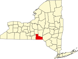
Kirkwood is located in the central part of Broome County, geographically adjacent to the northeast bank of the Susquehanna River. The town's boundaries extend from the Binghamton city limits on the north, to the Pennsylvania border on the south. [7] [8]

Kirkwood's hamlets and their locations within town boundaries (from north to south) are: [7] [8]

Related Research Articles

<span class="mw-page-title-main">Broome County, New York</span> County in New York, United States

Broome County is a county in the U.S. state of New York. As of the 2020 United States census, the county had a population of 198,683. Its county seat is Binghamton. The county was named for John Broome, the state's lieutenant governor when Broome County was created.

<span class="mw-page-title-main">Tioga County, New York</span> County in New York, United States

Tioga County is a county in the U.S. state of New York. As of the 2020 census, the population was 48,455. Its county seat is Owego. Its name derives from an American Indian word meaning "at the forks", describing a meeting place.

<span class="mw-page-title-main">Barker, Broome County, New York</span> Town in New York, United States

Barker is a town in Broome County, New York, United States. The population was 2,516 at the 2020 census. The town is named after John Barker, an early settler. The town is in the northern part of Broome County and is north of Binghamton.

<span class="mw-page-title-main">Colesville, New York</span> Town in New York, United States

Colesville is a town in Broome County, New York, United States. The population was 4,877 at the 2020 census.

<span class="mw-page-title-main">Conklin, New York</span> Town in New York, United States

Conklin is a town in Broome County, New York, United States. Per the 2020 census, the population was 5,008.

<span class="mw-page-title-main">Dickinson, Broome County, New York</span> Town in New York, United States

Dickinson is a town in Broome County, New York, United States. The population was 5,083 at the 2020 census. The town was named after Daniel S. Dickinson.

<span class="mw-page-title-main">Maine, New York</span> Town in New York, United States

Maine is a town in Broome County, New York, United States. The population was 5,377 at the 2010 census.

<span class="mw-page-title-main">Nanticoke, New York</span> Town in New York, United States

Nanticoke is a town in Broome County, New York, United States. The population was 1,672 at the 2010 census. The town was named after the Nanticoke people, who were a Native American tribe native to Chesapeake Bay.

<span class="mw-page-title-main">Sanford, New York</span> Town in New York, United States

Sanford is a town in Broome County, New York, United States. The population was 2,407 at the 2010 census.

<span class="mw-page-title-main">Triangle, New York</span> Town in New York, United States

Triangle is a town in Broome County, New York, United States. The population was 2,946 at the 2010 census. The town's primary settlement is the village of Whitney Point.

<span class="mw-page-title-main">Union, New York</span> Town in New York, United States

Union is a town in Broome County, New York, United States. As of the 2010 census, the town had a total population of 56,346. The name derives from the town having served as a rendezvous for the Sullivan Expedition.

<span class="mw-page-title-main">Vestal, New York</span> Town in Broome County, New York, US

Vestal is a town within Broome County in the Southern Tier of New York, United States, and lies between the Susquehanna River and the Pennsylvania border. As of the 2020 census, the population was 29,110. Vestal is on the southern border of the county, and serves as a western suburb of the city of Binghamton. The town is home to the main campus of Binghamton University.

<span class="mw-page-title-main">Great Bend, Pennsylvania</span> Borough in Pennsylvania, United States

Great Bend is a borough in Susquehanna County, Pennsylvania, United States, 39 miles (63 km) north of Scranton. According to 2020 Census data, Great Bend's population was 634, down 13.6% from 2010. Great Bend sits along the Susquehanna River, less than two miles from the New York State border, and is located directly off Interstate 81. Several small manufacturers also call Great Bend home. Great Bend is considered a bedroom community of the Binghamton, NY metropolitan area. Downtown Binghamton is roughly 11 miles (18 km) from Great Bend. The borough has three public parks. Billy Greenwood Memorial Park on Kilrow Avenue and Veterans' Memorial Park on Spring St. overlook the Susquehanna River. Great Bend is within the Blue Ridge School District.

<span class="mw-page-title-main">Deposit (village), New York</span> Village in New York, United States

Deposit is a village in Broome and Delaware counties in the U.S. state of New York. The population was 1,663 at the 2010 census.

<span class="mw-page-title-main">Binghamton (town), New York</span> Town in New York, United States

Binghamton is a town in Broome County, New York, United States. The population was 4,623 at the 2020 census. The town is named after an early developer, William Bingham.

<span class="mw-page-title-main">Windsor (village), New York</span> Village in New York, United States

Windsor is a village in Broome County, New York, United States. The population was 916 at the 2010 census. It is part of the Binghamton Metropolitan Statistical Area.

<span class="mw-page-title-main">Windsor, New York</span> Town in New York, United States

Windsor is a town in Broome County, New York, United States. The population was 5,804 at the 2020 census.

<span class="mw-page-title-main">Afton, New York</span> Town in New York, United States

Afton is a town in Chenango County, New York, United States. The population was 2,851 at the 2010 census. Afton is situated in the southeast corner of the county and lies wholly within the original Township of Clinton. It was formed from the town of Bainbridge on November 18, 1857, and derives its name from Afton Water, a small river in the parish of New Cumnock, Ayrshire, Scotland, immortalized by the poet Robert Burns. It is bounded on the north by Bainbridge and Coventry, on the east by Delaware County, and on the west and south by Broome County.

Nichols is a town in Tioga County, New York, United States. The town contains a village also called Nichols. The town is on the south border of both the county and the state. The town is halfway between Binghamton and Elmira. The population was 2,357 at the 2020 census. The town is named after Colonel Nichols, an early landowner.

<span class="mw-page-title-main">Owego, New York</span> Town in Tioga County, New York, US

Owego is a town in Tioga County, New York, United States. The population was 18,728 at the 2020 census. The name is derived from the Iroquois word Ahwaga, meaning "where the valley widens".

References

  1. "Meeting Minutes" (PDF). Town of Kirkwood. 2021-03-02. Retrieved 2021-03-14.
  2. "2016 U.S. Gazetteer Files". United States Census Bureau. Retrieved Jul 4, 2017.
  3. 1 2 3 4 Bureau, US Census. "City and Town Population Totals: 2020—2021". Census.gov. US Census Bureau. Retrieved October 7, 2022.
  4. "Geographic Identifiers: 2010 Demographic Profile Data (G001): Kirkwood town, Broome County, New York". U.S. Census Bureau, American Factfinder. Archived from the original on February 12, 2020. Retrieved January 30, 2014.
  5. "Census of Population and Housing". Census.gov. Retrieved June 4, 2015.
  6. "U.S. Census website". United States Census Bureau . Retrieved 2008-01-31.
  7. 1 2 Sam Borruso (Town Historian). "Town History". Town of Kirkwood. Retrieved 2021-03-14.
  8. 1 2 3 Broome County Department of Planning and Economic Development (Fall 2016). "Kirkwood Comprehensive Plan 2016" (PDF). Broome County New York. Retrieved 2021-03-14.