Seneca County, New York

Last updated

Seneca County
The Seneca County Courthouse Complex at Ovid (August 2017).jpg
Flag of Seneca County, New York.svg
Seal of Seneca County, New York.png
Map of New York highlighting Seneca County.svg
Location within the U.S. state of New York
New York in United States.svg
New York's location within the U.S.
Coordinates: 42°47′N76°50′W / 42.79°N 76.83°W / 42.79; -76.83
CountryFlag of the United States.svg United States
StateFlag of New York.svg  New York
Founded1804
Named for Seneca people
Seat Waterloo and Ovid
Largest CDP Seneca Falls
Area
  Total390 sq mi (1,000 km2)
  Land324 sq mi (840 km2)
  Water67 sq mi (170 km2)  17%
Population
 (2020)
  Total33,814 [1]
  Density104.5/sq mi (40.3/km2)
Time zone UTC−5 (Eastern)
  Summer (DST) UTC−4 (EDT)
Congressional district 24th
Website www.co.seneca.ny.us

Seneca County is located in the U.S. state of New York. As of the 2020 census, the population was 33,814. [2] The primary county seat is Waterloo, moved there from the original county seat of Ovid in 1819. [3] [4] It became a two-shire county in 1822, which currently remains in effect and uses both locations as county seats although the majority of Seneca County administrative offices are located in Waterloo. [5] [6] Therefore, most political sources list only Waterloo as the county seat. The county's name comes from the Seneca Nation of the Haudenosaunee (Iroquois), who occupied part of the region. The county is part of the Finger Lakes region of the state.

Contents

Seneca County comprises the Seneca Falls, NY Micropolitan Statistical Area, which is also included in the Rochester-Batavia-Seneca Falls, NY Combined Statistical Area.

History

The area covered by Seneca County straddles the prehistoric territories of both Seneca and Cayuga Nations of the Haudenosaunee. When counties were established by Europeans in New York in 1683, the present-day Seneca County was part of Albany County. This was an enormous county, including the northern part of New York as well as all of the present state of Vermont and, in theory, extending westward to the Pacific Ocean. This county was reduced in size on July 3, 1766, by the creation of Cumberland County, and further on March 16, 1770, by the creation of Gloucester County, both containing territory now in Vermont.

On March 12, 1772, what was left of Albany County was split into three parts, one remaining under the name Albany County. One of the other pieces, Tryon County, contained the western portion (and thus, since no western boundary was specified, theoretically still extended west to the Pacific). The eastern boundary of Tryon County was approximately five miles west of the present city of Schenectady, and the county included the western part of the Adirondack Mountains and the area west of the West Branch of the Delaware River. The area then designated as Tryon County now includes 37 counties of New York State. The county was named for William Tryon, colonial governor of New York.

In the years prior to 1776, most of the Loyalists in Tryon County fled to Canada. In the fall of 1779 on orders from commander-in-chief General George Washington the Sullivan Expedition conducted a scorched earth campaign against the Iroquois who sided with the Loyalists in the Revolutionary War. Sullivan's path destroyed Cayuga and Seneca villages along the east shore of Seneca Lake.

In 1784, following the peace treaty that ended the American Revolutionary War, the name of Tryon County was changed to Montgomery County in honor of the general, Richard Montgomery, who had captured several places in Canada and died attempting to capture the city of Quebec, replacing the name of the hated British governor.

In 1789, Montgomery County was reduced in size by the splitting off of Ontario County. The actual area split off from Montgomery County was much larger than the present Ontario County, also including the present Allegany, Cattaraugus, Chautauqua, Erie, Genesee, Livingston, Monroe, Niagara, Orleans, Steuben, Wyoming, Yates, and parts of Schuyler and Wayne counties.

Herkimer County was one of three counties split off from Montgomery County (the others being Otsego and Tioga counties) in 1791.

Onondaga County was formed in 1794 by the splitting of Herkimer County.

Cayuga County was formed in 1799 by the splitting of Onondaga County. This county was, however, much larger than the present Cayuga County. It then included the present Seneca and Tompkins counties and part of Wayne County.

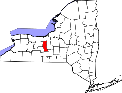
In 1804, Seneca County was formed by the splitting of Cayuga County. [7]

In 1817, Seneca County was reduced in size by combining portions of Seneca and the remainder of Cayuga County to form Tompkins County. Part of this territory, the current towns of Covert and Lodi, were returned to Seneca County in 1819.

The original county seat of Seneca County was located in Ovid, where a court house was constructed in 1806. After southern portions of the county were removed in 1817 to become part of Tompkins County, the seat was moved to Waterloo as the village was more geographically centered at the time. In 1823, northern portions of the county were removed to form part of Wayne County. This put Waterloo in the same situation as Ovid with being on one end of Seneca County. A compromise was made to use both locations as county seats, becoming a two-shire county. It included the constitution of two county courts and jury districts under Chapter 137 of the New York State Laws of 1822. [3] [4] In 1895, the Seneca County Board of Supervisors voted to abolish the setup of two jury districts. It later voted to remove the two-shire county system in 1921, making Waterloo the only county seat, but was reinstated two years later. [4] At least once a year, the County Board of Supervisors holds its monthly meeting in Ovid to maintain the two-shire status.

In 1823, Seneca County was reduced in size by combining portions of Seneca and Ontario counties to form Wayne County.

On April 6, 1830 the Church of Jesus Christ of Latter Day Saints was founded in Seneca County. The event took place at the log home of a local farmer, Peter Whitmer. Although church headquarters moved out of the area shortly thereafter, a historical visitor’s center is still operated at that location.[ citation needed ]

Geography

According to the U.S. Census Bureau, the county has a total area of 390 square miles (1,000 km2), of which 324 square miles (840 km2) is land and 67 square miles (170 km2) (17%) is water. [8]

Seneca County is in the western part of New York in the Finger Lakes Region, bounded on the east by Cayuga Lake and on the west by Seneca Lake.

The Finger Lakes National Forest is in the south part of the county.

Both the New York State Thruway and the Erie Canal cross the northern part of the county.

The former Seneca Army Depot occupies a portion of land between Cayuga and Seneca Lakes. The former Willard Drug Treatment Center and Five Points Correctional Facility are two New York State prisons located in the county. Sampson State Park is located next to the former Army base.

Adjacent counties

Major highways

National protected areas

Demographics

Historical population
CensusPop.Note
1810 16,609
1820 23,61942.2%
1830 21,041−10.9%
1840 24,87418.2%
1850 25,4412.3%
1860 28,13810.6%
1870 27,823−1.1%
1880 29,2785.2%
1890 28,227−3.6%
1900 28,114−0.4%
1910 26,972−4.1%
1920 24,735−8.3%
1930 24,9831.0%
1940 25,7323.0%
1950 29,25313.7%
1960 31,9849.3%
1970 35,0839.7%
1980 33,733−3.8%
1990 33,683−0.1%
2000 33,342−1.0%
2010 35,2515.7%
2020 33,814−4.1%
U.S. Decennial Census [9]
1790-1960 [10] 1900-1990 [11]
1990-2000 [12] 2010-2020 [2]

As of the census [13] of 2010, there were 35,251 people, 13,393 households, and 8,762 families residing in the county. The population density was 103 people per square mile (40 people/km2). There were 14,794 housing units at an average density of 46 units per square mile (18/km2). The racial makeup of the county was 93.7% White, 5.1% African American, 0.8% Native American, 0.8% Asian, 0.01% Pacific Islander, 0.9% from other races, and 1.3% from two or more races. Hispanic or Latino of any race were 2.7% of the population. 18.9% were of Italian, 16.7% German, 14.6% English, 13.4% Irish and 8.9% American ancestry according to Census 2000. 95.3% spoke English and 1.6% Spanish as their first language.

There were 12,630 households, out of which 31.90% had children under the age of 18 living with them, 53.60% were married couples living together, 10.30% had a female householder with no husband present, and 31.70% were non-families. 25.30% of all households were made up of individuals, and 11.60% had someone living alone who was 65 years of age or older. The average household size was 2.51 and the average family size was 2.99.

In the county, the population was spread out, with 24.80% under the age of 18, 7.50% from 18 to 24, 28.80% from 25 to 44, 23.80% from 45 to 64, and 15.10% who were 65 years of age or older. The median age was 38 years. For every 100 females there were 100.10 males. For every 100 females age 18 and over, there were 99.50 males.

The median income for a household in the county was $37,140, and the median income for a family was $45,445. Males had a median income of $32,512 versus $24,320 for females. The per capita income for the county was $17,630. About 8.00% of families and 11.50% of the population were below the poverty line, including 14.80% of those under age 18 and 7.30% of those age 65 or over.

2020 Census

Seneca County Racial Composition [14]
RaceNum.Perc.
White (NH)29,27386.6%
Black or African American (NH)1,2633.74%
Native American (NH)1510.45%
Asian (NH)2680.8%
Pacific Islander (NH)30.01%
Other/Mixed (NH)1,4894.4%
Hispanic or Latino 1,3674.04%

Government and politics

United States presidential election results for Seneca County, New York [15]
Year Republican Democratic Third party
No.%No.%No.%
2020 8,32953.28%6,91444.23%3892.49%
2016 7,23651.76%5,69740.75%1,0477.49%
2012 5,88944.39%7,09453.48%2832.13%
2008 7,03847.74%7,42250.35%2811.91%
2004 7,98152.08%6,97945.54%3652.38%
2000 6,73446.97%6,84147.71%7635.32%
1996 5,00435.86%6,82548.91%2,12615.23%
1992 5,43236.28%5,81038.80%3,73224.92%
1988 7,22153.21%6,21545.80%1350.99%
1984 9,42065.84%4,82533.72%620.43%
1980 7,17452.40%5,01036.60%1,50611.00%
1976 7,65956.70%5,74542.53%1040.77%
1972 9,36867.68%4,44132.08%330.24%
1968 7,08354.46%5,22240.15%7005.38%
1964 4,47333.44%8,89066.46%130.10%
1960 8,74160.55%5,69339.44%10.01%
1956 10,41774.20%3,62325.80%00.00%
1952 9,66969.01%4,32830.89%150.11%
1948 7,26658.05%4,89739.13%3532.82%
1944 7,42463.52%4,23636.24%280.24%
1940 8,36466.39%4,20333.36%310.25%
1936 7,91963.59%4,29534.49%2401.93%
1932 6,50256.61%4,76441.48%2201.92%
1928 7,91166.27%3,87332.44%1541.29%
1924 6,59866.15%2,72727.34%6496.51%
1920 6,26064.56%3,02331.18%4134.26%
1916 3,30750.84%2,84543.74%3535.43%
1912 2,33634.57%2,57338.07%1,84927.36%
1908 3,74952.80%3,13644.16%2163.04%
1904 3,82352.53%3,28845.18%1672.29%
1900 3,78751.18%3,46146.78%1512.04%
1896 3,85353.53%3,21344.64%1321.83%
1892 3,11246.40%3,19947.70%3965.90%
1888 3,57648.07%3,70549.81%1582.12%
1884 3,30946.51%3,62750.98%1782.50%

The county is governed by a fourteen-member Board of Supervisors, composed of the town supervisor representing each of the ten townships in Seneca County along with four additional at-large members from the towns of Waterloo and Seneca Falls (two per township). [16] [17] The board normally meets every 2nd Tuesday of the month at the Seneca County Office Building in Waterloo with at least one meeting per year held at the old Seneca County Courthouse Complex in Ovid as honor of the two-shire system. [18] [19] Each supervisor has a weighted vote based on the population of the town they represent.

Historically a Republican-voting county, Seneca has become more competitive in recent years and is now a swing county in Presidential elections. With the exception of 2000 and 2020, when Al Gore and Donald Trump, respectively, carried the county, voters here have opted for the winner of every Presidential election since 1980.

Communities

Larger Settlements

#LocationPopulationTypeRegion
1 Seneca Falls 6,681CDPNorth
2Waterloo 5,171VillageNorth
3 Interlaken 602VillageCayuga
3 Ovid 602VillageSeneca
5 Romulus 409CDPCayuga
6 Lodi 291VillageSeneca

† - County Seat

Towns

Hamlets

Seneca county has a number of unincorporated communities. Most are considered hamlets.

See also

Related Research Articles

<span class="mw-page-title-main">Cayuga County, New York</span> County in New York, United States

Cayuga County is a county in the U.S. state of New York. As of the 2020 census, the population was 76,248. Its county seat and largest city is Auburn. The county was named for the Cayuga people, one of the Native American tribes in the Iroquois Confederation. The county is part of the Central New York region of the state.

<span class="mw-page-title-main">Onondaga County, New York</span> County in New York, United States

Onondaga County is a county in the U.S. state of New York. As of the 2020 census, the population was 476,516. The county seat is Syracuse. The county is part of the Central New York region of the state.

<span class="mw-page-title-main">Oswego County, New York</span> County in New York, United States

Oswego County is a county in the U.S. state of New York. As of the 2020 census, the population was 117,525. The county seat is Oswego. The county name is from a Mohawk-language word meaning "the pouring out place", referring to the point at which the Oswego River feeds into Lake Ontario at the northern edge of the county in the city of Oswego. The county is part of the Central New York region of the state.

<span class="mw-page-title-main">Schuyler County, New York</span> County in New York, United States

Schuyler County is a county in the U.S. state of New York. As of the 2020 census, the population was 17,898, making it the second-least populous county in New York. The county seat is the village of Watkins Glen. The name is in honor of General Philip Schuyler, one of the four major generals in the Continental Army in the American Revolutionary War. The county is part of the Southern Tier region of the state.

<span class="mw-page-title-main">Tompkins County, New York</span> County in New York, United States

Tompkins County is a county located in the U.S. state of New York. As of the 2020 census, the population was 105,740. The county seat is Ithaca. The name is in honor of Daniel D. Tompkins, who served as Governor of New York and Vice President of the United States. The county is part of the Southern Tier region of the state.

<span class="mw-page-title-main">Wyoming County, New York</span> County in New York, United States

Wyoming County is a county in the U.S. state of New York in the state's western area. As of the 2020 census, the population was 40,531. The county seat is Warsaw. The name is modified from a Lenape (Delaware) Native American word meaning "broad bottom lands". Wyoming County was formed from Genesee County in 1841. Wyoming County is one of New York's mostly agricultural counties. With an estimated 47,500 dairy cows in the county, there are more cattle in Wyoming County than people. The county is part of the Finger Lakes region of the state.

<span class="mw-page-title-main">Yates County, New York</span> County in New York, United States

Yates County is a county in the U.S. state of New York. As of the 2020 Census, the population was 24,774, making it the third-least populous county in New York. The county seat is Penn Yan. The name is in honor of Joseph C. Yates, who as Governor of New York signed the act establishing the county. The county is part of the Finger Lakes region of the state.

Hector is a town in the northeastern corner of Schuyler County, New York, United States. The population was 4,916 at the 2020 census. The town is named after Hector Ely, who at the time was the firstborn son of the town founders. Hector is west of Ithaca.

Covert is a town in Seneca County, New York, United States. The population was 2,135 at the 2020 census.

Romulus is a town in Seneca County, New York, United States. The population was 3,203 at the 2020 census. The town is named after the mythical founder of Rome, Romulus, a name assigned by a clerk with an interest in the classics. It is located in the central part of the county, northwest of Ithaca, New York.

Varick is a town in Seneca County, New York, United States. The population was 1,656 at the 2020 census. The town is named after Richard Varick, an officer in the American Revolution, mayor of New York City, and uncle of the first Town Supervisor, Anthony Dey.

<span class="mw-page-title-main">Trumansburg, New York</span> Village in New York, United States

Trumansburg is a village in Tompkins County, New York, United States. The population was 1,797 at the 2010 census. The name incorporates a misspelling of the surname of the founder, Abner Treman. The Tremans spelled their surname several different ways; "Truman," however, was not one of them. The village's application for a post office established the present spelling. The Village of Trumansburg is located within the Town of Ulysses and is northwest of Ithaca, New York.

Ovid is a village in Seneca County, New York, United States. The population was 602 at the 2010 census. The town was named by a clerk interested in the classics.

Ovid is a town in Seneca County, New York, United States. The population was 2,847 at the 2020 census. The town is named after the Roman poet Ovid, a name assigned by a clerk interested in the classics.

<span class="mw-page-title-main">Waterloo (village), New York</span> Village in New York, United States

Waterloo is a village and primary county seat of Seneca County, New York, United States. The population was 5,171 at the 2010 census and is now the most populated village in Seneca County. The village is named after Waterloo, Belgium, where Napoleon was defeated. It is the primary county seat of Seneca County, with the other being Ovid as part of a two-shire system established in 1822. Most of the county administrative offices are located in the village. Therefore, many political sources only list Waterloo as the county seat.

<span class="mw-page-title-main">New York State Route 96</span> State highway near Finger Lakes, New York, US

New York State Route 96 (NY 96) is a 126.01-mile-long (202.79 km) northwest–southeast state highway in the Finger Lakes region of New York in the United States. The southern terminus of the route is at an interchange with NY 17 in the Southern Tier village of Owego, Tioga County. Its northern terminus is at a junction with East Main Street in the city of Rochester, Monroe County. Between the two endpoints, NY 96 passes through the city of Ithaca and the villages of Waterloo, Victor, and Pittsford. NY 96 is signed north–south for its entire length, although most of the route in Ontario County travels in an east–west direction.

<span class="mw-page-title-main">New York State Route 414</span> North–south state highway in New York

New York State Route 414 (NY 414) is a north–south state highway in the Southern Tier and Finger Lakes regions of New York in the United States. It extends for 83.20 miles (133.90 km) from an intersection with NY 352 in the Steuben County city of Corning to a junction with NY 104 in the Wayne County town of Huron. NY 414 spans five counties and roughly parallels NY 14 between Watkins Glen and Huron. It intersects every major east–west arterial in western New York, including the Southern Tier Expressway, U.S. Route 20 (US 20) and NY 5, and the New York State Thruway (I-90). The route passes through mostly rural areas as it travels between the several villages and cities along its routing.

<span class="mw-page-title-main">New York State Route 89</span> State highway in central New York, US

New York State Route 89 (NY 89) is a north–south state highway in central New York in the United States. It extends for 62.35 miles (100.34 km) from an intersection with NY 13, NY 34, and NY 96 in the Tompkins County city of Ithaca to an interchange with NY 104 in the Wayne County town of Wolcott. The route spans a total of three counties, connecting the heart of the Finger Lakes Region to a point 6 miles (10 km) south of Lake Ontario. Along the way, NY 89 intersects two regionally important highways: the conjoined routes of U.S. Route 20 (US 20) and NY 5 in Seneca Falls and NY 31 in Savannah. NY 89 runs along the western edge of Cayuga Lake from Ithaca to Seneca Falls.

<span class="mw-page-title-main">New York State Route 96A</span> State highway in Seneca County, New York, US

New York State Route 96A (NY 96A) is a state highway in Seneca County, New York, in the United States. It is a north–south road between Seneca Lake and Cayuga Lake, two of the Finger Lakes. NY 96A is two lanes wide for most of its length, with the exception of the 3-mile (5 km) long four-lane divided highway section at the northern end. The southern terminus of NY 96A is at an intersection with NY 96 in the village of Interlaken. Its northern terminus is at a junction with the conjoined routes of U.S. Route 20 (US 20) and NY 5 in the town of Waterloo just east of the city of Geneva. The junction with NY 5 and US 20 was once a trumpet interchange; however, it was converted into an at-grade intersection in the late 1980s.

<span class="mw-page-title-main">Ithaca (town), New York</span> Town in New York, United States

Ithaca is a town in Tompkins County, New York, United States. The town's population was 22,283 at the 2020 census. The town is in the central part of the county, in the Finger Lakes–Southern Tier region of New York, and is part of the Ithaca Metropolitan Statistical Area. The Town of Ithaca is a horseshoe-shaped portion of the metropolitan area of Ithaca, New York, surrounding the City of Ithaca and being the city's only border. Ithaca College is located in the South Hill section of the town.

References

  1. "US Census 2020 Population Dataset Tables for New York". United States Census Bureau. Retrieved January 2, 2022.
  2. 1 2 "U.S. Census Bureau QuickFacts: Seneca County, New York". United States Census Bureau. Retrieved January 2, 2022.
  3. 1 2 William V.R. Erving, The Miscellaneous Reports, Cases Decided in the Courts of Record of the State of New York, Volume 114 (1921), page 636, Retrieved May 27, 2015.
  4. 1 2 3 Seneca County, New York - The County Seat Story Archived 2015-05-28 at the Wayback Machine , Retrieved May 27, 2015.
  5. Office of the Seneca County Historian, Written History of Seneca County, New York Unit Three: Establishment of Seneca County & Townships, Chapter 3: History of the Towns of Seneca County Archived 2015-05-28 at the Wayback Machine , Retrieved May 27, 2015.
  6. Seneca County, New York Departments, Retrieved May 27, 2015.
  7. "A History of Seneca County Until About 1830" (PDF). Official Site of Seneca County. February 9, 2009. Archived from the original (PDF) on December 31, 2016. Retrieved December 31, 2016.
  8. "2010 Census Gazetteer Files". United States Census Bureau. August 22, 2012. Archived from the original on May 19, 2014. Retrieved January 7, 2015.
  9. "U.S. Decennial Census". United States Census Bureau. Retrieved January 7, 2015.
  10. "Historical Census Browser". University of Virginia Library. Retrieved January 7, 2015.
  11. "Population of Counties by Decennial Census: 1900 to 1990". United States Census Bureau. Retrieved January 7, 2015.
  12. "Census 2000 PHC-T-4. Ranking Tables for Counties: 1990 and 2000" (PDF). United States Census Bureau. Retrieved January 7, 2015.
  13. "U.S. Census website". United States Census Bureau . Retrieved January 31, 2008.
  14. "P2 HISPANIC OR LATINO, AND NOT HISPANIC OR LATINO BY RACE – 2020: DEC Redistricting Data (PL 94-171) – Seneca County, New York".
  15. Leip, David. "Dave Leip's Atlas of U.S. Presidential Elections". uselectionatlas.org. Retrieved April 5, 2018.
  16. Finger Lakes Central - Seneca County Government, Retrieved May 28, 2015.
  17. Seneca County Board of Supervisors Roster, Retrieved May 28, 2015.
  18. Seneca County, New York - Board of Supervisors Meeting Schedule, Retrieved May 29, 2015.
  19. Town of Ovid, New York - History of Ovid, Retrieved May 29, 2015.

Further reading

42°47′N76°50′W / 42.79°N 76.83°W / 42.79; -76.83