Romulus (CDP), New York

Last updated

Romulus, New York
Hamlet and CDP
USA New York location map.svg
Red pog.svg
Romulus, New York
Location within the state of New York
Coordinates: 42°45′06″N76°50′06″W / 42.75167°N 76.83500°W / 42.75167; -76.83500 Coordinates: 42°45′06″N76°50′06″W / 42.75167°N 76.83500°W / 42.75167; -76.83500
CountryUnited States
State New York
County Seneca
Town Romulus
Area
[1]
  Total0.61 sq mi (1.58 km2)
  Land0.61 sq mi (1.58 km2)
  Water0.00 sq mi (0.00 km2)
Elevation
718 ft (219 m)
Population
 (2020)
  Total356
  Density584.56/sq mi (225.85/km2)
Time zone UTC-5 (Eastern (EST))
  Summer (DST) UTC-4 (EDT)
ZIP code
14541
Area code 607
FIPS code 36-63429 [2]
GNIS feature ID2628183 [3]

Romulus is a hamlet (and census-designated place) located in the Town of Romulus, Seneca County, New York, United States on the border with the Town of Varick. The population was 409 at the 2010 census.

Contents

The hamlet was originally called "Romulusville." [4] It was renamed Romulus, after the town, circa 1870. [5] [6]

Geography

Romulus is located at 42°45′06″N76°50′06″W / 42.751799°N 76.835069°W / 42.751799; -76.835069 . [7]

According to the United States Census Bureau, the CDP has a total area of 0.6 square miles (1.6 km2), all of it land.

The primary intersection in the hamlet is at N.Y. Route 96, Cayuga Street (CR 148) and Seneca Street (CR 135). Romulus is adjacent to the former Seneca Army Depot.

Demographics

Historical population
CensusPop.
2020 356
U.S. Decennial Census [8]

As of the census [2] of 2010, there were 409 people, 152 households, and 100 families residing in the CDP. The population density was 681.7 people per square mile (255.6/km2). The racial makeup of the CDP was 94.9% White, 2.0% Black or African American, 0.5% Native American, 0.0% Asian, 0.0% Pacific Islander, 0.2% from other races, and 2.4% from two or more races. Hispanic or Latino of any race were 2.4% of the population.

There were 152 households, out of which 29.6% had children under the age of 18 living with them, 46.1% were married couples living together, 11.8% had a female householder with no husband present, and 34.2% were non-families. 28.3% of all households were made up of individuals, and 11.1% had someone living alone who was 65 years of age or older. The average household size was 2.64 and the average family size was 3.18.

In the CDP, the population was spread out, with 29.1% under the age of 20, 4.9% from 20 to 24, 24.7% from 25 to 44, 28.8% from 45 to 64, and 12.5% who were 65 years of age or older. The median age was 37.8 years. For every 100 females, there were 96.6 males. For every 100 females age 18 and over, there were 89.9 males.

The median income for a household in the CDP was $49,583, and the median income for a family was $48,917. Males had a median income of $22,188 versus $22,241 for females. The per capita income for the CDP was $17,521. About 8.2% of families and 17.1% of the population were below the poverty line, including 25.7% of those under age 18 and 0.0% of those age 65 or over.

Housing

There were 170 housing units at an average density of 283.3 per square mile (106.3/km2). 10.6% of housing units were vacant.

There were 152 occupied housing units in the CDP. 111 were owner-occupied units (73.0%), while 41 were renter-occupied (27.0%). The homeowner vacancy rate was 5.9% of total units. The rental unit vacancy rate was 12.5%. [2]

Related Research Articles

<span class="mw-page-title-main">Morrisonville, New York</span> Census-designated place in New York, United States

Morrisonville is a hamlet and census-designated place in Clinton County, New York, United States. The population was 1,545 at the 2010 census.

<span class="mw-page-title-main">Seneca Knolls, New York</span> Census-designated place in New York, United States

Seneca Knolls is a hamlet in Onondaga County, New York, United States. The population was 2,011 at the 2010 census.

<span class="mw-page-title-main">Village Green, New York</span> Census-designated place in New York, United States

Village Green is a hamlet in Onondaga County, New York, United States. The population was 3,891 at the 2010 census.

Covert is a town in Seneca County, New York, United States. The population was 2,135 at the 2020 census.

Fayette is a town in Seneca County, New York, United States. The population was 3,617 at the 2020 census. The town is in the north-central part of the county and is southeast of Geneva, New York.

Romulus is a town in Seneca County, New York, United States. The population was 3,383 at the 2020 census. The town is named after the mythical founder of Rome, Romulus, a name assigned by a clerk with an interest in the classics. It is located in the central part of the county, northwest of Ithaca, New York.

<span class="mw-page-title-main">Tyre, New York</span> Town in New York, United States

Tyre is a town in Seneca County, New York, United States. The population was 1,002 at the 2020 census. The town is named after the Lebanese city of Tyre.

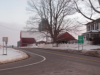
Varick is a town in Seneca County, New York, United States. The population was 1,639 at the 2020 census. The town is named after Richard Varick, an officer in the American Revolution, mayor of New York City, and uncle of the first Town Supervisor, Anthony Dey.

Newfield is a census-designated place (CDP) in Tompkins County, New York, United States. The population was 759 at the 2010 census.

<span class="mw-page-title-main">Marion, New York</span> Town in New York, United States

Marion is a town in Wayne County, New York, United States. The population was 4,746 as of the 2010 census. It is named after Revolutionary War hero Francis Marion. It is an interior town near the center of the county, approximately 20 miles east of Rochester, New York and 50 miles west of Syracuse.

Big Flats is an unincorporated community and census-designated place (CDP) within the town of Big Flats in Chemung County, New York, United States. The population of the CDP was 5,277 at the 2010 census, out of a total population in the town of 7,595.

<span class="mw-page-title-main">West Seneca (CDP), New York</span> Census-designated place in New York, United States

West Seneca is a hamlet and census-designated place (CDP) in Erie County, New York, United States. The population was 44,711 at the 2010 census. It is part of the Buffalo–Niagara Falls Metropolitan Statistical Area. The CDP corresponds exactly to the area of the town of West Seneca.

Lodi is a town in Seneca County, New York, United States. The population was 1,469 at the 2020 census.

Ovid is a village in Seneca County, New York, United States. The population was 602 at the 2010 census. The town was named by a clerk interested in the classics.

Ovid is a town in Seneca County, New York, United States. The population was 2,919 at the 2020 census. The town is named after the Roman poet Ovid, a name assigned by a clerk interested in the classics.

North Rose is a hamlet located in the Town of Rose, Wayne County, New York, United States. The population was 636 at the time of the 2010 census. Government offices for the Town of Rose are located in the hamlet.

Savannah is a hamlet located in the Town of Savannah, Wayne County, New York, United States. The population was 558 at the 2010 census. Savannah was incorporated as a village in 1867, but dissolved in 1979. Government offices for the Town of Savannah are located in the hamlet.

Marion is a hamlet located in the Town of Marion, Wayne County, New York, United States. The population was 1,511 at the 2010 census. Government offices for the Town of Marion are located in the hamlet.

Williamson is a hamlet located in the Town of Williamson, Wayne County, New York, United States. The population was 2,495 at the 2010 census. Government offices for the Town of Williamson are located in the hamlet.

Ontario is a hamlet and census-designated place (CDP) in the town of Ontario, Wayne County, New York, United States. The CDP extends into land surrounding the hamlet, including the east half of the hamlet of Ontario Center. The population of the CDP was 2,160 at the 2010 census. Government offices for the Town of Ontario are located in the hamlet.

References

  1. "ArcGIS REST Services Directory". United States Census Bureau. Retrieved September 20, 2022.
  2. 1 2 3 "U.S. Census website". United States Census Bureau . Retrieved May 30, 2015.
  3. "US Board on Geographic Names". United States Geological Survey. May 7, 2010. Retrieved May 30, 2015.
  4. Seneca County GenWeb – 1859 Town of Romulus Map, Retrieved June 10, 2015.
  5. New York State Agricultural Society, Abstract of the Proceedings, Part II, Volume 27, 1867, page 734, Retrieved June 10, 2015.
  6. Getty Images – 1874 Town of Romulus Map, Retrieved June 10, 2015.
  7. "US Gazetteer files: 2014". United States Census Bureau. February 12, 2014. Retrieved May 30, 2015.
  8. "Census of Population and Housing". Census.gov. Retrieved June 4, 2016.