Romulus, New York

Last updated
Romulus, New York
USA New York location map.svg
Red pog.svg
Romulus, New York
Location within the state of New York
Usa edcp location map.svg
Red pog.svg
Romulus, New York
Romulus, New York (the United States)
Coordinates: 42°43′19″N76°50′26″W / 42.72194°N 76.84056°W / 42.72194; -76.84056
Country United States
State New York
County Seneca
Settled1789
EstablishedMarch 5, 1794 [1]
Government
  Type Town Council
   Supervisor David Hayes
   Clerk Jane C. Braunig [2]
   Court Justice Kyle Collinsworth
Area
[3]
  Total51.38 sq mi (133.08 km2)
  Land37.79 sq mi (97.88 km2)
  Water13.59 sq mi (35.20 km2)
Elevation
758 ft (231 m)
Population
 (2020) [4]
  Total3,383 Decrease2.svg
  Estimate 
(2021) [4]
3,375
  Density114.33/sq mi (44.14/km2)
Time zone UTC-5 (Eastern (EST))
  Summer (DST) UTC-4 (EDT)
ZIP code
14541
Area code(s) 315, 607 and 680
FIPS code 36-63440
GNIS feature ID0979431
Website http://www.romulustown.com/

Romulus is a town in Seneca County, New York, United States. The population was 3,383 at the 2020 census. [4] The town is named after the mythical founder of Rome, Romulus, a name assigned by a clerk with an interest in the classics.[ citation needed ] It is located in the central part of the county, northwest of Ithaca, New York.

Contents

The town has a hamlet (and census-designated place), also called Romulus. Government offices for the town are located in nearby Willard. [5]

Romulus is home of the rare Seneca white deer, one of the largest populations of white deer in the world. They are located on the grounds of the former Seneca Army Depot. It is now a private wildlife refuge and conservation center which offers scenic tours. [6]

History

Before the American Revolution, this area was controlled by both the Cayuga and the Seneca nations of the Haudenosaunee (Iroquois). French Jesuit missionaries visited the area in the 17th century. The Sullivan Expedition in 1779 destroyed native villages and drove many of the Native Americans away. Romulus contains the area of Kendaia (Apple Town), a former Iroquois (Seneca) village destroyed by the residents in anticipation of the arrival of the Sullivan Expedition on September 5, 1779.

After the war, this town became part of the Central New York Military Tract, land for veterans of the Revolution. Returning natives were provided with land at the north end of Cayuga Lake. This reservation was partly in the eastern side of modern Romulus. The first non-native settlers arrived around 1789.

The town was formed while still part of Onondaga County in 1794. In 1800, part of Romulus was used to make the town of Fayette. The north part of Romulus was used to form the town of Varick in 1830.

The town also contains the former Seneca Army Depot (1941 - 1990s), built during World War II and finally closed in 2001. It was a major employer for citizens of Romulus and surrounding parts of Seneca County. Seneca Army Airfield, located along N.Y. Route 96A, provided a long runway for transport aircraft.

Willard State Hospital was converted to a state prison drug treatment center in 1995.

The town is home to the Five Points Correctional Facility, a New York state maximum security prison for men.

(Portions of a diary written by Henry McLafferty Jr (18191859) are available online from the Rochester Public Library: Romulus Revisited: Extracts from the Diary of Henry McLafferty, Jr. 18561857).

Geography

The town lies between Cayuga Lake and Seneca Lake at latitude 42° 45' 8" N. and longitude 76° 50' 2" W. at an altitude of 705 ft (214 m).

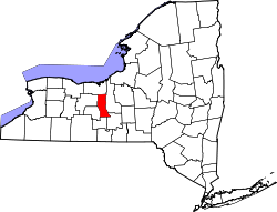
According to the United States Census Bureau, the town has a total area of 51.3 square miles (133 km2), of which 37.8 square miles (98 km2) is land and 13.5 square miles (35 km2) (26.34%) is water.

Romulus is in the Finger Lakes district of New York and lies between Cayuga Lake and Seneca Lake.

New York State Route 89, New York State Route 96, New York State Route 96A, and New York State Route 414 are all north-south highways in the town.

Demographics

Historical population
CensusPop.Note
1820 3,698
1830 2,089−43.5%
1840 2,2357.0%
1850 2,050−8.3%
1860 2,1705.9%
1870 2,2232.4%
1880 2,76524.4%
1890 2,8523.1%
1900 2,8951.5%
1910 2,803−3.2%
1920 2,754−1.7%
1930 2,8563.7%
1940 2,8650.3%
1950 4,26348.8%
1960 3,509−17.7%
1970 4,28422.1%
1980 2,464−42.5%
1990 2,5322.8%
2000 2,036−19.6%
2010 4,316112.0%
2020 3,383−21.6%
2021 (est.)3,375 [4] −0.2%
U.S. Decennial Census [7]

As of the census [8] of 2010, there were 4,316 people, 821 households, and 576 families residing in the town. The population density was 114.2 people per square mile (44.1/km2). The racial makeup of the town was 66.5% white, 29.2% black or African American, .5% Native American, .3% Asian, 2.8% from other races, and .7% from two or more races. Hispanic or Latino of any race were 9.2% of the population.

There were 821 households, out of which 30.5% had children under the age of 18 living with them, 55.4% were married couples living together, 9.9% had a female householder with no husband present, and 29.8% were non-families. 22.2% of all households were made up of individuals, and 9.2% had someone living alone who was 65 years of age or older. The average household size was 2.71 and the average family size was 3.20.

In the town, the population was spread out, with 17.2% under the age of 20, 13.0% from 20 to 24, 39.6% from 25 to 44, 23.5% from 45 to 64, and 6.7% who were 65 years of age or older. The median age was 33.4 years. For every 100 females, there were 264.2 males. For every 100 females age 18 and over, there were 324.1 males.

The median income for a household in the town was $56,705, and the median income for a family was $63,676. Males had a median income of $37,177 versus $30,313 for females. The per capita income for the town was $13,396. About 3.8% of families and 6.3% of the population were below the poverty line, including 7.8% of those under age 18 and 3.7% of those age 65 or over.

Housing

There were 1,101 housing units at an average density of 29.1 per square mile (11.2/km2). 25.4% of housing units were vacant.

There were 821 occupied housing units in the town. 571 were owner-occupied units (69.5%), while 250 were renter-occupied (30.5%). The homeowner vacancy rate was 2.5% of total units. The rental unit vacancy rate was 12.2%. [8]

NOTE: It is common for resort communities to have higher than normal vacant house counts. Many are vacation homes which are seasonal and not regularly occupied.

Communities and locations in the town of Romulus


Notable people

Related Research Articles

<span class="mw-page-title-main">Seneca County, New York</span> County in New York, United States

Seneca County is located in the U.S. state of New York. As of the 2020 census, the population was 33,814. The primary county seat is Waterloo, moved there from the original county seat of Ovid in 1819. It became a two-shire county in 1822, which currently remains in effect and uses both locations as county seats although the majority of Seneca County administrative offices are located in Waterloo. Therefore, most political sources list only Waterloo as the county seat. The county's name comes from the Seneca Nation of the Haudenosaunee (Iroquois), who occupied part of the region.

<span class="mw-page-title-main">Aurelius, New York</span> Town in New York, United States

Aurelius is a town in Cayuga County, New York, United States. The population was 2,610 at the 2020 census. The town was named after the Roman emperor Marcus Aurelius. It is at the western edge of the county and borders the city of Auburn.

<span class="mw-page-title-main">Ledyard, New York</span> Town in New York, United States

Ledyard is a town in Cayuga County, New York, United States. The population was 1,654 at the 2020 census. The name of the town is from General Benjamin Ledyard, an early settler of the town. Ledyard is on the western edge of the county and is southwest of Auburn.

<span class="mw-page-title-main">Mentz, New York</span> Town in New York, United States

Mentz is a town in Cayuga County, New York, United States. The population was 2,114 at the 2020 census. The town is in the central part of the county, 7 miles north of Auburn.The town's name has never been determined, but it is locally believed that it derived from Mainz, in Germany.

<span class="mw-page-title-main">Owasco, New York</span> Town in New York, United States

Owasco is a town in Cayuga County, New York, United States. It is part of the traditional territory of the Cayuga nation. The population was 3,793 at the 2010 census. Owasco is in the eastern part of Cayuga County and is at the southeast city line of Auburn. The town borders Owasco Lake, from where it gets its name.

<span class="mw-page-title-main">Springport, New York</span> Town in New York, United States

Springport is a town in Cayuga County, New York, United States. The population was 2,367 at the 2010 census. The name is derived from the local springs and lakeports. Springport is on the western border of the county and is southwest of Auburn.

Hector is a town in the northeastern corner of Schuyler County, New York, United States. The population was 4,916 at the 2020 census. The town is named after Hector Ely, who at the time was the firstborn son of the town founders. Hector is west of Ithaca.

Covert is a town in Seneca County, New York, United States. The population was 2,135 at the 2020 census.

Fayette is a town in Seneca County, New York, United States. The population was 3,617 at the 2020 census. The town is in the north-central part of the county and is southeast of Geneva, New York.

Varick is a town in Seneca County, New York, United States. The population was 1,639 at the 2020 census. The town is named after Richard Varick, an officer in the American Revolution, mayor of New York City, and uncle of the first Town Supervisor, Anthony Dey.

<span class="mw-page-title-main">Ulysses, New York</span> Town in New York, United States

Ulysses is a town located in northwest Tompkins County, New York, U.S. The population was 4,940 at the 2020 census. The town was named after the hero of the Odyssey.

Ovid is a town in Seneca County, New York, United States. The population was 2,919 at the 2020 census. The town is named after the Roman poet Ovid, a name assigned by a clerk interested in the classics.

<span class="mw-page-title-main">Seneca Falls, New York</span> Town in New York, United States

Seneca Falls is a town in Seneca County, New York, United States. The population was 8,942 at the 2020 census.

<span class="mw-page-title-main">Waterloo (town), New York</span> Town in New York, United States

Waterloo is a town in Seneca County, New York, United States. The population was 7,338 at the 2020 census. The town and its major community are named after Waterloo, Belgium, where Napoleon was defeated.

The former Seneca Army Depot occupied 10,587 acres (4,284 ha) between Seneca Lake and Cayuga Lake in Seneca County, New York. It was used as a munitions storage and disposal facility by the United States Army from 1941 until the 1990s. The Depot was listed in the 1995 Base Realignment and Closure Commission and formally shut down in 2000. The property has since been transferred to the Seneca County Industrial Development Agency, which leases it to Seneca County Economic Development Corp.

<span class="mw-page-title-main">New York State Route 89</span> State highway in central New York, US

New York State Route 89 (NY 89) is a north–south state highway in central New York in the United States. It extends for 62.35 miles (100.34 km) from an intersection with NY 13, NY 34, and NY 96 in the Tompkins County city of Ithaca to an interchange with NY 104 in the Wayne County town of Wolcott. The route spans a total of three counties, connecting the heart of the Finger Lakes Region to a point 6 miles (10 km) south of Lake Ontario. Along the way, NY 89 intersects two regionally important highways: the conjoined routes of U.S. Route 20 (US 20) and NY 5 in Seneca Falls and NY 31 in Savannah. NY 89 runs along the western edge of Cayuga Lake from Ithaca to Seneca Falls.

<span class="mw-page-title-main">New York State Route 96A</span> State highway in Seneca County, New York, US

New York State Route 96A (NY 96A) is a state highway in Seneca County, New York, in the United States. It is a north–south road between Seneca Lake and Cayuga Lake, two of the Finger Lakes. NY 96A is two lanes wide for most of its length, with the exception of the 3-mile (5 km) long four-lane divided highway section at the northern end. The southern terminus of NY 96A is at an intersection with NY 96 in the village of Interlaken. Its northern terminus is at a junction with the conjoined routes of U.S. Route 20 (US 20) and NY 5 in the town of Waterloo just east of the city of Geneva. The junction with NY 5 and US 20 was once a trumpet interchange; however, it was converted into an at-grade intersection in the late 1980s.

<span class="mw-page-title-main">Ithaca (town), New York</span> Town in New York, United States

Ithaca is a town in Tompkins County, New York, United States. The town's population was 22,283 at the 2020 census. The town is in the central part of the county, in the Finger Lakes–Southern Tier region of New York, and is part of the Ithaca Metropolitan Statistical Area. The Town of Ithaca is a horseshoe-shaped portion of the metropolitan area of Ithaca, New York, surrounding the City of Ithaca and being the city's only border. Ithaca College is located in the South Hill section of the town.

Lansing is a town in Tompkins County, New York, United States. The population was 11,691 at the 2020 census.

Romulus is a hamlet located in the Town of Romulus, Seneca County, New York, United States on the border with the Town of Varick. The population was 409 at the 2010 census.

References

  1. Sullivan, James; Williams, Melvin E.; Conklin, Edwin P.; Fitzpatrick, Benedict, eds. (1927), "Chapter IV. Seneca County.", History of New York State, 1523–1927 (PDF), vol. 2, New York City, Chicago: Lewis Historical Publishing Co., p. 635, hdl:2027/mdp.39015019994048, Wikidata   Q114149636
  2. Town of Romulus, Town Clerk Services, Retrieved May 25, 2019.
  3. "2016 U.S. Gazetteer Files". United States Census Bureau. Retrieved Jul 5, 2017.
  4. 1 2 3 4 Bureau, US Census. "City and Town Population Totals: 2020—2021". Census.gov. US Census Bureau. Retrieved October 12, 2022.
  5. Town of Romulus, New York, Retrieved May 28, 2015.
  6. Seneca White Deer, Retrieved Apr. 19, 2018.
  7. "Census of Population and Housing". Census.gov. Retrieved June 4, 2015.
  8. 1 2 "U.S. Census website". United States Census Bureau . Retrieved 2015-06-02.

Coordinates: 42°45′08″N76°50′01″W / 42.75222°N 76.83361°W / 42.75222; -76.83361