The name Onondaga derives from the name of the Native American tribe indigenous to this area, one of the original Five Nations of the Haudenosaunee. They call themselves (autonym) Onoda'gega, sometimes spelled Onontakeka. The word means "People of the Hills." Sometimes the term is Onondagaono ("The People of the Hills"). The federally recognized Onondaga Nation has a 9.3 square miles (24km2)reservation within the county, on which they have self-government.
When counties were established in New York in 1683, the present Onondaga County was part of Albany County. This enormous county included the northern part of New York State as well as all of the present State of Vermont and, in theory, extended westward to the Pacific Ocean. It was reduced in size on July 3, 1766, by the creation of Cumberland County, and further on March 16, 1770, by the creation of Gloucester County, both containing territory now in Vermont.
On March 12, 1772, what was left of Albany County was split into three parts, one remaining under the name Albany County. One of the other pieces, Tryon County, contained the western portion (and thus, since no western boundary was specified, theoretically still extended west to the Pacific). The eastern boundary of Tryon County was approximately 5 miles (8km) west of the present city of Schenectady, and the county included the western part of the Adirondack Mountains and the area west of the West Branch of the Delaware River. The area then designated as Tryon County now includes 37 counties of New York State. The county was named for William Tryon, colonial governor of New York.
Oneida Lake borders Onondaga County to the northeast. It is the largest lake wholly within the state of New York. This picture was taken from the town of Cicero, a northern suburban town in the northeast part of Onondaga County.
In the years prior to 1776, most of the Loyalists in Tryon County fled to Canada. The Onondaga were among four Iroquois tribes that allied with the British against the American colonists, as they hoped to end their encroachment. Instead, they were forced to cede most of their land in New York to the United States after the war. Many Onondaga went with Joseph Brant and other nations to Canada, where they received land grants in compensation and formed the Six Nations of the Grand River First Nation.
In 1784, after a peace treaty ended the American Revolutionary War, the name of Tryon County was changed to Montgomery County. It honored General Richard Montgomery, who had captured several places in Canada and died attempting to capture the city of Quebec, and replaced the name of the hated British governor.
In 1791, Herkimer County was one of three counties split off from Montgomery (the other two being Otsego, and Tioga County). This was much larger than the present county, however, and was reduced by a number of subsequent splits.
In 1794, Onondaga County was split off from Herkimer County. This county was larger than the current Onondaga County, including the present Cayuga, Cortland, and part of Oswego Counties.
In 1816, parts of Oneida and Onondaga Counties were taken to form the new Oswego County.
At the time Onondaga County was organized, it was divided into eleven towns: Homer, Pompey, Manlius, Lysander, Marcellus, Ulysses, Milton, Scipio, Ovid, Aurelius and Romulus.[3]
Central New York developed rapidly after the New Military Tract provided land in lieu of payment to Revolutionary War veterans. Migration was largely from the east, mostly from New England states. The Genesee Road, which became the Seneca Turnpike in 1800, provided access. Generally settlers preferred higher land, since they associated lowlands with disease. Over time, as early clearing and farming eroded hillside soil, valley lands were more fertile and highly prized for agriculture as well as for water power, which was the origin of many communities. An early settler of 1823 was James Hutchinson Woodworth, a native of Washington County, NY. He helped clear land for his family's farm in this region before he moved to Chicago where he became Mayor. The completion of the Erie Canal across New York state in 1825 accelerated trade, development and migration.
The city of Syracuse, New York developed relatively late, due to its marshy situation. It was incorporated as a village in 1825 and as a city in 1847; by contrast, the Village of Manlius, along the Cherry Valley and Seneca Turnpikes, was incorporated in 1813. The population of these rural towns was greatest in the late nineteenth century, when more people cultivated land and farms were relatively small, supporting large households.
Since that time, agriculture has declined in the county. Some Onondaga County towns like Spafford were largely depopulated and many villages became veritable ghost towns. Onondaga County highlands now are more heavily reforested, with public parks and preserves providing recreation. Two Finger Lakes in the county, Skaneateles and Otisco, also attract visitors. The village of Skaneateles on scenic Route 20 has become a major tourist destination.
At the turn of the twenty-first century, population declined in the City of Syracuse while suburban communities generally grew, particularly with tract developments north of the city. Elsewhere, scattered commuter houses appeared, generally on fairly large parcels. The rapid development of the village of Skaneateles and shores of Skaneateles Lake led to increased demand for property and property values.
Onondaga Lake Park in the northern suburbs of Syracuse. Picture captures Onondaga Lake with the Syracuse skyline in the background. Onondaga Lake Park attracts over one million visitors each year.
Geography
According to the U.S. Census Bureau, the county has an area of 806 square miles (2,090km2), of which 778 square miles (2,020km2) is land and 27 square miles (70km2) (3.4%) is water.[4] The geographic dimensions of the county are illustrated as approximately 35 miles (56km) in length and 30 miles (48km) in width, and comprising 25 miles (40km) of the New York State Barge Canal System, in combination with a number of lakes, streams and rivers.[5] Onondaga County is in the central portion of New York State, west of Albany and Utica, east of Rochester and northeast of Ithaca. Onondaga Lake is bordered by many of the larger communities in the county. The highest point in Onondaga County is at 2057 feet, along Morgan Hill located just east of Morgan Hill State Forest on private property. The second highest point in Onondaga County is at 2019 feet elevation and on the summit of Fellows Hill which is located in Morgan Hill State Forest near Fabius and Apulia south of state route 80.
The northern part of the county is fairly level lake plain, extending northward to Lake Ontario. Oneida Lake three rivers, as well as the Erie and subsequent Barge Canals are in the lake plain. The main line of the New York Central Railroad and the New York State Thruway extend east and west across the county through the lake plain. The southern part of the county is Appalachian Plateau, with high hills rising at the southern edge of Syracuse. This is the eastern part of the Finger Lakes region. Skaneateles Lake and Otisco Lake are both in Onondaga County. US 20 extends east and west across the county, traversing dramatic hill-and-valley terrain. Between the lake plain and Appalachian highlands is a zone noted for drumlins, smaller, scattered hills formed as mounds of debris left by the last glacier. Tully is geologically noted for the terminal moraine deposited there by the glacier, filling the deep Tully Valley, which might have been another Finger Lake had the moraine been left closer to Syracuse, impounding water. Tully is at the divide between two major watersheds, one flowing northward to the Atlantic Ocean by way of the St. Lawrence River and the other southward to the ocean via the Susquehanna River.[6] Oneida Lake, the Finger Lakes, and smaller bodies of water provide recreation. The Appalachian hills have several ski areas, waterfalls and historic villages as well as large parks and forest preserves.
Of the 181,153 households, 31.90% had children under age 18 living with them, 46.90% were married couples living together, 12.90% had a female householder with no husband present, and 36.30% were not families. About 29.40% of all households were made up of individuals, and 10.80% had someone living alone who was 65 years of age or older. The average household size was 2.46 and the average family size was 3.07.
25.80% of the county's population was under age 18, 9.50% was from age 18 to 24, 28.80% was from age 25 to 44, 22.10% was from age 45 to 64, and 13.80% was age 65 or older. The median age was 36 years. For every 100 females, there were 91.70 males. For every 100 females age 18 and over, there were 87.70 males.
The county's median household income was $40,847, and the median family income was $51,876. Males had a median income of $39,048 versus $27,154 for females. The county's per capita income was $21,336. About 8.60% of families and 12.20% of the population were below the poverty line, including 15.50% of those under age 18 and 7.10% of those age 65 or over.
Onondaga County was governed exclusively by a board of supervisors until 1961, when voters approved the creation of the county executive.[17] In 1968, the board reorganized into a 24-seat county legislature.[18] In 2001, the legislature was reduced to 19 seats. In 2010, voters approved a measure to reduce the legislature to 17 seats. None of the legislative seats, nor the county executive's seat, are at-large. Currently, there are 11 Republicans and 6 Democrats.[19] J. Ryan McMahon II (R) is the current County Executive.[20]
Politics
Historically, Onondaga County was a Republican stronghold, like most of Central New York. From 1856 to 1988, the GOP carried the county in all but one presidential election, Lyndon B. Johnson's landslide in 1964. Since 1992, the county has gone Democratic in every presidential election, much like many urban counties around the country. However, it is a swing county in congressional, state and local races. Onondaga is entirely located within New York's 22nd Congressional District, represented by Republican Brandon Williams. Democratic strength is concentrated in Syracuse itself, while Republicans do well in the suburbs.
As of 2021[update], the sheriff of Onondaga County is Eugene J. Conway.[23] Along with Broome County, New York, Onondaga County was sued in 2017 over placing juvenile inmates in solitary confinement.[24]
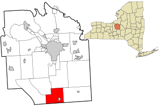
Communities
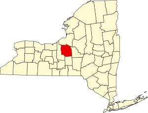
A map of towns (white), the city (orange), and villages (yellow) in Onondaga County (Indian reservation colored purple)
Syracuse, the county seat, is the only city in Onondaga County. The following is a list of official towns, villages, and hamlets.[25]
Syracuse is a city in and the county seat of Onondaga County, New York, United States. With a population of 148,620 and a metropolitan area of 662,057, it is the fifth-most populated city and 13th-most populated municipality in the state of New York.
Cayuga County is a county in the U.S. state of New York. As of the 2020 census, the population was 76,248. Its county seat and largest city is Auburn. The county was named for the Cayuga people, one of the Native American tribes in the Iroquois Confederation. The county is part of the Central New York region of the state.
Cortland County is a county located in the U.S. state of New York. As of the 2020 census, the population of Cortland County was 46,809. The county seat is Cortland. The county is named after Pierre Van Cortlandt, president of the convention at Kingston that wrote the first New York State Constitution in 1777, and first lieutenant governor of the state. The county is part of the Central New York region of the state.
Madison County is a county located in the U.S. state of New York. As of the 2020 census, the population was 68,016. Its county seat is Wampsville. The county is named after James Madison, the fourth president of the United States, and was first formed in 1806. The county is part of the Central New York region of the state.
Oswego County is a county in the U.S. state of New York. As of the 2020 census, the population was 117,525. The county seat is Oswego. The county name is from a Mohawk-language word meaning "the pouring out place", referring to the point at which the Oswego River feeds into Lake Ontario at the northern edge of the county in the city of Oswego. The county is part of the Central New York region of the state.
Tompkins County is a county located in the U.S. state of New York. As of the 2020 census, the population was 105,740. The county seat is Ithaca. The name is in honor of Daniel D. Tompkins, who served as Governor of New York and Vice President of the United States. The county is part of the Southern Tier region of the state.
Scott is a town in Cortland County, New York, United States. The population was 1,176 at the 2010 census. The town was named after General Winfield Scott. It is in the northwestern corner of Cortland County and is northwest of the City of Cortland.
DeWitt is a town in Onondaga County, New York, United States. As of the 2020 census, the population was 26,074. The town is named after major Moses DeWitt, a judge and soldier. An eastern suburb of Syracuse, DeWitt also is the site of most of the campus and all of the academic buildings of Le Moyne College.
Pompey is a town in the southeast part of Onondaga County, New York. As of the 2020 Census, the population was 7,080. The town was named after the Roman general and political leader Pompey by a late 18th-century clerk interested in the Classics in the new federal republic.
Spafford is a town in Onondaga County, New York, United States. As of the 2020 Census, the population was 1,588. The town was named after Horatio Gates Spafford, a writer and founder of the local library. Spafford is in the southwestern corner of Onondaga County and is southwest of Syracuse.
Manlius is a town to the south east of Syracuse in Onondaga County. As of the 2020 Census, the population was 33,712, making it the third largest suburb in metropolitan Syracuse. In 2005, the town was ranked 98th on CNN's list of Best Places to Live.
Marcellus is a town in Onondaga County, New York, United States. As of the 2020 Census, the population was 6,066. The town was probably named after Marcus Claudius Marcellus, a Roman general, by a clerk interested in the Classics.
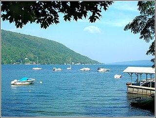
Skaneateles Lake is one of the Finger Lakes in central New York in the United States. The name Skaneateles means long lake in one of the local Iroquoian languages. The lake is sometimes referred to as "The Roof Garden of the Lakes" because its altitude is higher than the other Finger Lakes. It is one of the cleanest lakes in the United States.
Area codes 315 and 680 are telephone area codes of the North American Numbering Plan (NANP) for the north-central area of the U.S. state of New York. Area code 315 was installed as one of the original North American area codes in 1947, while area code 680 was added to the numbering plan area (NPA) in an overlay plan in 2017.
The Skaneateles Turnpike was an east–west turnpike in central New York in the United States. It began east of the village of Skaneateles and ran east across southern Onondaga and Madison counties to Richfield Springs in northern Otsego County. The road began and ended at the Cherry Valley Turnpike, part of the Great Western Turnpike system, and largely paralleled the Cherry Valley Turnpike between Skaneateles and Richfield Springs. Most of the road is now county-maintained, but a handful of sections are now part of New York state touring routes.
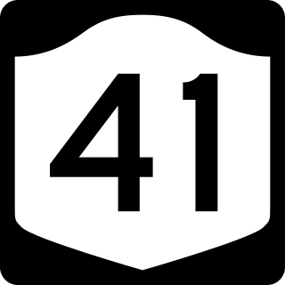
New York State Route 41 (NY 41) is a north–south state highway in Central New York in the United States. The southern terminus of the route is at an interchange with NY 17 in the town of Sanford in Broome County, New York. Its northern terminus is at an intersection with U.S. Route 20 (US 20) in the village of Skaneateles. The route is almost 100 miles (161 km) long and passes through Broome, Chenango, Cortland, and Onondaga counties. NY 41 was assigned as part of the 1930 renumbering of state highways in New York, replacing New York State Route 70 from Homer to Skaneateles. The route initially extended as far north as Jordan; however, NY 41 was cut back to its current northern terminus c. 1933.
New York State Route 80 (NY 80) is a 127.32-mile-long (204.90 km) west–east New York State Route located within Onondaga, Madison, Chenango, Otsego, Herkimer, and Montgomery counties in New York. Its western terminus is located at a junction with NY 175 in the city of Syracuse in Onondaga County, from which it actually runs in a north–south direction for 20 miles (32 km). The eastern terminus is located at a junction with NY 5 in the village of Nelliston in Montgomery County. The route is signed north–south from U.S. Route 20 (US 20) north to NY 5.
New York State Route 173 (NY 173) is a state highway located in the Syracuse area of central New York in the United States. It takes a slightly bow-shaped route from NY 31 in the town of Van Buren to NY 5 in Chittenango, gently curving to the south of Downtown Syracuse in the center of its 30.59-mile (49.23 km) routing. Even so, NY 173 briefly enters the Syracuse city limits near where it intersects U.S. Route 11 (US 11). NY 173 passes through several suburbs of Syracuse, including Camillus, where it first meets NY 5, and Manlius, where it has a short overlap with NY 92.
New York State Route 174 (NY 174) is a state highway in Onondaga County, located in Central New York, in the United States. The highway is 16.7 miles (26.9 km) long and passes through mostly rural regions. Route 174 begins at an intersection with NY 41 in Borodino, a hamlet of Spafford. It heads generally northward for most of its length, except for short distances in the villages of Marcellus and Camillus. The route ends at a junction with NY 5 west of Camillus, at the west end of the Route 5 Camillus bypass. Route 174 is located along a large mapped sedimentary bedrock unit, known as the Marcellus Formation. The formation is named for an outcrop found near the town of Marcellus, New York, during a geological survey in 1839.
Tully is a town in Onondaga County, New York, United States. As of the 2020 census, the population was 2,676. The name of the town is derived from the Roman orator Marcus Tullius Cicero. The town is on the county's southern border, south of Syracuse.
↑ Onondaga County Charter Commission (September 5, 1961), PROPOSED ONONDAGA COUNTY CHARTER ADOPTED BY THE BOARD OF SUPERVISORS SEPTEMBER 5, 1961 SUBJECT TO APPROVAL BY REFERENDUM NOVEMBER 7, 1961, Syracuse, New York, pp.3–4{{citation}}: CS1 maint: location missing publisher (link)
↑ Board Executive Office (1967), "LOCAL LAW NO. 2—1966", Journal of the Board of Supervisors of the County of Onondaga for 1966, Syracuse, New York, pp.182–187
This page is based on this Wikipedia article Text is available under the CC BY-SA 4.0 license; additional terms may apply. Images, videos and audio are available under their respective licenses.