Spafford Valley | |
|---|---|
 Bucktail Falls, Spafford Valley | |
 Interactive map of Spafford Valley | |
| Coordinates: 42°49′30.24″N76°14′42.75″W / 42.8250667°N 76.2452083°W | |
| Country | United States |
| State | New York |
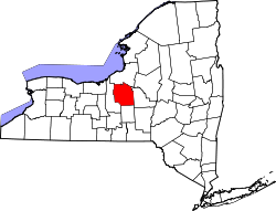
| County | Onondaga County |
Spafford Valley is a hamlet in Onondaga County, New York, United States, in the Otisco Valley south of Otisco Lake. [1] The hamlet is noted for "The Bucktail," a picturesque gorge with waterfalls.