Bridgeport, New York

Last updated

Bridgeport, New York
USA New York location map.svg
Red pog.svg
Bridgeport
Usa edcp location map.svg
Red pog.svg
Bridgeport
Coordinates: 43°9′16″N75°58′30″W / 43.15444°N 75.97500°W / 43.15444; -75.97500
Country United States
State New York
Counties Onondaga, Madison
Towns Cicero, Sullivan
Area
[1]
  Total
1.94 sq mi (5.03 km2)
  Land1.93 sq mi (4.99 km2)
  Water0.01 sq mi (0.04 km2)
Elevation
390 ft (119 m)
Population
 (2020) [2]
  Total
1,389
  Density720.81/sq mi (278.28/km2)
Time zone UTC-5 (Eastern (EST))
  Summer (DST) UTC-4 (EDT)
ZIP Codes
13030 (Bridgeport)
13082 (Kirkville)
Area code 315
FIPS code 36-08147
GNIS feature ID0944727

Bridgeport is a hamlet (and census-designated place) in upstate New York, United States, located partly in the town of Sullivan in Madison County, and partly in the town of Cicero in Onondaga County. The population was 1,389 as of the 2020 census, [2] , down from 1,490 in 2010.

Contents

Geography

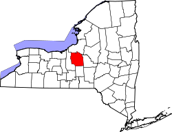
Bridgeport is located in northwestern Madison County and northeastern Onondaga County at 43°9′16″N75°58′30″W / 43.15444°N 75.97500°W / 43.15444; -75.97500 (43.154472, -75.974888). [3] It straddles the northward-flowing Chittenango Creek, which serves as the boundary between Onondaga County's town of Cicero on the west side of the creek and Madison County's town of Sullivan on the east side of the creek. The hamlet's namesake bridge spans the creek, which empties into Oneida Lake 2.25 linear miles approximately north of the bridge. There is no other bridge across Chittenango Creek north of Bridgeport, nor one within several linear miles to the south.

New York State Route 31 is an east–west highway through the community (the bridge over Chittenango Creek is on Route 31); it leads east 20 miles (32 km) to Verona and west 19 miles (31 km) to Baldwinsville. The north end of New York State Route 298 is at Route 31 in the hamlet, just west of Chittenango Creek. Syracuse is 13 miles (21 km) to the southwest via Route 298.

According to the U.S. Census Bureau, the Bridgeport CDP has an area of 1.94 square miles (5.02 km2), of which 0.02 square miles (0.05 km2), or 0.77%, are water. [1]

Demographics

Historical population
CensusPop.Note
2000 1,678
2010 1,490−11.2%
2020 1,389−6.8%
U.S. Decennial Census [4]

As of the census [5] of 2000, there were 1,678 people, 639 households, and 431 families residing in the hamlet. The population density was 912.4 inhabitants per square mile (352.3/km2). There were 685 housing units at an average density of 375.4 per square mile (144.9/km2). The racial makeup of the area was 96.10% White, 1.20% African American, 0.66% Native American, 0.42% Asian, and 1.62% from two or more races. Hispanic or Latino of any race were 0.36% of the population.

There were 639 households, out of which 32.4% had children under the age of 18 living with them, 51.5% were married couples living together, 11.9% had a female householder with no husband present, and 32.4% were non-families. 26.6% of all households were made up of individuals, and 14.7% had someone living alone who was 65 years of age or older. The average household size was 2.60 and the average family size was 3.13.

In the community, the population was spread out, with 25.8% under the age of 18, 8.8% from 18 to 24, 30.0% from 25 to 44, 21.7% from 45 to 64, and 13.8% who were 65 years of age or older. The median age was 38 years. For every 100 females, there were 98.7 males. For every 100 females age 18 and over, there were 93.1 males.

The median income for a household in the community was $31,358, and the median income for a family was $42,337. Males had a median income of $26,970 versus $26,316 for females. The per capita income for the CDP was $14,761. About 10.5% of families and 12.2% of the population were below the poverty line, including 19.9% of those under age 18 and 7.5% of those age 65 or over.

Related Research Articles

<span class="mw-page-title-main">Madison Park, New Jersey</span> Populated place in Middlesex County, New Jersey, US

Madison Park is an unincorporated community and census-designated place (CDP) in Old Bridge Township, Middlesex County, New Jersey, United States. As of the 2020 census, the CDP's population was 8,050, up from 7,144 in 2010. The name "Madison Park" comes from Madison Township, the original name for Old Bridge Township from 1869 until 1975.

<span class="mw-page-title-main">Myers Corner, New York</span> Census-designated place in New York, United States

Myers Corner is a hamlet and census-designated place (CDP) in the town of Wappinger, Dutchess County, New York, United States. The population was 6,790 at the 2010 census. It is part of the Poughkeepsie–Newburgh–Middletown, NY Metropolitan Statistical Area as well as the larger New York–Newark–Bridgeport, NY-NJ-CT-PA Combined Statistical Area.

<span class="mw-page-title-main">Red Oaks Mill, New York</span> Census-designated place in New York, United States

Red Oaks Mill is a hamlet and census-designated place (CDP) in Dutchess County, in the U.S. state of New York. It lies within the limits of the towns of Poughkeepsie and LaGrange. The population was 3,613 at the 2010 census.

<span class="mw-page-title-main">Chittenango, New York</span> Village in New York, United States

Chittenango is a village in Madison County, New York, United States. It is in the southern part of the town of Sullivan. The population was 4,896 at the 2020 census. Chittenango is the birthplace of L. Frank Baum, author of The Wonderful Wizard of Oz.

<span class="mw-page-title-main">Fenner, New York</span> Town in New York, United States

Fenner is a town in Madison County, New York, United States. The population was 1,668 at the 2020 census. The town is in the north-central part of the county, east of Cazenovia Lake.

Lenox is a town in Madison County, New York, United States. The population was 8,768 as of the 2020 census.

<span class="mw-page-title-main">Nelson, New York</span> Town in New York, United States

Nelson is a town in Madison County, New York, United States. The population was 1,890 at the 2020 census. The town was named after Horatio Nelson, the English naval hero.

<span class="mw-page-title-main">Sullivan, New York</span> Town in Madison County, New York, US

Sullivan is a town in Madison County, New York, United States. The population was 14,794 at the 2020 census. The town is named after Revolutionary War general John Sullivan.

<span class="mw-page-title-main">Cicero, New York</span> Town in New York, United States

Cicero is a town in northern Onondaga County, New York, United States. As of the 2020 Census, the population was 31,435. The name of the town was assigned by a clerk interested in the classics, honoring Cicero, a Roman statesman.

<span class="mw-page-title-main">Fairmount, New York</span> Census-designated place in New York, United States

Fairmount is a hamlet in Onondaga County, New York, United States. Fairmount is a western suburb of Syracuse, located in the far southeastern corner of the town of Camillus. Its zip code is 13219 (Syracuse). It is located within the West Genesee Central School District. The population was 10,224 at the 2010 census.

<span class="mw-page-title-main">Galeville, New York</span> Census-designated place in New York, United States

Galeville is a hamlet in Onondaga County, New York, United States. The population was 4,617 at the 2010 census.

<span class="mw-page-title-main">Mattydale, New York</span> Census-designated place in New York, United States

Mattydale is a hamlet in Onondaga County, New York, United States. The population was 6,446 at the 2010 census.

<span class="mw-page-title-main">Seneca Knolls, New York</span> Census-designated place in New York, United States

Seneca Knolls is a hamlet in Onondaga County, New York, United States. The population was 2,011 at the 2010 census.

<span class="mw-page-title-main">Village Green, New York</span> Census-designated place in New York, United States

Village Green is a hamlet in Onondaga County, New York, United States. The population was 3,891 at the 2010 census.

<span class="mw-page-title-main">Pine Plains (CDP), New York</span> Census-designated place in New York, United States

Pine Plains is a hamlet and census-designated place (CDP) in Dutchess County, New York, United States. The population was 1,142 at the 2020 census. It is part of the Poughkeepsie–Newburgh–Middletown, NY Metropolitan Statistical Area as well as the larger New York–Newark–Bridgeport, NY-NJ-CT-PA Combined Statistical Area.

Cairo is a hamlet and census-designated place (CDP) in the town of Cairo in Greene County, New York, United States. The population of the CDP was 1,368 at the 2020 census, out of 6,644 people in the entire town.

<span class="mw-page-title-main">Cazenovia, New York</span> Town in New York, United States

Cazenovia is an incorporated town in Madison County, New York, United States. The population was 6,740 at the time of the 2020 census. The town is named after Theophile Cazenove, the 'Agent General of the Holland Land Company. The village of Cazenovia is located in the center of the town. The town is on the county's western border.

<span class="mw-page-title-main">DeRuyter, New York</span> Town in New York, United States

DeRuyter is a town in Madison County, New York, United States. The population was 1,276 at the 2020 census, down from 1,589 in 2010. The town is named after Michiel Adriaenszoon de Ruyter, a famous admiral in the Dutch navy. The name de Ruyter means "the Rider".

<span class="mw-page-title-main">Manlius (village), New York</span> Village in New York, United States

Manlius is a village in Onondaga County, New York, United States, and a southeast suburb of Syracuse. As of the 2020 census, the population was 4,662.

<span class="mw-page-title-main">Manlius, New York</span> Town in New York, United States

Manlius is a town to the south east of Syracuse in Onondaga County, New York, United States. As of the 2020 Census, the population was 33,712, making it the third largest suburb in metropolitan Syracuse. In 2005, the town was ranked 98th on CNN's list of Best Places to Live.

References

  1. 1 2 "2024 U.S. Gazetteer Files: New York". United States Census Bureau. Retrieved February 4, 2025.
  2. 1 2 "P1. Race – Bridgeport CDP, New York: 2020 DEC Redistricting Data (PL 94-171)". U.S. Census Bureau. Retrieved February 4, 2025.
  3. "US Gazetteer files: 2010, 2000, and 1990". United States Census Bureau. February 12, 2011. Retrieved April 23, 2011.
  4. "Census of Population and Housing". Census.gov. Retrieved June 4, 2016.
  5. "U.S. Census website". United States Census Bureau . Retrieved January 31, 2008.