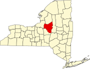
Madison County is a county located in the U.S. state of New York. As of the 2020 census, the population was 68,016. Its county seat is Wampsville. The county is named after James Madison, the fourth president of the United States, and was first formed in 1806. The county is part of the Central New York region of the state.
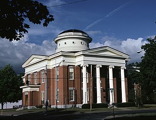
Oneida County is a county in the state of New York, United States. As of February 26, 2024, the population was 226,654. The county seat is Utica. The name is in honor of the Oneida, one of the Five Nations of the Iroquois League or Haudenosaunee, which had long occupied this territory at the time of European encounter and colonization. The federally recognized Oneida Indian Nation has had a reservation in the region since the late 18th century, after the American Revolutionary War.

Lawrence County is located in the southwest portion of the U.S. state of Missouri, in the area of the Ozarks. As of the 2020 census, the population was 38,001. Its county seat is Mount Vernon. The county was organized in 1845 and named for James Lawrence, a naval officer from the War of 1812 known for his battle cry, "Don't give up the ship!"
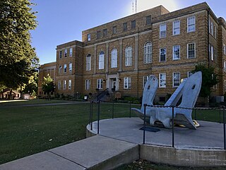
Faulkner County is a county located in the Central Arkansas region of the U.S. state of Arkansas. As of the 2020 census, the population was 123,498, making it the fifth most populous of Arkansas's 75 counties. The county seat and largest city is Conway. Faulkner County was created on April 12, 1873, one of nine counties formed during Reconstruction, and is named for Sandford C. Faulkner, better known as Sandy Faulkner, a popular figure in the state at the time.

Oneida is a city in Madison County in the U.S. state of New York. It is located west of Oneida Castle and east of Wampsville. The population was 11,390 at the 2010 census. The city, like both Oneida County and the nearby silver and china maker, was named for the Oneida tribe, which had a large territory here around Oneida Lake during the colonial period.

Oneida Castle is a village in Oneida County, New York, United States. The population was 586 at the 2020 census. The village is in the northwestern corner of the town of Vernon. Oneida Castle is east of the city of Oneida and west of the city of Sherrill in New York State.

Oriskany Falls is a village in Oneida County, New York, United States. The population was 732 at the 2010 census. The name is derived from a waterfall on a nearby stream. The vilalge is largely in the southeast section of the town of Augusta, but partly overlaps the town of Marshall. The community is at the intersection of routes 12B and 26, which share a brief concurrency within the village and south to Bouckville.
Paris is a town in Oneida County, New York, United States. The town is in the southeast part of the county and is south of Utica. The population was 4,332 at the 2020 census. The town was named after an early benefactor, Colonel Isaac Paris.
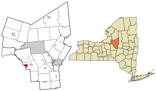
Sherrill is a city in Oneida County, New York, United States. With a population of 3,077, it is the state's least populous city. Sherrill is at the western end of the Town of Vernon on Route 5. Sherrill is referred to as The Silver City.

Verona is a town in southwestern Oneida County, New York, United States. The population was 6,293 at the 2010 census. The town was named after Verona, Italy.

Westmoreland is a town in Oneida County, New York, United States. The population was 6,138 at the 2010 census.

Vernon is a village in Oneida County, New York, United States. The population was 1,177 at the 2020 census.

Vernon is a town in Oneida County, New York, United States. The population was 5,408 at the 2010 census.

Turning Stone Resort Casino is a Native American resort casino owned and operated by the Oneida Indian Nation of New York (OIN) in Verona, New York.

The Oneida Indian Nation (OIN) or Oneida Nation is a federally recognized tribe of Oneida people in the United States. The tribe is headquartered in Verona, New York, where the tribe originated and held territory prior to European colonialism, and continues to hold territory today. They are Iroquoian-speaking people, and one of the Five Nations of the Iroquois Confederacy, or Haudenosaunee. The Oneida are known as "America's first allies" as they were the first, and one of the few, Iroquois nations to support the American cause. Three other federally recognized Oneida tribes operate in locations where they migrated or were removed to during and after the American Revolutionary War: one in Wisconsin in the United States, and two in Ontario, Canada.

Washington Mills is a hamlet and census-designated place in the Town of New Hartford, a suburb of Utica, New York, United States.
Durhamville is a hamlet located in Oneida County, New York, United States. The population was 584 as of the 2010 census.

Rome Free Academy is a public high school in Rome, New York, United States. It is a part of the Rome City School District.

Vernon-Verona-Sherrill High School, commonly referred to as VVS, is a public high school in Verona, New York. Vernon-Verona-Sherrill High School offers a comprehensive curriculum for grades 9-12 and is part of the Vernon-Verona-Sherrill Central School District which serves students from the towns of Verona and Vernon and the city of Sherrill.
Vernon-Verona-Sherrill Central School District, also known as the Sherrill City School District, is a school district in Verona, New York.


