Floyd, New York

Last updated
Floyd, New York
Oneida County New York incorporated and unincorporated areas Floyd highlighted.svg
Location in Oneida County and the state of New York.
Coordinates: 43°13′31″N75°19′54″W / 43.22528°N 75.33167°W / 43.22528; -75.33167
CountryUnited States
State New York
County Oneida
Government
  Type Town Council
   Town Supervisor Willard H. Strieff(R)
   Town Council
Members' List
Area
[1]
  Total34.79 sq mi (90.11 km2)
  Land34.62 sq mi (89.66 km2)
  Water0.17 sq mi (0.45 km2)
Elevation
889 ft (271 m)
Population
 (2010)
  Total3,819
  Estimate 
(2016) [2]
3,776
  Density109.08/sq mi (42.12/km2)
Time zone UTC-5 (Eastern (EST))
  Summer (DST) UTC-4 (EDT)
ZIP code
13440
Area code(s) 315
FIPS code 36-26385
GNIS feature ID0978962
Website Town website

Floyd is a town in Oneida County, New York, United States. The population was 3,819 at the 2010 census. The town is named after William Floyd, a signer of the Declaration of Independence. [3]

Contents

The Town of Floyd is located east of the City of Rome and the former Griffiss Air Force Base.

The Erie Canal passes along the southern part of the town.

History

The area was first settled around 1790. The Town of Floyd was founded in 1796 from the Town of Steuben. William Floyd, for whom the town is named, became a resident of Oneida County in 1794.

The population of Floyd was 1,227 in 1865, [4] but only 663 in 1920.

In the 19th century, Floyd was known for "Masonic, scholarly, political and anti-slavery activities." [5]

The Camroden Presbyterian Church was listed on the National Register of Historic Places in 2007. [6]

The town was briefly mentioned in the 1996 film "City Hall," where the two main characters were stuck in Floyd while waiting for snow to clear off the train tracks.
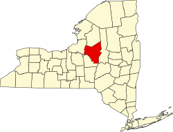
Geography

According to the United States Census Bureau, the town has a total area of 34.8 square miles (90 km2), of which 34.6 square miles (90 km2) is land and 0.2 square miles (0.52 km2) (0.46%) is water.

The Mohawk River defines the southern town line. The town has rolling hills, ascending to the north, which reach an elevation of about 200–300 feet above the river. Nine Mile Creek, which flows through the southeast part of the town, was originally known as Te-ya-nun-sak, or Teyanunsoke, "a beech tree standing." [4] [5]

Demographics

Historical population
CensusPop.
1800 767
1810 97026.5%
1820 1,48853.4%
1830 1,69914.2%
1840 1,7422.5%
1850 1,419−18.5%
1860 1,4401.5%
1870 1,209−16.0%
1880 1,115−7.8%
1890 920−17.5%
1900 785−14.7%
1910 697−11.2%
1920 663−4.9%
1930 75213.4%
1940 82810.1%
1950 1,01422.5%
1960 2,234120.3%
1970 3,62062.0%
1980 3,8636.7%
1990 3,856−0.2%
2000 3,8690.3%
2010 3,819−1.3%
2016 (est.)3,776 [2] −1.1%
U.S. Decennial Census [7]

As of the census [8] of 2000, there were 3,869 people, 1,394 households, and 1,091 families residing in the town. The population density was 111.8 people per square mile (43.2/km2). There were 1,483 housing units at an average density of 42.9 per square mile (16.5/km2). The racial makeup of the town was 97.49% White, 0.36% African American, 0.18% Native American, 0.41% Asian, 0.08% Pacific Islander, 0.18% from other races, and 1.29% from two or more races. Hispanic or Latino of any race were 1.03% of the population.

There were 1,394 households, out of which 38.8% had children under the age of 18 living with them, 63.0% were married couples living together, 10.4% had a female householder with no male present, and 21.7% were non-families. 17.3% of all households were made up of individuals, and 7.4% had someone living alone who was 65 years of age or older. The average household size was 2.78 and the average family size was 3.11.

In the town, the population was spread out, with 28.0% under the age of 18, 6.7% from 18 to 24, 29.7% from 25 to 44, 24.8% from 45 to 64, and 10.6% who were 65 years of age or older. The median age was 36 years. For every 100 females, there were 97.6 males. For every 100 females age 18 and over, there were 93.3 males.

The median income for a household in the town was $40,192, and the median income for a family was $44,583. Males had a median income of $33,151 versus $22,718 for females. The per capita income for the town was $17,405. About 2.8% of families and 4.2% of the population were below the poverty line, including 5.1% of those under age 18 and 5.6% of those age 65 or over.

Communities and locations in Floyd, NY

Notable people

Related Research Articles

Schuyler, New York Town in Herkimer County, New York, US

Schuyler is a town in Herkimer County, New York, United States. The population was 3,420 at the 2010 census. The town is in the western part of Herkimer County and is east of Utica.

Leyden is a town in Lewis County, New York, United States. The population was 1,785 at the 2010 census. The town is in the southern part of the county and is north of Rome.

Sullivan, New York Town in Madison County, New York, US

Sullivan is a town in Madison County, New York, United States. The population was 15,339 at the 2010 census. The town is named after General John Sullivan.

Forestport is a town in Oneida County, New York, United States. The population was 1,535 at the 2010 census.

Kirkland, New York Town in Oneida County, New York, United States

Kirkland is a town in Oneida County, New York, United States. The population was 10,315 at the 2010 census. The town is named after Samuel Kirkland, a missionary among the Oneidas.

Paris, New York Town in New York, United States

Paris is a town in Oneida County, New York, United States. The town is in the southeast part of the county and is south of Utica. The population was 4,411 at the 2010 census. The town was named after an early benefactor, Colonel Isaac Paris.

Steuben, New York Town in Oneida County, New York, US

Steuben is a town in Oneida County, New York, United States. The population was 1,110 at the 2010 census. The town is named after Baron von Steuben, a Prussian general who fought on the American side in the American Revolutionary War.

Trenton, New York Town in New York, United States

Trenton is a town in Oneida County, New York, United States. The population was 4,498 at the 2010 census.

Verona, New York Town in New York, United States

Verona is a town in southwestern Oneida County, New York, United States. The population was 6,293 at the 2010 census. The town was named after Verona, Italy.

Vienna, New York Town in New York, United States

Vienna is a town in Oneida County, New York, United States. The population was 5,440 at the 2010 census. The town is named after the capital of Austria.

<span class="mw-page-title-main">Western, New York</span> Town in New York, United States

Western is a town in Oneida County, New York, United States. The population was 1,951 at the 2010 census.

Westmoreland, New York Town in New York, United States

Westmoreland is a town in Oneida County, New York, United States. The population was 6,138 at the 2010 census.

Whitestown, New York Town in New York, United States

Whitestown is a town in Oneida County, New York, United States. The population was 18,667 at the 2010 census. The name is derived from Judge Hugh White, an early settler. The town is immediately west of Utica and the New York State Thruway passes across the town.

Hastings, New York Town in New York, United States

Hastings is a town in Oswego County, New York, United States. The population was 9,450 at the 2010 census. The town is named after Hastings Curtiss, a prominent citizen and member of the State Assembly in 1824.

Fremont is a town in Steuben County, New York, United States. The population was 964 at the 2000 census. The town is named after General John Fremont.

Pulteney is a town in Steuben County, New York, United States. The population was 1,405 at the 2000 census. The name is derived from the name of the original pioneer tract of land.

West Union is a town in Steuben County, New York, United States. The population was 343 as of the 2020 decennial census.

Boonville, New York Town in New York, United States

Boonville is a town in Oneida County, New York, United States. The town is in the northeastern section of the county. The population was 4,555 at the 2010 census. The town includes a village, also called Boonville. The town and village are named after Gerrit Boon, an agent of the Holland Land Company. The current mayor is Eric McIntyre.

Bridgewater, New York Town in New York, United States

Bridgewater is a town in Oneida County, New York, United States. The population was 1,522 at the 2010 census.

Vernon, New York Town in New York, United States

Vernon is a town in Oneida County, New York, United States. The population was 5,408 at the 2010 census.

References

  1. "2016 U.S. Gazetteer Files". United States Census Bureau. Retrieved Jul 5, 2017.
  2. 1 2 "Population and Housing Unit Estimates" . Retrieved June 9, 2017.
  3. Gannett, Henry (1905). The Origin of Certain Place Names in the United States. Govt. Print. Off. pp.  127.
  4. 1 2 3 Child, Hamilton (1869). Gazetteer and business directory of Oneida County. Syracuse, NY: Printed at the Journal office. pp.  90–91.
  5. 1 2 3 "Town Of Floyd: History: History [Digital Towpath]". town.floyd.ny.us. 2017. Retrieved 2017-09-30.
  6. "National Register Information System". National Register of Historic Places . National Park Service. March 13, 2009.
  7. "Census of Population and Housing". Census.gov. Retrieved June 4, 2015.
  8. "U.S. Census website". United States Census Bureau . Retrieved 2008-01-31.

Coordinates: 43°13′11″N75°20′04″W / 43.21972°N 75.33444°W / 43.21972; -75.33444