Steuben, New York

Last updated
Steuben, New York
Oneida County New York incorporated and unincorporated areas Steuben highlighted.svg
Location in Oneida County and the state of New York.
Coordinates: 43°20′16″N75°14′57″W / 43.33778°N 75.24917°W / 43.33778; -75.24917
CountryUnited States
State New York
County Oneida
Government
  Type Town Council
   Town Council
Members' List
Area
[1]
  Total42.70 sq mi (110.59 km2)
  Land42.65 sq mi (110.47 km2)
  Water0.05 sq mi (0.12 km2)
Elevation
1,519 ft (463 m)
Population
 (2010)
  Total1,100
  Estimate 
(2016) [2]
1,125
  Density26.38/sq mi (10.18/km2)
Time zone UTC-5 (Eastern (EST))
  Summer (DST) UTC-4 (EDT)
ZIP code
13354
Area code 315
FIPS code 36-71212
GNIS feature ID0979525
Website Town website

Steuben is a town in Oneida County, New York, United States. The population was 1,110 at the 2010 census. The town is named after Baron von Steuben, a Prussian general who fought on the American side in the American Revolutionary War.

Contents

The Town of Steuben is approximately 18 miles (29 kilometers) northwest of Utica.

History

The town is part of the land grant made to von Steuben after the American Revolution. He maintained his summer residence in a log cabin in the town. His remains are buried in a state historic site east of Steuben village.

Steuben was formed from part of the Town of Whitestown in 1792. In 1796, part of Steuben was used to form the newer Town of Floyd and Town of Rome. Steuben was reduced again in 1797 to form the Town of Western.

Geography

According to the United States Census Bureau, the town has a total area of 42.7 square miles (111 km2), all land.

Demographics

Historical population
CensusPop.Note
1800 552
1810 1,105100.2%
1820 1,46132.2%
1830 2,09143.1%
1840 1,993−4.7%
1850 1,754−12.0%
1860 1,554−11.4%
1870 1,264−18.7%
1880 1,223−3.2%
1890 1,005−17.8%
1900 902−10.2%
1910 785−13.0%
1920 7860.1%
1930 690−12.2%
1940 581−15.8%
1950 540−7.1%
1960 5868.5%
1970 73525.4%
1980 89722.0%
1990 1,00612.2%
2000 1,17216.5%
2010 1,100−6.1%
2016 (est.)1,125 [2] 2.3%
U.S. Decennial Census [3]

As of the census [4] of 2000, there were 1,172 people, 429 households, and 332 families residing in the town. The population density was 27.4 people per square mile (10.6/km2). There were 460 housing units at an average density of 10.8 per square mile (4.2/km2). The racial makeup of the town was 98.55% White, 0.51% African American, 0.34% Native American, 0.17% Asian, 0.09% Pacific Islander, and 0.34% from two or more races. Hispanic or Latino of any race were 0.43% of the population.

There were 429 households, out of which 36.4% had children under the age of 18 living with them, 63.2% were married couples living together, 9.6% had a female householder with no husband present, and 22.6% were non-families. 16.6% of all households were made up of individuals, and 4.9% had someone living alone who was 65 years of age or older. The average household size was 2.70 and the average family size was 3.06.

In the town, the population was spread out, with 27.3% under the age of 18, 6.1% from 18 to 24, 30.3% from 25 to 44, 26.3% from 45 to 64, and 10.0% who were 65 years of age or older. The median age was 38 years. For every 100 females, there were 93.1 males. For every 100 females age 18 and over, there were 97.7 males.

The median income for a household in the town was $41,136, and the median income for a family was $44,583. Males had a median income of $29,625 versus $21,635 for females. The per capita income for the town was $17,385. About 8.4% of families and 9.9% of the population were below the poverty line, including 8.7% of those under age 18 and 14.0% of those age 65 or over.

Communities and locations

Related Research Articles

<span class="mw-page-title-main">Benson, New York</span> Town in New York, United States

Benson is a town in Hamilton County, New York, United States. The population was 192 at the 2010 census. The town is on the southern border of Hamilton County and is northwest of Schenectady. The current Town Supervisor is John M. Stortecky.

<span class="mw-page-title-main">Columbia, New York</span> Town in New York, United States

Columbia is a town in Herkimer County, New York, United States. As of the 2010 census, the town population was 1,580. The town is at the southern border of the county and is southeast of Utica.

<span class="mw-page-title-main">Ohio, New York</span> Town in New York, United States

Ohio is a town in Herkimer County, New York, United States. The population was 1,002 at the 2010 census. The town is named after the state of Ohio. The town is in the northern part of the county and northeast of Utica. Part of Ohio is within the Adirondack Park.

<span class="mw-page-title-main">Salisbury, Herkimer County, New York</span> Town in New York, United States

Salisbury is a town in Herkimer County, New York, United States. The population was 1,958 at the 2010 census. The town is on the eastern edge of the county, north of the city of Little Falls. The northern part of the town is in the Adirondack Park.

<span class="mw-page-title-main">Warren, New York</span> Town in Herkimer County, New York, US

Warren is a town in Herkimer County, New York, United States. The population was 1,143 at the 2010 census. The town is named after General Joseph Warren, who was killed at the Battle of Bunker Hill. Warren is in the south part of Herkimer County. US 20 passes across the town.

Sparta is a town in Livingston County, New York, United States. The population was 1,624 at the 2010 census. Sparta is in the southeast part of the county and is north of Dansville.

<span class="mw-page-title-main">Florence, New York</span> Town in New York, United States

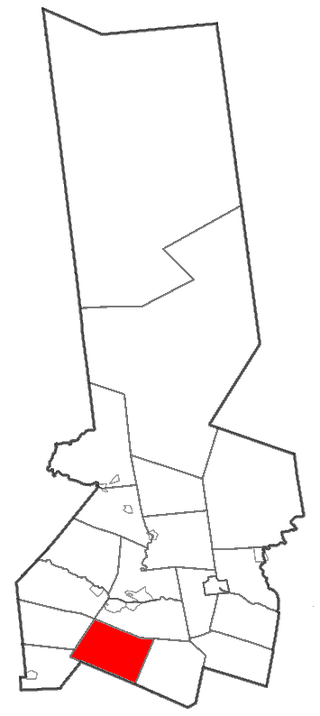
Florence is a town in Oneida County, New York, United States. The population was 1,025 at the 2010 census. The town is named after the city Florence in Italy.

<span class="mw-page-title-main">Floyd, New York</span> Town in New York, United States

Floyd is a town in Oneida County, New York, United States. The population was 3,819 at the 2010 census. The town is named after William Floyd, a signer of the Declaration of Independence.

<span class="mw-page-title-main">Trenton, New York</span> Town in New York, United States

Trenton is a town in Oneida County, New York, United States. The population was 4,498 at the 2010 census.

<span class="mw-page-title-main">Springfield, New York</span> Town in New York, United States

Springfield is a town in Otsego County, New York, United States. The population was 1,358 at the 2010 census.

Worcester is a town in Otsego County, New York, United States. The population was 2,220 at the 2010 census. Worcester is on the southeastern border of the county and is northeast of Oneonta. The Worcester Central School District presently has 369 students enrolled in grades K-12.

Tyrone is a town in Schuyler County, New York, United States. The population was 1,650 at the 2020 census.

Campbell is a town in Steuben County, New York, United States. The population was 3,163 at the 2020 census. The name is from Robert Campbell, an early landowner. The town is centrally located in the county and is northwest of Corning.

Pulteney is a town in Steuben County, New York, United States. The population was 1,260 at the 2020 census. The name is derived from the name of the original pioneer tract of land.

West Union is a town in Steuben County, New York, United States. The population was 343 as of the 2020 decennial census.

<span class="mw-page-title-main">Herkimer (town), New York</span> Town in New York, United States

Herkimer is a town in Herkimer County, New York, United States, southeast of Utica. It is named after Nicholas Herkimer. The population was 10,175 at the 2010 census.

<span class="mw-page-title-main">Newport, New York</span> Town in New York, United States

Newport is a town in Herkimer County, New York, United States. The population was 2,302 at the 2010 census. The town, located on the western edge of the county, contains the village of Newport. The town is northeast of Utica.

<span class="mw-page-title-main">Remsen, New York</span> Town in New York, United States

Remsen is a town in Oneida County, New York, United States. The population was 1,929 at the 2010 census. The town is named after Henry Remsen, an early settler. The Town of Remsen contains a village also named Remsen. The town is north of the city of Utica.

<span class="mw-page-title-main">Unadilla, New York</span> Town in New York, United States

Unadilla is a town in Otsego County, New York, United States. As of the 2010 census, the town had a population of 4,392. The name is derived from an Iroquois word for "meeting place". Unadilla is located in the southwestern corner of the county, southwest of Oneonta. The village of Unadilla is located in the southern part of the town. The mayor of Unadilla is David Welch, as of January 13, 2020.

<span class="mw-page-title-main">Bath, New York</span> Town in New York, United States

Bath is a town in Steuben County, New York, United States, with an area of 96.3 square miles and a population of 11,426 in 2020. Its largest settlement is the Village of Bath, which has an area of 2.9 sq mi and a population of 5,641. The Village is the county seat of Steuben County. The Town is located in the central part of the county, northwest of Elmira. The town and village are either named after the city of Bath in England or after Lady Bath, daughter of a landowner.

References

  1. "2016 U.S. Gazetteer Files". United States Census Bureau. Retrieved Jul 5, 2017.
  2. 1 2 "Population and Housing Unit Estimates" . Retrieved June 9, 2017.
  3. "Census of Population and Housing". Census.gov. Retrieved June 4, 2015.
  4. "U.S. Census website". United States Census Bureau . Retrieved 2008-01-31.

Coordinates: 43°19′12″N75°16′59″W / 43.32000°N 75.28306°W / 43.32000; -75.28306