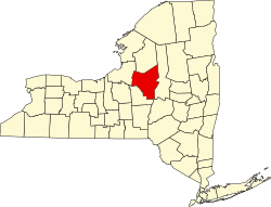
Clark Mills, New York

Last updated

Clark Mills, New York
CDP
USA New York location map.svg
Red pog.svg
Clark Mills, New York
Location within the state of New York
Coordinates: 43°5′31″N75°22′20″W / 43.09194°N 75.37222°W / 43.09194; -75.37222
Country United States
State New York
County Oneida
Area
[1]
  Total1.51 sq mi (3.91 km2)
  Land1.49 sq mi (3.87 km2)
  Water0.02 sq mi (0.05 km2)
Elevation
515 ft (157 m)
Population
 (2020)
  Total2,049
  Density1,373.32/sq mi (530.14/km2)
Time zone UTC-5 (Eastern (EST))
  Summer (DST) UTC-4 (EDT)
ZIP code
13321
Area code 315
FIPS code 36-15902
GNIS feature ID0946769

Clark Mills is a hamlet (and census-designated place) in Oneida County, New York, United States. The population was 1,905 at the 2010 census.

Contents

The community is located at the northeastern corner of the Town of Kirkland, west of the City of Utica.

History

The hamlet of Clark Mills, part of modern-day Town of Kirkland, is named for the Clark Mills Company, a textile mill on Oriskany Creek, and its founders: Ralph, Ammi, and Erastus Clark. The family business was established around 1845 and flourished for several years. [2] In 1891 the company name changed to the Hind & Harrison Plush Co. and remained in operation until its closure in 1949. [3]

St. Mark's Church was listed on the National Register of Historic Places in 1996. [4]

Geography

Clark Mills is located at 43°5′31″N75°22′20″W / 43.09194°N 75.37222°W / 43.09194; -75.37222 (43.091919, -75.372091). [5]

According to the United States Census Bureau, the CDP has a total area of 1.0 square mile (2.6 km2), of which 0.9 square miles (2.3 km2) is land and 0.04 square miles (0.10 km2) (3.12%) is water.

Demographics

Historical population
CensusPop.Note
2020 2,049
U.S. Decennial Census [6]

As of the census [7] of 2000, there were 1,424 people, 628 households, and 381 families residing in the CDP. The population density was 1,534.0 inhabitants per square mile (592.3/km2). There were 668 housing units at an average density of 719.6 per square mile (277.8/km2). The racial makeup of the CDP was 98.53% White, 0.91% African American, 0.07% Native American, and 0.49% from two or more races. Hispanic or Latino of any race were 0.35% of the population.

There were 628 households, out of which 28.0% had children under the age of 18 living with them, 39.8% were married couples living together, 15.3% had a female householder with no husband present, and 39.3% were non-families. 32.6% of all households were made up of individuals, and 12.9% had someone living alone who was 65 years of age or older. The average household size was 2.25 and the average family size was 2.85.

In the CDP, the population was spread out, with 22.5% under the age of 18, 8.3% from 18 to 24, 29.3% from 25 to 44, 23.9% from 45 to 64, and 15.9% who were 65 years of age or older. The median age was 39 years. For every 100 females, there were 87.1 males. For every 100 females age 18 and over, there were 81.4 males.

The median income for a household in the CDP was $36,026, and the median income for a family was $45,833. Males had a median income of $32,036 versus $25,523 for females. The per capita income for the CDP was $18,101. About 3.6% of families and 6.9% of the population were below the poverty line, including 7.4% of those under age 18 and 2.7% of those age 65 or over.

Related Research Articles

<span class="mw-page-title-main">Woodville, California</span> Census-designated place in California, United States

Woodville is a census-designated place (CDP) in Tulare County, California, United States. The population was 1,740 at the 2010 census, up from 1,678 at the 2000 census.

<span class="mw-page-title-main">Tariffville, Connecticut</span> Census-designated place in Connecticut, United States

Tariffville is a neighborhood and census-designated place (CDP) in the town of Simsbury in Hartford County, Connecticut, United States. The population was 1,324 at the 2010 census. It is a popular location for whitewater paddlers who use the Farmington River.

<span class="mw-page-title-main">East Brooklyn, Connecticut</span> Census-designated place in Connecticut, United States

East Brooklyn is a census-designated place located within the town of Brooklyn in Windham County, Connecticut. It is the portion of the Danielson urban cluster within the town of Brooklyn. The population was 2,205 at the 2020 census. US 6 runs through the town and severs the town.

Winn is a town in Penobscot County, Maine, United States, on the east bank of the Penobscot River. The town was named for John M. Winn, an early landholder. The population was 399 at the 2020 census.

Claverack-Red Mills, commonly known as Claverack, is a census-designated place (CDP) in Columbia County, New York, United States. The population was 913 at the 2010 census.

<span class="mw-page-title-main">Kirkland, New York</span> Town in Oneida County, New York, United States

Kirkland is a town in Oneida County, New York, United States. The population was 10,075 at the 2020 census. The town is named after Samuel Kirkland, a missionary among the Oneidas.

<span class="mw-page-title-main">Kirkland, North Carolina</span> CDP in North Carolina, United States

Kirkland, more commonly known as Porter's Neck, was a census-designated place (CDP) in New Hanover County, North Carolina, United States. Redesignated as Porters Neck CDP for the 2010 census, the population was 6,204. It is part of the Wilmington Metropolitan Statistical Area.

<span class="mw-page-title-main">Richboro, Pennsylvania</span> Census-designated place in Pennsylvania, United States

Richboro is a census-designated place (CDP) in Northampton Township, Bucks County, Pennsylvania, United States. The population was 6,378 during the 2020 census.

<span class="mw-page-title-main">Atlantic, Pennsylvania</span> Census-designated place in Pennsylvania, United States

Atlantic is a census-designated place (CDP) in Crawford County, Pennsylvania, United States. The population was 77 at the 2010 census, up from 43 in 2000.

<span class="mw-page-title-main">Brodheadsville, Pennsylvania</span> Census-designated place in Pennsylvania, United States

Brodheadsville is a census-designated place (CDP) in Monroe County, Pennsylvania, United States. The population was 1,700 at the 2020 census. The community is served by Pleasant Valley School District.

<span class="mw-page-title-main">Flourtown, Pennsylvania</span> Census-designated place in Pennsylvania, United States

Flourtown is a census-designated place (CDP) in Springfield Township, Montgomery County, Pennsylvania. Flourtown is adjacent to the neighborhoods of Erdenheim, Oreland, Whitemarsh, and Chestnut Hill. The population of Flourtown was 4,538 at the 2010 census. Its ZIP code is 19031.

<span class="mw-page-title-main">Hometown, Pennsylvania</span> CDP in Pennsylvania, United States

Hometown is a village in Rush Township, Schuylkill County, Pennsylvania, United States that sits astride a crossing point between important transportation corridors. The population was 1,399 at the 2000 census, and excepting for the area near the east–west PA 54 running mostly parallel to the tracks of the Reading, Blue Mountain, and Northern Railroad — once the important east-west shortline Nesquehoning & Mahanoy Railroad — and the PA 54 junction with PA 309.

<span class="mw-page-title-main">Sewickley Township, Pennsylvania</span> Township in Pennsylvania, United States

Sewickley Township is a township in Westmoreland County, Pennsylvania, United States. The population was 5,590 at the 2020 census.

<span class="mw-page-title-main">Susquehanna Trails, Pennsylvania</span> CDP in Pennsylvania, United States

Susquehanna Trails is a census-designated place (CDP) in York County, Pennsylvania, United States. The population was 2,264 at the 2010 census.

<span class="mw-page-title-main">Socastee, South Carolina</span> CDP in South Carolina, United States

Socastee is a census-designated place (CDP) in Horry County, South Carolina, United States. The population was 19,952 at the 2010 census.

<span class="mw-page-title-main">Clarks Hill, South Carolina</span> CDP in South Carolina, United States

Clarks Hill is a census-designated place (CDP) in McCormick County, South Carolina, United States. The population was 376 at the 2000 census.

<span class="mw-page-title-main">Mount Carmel, South Carolina</span> CDP in South Carolina, United States

Mt. Carmel is a census-designated place (CDP) in McCormick County, South Carolina, United States. The population was 237 at the 2000 census.

<span class="mw-page-title-main">Willington, South Carolina</span> CDP in South Carolina, United States

Willington is a census-designated place (CDP) in McCormick County, South Carolina, United States. The population was 177 at the 2000 census.

<span class="mw-page-title-main">Mill Plain, Washington</span> Former CDP in Washington, United States

Mill Plain is an unincorporated area in Clark County, Washington, United States. At the 2000 census it was defined as a census-designated place (CDP) and had a population of 7,400. The area was not listed as a CDP for the 2010 census.

Warrensburg is a census-designated place (CDP) in Warren County, New York, United States. The population was 3,045 at the 2020 census. It is part of the Glens Falls Metropolitan Statistical Area.

References

  1. "ArcGIS REST Services Directory". United States Census Bureau. Retrieved September 20, 2022.
  2. Gridley, A. D. (1874). History of the town of Kirkland, New York. New York: Hurd and Houghton. pp.  174–175.
  3. "Historic Marker Clark Mills". William G. Pomeroy Foundation. Retrieved September 20, 2023.
  4. "National Register Information System". National Register of Historic Places . National Park Service. March 13, 2009.
  5. "US Gazetteer files: 2010, 2000, and 1990". United States Census Bureau. February 12, 2011. Retrieved April 23, 2011.
  6. "Census of Population and Housing". Census.gov. Retrieved June 4, 2016.
  7. "U.S. Census website". United States Census Bureau . Retrieved January 31, 2008.

Further reading