Sangerfield, New York

Last updated

Sangerfield, New York
US 20 wb entering Sangerfield, NY, July 2023.jpg
Entering the hamlet of Sangerfield along US 20 westbound
Oneida County New York incorporated and unincorporated areas Sangerfield highlighted.svg
Location in Oneida County and the state of New York.
Coordinates: 42°54′50″N75°22′51″W / 42.91389°N 75.38083°W / 42.91389; -75.38083
CountryUnited States
State New York
County Oneida
Government
  Type Town Council
   Town Supervisor William Fredericks (R)
   Town Council
Members' List
Area
[1]
  Total30.98 sq mi (80.24 km2)
  Land30.80 sq mi (79.78 km2)
  Water0.18 sq mi (0.46 km2)
Elevation
1,575 ft (480 m)
Population
 (2010)
  Total2,561
  Estimate 
(2016) [2]
2,499
  Density81.13/sq mi (31.32/km2)
Time zone UTC-5 (Eastern (EST))
  Summer (DST) UTC-4 (EDT)
ZIP code
13455
Area code 315
FIPS code 36-65134
GNIS feature ID0979458

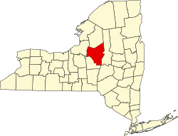
Sangerfield is a town in Oneida County, New York, United States. The population was 2,561 at the 2010 census. The town is named after Jedediah Sanger, an early settler.

Contents

The Town of Sangerfield is on the county's southern border.

Geography

According to the United States Census Bureau, the town has a total area of 31.0 square miles (80 km2), of which 30.8 square miles (80 km2) is land and 0.2 square miles (0.52 km2) (0.52%) is water.

The southern and western town lines are the border of Madison County. U.S. Route 20 crosses the town. The Sangerfield River is an important stream flowing southward through the town.

History

The town was first settled c.1792.

In 1788, the State of New York bought from the Oneida Indians twenty towns that bordered the Unadilla River. This land became known as "Clinton's Purchase". In 1789, the state surveyed "Township No. 20" in this tract for

This region then went through several name changes in its early years:

From DateTo DateTown NameCounty Name
15 Feb. 179110 Apr. 1792Whitestown Herkimer
10 Apr. 17925 Mar. 1795ParisHerkimer
5 Mar. 179515 Mar. 1798SangerfieldHerkimer
15 Mar. 17984 Apr. 1804Sangerfield Chenango
4 Apr. 1804PresentSangerfieldOneida

Basically, Sangerfield was formed from the Town of Paris in 1795, before the creation of Oneida County.

The population of Sangerfield in 1920 was 1,795.

Demographics

Historical population
CensusPop.Note
1800 1,143
1810 1,32415.8%
1820 2,01151.9%
1830 2,27213.0%
1840 2,251−0.9%
1850 2,3715.3%
1860 2,343−1.2%
1870 2,5137.3%
1880 3,17126.2%
1890 3,017−4.9%
1900 2,440−19.1%
1910 2,086−14.5%
1920 1,795−14.0%
1930 1,8623.7%
1940 1,9615.3%
1950 2,1439.3%
1960 2,48215.8%
1970 2,475−0.3%
1980 2,397−3.2%
1990 2,4602.6%
2000 2,6106.1%
2010 2,561−1.9%
2016 (est.)2,499 [2] −2.4%
U.S. Decennial Census [3]

As of the census [4] of 2000, there were 2,610 people, 944 households, and 684 families residing in the town. The population density was 84.7/sq mi (32.7/km2). There were 1,010 housing units at an average density of 32.8/sq mi (12.7/km2). The racial makeup of the town was 98.31% White, 0.38% African American, 0.31% Native American, 0.38% Asian, 0.04% Pacific Islander, 0.04% from other races, and 0.54% from two or more races. Hispanic or Latino of any race were 0.54% of the population.

There were 944 households, out of which 38.2% had children under the age of 18 living with them, 55.2% were married couples living together, 13.0% had a female householder with no husband present, and 27.5% were non-families. 22.5% of all households were made up of individuals, and 10.7% had someone living alone who was 65 years of age or older. The average household size was 2.67 and the average family size was 3.09.

In the town, the population was spread out, with 28.2% under the age of 18, 7.0% from 18 to 24, 26.9% from 25 to 44, 21.5% from 45 to 64, and 16.3% who were 65 years of age or older. The median age was 38 years. For every 100 females, there were 91.6 males. For every 100 females age 18 and over, there were 82.7 males.

The median income for a household in the town was $38,264, and the median income for a family was $44,871. Males had a median income of $31,144 versus $21,250 for females. The per capita income for the town was $17,068. About 5.9% of families and 9.7% of the population were below the poverty line, including 10.6% of those under age 18 and 9.2% of those age 65 or over.

Communities and locations in Sangerfield

Historic Places

Pleasant Valley Grange Hall is located on the National Register of Historic Places

Related Research Articles

<span class="mw-page-title-main">Chenango County, New York</span> County in New York, United States

Chenango County is a county located in the south-central section U.S. state of New York. As of the 2020 census, the population was 47,220. Its county seat is Norwich. The county's name originates from an Oneida word meaning 'large bull-thistle'. The county is part of the Southern Tier region of the state.

<span class="mw-page-title-main">Chenango, New York</span> Town in New York, United States

Chenango is a town in Broome County, New York, United States. The population was 10,983 at the 2020 census.

<span class="mw-page-title-main">Fenton, New York</span> Town in New York, United States

Fenton is a town in Broome County, New York, United States. The population was 6,441 at the 2020 census. The town was named after Reuben Fenton, a governor of New York.

<span class="mw-page-title-main">Guilford, New York</span> Town in New York, United States

Guilford is a town in Chenango County, New York, United States. The town is on the eastern border of the county. The population was 2,922 at the 2010 census.

<span class="mw-page-title-main">Cincinnatus, New York</span> Town in New York, United States

Cincinnatus is a small town in Cortland County, New York, United States. The population was 910 at the 2020 census. The town is named after the Roman general Lucius Quinctius Cincinnatus. It is in the eastern part of the county and is east of the city of Cortland.

Brookfield is a town in Madison County, New York, United States. The population was 2,247 at the 2020 census.

Lenox is a town in Madison County, New York, United States. The population was 8,768 as of the 2020 census.

<span class="mw-page-title-main">Marshall, New York</span> Town in New York, United States

Marshall is a town in Oneida County, New York, United States. The population was 1,966 at the 2020 census.

<span class="mw-page-title-main">Paris, New York</span> Town in New York, United States

Paris is a town in Oneida County, New York, United States. The town is in the southeast part of the county and is south of Utica. The population was 4,332 at the 2020 census. The town was named after an early benefactor, Colonel Isaac Paris.

<span class="mw-page-title-main">Vienna, New York</span> Town in New York, United States

Vienna is a town in Oneida County, New York, United States. The population was 5,440 at the 2010 census. The town is named after the capital of Austria.

<span class="mw-page-title-main">Waterville, New York</span> Village in New York, United States

Waterville is a village in Oneida County, New York, United States. According to the 2020 census, its population was 1,473.

<span class="mw-page-title-main">Hastings, New York</span> Town in New York, United States

Hastings is a town in Oswego County, New York, United States. Its population was 9,450 at the 2010 census. It is named after Hastings Curtiss, a prominent citizen and member of the State Assembly in 1824.

<span class="mw-page-title-main">Afton, New York</span> Town in New York, United States

Afton is a town in Chenango County, New York, United States. The population was 2,769 at the 2020 census. Afton is situated in the southeast corner of the county and lies wholly within the original Township of Clinton. It was formed from the town of Bainbridge on November 18, 1857, and derives its name from Afton Water, a small river in the parish of New Cumnock, Ayrshire, Scotland, immortalized by the poet Robert Burns. It is bounded on the north by Bainbridge and Coventry, on the east by Delaware County, and on the west and south by Broome County.

<span class="mw-page-title-main">Bainbridge, New York</span> Town in New York, United States

Bainbridge is a town in Chenango County, New York, United States. The population was 3,308 at the 2010 census. The town is at the eastern border of Chenango County, halfway between Binghamton and Oneonta.

<span class="mw-page-title-main">Greene, New York</span> Town in New York, United States

Greene is a town in Chenango County, New York, United States. The population was 5,604 at the 2010 census. The town is named after General Nathanael Greene. It is located in the southwestern corner of the county and contains a village, also named Greene. The town and village are northeast of Binghamton. Greene was founded in 1792, but commenced in 1798.

Smyrna is a village in Chenango County, New York, United States. The population was 213 at the 2010 census. The village is located in the town of Smyrna and is near the northern border of Chenango County.

<span class="mw-page-title-main">Smyrna, New York</span> Town in New York, United States

Smyrna is a town in Chenango County, New York, United States. The population was 1,280 at the 2010 census. Smyrna is named after a coastal city in ancient Greece, nowadays modern Izmir in Turkey.

<span class="mw-page-title-main">Madison, New York</span> Town in New York, United States

Madison is a town in Madison County, New York, United States. The population was 2,766 at the 2020 census.

<span class="mw-page-title-main">Bridgewater, New York</span> Town in New York, United States

Bridgewater is a town in Oneida County, New York, United States. The population was 1,522 at the 2010 census.

<span class="mw-page-title-main">Unadilla, New York</span> Town in New York, United States

Unadilla is a town in Otsego County, New York, United States. As of the 2010 census, the town had a population of 4,392. The name is derived from an Iroquois word for "meeting place". Unadilla is located in the southwestern corner of the county, southwest of Oneonta. The village of Unadilla is located in the southern part of the town. The mayor of Unadilla is Jason Cotten.

References

  1. "2016 U.S. Gazetteer Files". United States Census Bureau. Retrieved July 5, 2017.
  2. 1 2 "Population and Housing Unit Estimates" . Retrieved June 9, 2017.
  3. "Census of Population and Housing". Census.gov. Retrieved June 4, 2015.
  4. "U.S. Census website". United States Census Bureau . Retrieved January 31, 2008.

42°54′50″N75°22′45″W / 42.91389°N 75.37917°W / 42.91389; -75.37917