North Bay, New York | |
|---|---|
hamlet and CDP | |
 North Bay, New York | |
| Coordinates: 43°13′48″N75°44′54″W / 43.23000°N 75.74833°W | |
| Country | United States |
| State | New York |
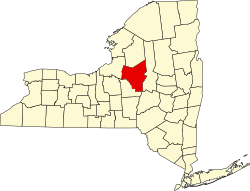
| County | Oneida |
| Elevation | 476 ft (145 m) |
| Time zone | UTC-5 (Eastern (EST)) |
| • Summer (DST) | UTC-4 (EDT) |
| Zip code | 13123 |
| Area code | 315 |
| GNIS feature ID | 958677 [1] |
North Bay is a hamlet [2] located in Oneida County, New York, United States. [1] It is located in the town of Vienna. The zipcode is: 13123. [3]