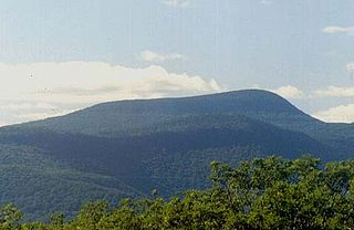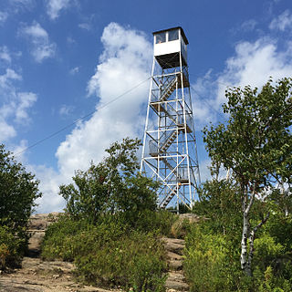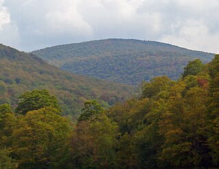
The Taconic Mountains or Taconic Range are a range of the Appalachian Mountains, running along the eastern border of New York State and adjacent New England from northwest Connecticut to western Massachusetts, north to central western Vermont. A physiographic region of the larger New England province, the range includes notable summits, including its high point, 3,840 feet (1,170 m) Mount Equinox In Vermont, and 3,489 feet (1,063 m) Mount Greylock, the highest point in Massachusetts.

Hudson Highlands State Park is a non-contiguous state park in the U.S. state of New York, located on the east side of the Hudson River. The park runs from Peekskill in Westchester County, through Putnam County, to Beacon in Dutchess County, in the eastern section of the Hudson Highlands.

Storm King Mountain is a mountain on the west bank of the Hudson River just south of Cornwall-on-Hudson, New York. Together with Breakneck Ridge on the opposite bank of the river it forms "Wey-Gat" or Wind Gate, the picturesque northern narrows of the Hudson Highlands. Its distinctive curved ridge is the most prominent aspect of the view south down Newburgh Bay, from Newburgh, Beacon, and the Newburgh-Beacon Bridge. It can also be seen by southbound travelers on nearby sections of the New York State Thruway. This view was a popular subject for early artists of the Hudson River School.

Mount Frissell, 2,454 feet (748 m), which straddles the border of southwest Massachusetts and northwest Connecticut, is a prominent peak of the Taconic Range.

Slide Mountain is the highest peak in the Catskill Mountains of the U.S. state of New York. It is located in the town of Shandaken in Ulster County. While the 4,180-foot (1,270 m) contour line on topographic maps is generally accepted as its height, the exact elevation of the summit has never been officially determined by the U.S. Coast and Geodetic Survey, and many informal surveys suggest the mountain may actually top 4,200 feet above sea level.
Taconic State Park is located in Columbia and Dutchess County, New York abutting Massachusetts and Connecticut within the Taconic Mountains. The state park is located off New York State Route 344 south of Interstate 90 and 110 miles (180 km) north of New York City. It features camping, hiking, bicycling, hunting, cross county skiing and other recreational opportunities.

Hadley Mountain is a mountain located in the southern Adirondacks in the U.S. state of New York and is the second highest peak in Saratoga County after neighboring Tenant Mountain. The Hadley Mountain Fire Observation Station was listed on the National Register of Historic Places on September 23, 2001 for its role as a Fire lookout tower with the New York State Forest Preserve. Hadley Mountain is the highest of the three peaks that form the West Mountain ridge.

Halcott Mountain is one of the Catskill Mountains of the U.S. state of New York. It is mostly located in Greene County, with some of its lower slopes in Delaware and Ulster counties. Its exact summit elevation has not been officially determined, but the highest contour line on the mountain is 3,520 feet (1,070 m). It is one of the peaks on the divide between the Delaware and Hudson watersheds.

Balsam Mountain is one of the High Peaks of the Catskill Mountains in the U.S. state of New York. Its exact height has not been determined, so the highest contour line, 3,600 feet (1,100 m), is usually given as its elevation. It is located in western Ulster County, on the divide between the Hudson and Delaware watersheds. The summit and western slopes of the peak are within the Town of Hardenburgh and its eastern slopes are in Shandaken. The small community of Oliverea is near its base on that side. Most of the mountain is publicly owned, managed by the New York State Department of Environmental Conservation as part of the state Forest Preserve, part of the Big Indian-Beaverkill Range Wilderness Area in the Catskill Park. The summit is on a small corner of private land.

Balsam Lake Mountain is one of the Catskill Mountains, located in the Town of Hardenburgh, New York, United States. It is the westernmost of the range's 35 High Peaks. Its exact height has not been determined, but the highest contour line on topographic maps, 3,720 feet (1,130 m), is usually given as its elevation.
Mount Raimer, 2,572 feet (784 m), is a prominent peak in the Taconic Mountains of western Massachusetts and adjacent New York. The west side and summit are located in New York; the east slopes lie within Massachusetts. The summit ridge is part meadow and part wooded with red spruce, balsam fir, and northern hardwood tree species. It is notable for its views of the Hoosic River valley and Hudson River Valley. The 35 mi (56 km) Taconic Crest Trail traverses the mountain. Much of the upper slopes and summit are within protected conservation land. The mountain is the location of a defunct ski area.

Brace Mountain is the peak of a ridge in the southern Taconic Mountains, near the tripoint of the U.S. states of New York, Connecticut and Massachusetts. Its 2,311-foot (704 m) main summit is located in New York; it is the highest point in that state's Dutchess County.

Alander Mountain, 2,239 feet (682 m), is a prominent peak of the south Taconic Mountains; it is located in southwest Massachusetts and adjacent New York. Part of the summit is grassy and open and part is covered with scrub oak and shrubs; the sides of the mountain are wooded with northern hardwood tree species. Views from the top include the southern Taconic Mountains, the Hudson River Valley including the Catskills. Several trails traverse Alander Mountain, most notably the 15.7 mi (25.3 km) South Taconic Trail, which passes just beneath the summit.
Berry Mountain, east peak 2,203 feet (671 m) and west peak 2,188 feet (667 m), is a prominent mountain in the Taconic Mountains of western Massachusetts. The mountain is located in Pittsfield State Forest. The west peak is traversed by the 35 mi (56 km) Taconic Crest hiking trail and the east peak is traversed by the 12.1 mi (19.5 km) multi-use Taconic Skyline Trail. The summits are mostly wooded with northern hardwood forest species, but also support a 65-acre (260,000 m2) field of wild azaleas. A microwave tower stands on the east peak. A park loop automobile road and a campground, maintained for summer use, are located just to the north of the summits. Berry Pond, 2,150 feet (660 m), presumed the highest natural pond in the state of Massachusetts, is located on the ridge between Berry Mountain and Berry Hill to the north.
Berry Hill, 2,200 feet (670 m), is a prominent mountain in the Taconic Mountains of western Massachusetts. The mountain is located in Pittsfield State Forest and is traversed by a short spur trail from a park automobile road. The Taconic Crest hiking trail and the multi-use Taconic Skyline Trail are located nearby. The mountain is known for its wild azalea fields. Its slopes are wooded with northern hardwood forest species. A park loop automobile road nearly encircles the summit, and a campground, maintained for summer use, is located just to the south of the summit. Berry Pond, 2,150 feet (660 m), presumed the highest natural pond in the state of Massachusetts, is located on the ridge between Berry Hill and Berry Mountain to the south.
Honwee Mountain, east summit 2,313 feet (705 m) and west summit 2,280 feet (690 m), is a prominent mountain in the Taconic Mountains of western Massachusetts. The mountain is located in Pittsfield State Forest. The east (highest) summit is traversed by the Honwee Circuit multi-use trail. The west summit is crossed by the 35 mi (56 km) Taconic Crest hiking trail and the 12.1 mi (19.5 km) multi-use Taconic Skyline Trail. The mountain is wooded with northern hardwood forest species.

Shooters Hill is a locality and mountain located 25 kilometres (16 mi) south of Oberon, New South Wales. It is the fourth highest point in the Central Tablelands at 1,355 metres (4,446 ft) AHD , behind Mount Canobolas at 1,394 metres (4,573 ft) AHD , Mount Bindo at 1,363 metres (4,472 ft) AHD and Mount Trickett at 1,362 metres (4,469 ft) AHD . Shooters Hill is a common location for snowfalls in the Central Ranges.

The Red Hill Fire Observation Station consists of a fire lookout tower, cabin and pit privy located on the summit of Red Hill, a 2,990-foot (910 m) Catskill Mountain peak in Denning, New York, United States. It is the southernmost fire tower in the Catskill Park.

Mount Tremper, officially known as Tremper Mountain and originally called Timothyberg, is one of the Catskill Mountains in the U.S. state of New York. It is located near the hamlet of Phoenicia, in the valley of Esopus Creek.

Dennis Hill State Park is a public recreation area located in the town of Norfolk, Connecticut, that was once the estate of Dr. Frederick Shepard Dennis. The state park offers hiking, picnicking, and scenic views. It is administered by the Connecticut Department of Energy and Environmental Protection.


