
Springfield is a town in Otsego County, New York, United States. The population was 1,358 at the 2010 census.

Cobble Hill is a neighborhood in the northwestern portion of the New York City borough of Brooklyn. A small neighborhood comprising 40 blocks, Cobble Hill sits adjacent to Brooklyn Heights to the north, Boerum Hill to the east, Carroll Gardens to the south, and the Columbia Street Waterfront District to the west. It is bounded by Atlantic Avenue (north), Court Street (east), Degraw Street (south) and the Brooklyn Queens Expressway (west). Other sources add to the neighborhood a rectangle bounded by Wyckoff Street on the north, Hoyt Street on the east, Degraw Street on the south, and Court Street on the west.

The pine warbler is a small songbird of the New World warbler family.

Cobblestone is a natural building material based on cobble-sized stones, and is used for pavement roads, streets, and buildings.

The West Branch Delaware River is one of two branches that form the Delaware River. It is approximately 90 mi (144 km) long, and flows through the U.S. states of New York and Pennsylvania. It winds through a mountainous area of New York in the western Catskill Mountains for most of its course, before joining the East Branch along the northeast border of Pennsylvania with New York. Midway or so it is empounded by the Cannonsville Dam to form the Cannonsville Reservoir, both part of the New York City water supply system for delivering drinking water to the City.

Christopher Whitelaw Pine is an American actor. Pine made his feature film debut as Lord Devereaux in The Princess Diaries 2: Royal Engagement (2004), and is known for playing James T. Kirk in the Star Trek reboot film series (2009–2016), Will Colson in Unstoppable (2010), Cinderella's Prince in Into the Woods (2014), Jack Ryan in Jack Ryan: Shadow Recruit (2014), Toby Howard in Hell or High Water (2016), Bernie Webber in The Finest Hours (2016), Steve Trevor in Wonder Woman (2017) and Wonder Woman 1984 (2020), Dr. Alexander Murry in A Wrinkle in Time (2018), and Robert the Bruce in Outlaw King (2018).

Glacial Lake Albany was a prehistoric North American proglacial lake that formed during the end of the Wisconsinan glaciation. It existed between 15,000 and 12,600 years ago and was created when meltwater from a retreating glacier, along with water from rivers such as the Iromohawk, became ice dammed in the Hudson Valley. Organic materials in Lake Albany deposits have been carbon dated to approximately 11,700 years ago. The lake spanned approximately 160 miles (260 km) from present-day Newburgh to Glens Falls.

Pine Cobble Mountain, located in Williamstown, Massachusetts, is a sub-summit of East Mountain in the Clarksburg State Forest. This outcropping is best known as a popular hiking destination, where an outlook encompasses panoramic views of Williamstown, the Mount Greylock Range, and North Adams.
Pine Cobble may refer to:
The Verkeerder Kill, sometimes Verkeerderkill and locally shortened to Kaidy Kill is an 8-mile-long (13 km) stream in Ulster County, New York, United States. It rises on the Shawangunk Ridge, in the town of Wawarsing, and flows southwards through the town of Shawangunk, toward the Shawangunk Kill, itself a major tributary of the Wallkill River. Ultimately it is a part of the Hudson River's watershed.

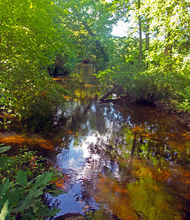
Cobleskill Creek starts at Pine Mountain west of West Richmondville and flows east-northeast before converging with Schoharie Creek in Central Bridge, New York. The creek flows through the village of Richmondville, New York and Cobleskill, New York.

Tunnicliff Hill is a mountain located in Central New York region of New York by Snowdon, New York.
Murphy Hill is a mountain located in Central New York Region of New York east of Cooperstown, New York.
Rice Hill is a mountain located in Central New York region of New York east of West Burlington, New York.
Pine Hill is a mountain in the Central New York region of New York, United States. It is located northeast of South Worcester, New York.
Pine Mountain is a mountain in the Central New York region of New York. It is located northeast of East Worcester, New York.
Algerine Hill is a mountain in the Central New York region of New York state. It is located south of Furnaceville, New York.
Round Top is a mountain in the Central New York region of New York. It is located southeast of East Winfield, New York.
Shacktown Mountain is a mountain in the Central New York region of New York. It is located south of Hoboken, New York.
Gifford Hill is a small mountain chain in the Central New York Region of New York. It is located northeast of Oneonta, New York. It is made of three main peaks the highest being 1928 feet. Gifford Hill is named for the Gifford Family who moved to the area in 1803 and settled along the Oneonta Creek on what is now called Gifford Hill.


