Dorset Mountain, on the border of Rutland and Bennington counties in Vermont, is part of the Taconic Range. The summit of Dorset Mountain is in Danby. An unmaintained hiking trail ascends from the southwest.
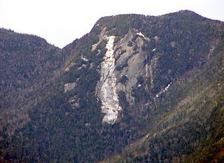
Cliff Mountain is a mountain located in Essex County, New York. The mountain is part of the Marcy Group of the Great Range of the Adirondack Mountains. Cliff is flanked to the southeast by Mount Redfield.

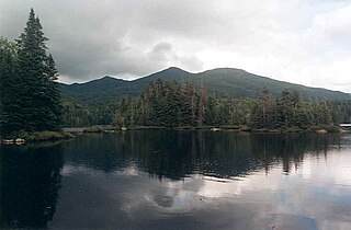
Lower Wolfjaw Mountain is located in Essex County, New York, United States. Landscape artist Alexander Helwig Wyant (1836–1892) named Lower Wolfjaw, together with neighboring Upper Wolfjaw Mountain, about 1870 for their appearance in profile. The mountain is the northeasternmost of the Adirondack High Peaks in the Great Range of the Adirondack Mountains. Lower Wolfjaw Mountain is flanked to the southwest by Upper Wolfjaw Mountain, and to the northeast by Hedgehog Mountain.
Upper Wolfjaw Mountain is a mountain located in Essex County, New York. Landscape artist Alexander Helwig Wyant (1836–1892) named the mountain, in combination with neighboring Lower Wolfjaw Mountain, c. 1870 for their appearance in profile. The mountain is part of the Great Range of the Adirondack Mountains. Upper Wolfjaw Mtn. is flanked to the southwest by Armstrong Mountain, and to the northeast by Lower Wolfjaw Mtn.

Seymour Mountain is a mountain located in Franklin County, New York, named after Horatio Seymour (1810–1886), Governor of New York. The mountain is part of the Seward Mountains of the Adirondacks. Seymour Mountain faces Seward Mountain to the west across Ouluska Pass.
MacNaughton Mountain is a mountain located in Essex County, New York, named after James MacNaughton (1851–1905), the grandson of Archibald McIntyre. The mountain is part of the Street Range of the Adirondack Mountains.
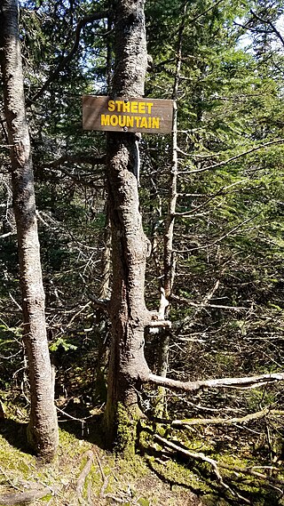
Street Mountain is a mountain located in Essex County, New York, named after Alfred Billings Street (1811–1881), a poet and New York State Librarian. The mountain is the high point of the Street Range of the Adirondack Mountains. Street's northeast ridge is Nye Mountain.

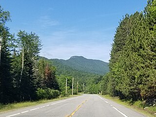
Lyon Mountain is a 3,820 ft (1,160 m) mountain located in Clinton County, New York, the county’s high point. It is named for Nathaniel Lyon, an early settler of the area who moved from Vermont in 1803 and died circa 1850. The mountain is within New York's Adirondack Park.
Snowy Mountain is a mountain located in Hamilton County, New York. Initially known as 'Squaw Bonnet', its summit is the highest point in the county. While most maps show the elevation as 3899 feet, some suggest that more recent surveys have it as 3904 feet or even 3908 feet.
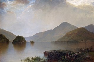
Black Mountain is a mountain located in Washington County, New York, of which its peak is the highest point. Isolated from the rest of the Adirondack Mountains by Lake George, Black Mtn. has the seventh highest topographic prominence of all the mountains in New York. Black Mountain also has the highest elevation of any of the peaks which surround Lake George and offers unobstructed views of the lake from its summit.

Vly Mountain is a mountain located in the town of Halcott, New York, United States in Greene County. The mountain is part of the Catskill Mountains. Vly Mountain is flanked to the northwest by Bearpen Mountain, to the east by Vinegar Hill, to the northeast by Kipp Hill, and to the southeast by Beech Ridge.
North Dome is a mountain located in Greene County, New York. The mountain is part of the Catskill Mountains. North Dome is flanked to the east by West Kill Mountain, and to the west faces Mount Sherrill.
Mount Sherrill is a mountain located in Greene County, New York, and is named after Eliakim Sherrill, and is part of the Catskill Mountains. Mount Sherrill is flanked to the east by North Dome, and to the west by Balsam Mountain.
Big Indian Mountain is a mountain located in Ulster County, New York. The mountain is part of the Catskill Mountains. It is flanked to the northwest by Eagle Mountain, to the southeast by Fir Mountain, and to the southwest by Doubletop Mountain.

Peekamoose Mountain is a mountain located in Ulster County, New York. The mountain is part of the Catskill Mountains. Peekamoose Mountain is flanked to the north by Table Mountain. The name Peekamoose is possibly an anglicization of an Algonquin word meaning 'broken off smooth', cf. Poke-O-Moonshine Mountain.

Table Mountain is located in Ulster County, New York. The mountain is part of the Catskill Mountains. Table Mountain is flanked to the south by Peekamoose Mountain, and to the northeast by Lone Mountain.
Friday Mountain is a mountain located in Ulster County, New York. The mountain is part of the Catskill Mountains. Friday Mountain is flanked to the north by Cornell Mountain, and to the south by Balsam Cap.

Wittenberg Mountain, locally "the Wittenberg'', is a mountain in Ulster County, New York. It is part of the Burroughs Range of the Catskill Mountains. Wittenberg is flanked to the southwest by Cornell Mountain and to the northeast by Terrace Mountain.

Alander Mountain is a 2,241-foot-tall (683 m) part of the south Taconic Mountains in southwest Massachusetts and adjacent to New York. The summit is grassy and covered with scrub oak and shrubs; the sides of the mountain are heavily forested. Several trails traverse Alander Mountain, most notably is the 15.7 mi (25.3 km) South Taconic Trail, which passes just beneath the summit.

Gore Mountain Garnet, found in the Adirondack Mountains in New York, contains the world's largest garnets. The rock that holds these garnets, garnet amphibolite, is sometimes referred to as 'black ore' or 'dark ore.' This rock formation formed during metamorphism during the Ottawan phase of the Grenvillian orogeny, and extremely high temperatures combined with introduction of fluids is what most likely contributed to the unusual size of the megacrystic garnets.