The Adirondack Park is a park in northeastern New York protecting the Adirondack Mountains. The park was established in 1892 for "the free use of all the people for their health and pleasure", and for watershed protection. At 6.1 million acres, it is the largest park in the contiguous United States.

The Fulton Chain of Lakes is a string of eight lakes located in the Adirondack Park in upstate New York, United States. The chain is the dammed-up Moose River, and the dam which creates the chain holds back nearly 6.8 billion US gallons (26,000,000 m3) of water. The lakes are located in Herkimer and Hamilton Counties. Inlet, Old Forge, and Eagle Bay are towns on them. The chain begins near Old Forge and ends before it reaches Raquette Lake. The lakes are named for Robert Fulton, inventor of the steamboat, who proposed connecting the lakes to create an Adirondack canal. They are suitable for pontoon boats, kayaks, and motorboats. The chain is part of the 740-mile (1,190 km) Northern Forest Canoe Trail, which begins on First Lake and ends in Fort Kent, Maine.

Whiteface Mountain is the fifth-highest mountain in the U.S. state of New York, and one of the High Peaks of the Adirondack Mountains, located in the town of Wilmington in Essex County. Set apart from most of the other High Peaks, the summit offers a 360-degree view of the Adirondacks and clear-day glimpses of Vermont and Canada, where Montreal can be seen on a very clear day. Because of its relative isolation, the mountain is exposed to prevailing winds from the west and frequently capped with snow and ice, making it an area of interest to meteorologists. Weather data has been collected on the summit since 1937. The mountain's east slope is home to a major ski area which boasts the greatest vertical drop east of the Rockies, and which hosted the alpine skiing competitions of the 1980 Winter Olympics. Unique among the High Peaks, Whiteface features a developed summit and seasonal accessibility by motor vehicle. The Whiteface Veterans Memorial Highway reaches a parking area at an elevation shortly below the summit, with the remaining distance covered by tunnel and elevator. The peak can also be reached on two hiking trails.
The High Peaks Wilderness Area is the largest wilderness area of the Forest Preserve in the U.S. state of New York. It is located in three counties and six towns in the Adirondack Park: Harrietstown in Franklin County, North Elba, Keene, North Hudson and Newcomb in Essex County and Long Lake in Hamilton County.

Lyon Mountain is a 3,820 ft (1,160 m) mountain located in Clinton County, New York, the county’s high point. It is named for Nathaniel Lyon, an early settler of the area who moved from Vermont in 1803 and died circa 1850. The mountain is within New York's Adirondack Park.

Snowy Mountain is a mountain located in Hamilton County, New York. Initially known as 'Squaw Bonnet', its summit is the highest point in the county. While most maps show the elevation as 3899 feet, some suggest that more recent surveys have it as 3904 feet or even 3908 feet.

Black Mountain is a mountain located in Washington County, New York, of which its peak is the highest point. Isolated from the rest of the Adirondack Mountains by Lake George, Black Mtn. has the seventh highest topographic prominence of all the mountains in New York. Black Mountain also has the highest elevation of any of the peaks which surround Lake George and offers unobstructed views of the lake from its summit.

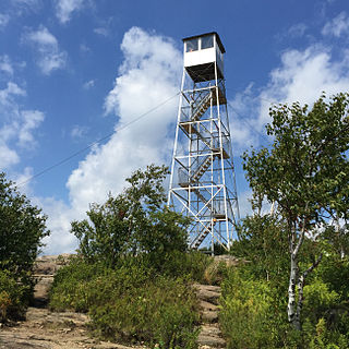
Hadley Mountain is a mountain located in the southern Adirondacks in the U.S. state of New York and is the second-highest peak in Saratoga County after neighboring Tenant Mountain. The Hadley Mountain Fire Observation Station was listed on the National Register of Historic Places on September 23, 2001 for its role as a Fire lookout tower with the New York State Forest Preserve. Hadley Mountain is the highest of the three peaks that form the West Mountain ridge.

Blue Mountain is a peak in the Adirondack Mountains of New York State in the United States. Located east of Blue Mountain Lake, Hamilton County, the peak reaches a height of 3,750 ft (1,140 m). For hiking, the elevation gain is 1,559 feet and the trail length is four miles. The trailhead elevation is 2,200 feet. It is the location of the Blue Mountain Fire Observation Station, listed on the National Register of Historic Places in 2001.

The Balsam Lake Mountain Fire Observation Station is located at the summit of the mountain of that name in the Town of Hardenburgh, New York, United States. It comprises a steel frame fire lookout tower, the observer's cabin and privy and the jeep road to the complex.

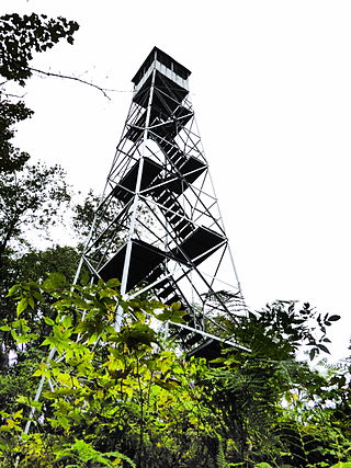
The Kane Mountain Fire Observation Station is a historic fire observation station located on Kane Mountain at Caroga in Fulton County, New York. The station includes a 60-foot-tall (18 m), steel-frame lookout tower erected in 1925, an observer's cabin built about 1960, and foot trail. The tower and trail are contributing resources. The tower is a prefabricated structure built by the Aermotor Corporation and provided a front line of defense in preserving the Adirondack Forest Preserve from the hazards of forest fires.
Poke-O-Moonshine Mountain, spelled Pokamoonshine on U.S. Geological Survey maps, and sometimes known as just Poke-O, is a minor peak of the Adirondack Mountains. The name is believed to be a corruption of the Algonquin words pohqui, meaning 'broken', and moosie, meaning 'smooth'. It is located in the town of Chesterfield, New York, United States, on New York state Forest Preserve land, part of the Taylor Pond Wild Forest complex within the Adirondack Park. Due to its location next to the pass through which most travelers from the north enter the range, it has been called the "gateway to the Adirondacks".

Owls Head Mountain is a 2,786-foot-tall (849 m) mountain in the Adirondack Mountains region of New York. It is located west-southwest of the hamlet of Long Lake in Hamilton County.
Meenahga Mountain is a 2,087-foot-tall (636 m) mountain located in Adirondack Mountains of New York. It is located in the northeast of the hamlet of Paul Smiths in Franklin County. The mountain is the site of a 73-foot-tall (22 m) Aermotor LS40 fire lookout tower.
Salmon Lake Mountain is a 2,500-foot-tall (760 m) summit located in Adirondack Mountains of New York. It is located west of the hamlet of Long Lake in Hamilton County. Around 1933, a 35-foot-tall (11 m) Aermotor LX24 tower was built on the mountain. The tower was privately owned, but cooperated with the Conservation Commission for fire watching operations. The tower still remains, but is in poor condition and is not open to the public.
Loon Lake Mountains are a pair of mountains, the tallest being 3,311-foot-tall (1,009 m), near Loon Lake in Franklin County, New York. On the summit is the Loon Lake Mountain Fire Observation Station, which was added to the National Register of Historic Places in 2015.

Kane Mountain is a mountain in the Adirondack Mountains region of New York. It is located north of the Hamlet of Canada Lake. The Kane Mountain Fire Observation Station is located on top of the mountain. Sheeley Mountain is located south-southwest, Canada Lake is located south, Camelhump is located east and Pine Lake is located north of Kane Mountain.

Goodnow Mountain is a 2,664-foot-tall (812 m) peak in the Adirondack Mountains of New York in the United States. It is the location of the Goodnow Mountain Fire Observation Station. In 1922, the Civilian Conservation Corps built a 60-foot-tall fire tower on the mountain. The tower closed at the end of the 1979 season. The tower was later transferred to SUNY College of Forestry and is now open to the public.

Swede Mountain is a mountain in the Adirondack Mountains region of New York. It is located southwest of Ticonderoga and north of Glens Falls in Warren County. The Swede Mountain Fire Observation Station is located on top of the mountain.
Tomany Mountain is a 2,589-foot-tall (789 m) mountain in the Adirondack Mountains region of New York. It is located northwest of Arietta in Hamilton County. In 1912, the Conservation Commission built a wooden fire observation tower on the mountain. In 1916, wooden tower was replaced with a 50-foot-tall Aermotor LL25 tower. The tower was closed at the end of the 1970 fire watching season, and later dismantled.


