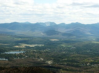
Lake Placid is a village in the Adirondack Mountains in Essex County, New York, United States. As of the 2020 census, the population was 2,303.

Mount Marcy is the highest point in New York, with an elevation of 5,343.1 feet (1,628.6 m). It is located in the Town of Keene in Essex County. The mountain is in the heart of the Adirondack High Peaks region of the High Peaks Wilderness Area. Its stature and expansive views make it a popular destination for hikers, who crowd its summit in the summer months.

The Ausable River, also known as AuSable River and originally written as "Au Sable", runs in the U.S. state of New York, from the Adirondack Mountains and past the village of Lake Placid and Au Sable Forks to empty into Lake Champlain. It has an East and West branch that join at Au Sable Forks. The river forms a partial boundary between Clinton County and Essex County. The Ausable River is known for its gorge, Ausable Chasm, located a few miles east of Keeseville.

The Adirondak Loj is a historic lodge in North Elba, Essex County, New York. It is near Lake Placid in the Adirondack Mountains. The current facility, located on the shore of Heart Lake, was built in 1927 and is owned and operated by ADK. The Loj property hosts the trailhead of the popular Van Hoevenberg Trail, which leads to Mount Marcy and Algonquin Peak, the two highest points in the state.

The Adirondack Mountain Club (ADK) is a nonprofit organization founded in 1922. It has approximately 30,000 members. The ADK is dedicated to the protection and responsible recreational use of the New York State Forest Preserve, parks, wild lands, and waters; it conducts conservation, and natural history programs. There are 27 local chapters in New York and New Jersey. The club has worked to increase state holdings in the Adirondack Park and to protect the area from commercial development.

Algonquin Peak is in the MacIntyre Range in the town of North Elba, in Essex County, New York. It is the second highest mountain in New York, and one of the 46 Adirondack High Peaks in Adirondack Park. Its name comes from its reputedly being on the Algonquian side of a nearby informal boundary between the Algonquian and their Iroquois neighbors.
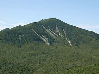
Dix Mountain is the sixth highest peak in the High Peaks Region of the Adirondack Park, and is located roughly on the boundary between the towns of North Hudson and Keene in Essex County, New York. The peak was named in 1837 after John Dix (1798–1879), who was the Secretary of State of New York at the time, and later became the state's governor.

Mount Moosilauke is a 4,802-foot-high (1,464 m) mountain at the southwestern end of the White Mountains in the town of Benton, New Hampshire, United States. It is the tenth highest and most southwesterly of the 4,000 foot summits in the White Mountains.

Mount Colden is the eleventh-highest peak in the High Peaks of the Adirondack Mountains, New York, United States. The peak was named after David S. Colden, an investor in the McIntyre Iron Works, in 1836. The peak was briefly renamed "Mount McMartin" the next year, but the older name persisted. The mountain is known for its distinctive Trap Dike, a large crevice running up the center of the mountain, which can clearly be seen from Avalanche Lake.

Wright Peak is the 16th highest peak in the High Peaks of the Adirondack Park, and is located in the MacIntyre Range in the town of North Elba, New York, in Essex County, New York. Named for N.Y. Governor Silas Wright (1795–1847), Wright is the northernmost peak in the MacIntyre Range, and is one of the windiest peaks in the park, as well as one of the best for back-country skiing. There are long slides from the summit that lead to Marcy Dam which are often skied in the winter.

Rocky Peak Ridge is the twentieth highest peak in the High Peaks Region of the Adirondack Park of New York, United States. The name of the mountain is due to its geology, a rocky ridge to the east of the better known Giant Mountain. The long, bare ridge is unusual in the Adirondacks; it resulted from the last great forest fire in the region, in 1913.
The High Peaks Wilderness Area, the largest Forest Preserve unit in the U.S. state of New York, is located in three counties and six towns in the Adirondack Park: Harrietstown in Franklin County, North Elba, Keene, North Hudson and Newcomb in Essex County and Long Lake in Hamilton County.
Black Mountain is a mountain located in Washington County, New York, of which its peak is the highest point. Isolated from the rest of the Adirondack Mountains by Lake George, Black Mtn. has the seventh highest topographic prominence of all the mountains in New York. Black Mountain also has the highest elevation of any of the peaks which surround Lake George and offers unobstructed views of the lake from its summit.
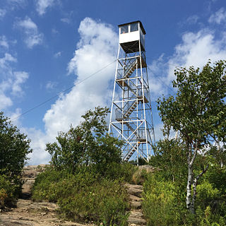
Hadley Mountain is a mountain located in the southern Adirondacks in the U.S. state of New York and is the second-highest peak in Saratoga County after neighboring Tenant Mountain. The Hadley Mountain Fire Observation Station was listed on the National Register of Historic Places on September 23, 2001 for its role as a Fire lookout tower with the New York State Forest Preserve. Hadley Mountain is the highest of the three peaks that form the West Mountain ridge.
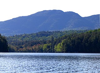
Ampersand Mountain is a 3,352 ft (1,021.7 m) mountain in Franklin County in the High Peaks Wilderness Area of the northeastern Adirondacks, west of the High Peaks proper in New York State. The trail up the mountain begins on New York State Route 3 8.1 miles (13.0 km) southwest of the village of Saranac Lake, near Middle Saranac Lake; it is a popular day hike. The mountain takes its name from nearby Ampersand Creek, so named because it twists and turns like the ampersand symbol. The summit is bare rock, with extensive views of the High Peaks to the east and the Saranac Lakes to the west. Stony Creek Mountain is located west-southwest of Ampersand Mountain. The mountain is notable as the land surrounding its hiking trail's initial ascent is generally acknowledged as unlogged old growth forest.

Hurricane Mountain is a 3,688-foot-tall (1,124 m) mountain near Keene in the north of the High Peaks region of the Adirondacks in New York, United States. It is considered to boast some of the most impressive views of any of the lesser peaks; this is due to its prominence, and because its summit was cleared by Verplanck Colvin in the course of his early survey of the Adirondacks. On a clear day, the length of Lake Champlain and the Green Mountains of Vermont are visible to the east, and many of the High Peaks can be seen to the south through the northwest. There is a disused fire tower on the top.
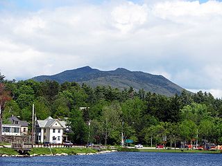
McKenzie Mountain is a 3,861-foot (1,177 m) mountain in western Essex County in the towns of St. Armand and North Elba in the Adirondack Park, a unit of the Forest Preserve.
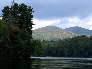
Saint Regis Mountain is a 2,838-foot-tall (865 m) mountain in the town of Santa Clara, New York, in Franklin County at the center of the Saint Regis Canoe Area in the Adirondack Park.

Pitchoff Mountain is a 3,600-foot (1,097 m) mountain opposite Cascade Mountain on NY 73 west of Keene Valley in Essex County, New York, in the US. There are two summits; the higher summit is viewless, but the northern summit, at 3,323 feet (1,013 m) offers 360 degree views of the nearby Cascade Lakes, the High Peaks of the Adirondacks, and, in clear weather, the Green Mountains of Vermont. There is a 5.2-mile (8.4 km) hiking trail that starts on Route 73 west of the Cascade Lakes, climbs 2.0 miles (3.2 km) to the blind summit, then traverses the nearly two-mile summit ridge to the northern summit before descending 1.4 miles (2.3 km) to Route 73 east of the Lakes, 2.7 miles (4.3 km) east of the starting point.
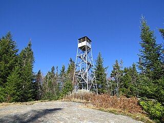
Owls Head Mountain is a 2,786-foot-tall (849 m) mountain in the Adirondack Mountains region of New York. It is located west-southwest of the hamlet of Long Lake in Hamilton County.


