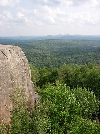
The Adirondack Mountains are a massif of mountains in Northeastern New York which form a circular dome approximately 160 miles (260 km) wide and covering about 5,000 square miles (13,000 km2). The region contains more than 100 peaks, including Mount Marcy, which is the highest point in New York at 5,344 feet (1,629 m). The Adirondack High Peaks, a traditional list of 46 peaks over 4,000 feet (1,200 m), are popular hiking destinations. There are over 200 named lakes with the number of smaller lakes, ponds, and other bodies of water reaching over 3,000. Among the named lakes around the mountains are Lake George, Lake Placid, and Lake Tear of the Clouds. The region has over 1,200 miles (1,900 km) of river.
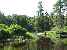
Long Lake is a town in Hamilton County, New York, United States. The population was 791 at the 2020 census.

The Adirondack Park is a park in northeastern New York protecting the Adirondack Mountains. The park was established in 1892 for "the free use of all the people for their health and pleasure", and for watershed protection. At 6.1 million acres, it is the largest park in the contiguous United States.

New York's Forest Preserve, comprises almost all the lands owned by the state of New York within the Adirondack and Catskill parks. It is managed by the state Department of Environmental Conservation (DEC).
The Blue Ridge Wilderness Area, a unit of New York's Forest Preserve in the Adirondack Park, is located in the towns of Arietta, Lake Pleasant and Indian Lake in Hamilton County. It is roughly bounded on the north by NY 28; on the east by Route 28 and private lands immediately west of this route; on the south by private lands immediately north and west of Cedar River Flow; and on the west by the Lake Kora and Sagamore Lake properties and the South Inlet of Raquette Lake. It contains 19 bodies of water covering 275 acres and features 15 miles of foot trails and three lean-tos.

The Dix Mountain Wilderness Area is the name previously given to an area of New York's Forest Preserve in the Adirondack Park located in the towns of Elizabethtown, Keene and North Hudson, Essex County. It was roughly bounded on the north by NY 73, on the east by the Adirondack Northway (Interstate 87), on the south by Blue Ridge Road and on the west by Elk Lake Club and Ausable Club lands.
The Five Ponds Wilderness Area, an Adirondack Park unit of New York's Forest Preserve, is located in the towns of Fine and Clifton in St. Lawrence County, the town of Webb in Herkimer County and the town of Long Lake in Hamilton County. It includes 1,064 acres (4.3 km2) of private inholdings, 99 bodies of water covering 1,964 acres (7.9 km2), 57.9 miles (93.2 km) of trails, and 14 lean-tos.
The High Peaks Wilderness Area is the largest wilderness area of the Forest Preserve in the U.S. state of New York. It is located in three counties and six towns in the Adirondack Park: Harrietstown in Franklin County, North Elba, Keene, North Hudson and Newcomb in Essex County and Long Lake in Hamilton County.
The McKenzie Mountain Wilderness Area, an Adirondack Park unit of the Forest Preserve, lies in western Essex County in the towns of St. Armand, North Elba and Wilmington. In general, the Saranac River and Franklin Falls Pond border on the north; the Wilmington-Franklin Falls road, the Whiteface Mountain Memorial Highway and the west branch of the Ausable River form the eastern boundary; the Saranac Lake-Lake Placid Road, NY 86, forms the southern boundary; and the Saranac River forms the western boundary.
The Pepperbox Wilderness Area, an Adirondack Park unit of the New York Forest Preserve, lies entirely within the town of Webb in Herkimer County. Stillwater Reservoir and the Beaver River Primitive Area form the southern boundary, while the north bank of the West Branch of the Oswegatchie River generally forms the northern boundary. The western boundary is the county line, and the eastern boundary is the Raven Lake Road and the Five Ponds Wilderness Area.
The Pharaoh Lake Wilderness Area, an Adirondack Park unit of New York's Forest Preserve, straddles the Essex County-Warren County line in the towns of Ticonderoga, Hague, Horicon and Schroon. The county road along the east shore of Schroon Lake forms the western boundary; to the north, private land and NY 74 form the boundary. The state land boundary forms most of the remaining perimeter except for a stretch of NY 8 on the south.
The Sentinel Range Wilderness Area, an Adirondack Park unit of New York's Forest Preserve, is located in the towns of Wilmington, North Elba and Keene, Essex County. It is bounded by NY 86 on the north, NY 73 on the south, and private lands on the east and west.
The Siamese Ponds Wilderness Area, an Adirondack Park unit of the Forest Preserve, is located in the towns of Lake Pleasant, Wells and Indian Lake in Hamilton County and the towns of Johnsburg and Thurman in Warren County. It is one of the larger wilderness areas of the Northeast; extending about 18 miles (29 km) from north to south and about 13 miles (21 km) from east to west at its widest part.
The Silver Lake Wilderness Area, an Adirondack Park unit of the Forest Preserve, is located in the towns of Lake Pleasant, Benson, Wells and Arietta in Hamilton County and is roughly bounded on the north by NY 8 and private lands near Piseco Lake, Oxbow Lake, Hamilton Lake, Sand Lake and Lake Pleasant; on the east by NY 30; on the south generally by the Hamilton County line; and on the west by NY 10, the West Branch of the Sacandaga River and the Piseco Outlet.
The West Canada Lake Wilderness Area is an Adirondack Park Forest Preserve management unit in the State of New York, USA.

The Saranac Lakes Wild Forest is a discontinuous 79,000-acre (320 km2) tract designated as Wild Forest by the New York State Department of Environmental Conservation in Franklin and Essex Counties near Saranac Lake, Tupper Lake, and Lake Placid. The area covers large portions of Harrietstown, Santa Clara, and North Elba; smaller portions are in Altamont, St. Armand, Brighton, and Franklin. The area is served by State Routes NY-3, NY-30, NY-86, and NY-73.

Lake Lila is a remote 1,436-acre (5.81 km2) lake in the William C. Whitney Wilderness Area, in the west-central portion of the Adirondack Park. It is accessed via a 6-mile (9.7 km) dirt road. Boat access to the lake is by hand-launch only, after a 0.3-mile (0.48 km) portage from the parking lot.

The Round Lake Wilderness Area, an Adirondack Park unit of New York's Forest Preserve, is located in the town of Long Lake in Hamilton County. It is adjacent to the William C. Whitney Wilderness. The area is approximately 11,000 acres (45 km2); it was created in 2005 by the Adirondack Park Agency by classifying Round Lake as wilderness, and reclassifying of portions of the Horseshoe Lake Wild Forest and the Hitchens Pond Primitive Area to wilderness status.

Little Tupper Lake is a 2,300-acre lake located in the town of Long Lake, Hamilton County, New York by Whitney Headquarters, New York. It is located in the 19,500-acre William C. Whitney Wilderness Area.

Round Lake is a 744-acre (301-hectare) lake in the town of Long Lake, Hamilton County, New York, US. It is the centerpiece of the 11,430-acre Round Lake Wilderness Area are part of the Adirondack Forest Preserve, adjacent to the 19,500-acre William C. Whitney Wilderness in the Adirondack Park.