Cazenovia, New York

Last updated

Cazenovia, New York
Downtown Cazenovia, NY May.jpg
Downtown Cazenovia
USA New York location map.svg
Red pog.svg
Cazenovia
Usa edcp location map.svg
Red pog.svg
Cazenovia
Coordinates: 42°55′53″N75°51′09″W / 42.9315°N 75.8526°W / 42.9315; -75.8526
CountryUnited States
State New York
County Madison
Government
   Town supervisor Kyle Reger (R)
   Town council
Members
  • Patrick Race (R)
  • Jimmy Golub (D)
  • Sheila Fallon (R)
  • Kelli Johnson (D)
Area
[1]
  Total
51.79 sq mi (134.14 km2)
  Land49.94 sq mi (129.35 km2)
  Water1.85 sq mi (4.79 km2)
Population
 (2020) [2]
  Total
6,740
  Density134.96/sq mi (52.11/km2)
Time zone UTC-5 (EST)
  Summer (DST) UTC-4 (EDT)
ZIP Codes
13035 (Cazenovia)
13122 (New Woodstock)
13104 (Manlius)
Area code(s) 315, 680
FIPS code 36-053-13156
Website towncazenovia.digitaltowpath.org:10079

Cazenovia is an incorporated town in Madison County, New York, United States. The population was 6,740 at the time of the 2020 census. [3] The town is named after Theophile Cazenove, the 'Agent General of the Holland Land Company. The village of Cazenovia is located in the center of the town. The town is on the county's western border.

Contents

The village of Cazenovia was home to Cazenovia College, a small liberal arts college in the greater Syracuse area. It was founded in 1824, known then as the Genesee Seminary.

History

Perspective map of Cazenovia with list of landmarks published in 1890 by L.R. Burleigh Cazenovia, N.Y. LOC 75694758.tif
Perspective map of Cazenovia with list of landmarks published in 1890 by L.R. Burleigh

The town of Cazenovia was established in 1793 from the towns of Whitestown and Paris (both in Oneida County) before the creation of Madison County. Subsequently, other towns in the county were formed from partitions of its territory. Cazenovia was part of a region called "The Gore", based on a surveying error.

It was founded by John Lincklaen, an agent of the Holland Land Company, and was named after Theophile Cazenove, Lincklaen's supervisor.

Geography

The town is situated along the western edge of Madison County and is bordered to the west by Onondaga County. U.S. Route 20, also known as Albany Street, crosses the town, leading east toward Albany and west toward Auburn.

According to the U.S. Census Bureau, the town of Cazenovia has a total area of 51.79 square miles (134.1 km2), with 49.94 square miles (129.3 km2) of land and {convert|1.85|sqmi}} of water (3.57%). [1] Cazenovia Lake is in the north-central part of town. Its outlet, at the south end of the lake in the village of Cazenovia, feeds Chittenango Creek, which descends to the north and flows into Oneida Lake, part of the Oswego River watershed leading to Lake Ontario. The southern part of the town is drained by the East Branch of Limestone Creek, which in turn flows north to join Chittenango Creek in the northern part of Manlius.

Demographics

Historical population
CensusPop.Note
1820 3,909
1830 4,34411.1%
1840 4,153−4.4%
1850 4,81215.9%
1860 4,343−9.7%
1870 4,265−1.8%
1880 4,3632.3%
1890 4,182−4.1%
1900 3,830−8.4%
1910 3,687−3.7%
1920 3,343−9.3%
1930 3,5044.8%
1940 3,424−2.3%
1950 3,96915.9%
1960 4,96825.2%
1970 6,09222.6%
1980 5,880−3.5%
1990 6,51410.8%
2000 6,481−0.5%
2010 7,0869.3%
2020 6,740−4.9%
U.S. Decennial Census [4]

As of the census [5] of 2000, there were 6,481 people, 2,353 households, and 1,658 families residing in the town. The population density was 129.9 inhabitants per square mile (50.2/km2). There were 2,567 housing units at an average density of 51.5 per square mile (19.9/km2). The racial makeup of the town was 97.25% White, 1.10% Black or African American, 0.26% Native American, 0.52% Asian, 0.15% from other races, and 0.69% from two or more races. Hispanic or Latino of any race were 1.48% of the population.

There were 2,353 households, out of which 32.3% had children under the age of 18 living with them, 61.0% were married couples living together, 6.8% had a female householder with no husband present, and 29.5% were non-families. 24.5% of all households were made up of individuals, and 12.3% had someone living alone who was 65 years of age or older. The average household size was 2.51 and the average family size was 3.02.

In the town, the population was spread out, with 24.0% under the age of 18, 12.8% from 18 to 24, 23.5% from 25 to 44, 25.2% from 45 to 64, and 14.5% who were 65 years of age or older. The median age was 39 years. For every 100 females, there were 88.7 males. For every 100 females age 18 and over, there were 83.1 males.

The median income for a household in the town was $57,232, and the median income for a family was $73,590. Males had a median income of $50,556 versus $31,613 for females. The per capita income for the town was $28,957. About 2.4% of families and 4.3% of the population were below the poverty line, including 1.9% of those under age 18 and 6.7% of those age 65 or over.

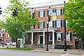
Communities and locations in the town of Cazenovia

National Register of Historic Places

The following sites and historic districts are listed on the National Register of Historic Places. [6]

[7] Name on the RegisterImageDate listed [8] Location NeighborhoodDescription
1 Abell Farmhouse and Barn November 2, 1987
(#87001860)
Ballina Rd.
42°54′11″N75°49′31″W / 42.903056°N 75.825278°W / 42.903056; -75.825278 (Abell Farmhouse and Barn)
2 Annas Farmhouse February 18, 1988
(#87001861)
4812 Ridge Rd.
42°57′25″N75°51′20″W / 42.956944°N 75.855556°W / 42.956944; -75.855556 (Annas Farmhouse)
3 Beckwith Farmhouse November 2, 1987
(#87001862)
4652 Syracuse Rd.
42°56′51″N75°53′07″W / 42.9475°N 75.885278°W / 42.9475; -75.885278 (Beckwith Farmhouse)
4 Cedar Cove July 15, 1991
(#91000867)
W side of E. Lake Rd.
42°57′00″N75°51′49″W / 42.95°N 75.863611°W / 42.95; -75.863611 (Cedar Cove)
5 Chappell Farmhouse November 2, 1987
(#87001864)
Ridge Rd.
42°56′52″N75°51′23″W / 42.947778°N 75.856389°W / 42.947778; -75.856389 (Chappell Farmhouse)
6 Cobblestone House November 2, 1987
(#87001865)
Syracuse Rd.
42°56′35″N75°52′59″W / 42.943056°N 75.883056°W / 42.943056; -75.883056 (Cobblestone House)
7 Zephnia Comstock Farmhouse November 2, 1987
(#87001866)
2363 Nelson St.
42°55′30″N75°50′19″W / 42.925°N 75.838611°W / 42.925; -75.838611 (Zephnia Comstock Farmhouse)
8 Crandall Farm Complex November 2, 1987
(#87001867)
2430 Ballina Rd.
42°53′35″N75°50′13″W / 42.893056°N 75.836944°W / 42.893056; -75.836944 (Crandall Farm Complex)
9 Evergreen Acres November 2, 1987
(#87001868)
Syracuse Rd.
42°55′38″N75°52′38″W / 42.927222°N 75.877222°W / 42.927222; -75.877222 (Evergreen Acres)
10 Hillcrest July 15, 1991
(#91000869)
Ridge Rd. S of Hoffman
42°56′20″N75°51′27″W / 42.938889°N 75.8575°W / 42.938889; -75.8575 (Hillcrest)
11 Lorenzo
Lorenzo LorenzoCaz.JPG
Lorenzo
February 18, 1971
(#71000541)
Ledyard St. (U.S. 20)
42°55′23″N75°51′56″W / 42.923056°N 75.865556°W / 42.923056; -75.865556 (Lorenzo)
12 The Maples November 2, 1987
(#87001876)
2420 Nelson Rd.
42°55′19″N75°50′08″W / 42.921944°N 75.835556°W / 42.921944; -75.835556 (The Maples)
13 Meadows Farm Complex November 2, 1987
(#87001869)
Rippleton Rd.
42°55′01″N75°51′40″W / 42.916944°N 75.861111°W / 42.916944; -75.861111 (Meadows Farm Complex)
14 Middle Farmhouse November 2, 1987
(#87001870)
4875 W. Lake Rd.
42°57′29″N75°52′58″W / 42.958056°N 75.882778°W / 42.958056; -75.882778 (Middle Farmhouse)
15 Niles Farmhouse November 2, 1987
(#87001871)
Rippleton Rd.
42°54′45″N75°52′08″W / 42.9125°N 75.868889°W / 42.9125; -75.868889 (Niles Farmhouse)
16 Notleymere July 15, 1991
(#91000868)
4641 E. Lake Rd.
42°56′52″N75°51′47″W / 42.947778°N 75.863056°W / 42.947778; -75.863056 (Notleymere)
17 Old Trees July 15, 1991
(#91000865)
W side of Rippleton Rd.
42°54′59″N75°52′35″W / 42.916389°N 75.876389°W / 42.916389; -75.876389 (Old Trees)
18 Ormonde July 15, 1991
(#91000866)
Between E. Lake Rd. and Ormonde Dr.
42°57′20″N75°51′41″W / 42.955556°N 75.861389°W / 42.955556; -75.861389 (Ormonde)
19 Parker Farmhouse November 2, 1987
(#87001872)
3981 East Rd.
42°54′58″N75°51′04″W / 42.916111°N 75.851111°W / 42.916111; -75.851111 (Parker Farmhouse)
20 Rippleton Schoolhouse August 6, 1998
(#98000996)
Rippleton Rd., 15 mi. SE of Syracuse
42°55′16″N75°51′46″W / 42.921111°N 75.862778°W / 42.921111; -75.862778 (Rippleton Schoolhouse)
21 Rolling Ridge Farm November 2, 1987
(#87001873)
3937 Number Nine Rd.
42°54′46″N75°50′45″W / 42.912778°N 75.845833°W / 42.912778; -75.845833 (Rolling Ridge Farm)
22 Shattuck House July 15, 1991
(#91000873)
W. Lake Rd.
42°58′16″N75°53′04″W / 42.971111°N 75.884444°W / 42.971111; -75.884444 (Shattuck House)
23 Sweetland Farmhouse November 2, 1987
(#87001874)
Number Nine Rd.
42°54′52″N75°50′44″W / 42.914444°N 75.845556°W / 42.914444; -75.845556 (Sweetland Farmhouse)
24 Tall Pines November 2, 1987
(#87001875)
Ridge Rd.
42°57′03″N75°51′23″W / 42.950833°N 75.856389°W / 42.950833; -75.856389 (Tall Pines)
25 The Hickories July 15, 1991
(#91000870)
47 Forman St.
42°56′04″N75°51′37″W / 42.934444°N 75.860278°W / 42.934444; -75.860278 (The Hickories)
26 Upenough July 15, 1991
(#91000871)
Rippleton St.
42°54′12″N75°52′34″W / 42.903333°N 75.876111°W / 42.903333; -75.876111 (Upenough)
27 York Lodge July 15, 1991
(#91000872)
4448 E. Lake Rd.
42°56′21″N75°51′29″W / 42.939167°N 75.858056°W / 42.939167; -75.858056 (York Lodge)

Notable people

Economy

See also

Related Research Articles

<span class="mw-page-title-main">Lincklaen, New York</span> Town in New York, United States

Lincklaen is a town in Chenango County, New York, United States. The population was 392 at the 2020 census. The town was named after Colonel John Lincklaen, an agent of the Holland Land Company and a land owner. The town is in the northwestern corner of the county, northwest of the city Norwich and northeast of Cortland.

<span class="mw-page-title-main">Aurora, Erie County, New York</span> Town in New York, United States

Aurora is a town in Erie County, New York, United States. The population was 13,782 at the 2010 census. It is one of the "Southtowns" of Erie County and is also erroneously called "East Aurora", the name of its principal village. The town is centrally located in the county, southeast of Buffalo.

<span class="mw-page-title-main">Sardinia, New York</span> Town in New York, United States

Sardinia is a town in Erie County, New York, United States. The town lies in the southeast corner of Erie County and is considered one of the county's "Southtowns". The town is southeast of Buffalo. The population was 2,775 at the 2010 census. The town is reportedly named after an old Christian hymn, Sardinia, and the homonymous Mediterranean island.

Conesus is a town in Livingston County, New York, United States. The population was 2,473 at the 2010 census. The name is derived from a native word meaning "berry place".

<span class="mw-page-title-main">Chittenango, New York</span> Village in New York, United States

Chittenango is a village in Madison County, New York, United States. It is in the southern part of the town of Sullivan. The population was 4,896 at the 2020 census. Chittenango is the birthplace of L. Frank Baum, author of The Wonderful Wizard of Oz.

<span class="mw-page-title-main">Eaton, New York</span> Town in New York, United States

Eaton is a town in Madison County, New York, United States. The population was 4,284 at the 2020 census, down from 5,255 in 2010.

<span class="mw-page-title-main">Fenner, New York</span> Town in New York, United States

Fenner is a town in Madison County, New York, United States. The population was 1,668 at the 2020 census. The town is in the north-central part of the county, east of Cazenovia Lake.

Lenox is a town in Madison County, New York, United States. The population was 8,768 as of the 2020 census.

<span class="mw-page-title-main">Nelson, New York</span> Town in New York, United States

Nelson is a town in Madison County, New York, United States. The population was 1,890 at the 2020 census. The town was named after Horatio Nelson, the English naval hero.

<span class="mw-page-title-main">Sullivan, New York</span> Town in Madison County, New York, US

Sullivan is a town in Madison County, New York, United States. The population was 14,794 at the 2020 census. The town is named after Revolutionary War general John Sullivan.

<span class="mw-page-title-main">Hamlin, New York</span> Town in New York, United States

Hamlin is a town in Monroe County, New York, United States. The population was 8,725 at the 2020 census. The town is in the northwestern part of the county and is the second-largest town in area in the county.

<span class="mw-page-title-main">Cicero, New York</span> Town in New York, United States

Cicero is a town in northern Onondaga County, New York, United States. As of the 2020 Census, the population was 31,435. The name of the town was assigned by a clerk interested in the classics, honoring Cicero, a Roman statesman.

<span class="mw-page-title-main">Pompey, New York</span> Town in New York, United States

Pompey is a town in the southeast part of Onondaga County, New York, United States. As of the 2020 Census, the population was 7,080. The town was named after the Roman general and political leader Pompey by a late 18th-century clerk interested in the Classics in the new federal republic.

Bridgeport is a hamlet located partly in the town of Sullivan in Madison County, New York, United States and partly in the town of Cicero in Onondaga County. The population was 1,490 at the 2010 census.

<span class="mw-page-title-main">Cazenovia (village), New York</span> Village in New York, United States

Cazenovia is a village in the town of Cazenovia in Madison County, New York, United States. As of the 2020 census, the village had a population of 2,767. The village lies at the south end of Cazenovia Lake and is within a half hour of Syracuse. The village is located on US Route 20 and New York State Route 13, and was home to Cazenovia College.

<span class="mw-page-title-main">DeRuyter (village), New York</span> Village in New York, United States

DeRuyter is a village located in the Town of DeRuyter in Madison County, New York, United States. The population was 558 at the 2010 census. The village and town are named after Michiel Adriaenszoon de Ruyter, a famous admiral in the Dutch navy.

<span class="mw-page-title-main">DeRuyter, New York</span> Town in New York, United States

DeRuyter is a town in Madison County, New York, United States. The population was 1,276 at the 2020 census, down from 1,589 in 2010. The town is named after Michiel Adriaenszoon de Ruyter, a famous admiral in the Dutch navy. The name de Ruyter means "the Rider".

<span class="mw-page-title-main">Manlius, New York</span> Town in New York, United States

Manlius is a town to the south east of Syracuse in Onondaga County, New York, United States. As of the 2020 Census, the population was 33,712, making it the third largest suburb in metropolitan Syracuse. In 2005, the town was ranked 98th on CNN's list of Best Places to Live.

<span class="mw-page-title-main">Stillwater, New York</span> Town in New York, United States

Stillwater is a town in Saratoga County, New York, United States, with a population of 9,022 at the 2020 census. The town contains a village called Stillwater. The town is at the eastern border of the county, southeast of Saratoga Springs and borders both Rensselaer and Washington counties. Saratoga National Historical Park is located within the town's limits. There is a hamlet in Minerva, Essex County, New York, with the same name which has nothing to do with this town.

<span class="mw-page-title-main">Dryden, New York</span> Town in New York, United States

Dryden is a town in Tompkins County, New York, United States. The population was 14,435 at the 2010 census. The town administers an area that includes two villages, one also named Dryden and one named Freeville, as well as a number of hamlets. The town is on the county's eastern border, east of Ithaca, in the Finger Lakes region.

References

  1. 1 2 "2024 U.S. Gazetteer Files: New York". United States Census Bureau. Retrieved December 24, 2024.
  2. "P1. Race – Cazenovia town, New York: 2020 DEC Redistricting Data (PL 94-171)". U.S. Census Bureau. Retrieved December 24, 2024.
  3. "U.S. Census website". United States Census Bureau . Retrieved September 3, 2022.
  4. "Census of Population and Housing". Census.gov. Retrieved June 4, 2015.
  5. "U.S. Census website". United States Census Bureau . Retrieved January 31, 2008.
  6. "National Register Information System". National Register of Historic Places . National Park Service. March 13, 2009.
  7. Numbers represent an alphabetical ordering by significant words. Various colorings, defined here, differentiate National Historic Landmarks and historic districts from other NRHP buildings, structures, sites or objects.
  8. The eight-digit number below each date is the number assigned to each location in the National Register Information System database, which can be viewed by clicking the number.
  9. Who Was Who in America, Historical Volume, 1607-1896. Chicago: Marquis Who's Who. 1963.