Fabius (village), New York

Last updated
Fabius, New York
Onondaga County New York incorporated and unincorporated areas Fabius (village) highlighted.svg
Location in Onondaga County and the state of New York.
Coordinates: 42°50′8″N75°59′7″W / 42.83556°N 75.98528°W / 42.83556; -75.98528
Country United States
State New York
County Onondaga
Area
[1]
  Total0.43 sq mi (1.10 km2)
  Land0.43 sq mi (1.10 km2)
  Water0.00 sq mi (0.00 km2)
Population
 (2020)
  Total309
  Density725.35/sq mi (280.06/km2)
Time zone UTC-5 (Eastern (EST))
  Summer (DST) UTC-4 (EDT)
FIPS code 36-24867

Fabius is a village in Onondaga County, New York, United States. As of the 2020 census, the population was 309. It is part of the Syracuse Metropolitan Statistical Area. The village is near the center of the town of Fabius and is south of Syracuse.

Contents

History

The village is within the former Central New York Military Tract and was originally called "Franklinville." Fabius became an incorporated village in 1880. Fabius was named for Quintus Fabius Maximus Verrucosus, a Roman soldier and politician.

The Fabius Village Historic District was listed on the National Register of Historic Places in 2000. [2]

Geography

Fabius is located at 42°50′7″N75°59′6″W / 42.83528°N 75.98500°W / 42.83528; -75.98500 (42.835551, -75.98515). [3]

According to the United States Census Bureau, the village has a total area of 0.4 square mile (1.0 km2), all land.

The village is situated at the intersection of state routes 80 and 91.

Demographics

Historical population
CensusPop.Note
1870 378
1880 4057.1%
1890 312−23.0%
1900 38724.0%
1910 344−11.1%
1920 240−30.2%
1930 26711.3%
1940 30815.4%
1950 36919.8%
1960 3782.4%
1970 374−1.1%
1980 367−1.9%
1990 310−15.5%
2000 35514.5%
2010 352−0.8%
2020 309−12.2%
U.S. Decennial Census [4]

As of the census [5] of 2000, there were 355 people, 127 households, and 92 families residing in the village. The population density was 885.6 inhabitants per square mile (341.9/km2). There were 137 housing units at an average density of 341.8 per square mile (132.0/km2). The racial makeup of the village was 98.03% White, 1.41% Native American, 0.28% Asian, and 0.28% from two or more races. Hispanic or Latino of any race were 2.25% of the population.

There were 127 households, out of which 38.6% had children under the age of 18 living with them, 60.6% were married couples living together, 9.4% had a female householder with no husband present, and 26.8% were non-families. 22.0% of all households were made up of individuals, and 7.9% had someone living alone who was 65 years of age or older. The average household size was 2.80 and the average family size was 3.23.

In the village, the population was spread out, with 31.5% under the age of 18, 5.1% from 18 to 24, 29.9% from 25 to 44, 23.1% from 45 to 64, and 10.4% who were 65 years of age or older. The median age was 36 years. For every 100 females, there were 85.9 males. For every 100 females age 18 and over, there were 92.9 males.

The median income for a household in the village was $52,321, and the median income for a family was $55,417. Males had a median income of $39,844 versus $26,500 for females. The per capita income for the village was $17,994. About 4.0% of families and 5.5% of the population were below the poverty line, including 12.7% of those under age 18 and none of those age 65 or over.

Notable person

Related Research Articles

<span class="mw-page-title-main">Newark, Missouri</span> Village in Missouri, United States

Newark is a village in southeast Knox County, Missouri, United States, along the South Fabius River. As of the 2020 census, its population was 54.

<span class="mw-page-title-main">Chambers, Nebraska</span> Village in Nebraska, United States

Chambers is a village in Holt County, Nebraska, United States. The population was 268 at the 2010 census.

<span class="mw-page-title-main">Des Moines, New Mexico</span> Village in New Mexico, United States

Des Moines is a village in Union County, New Mexico, United States. The population was 143 at the 2010 census. Des Moines is a small village surrounded by large cattle ranches. The summit of Sierra Grande, the largest shield volcano in the Raton-Clayton Volcanic Field, is 5 kilometres (3.1 mi) southwest of the village. The population in 2018 was 20% lower than it was in 2000. Des Moines is known for its educational services, construction, and agriculture. The general cost of living index for Des Moines is 84.9.

Morrisville is a village in Madison County, New York, United States. The population was 2,199 at the 2010 census. The village is named after its founder, Thomas Morris.

<span class="mw-page-title-main">Munnsville, New York</span> Village in New York, United States

Munnsville is a village located in the Town of Stockbridge in Madison County, New York, United States. The population was 474 at the 2010 census. The village is named for an early settler, Asa Munn, and located on New York State Route 46.

<span class="mw-page-title-main">Minoa, New York</span> Village in New York, United States

Minoa is a village in Onondaga County, New York, United States. As of the 2020 census, the population was 3,657. Minoa is in the northern part of the town of Manlius and is east of Syracuse.

<span class="mw-page-title-main">Nedrow, New York</span> Census-designated place in New York, United States

Nedrow is a hamlet located in the town of Onondaga in Onondaga County, New York, United States. The population was 2,244 at the 2010 census. It is a suburb of Syracuse, whose southern border it adjoins.

<span class="mw-page-title-main">Lacona, New York</span> Village in New York, United States

Lacona is a village in Oswego County, New York, United States. The population was 582 at the 2010 census.

<span class="mw-page-title-main">Syracuse, Ohio</span> Village in Ohio, United States

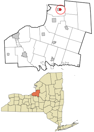
Syracuse is a village in Meigs County, Ohio, United States, along the Ohio River. The population was 781 at the 2020 census.

Spring Ridge is a census-designated place (CDP) in Spring Township, Berks County, Pennsylvania, United States. The population was 1,003 at the 2010 census.

<span class="mw-page-title-main">Lanesboro, Pennsylvania</span> Borough in Pennsylvania, United States

Lanesboro is a borough in Susquehanna County, Pennsylvania, United States. The population was 485 at the 2020 census.

<span class="mw-page-title-main">Sister Bay, Wisconsin</span> Village in Wisconsin, United States

Sister Bay is a village in Door County, Wisconsin, United States. The population was 876 at the 2010 census.

<span class="mw-page-title-main">Browntown, Wisconsin</span> Village in Wisconsin, United States

Browntown is a village in Green County, Wisconsin, United States. The population was 280 at the 2010 census.

<span class="mw-page-title-main">Bridgewater (CDP), New York</span> Hamlet and CDP in New York, United States

Bridgewater is a hamlet in Oneida County, New York, United States. The population was 470 at the 2010 census.

<span class="mw-page-title-main">Vernon (village), New York</span> Village in New York, United States

Vernon is a village in Oneida County, New York, United States. The population was 1,172 at the 2010 census.

<span class="mw-page-title-main">Fabius, New York</span> Town in New York, United States

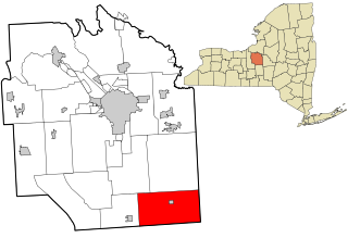
Fabius is a town in Onondaga County, New York, United States. As of the 2020 Census, the population was 2,006. The classical name of the town was assigned by a clerk interested in the classics.

Otego is a village in Otsego County, New York, United States. It is located within the Mohawk Valley Region of the state. The population was 1,010 at the 2010 census.

<span class="mw-page-title-main">Eastchester (CDP), New York</span> CDP in New York, United States

Eastchester is a census-designated place (CDP) in Westchester County, New York, United States. The population was 19,554 at the 2010 census. The Eastchester CDP consists of the Town of Eastchester excluding the villages of Bronxville and Tuckahoe.

The Town of Spencer is located in Marathon County, Wisconsin, United States. It is part of the Wausau, WI Metropolitan Statistical Area. The population was 1,581 at the 2010 census. The village of Spencer is located in the northeastern part of the town.The unincorporated community of Mann also is located in the town.

<span class="mw-page-title-main">Tremont City, Ohio</span> Village in Ohio, United States

Tremont City is a village in Clark County, Ohio, United States. The population was 375 at the 2010 census. The village is part of the Springfield, Ohio Metropolitan Statistical Area.

References

  1. "ArcGIS REST Services Directory". United States Census Bureau. Retrieved September 20, 2022.
  2. "National Register Information System". National Register of Historic Places . National Park Service. March 13, 2009.
  3. "US Gazetteer files: 2010, 2000, and 1990". United States Census Bureau. 2011-02-12. Retrieved 2011-04-23.
  4. "Census of Population and Housing". Census.gov. Retrieved June 4, 2015.
  5. "U.S. Census website". United States Census Bureau . Retrieved 2008-01-31.