Syracuse is a city in and the county seat of Onondaga County, New York, United States. With a population of 148,620 and a metropolitan area of 662,057, it is the fifth-most populated city and 13th-most populated municipality in the state of New York.

Onondaga County is a county in the U.S. state of New York. As of the 2020 census, the population was 476,516. The county seat is Syracuse. The county is part of the Central New York region of the state.

Cicero is a town in northern Onondaga County, New York, United States. As of the 2020 Census, the population was 31,435. The name of the town was assigned by a clerk interested in the classics, honoring Cicero, a Roman statesman.
Clay is a town in Onondaga County, New York, United States. As of the 2020 Census, the population was 60,527, making it Syracuse's most populous suburb. The town was named after American attorney and statesman Henry Clay.

DeWitt is a town in Onondaga County, New York, United States. As of the 2020 census, the population was 26,074. The town is named after major Moses DeWitt, a judge and soldier. An eastern suburb of Syracuse, DeWitt also is the site of most of the campus and all of the academic buildings of Le Moyne College.

Geddes is a town in Onondaga County, New York, United States. As of the 2020 Census, the population was 17,088.

LaFayette is a town in Onondaga County, New York, United States. As of the 2020 Census, its population was 4,910. The town is named after the Marquis de Lafayette, a key figure in the French and American revolutions, and widely considered a national hero of France and the United States. LaFayette is in the southern part of Onondaga County, south of Syracuse.

Onondaga is a town in Onondaga County, New York, United States, encompassing 65 square miles. As of the 2020 Census, the population was 22,937. The town is named after the native Onondaga tribe, part of the Iroquois Confederacy. Onondaga was incorporated April 2, 1798, and is located southwest of the city of Syracuse, which it borders. The villages and hamlets which make up the town are: Cedarvale, Howlett Hill, Navarino, Nedrow, Onondaga Hill, Sentinel Heights, South Onondaga, Southwood, Split Rock, and Taunton.

Pompey is a town in the southeast part of Onondaga County, New York. As of the 2020 Census, the population was 7,080. The town was named after the Roman general and political leader Pompey by a late 18th-century clerk interested in the Classics in the new federal republic.

Salina is a town in Onondaga County, New York, United States. As of the 2020 Census, the population was 33,223. The name of the town is derived from the Latin word for "salt." Salina is a northern suburb of Syracuse.

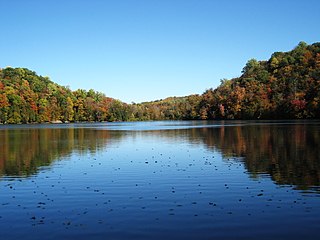
Spafford is a town in Onondaga County, New York, United States. As of the 2020 Census, the population was 1,588. The town was named after Horatio Gates Spafford, a writer and founder of the local library. Spafford is in the southwestern corner of Onondaga County and is southwest of Syracuse.

Carmel is a town in Putnam County, New York, United States. As of the 2020 United States census, the town had a population of 33,576.

Camillus is a town in Onondaga County, New York, United States. As of the 2020 Census, the population was 25,346.

Elbridge is a town in Onondaga County, New York, United States. As of the 2020 Census, the population was 5,476. The town is named after Elbridge Gerry, the fifth Vice President of the United States, and one of the signers of the Declaration of Independence.

Manlius is a town to the south east of Syracuse in Onondaga County. As of the 2020 Census, the population was 33,712, making it the third largest suburb in metropolitan Syracuse. In 2005, the town was ranked 98th on CNN's list of Best Places to Live.

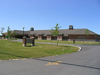
Onondaga Community College (OCC) is a public community college that serves Onondaga County and Central New York. It is part of the State University of New York (SUNY) system. OCC's 280-acre main campus is located in the Town of Onondaga, which borders the city of Syracuse, New York.

New York State Route 48 (NY 48) is a 28.20-mile (45.38 km) north–south state highway in Central New York in the United States. The southern terminus of the route is located at Interstate 690 (I-690) exit 3 near the interchange between I-690 and the New York State Thruway (I-90) in Van Buren, northwest of Syracuse. The northern terminus is located at an intersection with NY 104 in Oswego. In between, NY 48 passes through the riverside communities of Baldwinsville and Fulton and runs alongside both the Seneca River and Oswego River. For most of its route, NY 48 serves as an alternate route of NY 481. The routes share similar alignments along the Oswego River from the Syracuse area to Oswego, with NY 481 following the eastern riverbank between the two locations.
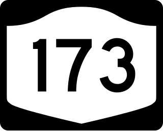
New York State Route 173 (NY 173) is a state highway located in the Syracuse area of central New York in the United States. It takes a slightly bow-shaped route from NY 31 in the town of Van Buren to NY 5 in Chittenango, gently curving to the south of Downtown Syracuse in the center of its 30.59-mile (49.23 km) routing. Even so, NY 173 briefly enters the Syracuse city limits near where it intersects U.S. Route 11 (US 11). NY 173 passes through several suburbs of Syracuse, including Camillus, where it first meets NY 5, and Manlius, where it has a short overlap with NY 92.

New York State Route 175 is an east–west state highway located entirely within Onondaga County, New York, in the United States. The 15.46-mile (24.88 km) route begins at an intersection with U.S. Route 20 (US 20) east of the village of Skaneateles and passes through the village of Marcellus before ending at a junction with US 11 in Syracuse. The highway was designated in the 1930 renumbering of state highways in New York.

New York State Route 11A (NY 11A) is a 13.11-mile (21.10 km) state highway in Onondaga County, New York, in the United States. It is an alternate route of U.S. Route 11 (US 11), beginning at an intersection with NY 80 in the town of Tully just west of where NY 80 crosses US 11. The route heads to the north, running along Onondaga Creek and passing through the Onondaga Reservation before ending at a junction with US 11 in Nedrow, a neighborhood just south of the Syracuse city limits. NY 11A was assigned as part of the 1930 renumbering of state highways in New York and has not been substantially altered since.

