Cicero, New York

Last updated
Cicero, New York
Onondaga County New York incorporated and unincorporated areas Cicero highlighted.svg
Location in Onondaga County and the state of New York.
Coordinates: 43°8′5″N76°7′49″W / 43.13472°N 76.13028°W / 43.13472; -76.13028
Country United States
State New York
County Onondaga
Government
  Type Town Council
   Town Supervisor Michael Aregano
   Town Council
Members' List
Area
[1]
  Total48.47 sq mi (125.52 km2)
  Land48.28 sq mi (125.04 km2)
  Water0.19 sq mi (0.48 km2)
Elevation
413 ft (126 m)
Population
 (2020)
  Total31,435
  Density650/sq mi (250/km2)
Time zone UTC-5 (Eastern (EST))
  Summer (DST) UTC-4 (EDT)
ZIP code
13039
Area code 315|680
FIPS code 36-15704
GNIS feature ID0978826
Website Town of Cicero

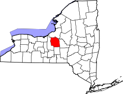
Cicero is a town in northern Onondaga County, New York, United States. As of the 2020 Census, the population was 31,435. The name of the town was assigned by a clerk interested in the classics, honoring Cicero, a Roman statesman.

Contents

The Town of Cicero is in the central part of New York and a suburb of Syracuse in the northeastern section of Onondaga County.

History

Cicero was one of the townships of the former Central New York Military Tract, land reserved for soldiers of the American Revolution.

The Town of Cicero was formed in 1790 as a Township in the Military Tract, but was part of the Town of Lysander when Onondaga County was formed in 1794 and was separated from Lysander in 1807. The first settler to arrive was John Leach, who established a tavern at Cody's Corners.

In 1827 the town was split approximately in half, with the western portion of Cicero becoming the Town of Clay.

The Stone Arabia School was listed on the National Register of Historic Places in 2007. [2]

Geography

Oneida Lake taken from the Yacht Club in Cicero. Two small islands in the lake can be seen from this shoreline. Cicero, New York Yacht Club.jpg
Oneida Lake taken from the Yacht Club in Cicero. Two small islands in the lake can be seen from this shoreline.

According to the United States Census Bureau, the town has a total area of 48.5 square miles (126 km2), of which 48.5 square miles (126 km2) is land and 0.1 square miles (0.26 km2) (0.10%) is water.

The northern town line of Cicero, marked by the Oneida River, is the border of Oswego County. The eastern town boundary is the border of Madison County, marked by the Chittenango Creek.

At the northern border of Cicero is Oneida Lake, one of the largest bodies of water located within New York State. Also within Cicero is a fairly large swamp named Cicero Swamp. Cicero consists of mainly wetland, forests, farms and a large and growing number of housing developments encroaching on farmland. The soils are mostly brown silt loams and loams with slight to moderate acidity in surface layers (subsoils may be somewhat alkaline); their drainage varies.

U.S. Route 11, Interstate 81, Interstate 481, and New York State Route 31 pass through Cicero. New York State Route 298 intersects NY-31 near the eastern town line. Michael Airfield, a single runway general aviation airport, is located within Cicero.

The reconstructed Erie Canal follows the Oneida River along the northern town line.

Demographics

Historical population
CensusPop.Note
1820 1,303
1830 1,80838.8%
1840 2,46436.3%
1850 2,98020.9%
1860 3,27710.0%
1870 2,902−11.4%
1880 2,9341.1%
1890 2,636−10.2%
1900 2,611−0.9%
1910 2,475−5.2%
1920 2,5362.5%
1930 3,68445.3%
1940 4,34618.0%
1950 5,95637.0%
1960 14,725147.2%
1970 22,53953.1%
1980 23,6484.9%
1990 25,5608.1%
2000 27,9829.5%
2010 31,68213.2%
2020 31,435−0.8%
U.S. Decennial Census [3]
Oneida Lake from Williams Park in Cicero. Cicerowilliamspark.jpg
Oneida Lake from Williams Park in Cicero.

As of the census [4] of 2000, there were 27,982 people, 10,538 households, and 7,692 families residing in the town. The population density was 577.4 inhabitants per square mile (222.9/km2). There were 11,033 housing units at an average density of 227.7 per square mile (87.9/km2). The racial makeup of the town was 96.31% White, 1.19% African American, 0.38% Native American, 0.71% Asian, 0.02% Pacific Islander, 0.22% from other races, and 1.17% from two or more races. Hispanic or Latino of any race were 0.88% of the population.

Cicero is currently undergoing a retail renaissance. Old run-down properties are redeveloped into new retail plazas like this one called The Marketplace. Ciceroretail.jpg
Cicero is currently undergoing a retail renaissance. Old run-down properties are redeveloped into new retail plazas like this one called The Marketplace.

There were 10,538 households, out of which 38.7% had children under the age of 18 living with them, 58.9% were married couples living together, 10.1% had a female householder with no husband present, and 27.0% were non-families. 21.3% of all households were made up of individuals, and 8.3% had someone living alone who was 65 years of age or older. The average household size was 2.65 and the average family size was 3.10.

In the town, the population was spread out, with 28.1% under the age of 18, 5.9% from 18 to 24, 33.2% from 25 to 44, 22.1% from 45 to 64, and 10.7% who were 65 years of age or older. The median age was 36 years. For every 100 females, there were 96.5 males. For every 100 females age 18 and over, there were 93.6 males.

The median income for a household in the town was $50,055, and the median income for a family was $57,531. Males had a median income of $41,038 versus $26,983 for females. The per capita income for the town was $21,527. About 3.9% of families and 5.1% of the population were below the poverty line, including 6.0% of those under age 18 and 3.5% of those age 65 or over.

Communities and locations within Cicero

Syracuse Research Corporation Headquarters is located in Cicero. SyracuseResearchC.jpg
Syracuse Research Corporation Headquarters is located in Cicero.
This picture was taken from the Cicero Yacht Club parking lot. Two islands can be seen. Frenchman Island on the left and Dunham Island on the right. Oneida Lake seen from Yacht Club in Cicero New York.jpg
This picture was taken from the Cicero Yacht Club parking lot. Two islands can be seen. Frenchman Island on the left and Dunham Island on the right.

Related Research Articles

<span class="mw-page-title-main">Onondaga County, New York</span> County in New York, United States

Onondaga County is a county in the U.S. state of New York. As of the 2020 census, the population was 476,516. The county seat is Syracuse.

<span class="mw-page-title-main">Oswego County, New York</span> County in New York, United States

Oswego County is a county in the U.S. state of New York. As of the 2020 census, the population was 117,525. The county seat is Oswego. The county name is from a Mohawk-language word meaning "the pouring out place", referring to the point at which the Oswego River feeds into Lake Ontario at the northern edge of the county in the city of Oswego.

<span class="mw-page-title-main">North Harmony, New York</span> Town in New York, United States

North Harmony is a town in Chautauqua County, New York, United States. The population was 2,182 at the 2020 census. The town is on the west side of Chautauqua Lake. The shore of the lake is the location of many summer resort communities.

Lenox is a town in Madison County, New York, United States. The population was 9,112 as of the 2010 census.

<span class="mw-page-title-main">Vienna, New York</span> Town in New York, United States

Vienna is a town in Oneida County, New York, United States. The population was 5,440 at the 2010 census. The town is named after the capital of Austria.

<span class="mw-page-title-main">Clay, New York</span> Town in New York, United States

Clay is a town in Onondaga County, New York, United States. As of the 2020 Census, the population was 60,527, making it Syracuse's most populous suburb. The town was named after American attorney and statesman Henry Clay.

<span class="mw-page-title-main">DeWitt, New York</span> Town in New York, United States

DeWitt is a town in Onondaga County, New York, United States. As of the 2020 census, the population was 26,074. The town is named after major Moses DeWitt, a judge and soldier. An eastern suburb of Syracuse, DeWitt also is the site of most of the campus and all of the academic buildings of Le Moyne College.

<span class="mw-page-title-main">Geddes, New York</span> Town in New York, United States

Geddes is a town in Onondaga County, New York, United States. As of the 2020 Census, the population was 17,088.

<span class="mw-page-title-main">Lysander, New York</span> Town in New York, United States

Lysander is a town in Onondaga County, New York, United States. As of the 2020 Census, the population was 23,074. The town was named after Lysander, a Spartan military leader, by a clerk interested in the classics. Lying to the northwest of Syracuse, much of the town is suburban in character.

<span class="mw-page-title-main">Otisco, New York</span> Town in New York, United States

Otisco is a town in Onondaga County, New York, United States. As of the 2020 Census, the population was 2,368. Otisco is in the southwestern part of the county, situated at the northern edge of the Appalachian Highlands, where an escarpment declines to the Lake Ontario plain and the city of Syracuse five miles to the north.

<span class="mw-page-title-main">Salina, New York</span> Town in New York, United States

Salina is a town in Onondaga County, New York, United States. As of the 2020 Census, the population was 33,223. The name of the town is derived from the Latin word for "salt." Salina is a northern suburb of Syracuse.

<span class="mw-page-title-main">Spafford, New York</span> Town in New York, United States

Spafford is a town in Onondaga County, New York, United States. As of the 2020 Census, the population was 1,588. The town was named after Horatio Gates Spafford, a writer and founder of the local library. Spafford is in the southwestern corner of Onondaga County and is southwest of Syracuse.

<span class="mw-page-title-main">Hastings, New York</span> Town in New York, United States

Hastings is a town in Oswego County, New York, United States. Its population was 9,450 at the 2010 census. It is named after Hastings Curtiss, a prominent citizen and member of the State Assembly in 1824.

<span class="mw-page-title-main">Brewerton, New York</span> Census-designated place in New York, United States

Brewerton is a census-designated place (CDP) in the town of Cicero in Onondaga County and the town of Hastings in Oswego County in the U.S. state of New York. It lies at the west end of Oneida Lake at its outlet into the Oneida River. The population was 4,029 at the 2010 census. Maps of the 19th century indicate that this area was once known as Fort Brewerton, while Brewerton meant the Cicero portion.

<span class="mw-page-title-main">Camillus, New York</span> Town in New York, United States

Camillus is a town in Onondaga County, New York, United States. As of the 2020 Census, the population was 25,346.

<span class="mw-page-title-main">Manlius, New York</span> Town in New York, United States

Manlius is a town to the east of Syracuse in Onondaga County. As of the 2020 Census, the population was 33,712, making it the third largest suburb in metropolitan Syracuse. In 2005, the town was ranked 98th on CNN's list of Best Places to Live.

<span class="mw-page-title-main">Skaneateles (town), New York</span> Town in New York, United States

Skaneateles is a town in Onondaga County, New York, United States. As of the 2020 Census, the population was 7,112. The name is from the Iroquois term for the adjacent Skaneateles Lake, which means "long lake." The town is on the western border of the county and includes a village, also named Skaneateles. Both the town and village are southwest of Syracuse.

<span class="mw-page-title-main">Constantia (town), New York</span> Town in New York, United States

Constantia is a town in Oswego County, New York, United States. The population was 4,973 at the 2010 census.

<span class="mw-page-title-main">New York State Route 298</span> State highway in Onondaga County, New York, US

New York State Route 298 (NY 298) is an east–west state highway located entirely within Onondaga County, New York, in the United States. It runs in a generally northeast direction for 14.05 miles (22.61 km) from an interchange with Interstate 690 (I-690) in the city of Syracuse to a roundabout intersection with NY 31 near the shores of Oneida Lake. Along its course it has exits with all four Interstate Highways in the area. Most of NY 298 was originally designated as part of NY 91 in 1930 before gaining its current designation later in the decade.

<span class="mw-page-title-main">Tully, New York</span> Town in New York, United States

Tully is a town in Onondaga County, New York, United States. As of the 2020 Census, the population was 2,676. The name of the town is derived from the Roman orator Marcus Tullius Cicero. The town is on the county's southern border, south of Syracuse.

References

  1. "2016 U.S. Gazetteer Files". United States Census Bureau. Retrieved Jul 5, 2017.
  2. "National Register Information System". National Register of Historic Places . National Park Service. March 13, 2009.
  3. "Census of Population and Housing". Census.gov. Retrieved June 4, 2015.
  4. "U.S. Census website". United States Census Bureau . Retrieved 2008-01-31.