Spafford, New York

Last updated
Spafford, New York
Onondaga County New York incorporated and unincorporated areas Spafford highlighted.svg
Location in Onondaga County and the state of New York.
Coordinates: 42°49′58″N76°18′6″W / 42.83278°N 76.30167°W / 42.83278; -76.30167 Coordinates: 42°49′58″N76°18′6″W / 42.83278°N 76.30167°W / 42.83278; -76.30167
Country United States
State New York
County Onondaga
Government
  Type Town Council
   Town Supervisor Christopher Kozub (R)
   Town Council
Members' List
Area
[1]
  Total39.22 sq mi (101.57 km2)
  Land32.70 sq mi (84.69 km2)
  Water6.52 sq mi (16.88 km2)
Elevation
1,490 ft (454 m)
Population
 (2020)
  Total1,588
  Density40/sq mi (16/km2)
Time zone UTC-5 (Eastern (EST))
  Summer (DST) UTC-4 (EDT)
FIPS code 36-70057
GNIS feature ID0979511
Website www.townofspafford.com
Some of the highest points in Onondaga County afford fine views. RipleyHill.Tree.700.jpg
Some of the highest points in Onondaga County afford fine views.

Spafford is a town in Onondaga County, New York, United States. As of the 2020 Census, the population was 1,588. The town was named after Horatio Gates Spafford, a writer and founder of the local library. Spafford is in the southwestern corner of Onondaga County and is southwest of Syracuse.

Contents

History

Spafford was located within the former Central New York Military Tract.

The first European settler arrived in 1794, the same year Onondaga County was established.

The Town of Spafford was formed in 1811 from parts of the Towns of Marcellus, Sempronius and Tully.

Geography

According to the United States Census Bureau, the town has a total area of 39.2 square miles (102 km2), of which 32.8 square miles (85 km2) is land and 6.4 square miles (17 km2) (16.31%) is water.

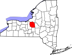
The western town line is the border of Cayuga County, and the southern town boundary is the border of Cortland County. Part of the town lies between Skaneateles Lake and Otisco Lake, two of the Finger Lakes.

Spafford's high terrain, between two of the Finger Lakes, provides spectacular scenery. Spafford is largely rural, with only small hamlets, and retains many forested areas, some protected as public preserves.

New York State Route 41 is a north–south highway in the town. New York State Route 174 is a state highway in the northern part of Spafford.

Demographics

Historical population
CensusPop.Note
1820 1,294
1830 2,647104.6%
1840 1,873−29.2%
1850 1,9031.6%
1860 1,814−4.7%
1870 1,595−12.1%
1880 1,450−9.1%
1890 1,227−15.4%
1900 1,159−5.5%
1910 1,064−8.2%
1920 875−17.8%
1930 767−12.3%
1940 742−3.3%
1950 82911.7%
1960 97417.5%
1970 1,14817.9%
1980 1,59639.0%
1990 1,6754.9%
2000 1,661−0.8%
2010 1,6861.5%
2020 1,588−5.8%
U.S. Decennial Census [2]

Although situated in a remote corner of Onondaga County, somewhat isolated by two of the Finger Lakes, residential development is expanding into the town from adjacent Skaneateles. As of the census [3] of 2000, there were 1,661 people, 631 households, and 485 families residing in the town. The population density was 50.6 people per square mile (19.5/km2). There were 1,095 housing units at an average density of 33.4 per square mile (12.9/km2). The racial makeup of the town was 98.74% White, 0.06% African American, 0.42% Native American, 0.18% Asian, and 0.60% from two or more races. Hispanic or Latino of any race were 0.36% of the population.

There were 631 households, out of which 35.0% had children under the age of 18 living with them, 65.0% were married couples living together, 7.1% had a female householder with no husband present, and 23.1% were non-families. 17.3% of all households were made up of individuals, and 5.2% had someone living alone who was 65 years of age or older. The average household size was 2.63 and the average family size was 2.97.

In the town, the population was spread out, with 25.5% under the age of 18, 5.7% from 18 to 24, 27.0% from 25 to 44, 30.8% from 45 to 64, and 11.0% who were 65 years of age or older. The median age was 41 years. For every 100 females, there were 105.1 males. For every 100 females age 18 and over, there were 103.1 males.

The median income for a household in the town was $53,553, and the median income for a family was $61,250. Males had a median income of $41,515 versus $31,071 for females. The per capita income for the town was $24,014. About 4.7% of families and 5.2% of the population were below the poverty line, including 7.2% of those under age 18 and 5.6% of those age 65 or over.

Communities and locations in Spafford

Related Research Articles

<span class="mw-page-title-main">Onondaga County, New York</span> County in New York, United States

Onondaga County is a county in the U.S. state of New York. As of the 2020 census, the population was 476,516. The county seat is Syracuse.

<span class="mw-page-title-main">Niles, New York</span> Town in New York, United States

Niles is a town in Cayuga County, New York, United States. The population was 1,194 at the 2010 census. Niles lies in the eastern part of the county, southeast of Auburn.

<span class="mw-page-title-main">Owasco, New York</span> Town in New York, United States

Owasco is a town in Cayuga County, New York, United States. It is part of the traditional territory of the Cayuga nation. The population was 3,793 at the 2010 census. Owasco is in the eastern part of Cayuga County and is at the southeast city line of Auburn. The town borders Owasco Lake, from where it gets its name.

<span class="mw-page-title-main">Sempronius, New York</span> Town in New York, United States

Sempronius is a town in Cayuga County, New York, United States. The population was 895 at the 2010 census. The town was named after a Roman military and political leader by Robert Harpur, a clerk interested in the classics. Sempronius is in the southeastern part of the county, southeast of Auburn.

<span class="mw-page-title-main">Sennett, New York</span> Town in New York, United States

Sennett is a town in Cayuga County, New York, United States. The population was 3,595 at the 2010 census. The town is named after a public official and early settler, Daniel Sennett. The town is on the eastern county line of Cayuga County and borders Auburn.

<span class="mw-page-title-main">Preble, New York</span> Town in New York, United States

Preble is a town in Cortland County, New York, United States. The population was 1,393 at the 2010 census. The town is named after Commodore Edward Preble, a naval hero.

<span class="mw-page-title-main">Scott, New York</span> Town in New York, United States

Scott is a town in Cortland County, New York, United States. The population was 1,176 at the 2010 census. The town was named after General Winfield Scott. It is in the northwestern corner of Cortland County and is northwest of the City of Cortland.

<span class="mw-page-title-main">Cicero, New York</span> Town in New York, United States

Cicero is a town in northern Onondaga County, New York, United States. As of the 2020 Census, the population was 31,435. The name of the town was assigned by a clerk interested in the classics, honoring Cicero, a Roman statesman.

<span class="mw-page-title-main">Otisco, New York</span> Town in New York, United States

Otisco is a town in Onondaga County, New York, United States. As of the 2020 Census, the population was 2,368. Otisco is in the southwestern part of the county, situated at the northern edge of the Appalachian Highlands, where an escarpment declines to the Lake Ontario plain and the city of Syracuse five miles to the north.

<span class="mw-page-title-main">Pompey, New York</span> Town in New York, United States

Pompey is a town in the southeast part of Onondaga County, New York. As of the 2020 Census, the population was 7,080. The town was named after the Roman general and political leader Pompey by a late 18th-century clerk interested in the Classics in the new federal republic.

<span class="mw-page-title-main">Elbridge, New York</span> Town in New York, United States

Elbridge is a town in Onondaga County, New York, United States. As of the 2020 Census, the population was 5,476. The town is named after Elbridge Gerry, the fifth Vice President of the United States, and one of the signers of the Declaration of Independence.

<span class="mw-page-title-main">Marcellus (village), New York</span> Village in New York, United States

Marcellus is a village in the town of Marcellus in Onondaga County, New York, United States. As of the 2020 census, the population was 1,745. The village is southwest of Syracuse and is in the southern part of the town of Marcellus.

<span class="mw-page-title-main">Marcellus, New York</span> Town in New York, United States

Marcellus is a town in Onondaga County, New York, United States. As of the 2020 Census, the population was 6,066. The town was probably named after Marcus Claudius Marcellus, a Roman general, by a clerk interested in the Classics.

<span class="mw-page-title-main">Skaneateles (town), New York</span> Town in New York, United States

Skaneateles is a town in Onondaga County, New York, United States. As of the 2020 Census, the population was 7,112. The name is from the Iroquois term for the adjacent Skaneateles Lake, which means "long lake." The town is on the western border of the county and includes a village, also named Skaneateles. Both the town and village are southwest of Syracuse.

Ovid is a town in Seneca County, New York, United States. The population was 2,919 at the 2020 census. The town is named after the Roman poet Ovid, a name assigned by a clerk interested in the classics.

<span class="mw-page-title-main">Skaneateles Lake</span> Body of water

Skaneateles Lake is one of the Finger Lakes in central New York in the United States. The name Skaneateles means long lake in one of the local Iroquoian languages. The lake is sometimes referred to as "The Roof Garden of the Lakes" because its altitude is higher than the other Finger Lakes. It is one of the cleanest lakes in the United States.

<span class="mw-page-title-main">New York State Route 41</span> State highway in central New York, US

New York State Route 41 (NY 41) is a north–south state highway in Central New York in the United States. The southern terminus of the route is at an interchange with NY 17 in the town of Sanford in Broome County, New York. Its northern terminus is at an intersection with U.S. Route 20 (US 20) in the village of Skaneateles. The route is almost 100 miles (161 km) long and passes through Broome, Chenango, Cortland, and Onondaga counties. NY 41 was assigned as part of the 1930 renumbering of state highways in New York, replacing New York State Route 70 from Homer to Skaneateles. The route initially extended as far north as Jordan; however, NY 41 was cut back to its current northern terminus c. 1933.

<span class="mw-page-title-main">New York State Route 174</span> State highway in Onondaga County, New York, US

New York State Route 174 (NY 174) is a state highway in Onondaga County, located in Central New York, in the United States. The highway is 16.7 miles (26.9 km) long and passes through mostly rural regions. Route 174 begins at an intersection with NY 41 in Borodino, a hamlet of Spafford. It heads generally northward for most of its length, except for short distances in the villages of Marcellus and Camillus. The route ends at a junction with NY 5 west of Camillus, at the west end of the Route 5 Camillus bypass. Route 174 is located along a large mapped sedimentary bedrock unit, known as the Marcellus Formation. The formation is named for an outcrop found near the town of Marcellus, New York, during a geological survey in 1839.

Borodino is a hamlet located at the intersection of New York State Route 41 and New York State Route 174 in the Town of Spafford in Onondaga County, New York, United States, near Skaneateles Lake. The hamlet proper extends five to ten properties to the east, south, west and north from the intersection, until houses and a few other buildings are replaced by farm fields. A monument for veterans, designed by Gianfranco Fritelli, stands in a cemetery at the southeast corner of the intersection. A little-altered Federal style Methodist Church, known locally as "The Church", dating from 1830, stands close to the 174, about five properties north. The Borodino District School No. 8 and Borodino Hall (1835) are listed on the National Register of Historic Places.

<span class="mw-page-title-main">Tully, New York</span> Town in New York, United States

Tully is a town in Onondaga County, New York, United States. As of the 2020 Census, the population was 2,676. The name of the town is derived from the Roman orator Marcus Tullius Cicero. The town is on the county's southern border, south of Syracuse.

References

  1. "2016 U.S. Gazetteer Files". United States Census Bureau. Retrieved Jul 5, 2017.
  2. "Census of Population and Housing". Census.gov. Retrieved June 4, 2015.
  3. "U.S. Census website". United States Census Bureau . Retrieved 2008-01-31.