Radisson, New York

Last updated

Radisson, New York
USA New York location map.svg
Red pog.svg
Radisson
Usa edcp location map.svg
Red pog.svg
Radisson
Coordinates: 43°11′4″N76°17′49″W / 43.18444°N 76.29694°W / 43.18444; -76.29694
CountryUnited States
State New York
County Onondaga
Town Lysander
Area
[1]
  Total4.64 sq mi (12.01 km2)
  Land4.52 sq mi (11.70 km2)
  Water0.12 sq mi (0.31 km2)
Elevation
435 ft (133 m)
Population
 (2020)
  Total7,038
  Density1,557.42/sq mi (601.38/km2)
Time zone UTC-5 (Eastern (EST))
  Summer (DST) UTC-4 (EDT)
ZIP Code
Area code(s) 315/680
FIPS code 36-60455
GNIS feature ID2806957 [2]

Radisson is a planned community and census-designated place (CDP) in the town of Lysander, Onondaga County, New York, United States. It was first listed as a CDP prior to the 2020 census. [2] The population was 7,038 at the 2020 census.

Contents

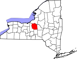
The CDP is in northwestern Onondaga County, in the eastern part of the town of Lysander. It is bordered to the southwest by the village of Baldwinsville, to the northwest by the Three Rivers Wildlife Management Area, and to the east by the Seneca River, part of the Erie Canal in this location.

New York State Route 31 (Belgium Road) runs along the southern side of the CDP, leading southwest into Baldwinsville and east 10 miles (16 km) to Cicero. Syracuse is 13 miles (21 km) to the southeast.

History of Radisson

The name “Radisson” is attributed to the earliest known European explorer, Pierre-Esprit Radisson (b. 1636 - d. 1710). While fur trapping and hunting, he was captured by Native American tribes and ultimately escaped. In both service to England and France, he formed exploration parties for scouting resources in Canada as well as the Great Lakes region. Later in life, he co-founded Hudson's Bay Company, where he acquired modest fame that lead to use of his namesake in the famous international hotel chain, multiple towns in North America, movies, books and an outdoor product line.

The current subdivision was once simply called “New Community of Lysander,” the area now named for Radisson has a long and interesting history, beginning just after the American Revolution. At that time, a grateful but impoverished Congress wished to reward its war heroes for their efforts. One of these heroes was young Colonel Marinus Willett. Congress paid its debt to Willett with the grant of a huge parcel of land. Over the years, the Willett family sold parcels of the rich farm land. John Jacob Astor purchased thousands of acres of Willett's land and then sold small parcels to homesteading farmers to visit the area.

At the outset of World War II, the federal government, seeking a site to manufacture armor-piercing munitions, purchased 6,000 acres of the tract from Astor. Farming ceased and much of the land was fenced in as construction began on a large and intricate munitions works. The munitions works employed hundreds of Syracuse-area residents, but operated only briefly and closed down soon after the war. Machinery was removed, buildings demolished and slowly, the acreage returned to woodlands. Deer and other animals returned as the site became an oasis of trees, lakes, and woodland streams. The government provided 3,000 acres of this land to the State of New York for a game management area. The remaining 3,000 acres was retained for future use. A number of potential uses were suggested for this large, attractive 3,000 acre tract over the years.

In 1968, officials of the New York State Urban Development Corporation (UDC) visited the area to discuss potential projects the corporation could undertake that would benefit Central New Yorkers. The UDC was directed to the old munitions site. UDC officials agreed to study the possibility that this site could be used to absorb and control the rapid growth of Central New York's northern area. After nearly a year of preliminary study, UDC presented its plan for a brand new community - Radisson.

In 1974, the first home was constructed. Since then, the community has grown rapidly, with steady improvements in amenities and overall quality of life for its residents. The adjacent corporate park is home to over forty businesses and covers fifty-six acres. Notable corporate tenants include town offices, childcare, distribution centers, food production & warehousing, banking, law enforcement, several engineering/manufacturing companies, large athletic complexes and the largest brewery in the Northeast.

Radisson Today

Radisson is best known for its beautiful neighborhoods, golf course, miles of community trails that meander near streams and ponds, design standards for homes and its corporate park. When Radisson is complete, this planned unit development (PUD) will have nearly 3,500 homes, an even larger corporate park as well as a wide range of recreational, educational and community services. It's located a short distance from major highways, the Village of Baldwinsville and is within the Baldwinsville Central School District.

Demographics

As of the 2020 USA Census, Radisson had a population of 7,038 people. Positive population growth is expected in the 2020 decade, likely attributable to expansion of community lands (by acquisition and merging of adjacent acreage), thus lending itself to construction of new homes. Population inflow to Radisson may reasonably be driven by relocations from surrounding communities as well as out-of-state relocations associated with overall regional economic growth (e.g., semiconductor chip business) in the Syracuse, NY census designated area.

Historical population
CensusPop.Note
2020 7,038
U.S. Decennial Census [3]

Related Research Articles

<span class="mw-page-title-main">Syracuse, New York</span> City in Central New York

Syracuse is a city and the county seat of Onondaga County, New York, United States. It is the fifth-most populated city and 13th-most populated municipality in the state of New York.

<span class="mw-page-title-main">Onondaga County, New York</span> County in New York, United States

Onondaga County is a county in the U.S. state of New York. As of the 2020 census, the population was 476,516. The county seat is Syracuse.

<span class="mw-page-title-main">Baldwinsville, New York</span> Village in New York, United States

Baldwinsville is a village in Onondaga County, New York, United States. As of the 2020 census, the population was 7,898. It is part of the Syracuse Metropolitan Statistical Area.

<span class="mw-page-title-main">Cicero, New York</span> Town in New York, United States

Cicero is a town in northern Onondaga County, New York, United States. As of the 2020 Census, the population was 31,435. The name of the town was assigned by a clerk interested in the classics, honoring Cicero, a Roman statesman.

<span class="mw-page-title-main">DeWitt, New York</span> Town in New York, United States

DeWitt is a town in Onondaga County, New York, United States. As of the 2020 census, the population was 26,074. The town is named after major Moses DeWitt, a judge and soldier. An eastern suburb of Syracuse, DeWitt also is the site of most of the campus and all of the academic buildings of Le Moyne College.

<span class="mw-page-title-main">Fairmount, New York</span> Census-designated place in New York, United States

Fairmount is a hamlet in Onondaga County, New York, United States. Fairmount is a western suburb of Syracuse, located in the far southeastern corner of the town of Camillus. Its zip code is 13219 (Syracuse). It is located within the West Genesee Central School District. The population was 10,224 at the 2010 census.

<span class="mw-page-title-main">Galeville, New York</span> Census-designated place in New York, United States

Galeville is a hamlet in Onondaga County, New York, United States. The population was 4,617 at the 2010 census.

<span class="mw-page-title-main">Lakeland, New York</span> Census-designated place in New York, United States

Lakeland is a hamlet in Onondaga County, New York, United States. The population was 2,786 at the 2010 census. The community name is derived from its location next to Onondaga Lake.

<span class="mw-page-title-main">Lysander, New York</span> Town in New York, United States

Lysander is a town in Onondaga County, New York, United States. As of the 2020 Census, the population was 23,074. The town was named after Lysander, a Spartan military leader, by a clerk interested in the classics. Lying to the northwest of Syracuse, much of the town is suburban in character.

<span class="mw-page-title-main">Mattydale, New York</span> Census-designated place in New York, United States

Mattydale is a hamlet in Onondaga County, New York, United States. The population was 6,446 at the 2010 census.

<span class="mw-page-title-main">Van Buren, New York</span> Town in New York, United States

Van Buren is a town located in Onondaga County, New York, United States. As of the 2020 Census, the population was 14,367. The town is named after then-Senator Martin Van Buren, who would later become the eighth president of the United States.

<span class="mw-page-title-main">Village Green, New York</span> Census-designated place in New York, United States

Village Green is a hamlet in Onondaga County, New York, United States. The population was 3,891 at the 2010 census.

<span class="mw-page-title-main">New York State Route 48</span> State highway in Central New York, US

New York State Route 48 (NY 48) is a 28.20-mile (45.38 km) north–south state highway in Central New York in the United States. The southern terminus of the route is located at Interstate 690 (I-690) exit 3 near the interchange between I-690 and the New York State Thruway (I-90) in Van Buren, northwest of Syracuse. The northern terminus is located at an intersection with NY 104 in Oswego. In between, NY 48 passes through the riverside communities of Baldwinsville and Fulton and runs alongside both the Seneca River and Oswego River. For most of its route, NY 48 serves as an alternate route of NY 481. The routes share similar alignments along the Oswego River from the Syracuse area to Oswego, with NY 481 following the eastern riverbank between the two locations.

<span class="mw-page-title-main">New York State Route 370</span> State highway in central New York, US

New York State Route 370 (NY 370) is an east–west state highway in Central New York in the United States. It extends for about 35 miles (56.33 km) from an intersection with NY 104 and NY 104A south of the Wayne County village of Red Creek to a junction with U.S. Route 11 (US 11) in the Onondaga County city of Syracuse. The western and central portions of the route pass through mostly rural areas; however, the eastern section serves densely populated areas of Onondaga County, including the villages of Baldwinsville and Liverpool. NY 370 also passes through Cayuga County, where it connects to NY 34, a major north–south highway in Central New York.

<span class="mw-page-title-main">New York State Route 690</span> State highway in central New York, US

New York State Route 690 (NY 690) is a state highway in Central New York in the United States. NY 690's southern terminus is at an interchange with the New York State Thruway and I-690 in Van Buren. The northern terminus is at an intersection with NY 48 and NY 631 in Lysander. NY 690 serves the northwest suburbs of Syracuse and Onondaga County. It also provides a link to routes that run into the populated areas of Oswego County, because its northern terminus is just a few miles shy of the county line.

<span class="mw-page-title-main">The Acreage, Florida</span> CDP in Florida, United States

The Acreage is a census-designated place (CDP) located in Palm Beach County, Florida, United States. It is part of the Miami metropolitan area of South Florida. The population of the CDP had 41,654 residents in the 2020 US census.

Ephraim Webster was the first white settler in Central New York when he arrived in 1786 to an area later named Syracuse. For three decades, the Onondagas trusted him more than any other non-tribe member.

<span class="mw-page-title-main">New York State Route 631</span> State highway in Onondaga County, New York, US

New York State Route 631 (NY 631) is a north–south state highway in Onondaga County, New York, in the United States. It serves as a bypass around the village of Baldwinsville, extending for just over 5 miles (8.0 km) from an intersection with NY 370 in the southeastern part of the village to a junction with NY 48 and NY 690 just north of Baldwinsville in the town of Lysander. The route has a short overlap with NY 31 east of the village. Most of the route is two lanes wide and passes through rural areas around the edge of Baldwinsville, while a part near the Lysander community of Radisson is four lanes wide and serves residential and commercial neighborhoods.

The story of the city of Syracuse began with the land which was covered with swamps and bogs, and with a large forest surrounding a clear, freshwater lake located in the northeast corner of the Finger Lakes Region. The land around the present day city was originally the home of the Haudensaunee, or the Onondaga Nation. They were members of the Iroquois Confederacy, which spanned most of Upstate New York.

Syracuse is a city in Central New York sited on the former lands of the Onondaga Nation. Officially incorporated as a village in 1825, it has been at a major crossroads over the last two centuries, first of the Erie Canal and its branch canals, then on the railway network. The city grew on the back of its salt and chemical industries, and later as a center of manufacturing and engineering. Although its industries have dwindled, the city has remained the economic and educational hub of Central New York, a region with over a million inhabitants; the population of the city, though, has been in decline since peaking in the 1950s.

References

  1. "ArcGIS REST Services Directory". United States Census Bureau. Retrieved September 20, 2022.
  2. 1 2 "Radisson Census Designated Place". Geographic Names Information System . United States Geological Survey, United States Department of the Interior.
  3. "Census of Population and Housing". Census.gov. Retrieved June 4, 2016.