Lewis County, New York

Last updated

Lewis County
Soldier's Monument of Lowville, NY in the Fall..JPG
Flag of Lewis County, New York.gif
Lewis County, New York seal.png
Map of New York highlighting Lewis County.svg
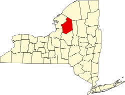
Location within the U.S. state of New York
New York in United States.svg
New York's location within the U.S.
Coordinates: 43°47′N75°27′W / 43.79°N 75.45°W / 43.79; -75.45
CountryFlag of the United States.svg United States
StateFlag of New York.svg  New York
Founded1805
Named for Morgan Lewis
Seat Lowville
Largest villageLowville
Area
  Total1,290 sq mi (3,300 km2)
  Land1,275 sq mi (3,300 km2)
  Water15 sq mi (40 km2)  1.2%
Population
 (2020)
  Total26,582 [1]
  Density20.8/sq mi (8.0/km2)
Time zone UTC−5 (Eastern)
  Summer (DST) UTC−4 (EDT)
Congressional district 21st
Website www.lewiscounty.org

Lewis County is a county located in the U.S. state of New York. As of the 2020 census, the population was 26,582, [2] making it the fourth-least populous county in New York. Its county seat is Lowville. [3] The county is named after Morgan Lewis, the Governor of New York when the county was established. [4] The county is part of the North Country region of the state.

Contents

History

The area now occupied by Lewis County was very sparsely occupied until the end of the 18th century. Although the land was already claimed by the Province of New York in its original grant, the land was clearly part of the territory of the Iroquois confederacy until after the American Revolutionary War, when New York seized the lands from tribes that had supported the British. The lands were unsurveyed and remained unattractive to settlement until after the complex process of Macomb's Purchase of 1791 eventually put much of the land in the hands of John Brown.

Jurisdiction history

The area now falling in the jurisdiction of Lewis County, New York, has changed jurisdiction many times, beginning as part of the originally enormous Albany County in 1683, then, after one of the many times that Albany County was divided, becoming part of Tryon County in 1772, which was renamed to Montgomery County in 1784; next, present-day Lewis County was part of Herkimer County in 1791, then part of Oneida County in 1798, and finally assumed its current name and borders in 1805.

When counties were established in New York State in 1683, the present Lewis County was part of Albany County. This was an enormous county, including the northern part of New York State as well as all of the present State of Vermont and, in theory, extending westward to the Pacific Ocean. This county was reduced in size on July 3, 1766, by the creation of Cumberland County, and further on March 16, 1770, by the creation of Gloucester County, both containing territory now in Vermont.

On March 12, 1772, what was left of Albany County was split into three parts, one remaining under the name Albany County. One of the other pieces, Tryon County, contained the western portion (and thus, since no western boundary was specified, theoretically still extended west to the Pacific). The eastern boundary of Tryon County was approximately five miles west of the present city of Schenectady, and the county included the western part of the Adirondack Mountains and the area west of the West Branch of the Delaware River. The area then designated as Tryon County now includes 37 counties of New York State. The county was named for William Tryon, colonial governor of New York.

In the years prior to 1776, most of the Loyalists in Tryon County fled to Canada. In 1784, following the peace treaty that ended the American Revolutionary War, the name of Tryon County was changed to Montgomery County to honor the general, Richard Montgomery, who had captured several places in Canada and died attempting to capture the city of Quebec, replacing the name of the despised British governor.

In 1789, the size of Montgomery County was reduced by the splitting off of Ontario County from Montgomery. The actual area split off from Montgomery County was much larger than the present county, also including the present Allegany, Cattaraugus, Chautauqua, Erie, Genesee, Livingston, Monroe, Niagara, Orleans, Steuben, Wyoming, Yates, and part of Schuyler and Wayne Counties.

In 1791, Herkimer County was one of three counties split off from Montgomery (the other two being Otsego, and Tioga County). This was much larger than the present county, however, and was reduced by a number of subsequent splits. The first one of these, in 1794, produced Onondaga County. This county was larger than the current Onondaga County, including the present Cayuga, Cortland, and part of Oswego Counties.

Oneida County (as well as a part of Chenango County), was split off from Herkimer County in 1798.

Lewis County was split off from Oneida County in 1805.

Military history

On April 11, 1805, the Militia of Lewis, Jefferson and St Lawrence was established by the Council of Appointment under General Walter Martin. This was known as the 26th Brigade, aka Martin's Brigade.

350 men of the 26th Brigade were detached but never deployed in response to an Act of Congress dated March 30, 1808, in response to the English troubles.

On June 15, 1808, the 1st Regiment was established under Lieutenant Luke Winchell, consisting of troops from Lowville, Denmark, Harrisburg and Pinckney. A cavalry troop was formed in 1809 under Captain Levi Collins.

On April 10, 1812, in anticipation of war, the President of the United States was authorized to call up men for military service. To that end, a company was drafted for three months, under Captain Lyman Deming, of Denmark, in the regiment of Colonel Christopher P. Bellinger, of German Flats. They served at Sackett's Harbor from May 12, 1812, to August 21, 1812, when they were discharged.

When the War of 1812 began on June 12, 1812, the above company was in the field, participating in the First Battle of Sacket's Harbor. To supply them, a company of 72 men were called up on June 23, 1812, under Captain Nathan Cook and placed under Colonel Thomas B Benedict of DeKalb.

County wide drafts were issued in March 1813, September 1813, July 1814 and October 1814 in support of the war effort.

Geography

According to the U.S. Census Bureau, the county has a total area of 1,290 square miles (3,300 km2), of which 1,275 square miles (3,300 km2) is land and 15 square miles (39 km2) (1.2%) is water. [5]

Lewis County is located in northwestern New York State, slightly east of due north from Syracuse. The eastern part of the county is in the Adirondack Park. A good portion of the Tug Hill Plateau is in the western part of the county. The county is home to the Black River Valley.

Adjacent counties

Transportation

Major Routes include:

Demographics

Historical population
CensusPop.Note
1810 6,433
1820 9,22743.4%
1830 15,23965.2%
1840 17,83017.0%
1850 24,56437.8%
1860 28,58016.3%
1870 28,6990.4%
1880 31,4169.5%
1890 29,806−5.1%
1900 27,427−8.0%
1910 24,849−9.4%
1920 23,704−4.6%
1930 23,447−1.1%
1940 22,815−2.7%
1950 22,521−1.3%
1960 23,2493.2%
1970 23,6441.7%
1980 25,0355.9%
1990 26,7967.0%
2000 26,9440.6%
2010 27,0870.5%
2020 26,582−1.9%
U.S. Decennial Census [6]
1790-1960 [7] 1900-1990 [8]
1990-2000 [9] 2010-2020 [2]

As of the census of 2000, [10] there were 26,944 people, 10,040 households, and 7,309 families residing in the county. The population density was 21 inhabitants per square mile (8.1/km2). There were 15,134 housing units at an average density of 12 units per square mile (4.6/km2). The racial makeup of the county was 98.17% White, 0.39% African American, 0.28% Native American, 0.23% Asian, 0.05% Pacific Islander, 0.28% from other races, and 0.59% from two or more races. Hispanic or Latino of any race were 0.64% of the population. 28.8% were of German, 13.8% French, 13.1% Irish, 9.2% English, 6.5% American and 5.3% Polish ancestry according to Census 2000. 97.3% spoke English and 1.0% Spanish as their first language.

There were 10,040 households, out of which 35.30% had children under the age of 18 living with them, 59.40% were married couples living together, 8.40% had a female householder with no husband present, and 27.20% were non-families. 22.60% of all households were made up of individuals, and 10.80% had someone living alone who was 65 years of age or older. The average household size was 2.66 and the average family size was 3.12.

In the county, the population was spread out, with 27.80% under the age of 18, 7.70% from 18 to 24, 28.20% from 25 to 44, 22.50% from 45 to 64, and 13.80% who were 65 years of age or older. The median age was 37 years. For every 100 females there were 98.60 males. For every 100 females age 18 and over, there were 97.60 males.

The median income for a household in the county was $34,361, and the median income for a family was $39,287. Males had a median income of $30,479 versus $21,115 for females. The per capita income for the county was $14,971. About 10.10% of families and 13.20% of the population were below the poverty line, including 16.40% of those under age 18 and 14.00% of those age 65 or over.

2020 Census

Lewis County Racial Composition [11]
RaceNum.Perc.
White (NH)24,94293.83%
Black or African American (NH)1030.39%
Native American (NH)400.15%
Asian (NH)650.24%
Pacific Islander (NH)110.04%
Other/Mixed (NH)9613.61%
Hispanic or Latino 4601.73%

Communities

Larger Settlements

#LocationPopulationTypeSector
1Lowville 3,470VillageCenter
2 Copenhagen 841VillageNorthwest
3 Port Leyden 672VillageSoutheast
4††Harrisville 628CDPNorth
5 Croghan 618VillageEast
6 Lyons Falls 566VillageSoutheast
7 Castorland 351VillageNorthwest
8 Constableville 242VillageSouthwest
9 Turin 232VillageSoutheast

† - County Seat

†† - Former Village

Towns

Hamlets

Notable people

Child actor and veterinarian Peter Ostrum (born November 1957) settled in Lowville, Lewis County to practice veterinary medicine.

Judge Fred A. Young (August 27, 1904 – October 16, 1973) was a prominent Republican politician, lawyer, state legislator, and state judge, who was born in, and lived most of his life in, Lowville.

Florence Augusta Merriam Bailey (August 8, 1863 – September 22, 1948) was an American ornithologist and nature writer. She was born in Locust Grove, New York. [12]

Franklin B. Hough (July 20, 1822 – June 11, 1885) was a scientist, historian and the first chief of the United States Division of Forestry, the predecessor of the United States Forest Service. He was born in Martinsburg and retired in Lowville.

Clinton Hart Merriam (December 5, 1855 – March 19, 1942) was an American zoologist, ornithologist, entomologist, ethnographer, and naturalist.

Edward McGlachlin (December 19. 1840 - April 22, 1931) was an American newspaper editor and politician. McGlachlin was born in Watson. [13]

Politics

United States presidential election results for Lewis County, New York [14]
Year Republican Democratic Third party
No.%No.%No.%
2020 8,89068.57%3,82329.49%2511.94%
2016 7,40065.34%3,14627.78%7796.88%
2012 5,65153.71%4,72444.90%1471.40%
2008 5,96953.59%4,98644.77%1831.64%
2004 6,62458.12%4,54639.89%2271.99%
2000 6,10355.83%4,33339.64%4964.54%
1996 3,96538.93%4,40243.22%1,81817.85%
1992 4,10137.17%3,67633.32%3,25529.51%
1988 5,78757.08%4,25241.94%990.98%
1984 7,06971.69%2,75727.96%340.34%
1980 4,93750.26%3,97340.45%9129.29%
1976 5,84060.62%3,76439.07%290.30%
1972 6,59168.60%2,98731.09%300.31%
1968 5,52460.17%3,20534.91%4514.91%
1964 3,18532.57%6,58467.33%100.10%
1960 6,63262.00%4,05637.92%90.08%
1956 7,76475.38%2,53624.62%00.00%
1952 7,62272.14%2,92727.70%170.16%
1948 5,69262.70%3,21135.37%1751.93%
1944 6,25664.40%3,44135.42%180.19%
1940 8,04969.80%3,46630.06%170.15%
1936 8,04870.44%3,26328.56%1151.01%
1932 6,25860.03%4,08639.20%800.77%
1928 7,17563.25%4,16136.68%80.07%
1924 6,06666.98%2,80130.93%1902.10%
1920 5,90667.95%2,67330.75%1131.30%
1916 3,41854.90%2,67542.96%1332.14%
1912 2,06433.87%2,33938.39%1,69027.74%
1908 4,15958.13%2,81039.27%1862.60%
1904 4,24258.53%2,84239.21%1642.26%
1900 4,30859.32%2,85739.34%971.34%
1896 4,46158.34%3,04239.78%1441.88%
1892 3,96551.76%3,36943.98%3274.27%
1888 4,36952.33%3,80745.60%1732.07%
1884 3,85449.66%3,77848.69%1281.65%

Lewis County is strongly Republican having been won by Republican presidential candidates all but three times since the Civil War, with the only exceptions being in 1912, 1964, and 1996. Republican Donald Trump received over two-thirds of the vote in 2020.

See also

Bibliography

Related Research Articles

<span class="mw-page-title-main">Montgomery County, New York</span> County in New York, United States

Montgomery County is a county in the U.S. state of New York. As of the 2020 census, the population was 49,532. The county seat is Fonda. The county was named in honor of Richard Montgomery, an American Revolutionary War general killed in 1775 at the Battle of Quebec. The county is part of the Mohawk Valley region of the state.

<span class="mw-page-title-main">Broome County, New York</span> County in New York, United States

Broome County is a county in the U.S. state of New York. As of the 2020 United States census, the county had a population of 198,683. Its county seat is Binghamton. The county was named for John Broome, the state's lieutenant governor when Broome County was created. The county is part of the Southern Tier region of the state.

<span class="mw-page-title-main">Cayuga County, New York</span> County in New York, United States

Cayuga County is a county in the U.S. state of New York. As of the 2020 census, the population was 76,248. Its county seat and largest city is Auburn. The county was named for the Cayuga people, one of the Native American tribes in the Iroquois Confederation. The county is part of the Central New York region of the state.

<span class="mw-page-title-main">Chenango County, New York</span> County in New York, United States

Chenango County is a county located in the south-central section U.S. state of New York. As of the 2020 census, the population was 47,220. Its county seat is Norwich. The county's name originates from an Oneida word meaning 'large bull-thistle'. The county is part of the Southern Tier region of the state.

<span class="mw-page-title-main">Delaware County, New York</span> County in New York, United States

Delaware County is a county located in the US state of New York. As of the 2020 United States census, the population was 44,308. The county seat is Delhi. The county is named after the Delaware River, which was named in honor of Thomas West, 3rd Baron De La Warr, appointed governor of Virginia in 1609. The county is part of the Southern Tier region of the state.

<span class="mw-page-title-main">Jefferson County, New York</span> County in New York, United States

Jefferson County is a county on the northern border of the U.S. state of New York. As of the 2020 census, the population was 116,721. Its county seat is Watertown. The county is named after Thomas Jefferson, third President of the United States of America. It is adjacent to Lake Ontario, southeast from the Canada–US border of Ontario. The county is part of the North Country region of the state.

<span class="mw-page-title-main">Herkimer County, New York</span> County in New York, United States

Herkimer County is a county in the U.S. state of New York. As of the 2020 census, the population was 60,139. Its county seat is Herkimer. The county was created in 1791 north of the Mohawk River out of part of Montgomery County. It is named after General Nicholas Herkimer, who died from battle wounds in 1777 after taking part in the Battle of Oriskany during the Revolutionary War.

<span class="mw-page-title-main">Madison County, New York</span> County in New York, United States

Madison County is a county located in the U.S. state of New York. As of the 2020 census, the population was 68,016. Its county seat is Wampsville. The county is named after James Madison, the fourth president of the United States, and was first formed in 1806. The county is part of the Central New York region of the state.

<span class="mw-page-title-main">Oneida County, New York</span> County in New York, United States

Oneida County is a county in the state of New York, United States. As of February 26, 2024, the population was 226,654. The county seat is Utica. The name is in honor of the Oneida, one of the Five Nations of the Iroquois League or Haudenosaunee, which had long occupied this territory at the time of European encounter and colonization. The federally recognized Oneida Indian Nation has had a reservation in the region since the late 18th century, after the American Revolutionary War.

<span class="mw-page-title-main">Onondaga County, New York</span> County in New York, United States

Onondaga County is a county in the U.S. state of New York. As of the 2020 census, the population was 476,516. The county seat is Syracuse. The county is part of the Central New York region of the state.

<span class="mw-page-title-main">Orleans County, New York</span> County in New York, United States

Orleans County is a county in the western part of the U.S. state of New York. As of the 2020 census, the population was 40,343. The county seat is Albion. The county received its name at the insistence of Nehemiah Ingersoll though historians are unsure how the name was selected. The two competing theories are that it was named to honor the French Royal House of Orleans or that it was to honor Andrew Jackson's victory in New Orleans. The county is part of the Finger Lakes region of the state.

<span class="mw-page-title-main">Oswego County, New York</span> County in New York, United States

Oswego County is a county in the U.S. state of New York. As of the 2020 census, the population was 117,525. The county seat is Oswego. The county name is from a Mohawk-language word meaning "the pouring out place", referring to the point at which the Oswego River feeds into Lake Ontario at the northern edge of the county in the city of Oswego. The county is part of the Central New York region of the state.

<span class="mw-page-title-main">Otsego County, New York</span> County in New York, United States

Otsego County is a county in the U.S. state of New York located within the Mohawk Valley Region. As of the 2020 census, the population was 58,524. The county seat is Cooperstown. The county's population center is Oneonta. The name Otsego is from a Mohawk or Oneida word meaning "place of the rock." The county is part of the Mohawk Valley region of the state.

<span class="mw-page-title-main">Schoharie County, New York</span> County in New York, United States

Schoharie County is a county in the U.S. state of New York. As of the 2020 census, the population was 29,714, making it the state's fifth-least populous county. The county seat is Schoharie. "Schoharie" comes from a Mohawk word meaning "floating driftwood." Schoharie County is part of the Albany-Schenectady-Troy, NY Metropolitan Statistical Area. The county is part of the Mohawk Valley region of the state.

<span class="mw-page-title-main">Seneca County, New York</span> County in New York, United States

Seneca County is located in the U.S. state of New York. As of the 2020 census, the population was 33,814. The primary county seat is Waterloo, moved there from the original county seat of Ovid in 1819. It became a two-shire county in 1822, which currently remains in effect and uses both locations as county seats although the majority of Seneca County administrative offices are located in Waterloo. Therefore, most political sources list only Waterloo as the county seat. The county's name comes from the Seneca Nation of the Haudenosaunee (Iroquois), who occupied part of the region. The county is part of the Finger Lakes region of the state.

<span class="mw-page-title-main">Schuyler County, New York</span> County in New York, United States

Schuyler County is a county in the U.S. state of New York. As of the 2020 census, the population was 17,898, making it the second-least populous county in New York. The county seat is the village of Watkins Glen. The name is in honor of General Philip Schuyler, one of the four major generals in the Continental Army in the American Revolutionary War. The county is part of the Southern Tier region of the state.

<span class="mw-page-title-main">Tompkins County, New York</span> County in New York, United States

Tompkins County is a county located in the U.S. state of New York. As of the 2020 census, the population was 105,740. The county seat is Ithaca. The name is in honor of Daniel D. Tompkins, who served as Governor of New York and Vice President of the United States. The county is part of the Southern Tier region of the state.

<span class="mw-page-title-main">St. Lawrence County, New York</span> County in New York, United States

St. Lawrence County is a county in the U.S. state of New York. As of the 2020 census, the population was 108,505. The county seat is Canton. The county is named for the Saint Lawrence River. This was as named by early French explorer Jacques Cartier for the Christian saint Lawrence of Rome, as he visited the river on the saint's feast day. The county is part of the North Country region of the state.

<span class="mw-page-title-main">Martinsburg, New York</span> Town in New York, United States

Martinsburg is a town in Lewis County, New York, United States. The population was 1,433 at the 2010 census. The town is named after its founding father, General Walter Martin.

<span class="mw-page-title-main">Frankfort, New York</span> Town in New York, United States

Frankfort is a town in Herkimer County, New York, United States. The town is named after one of its earliest settlers, Lawrence (Lewis) Frank. The town of Frankfort includes a village, also called Frankfort. Frankfort is located east of Utica, and the Erie Canal passes along its northern border. At the time of the 2020 census, the population was 7,011, down from 7,636 in 2010.

References

  1. "US Census 2020 Population Dataset Tables for New York". United States Census Bureau. Retrieved January 2, 2022.
  2. 1 2 "U.S. Census Bureau QuickFacts: Lewis County, New York". United States Census Bureau. Retrieved January 2, 2022.
  3. "Find a County". National Association of Counties. Retrieved June 7, 2011.
  4. Gannett, Henry (1905). The Origin of Certain Place Names in the United States. U.S. Government Printing Office. p.  185.
  5. "2010 Census Gazetteer Files". United States Census Bureau. August 22, 2012. Archived from the original on May 19, 2014. Retrieved January 5, 2015.
  6. "U.S. Decennial Census". United States Census Bureau. Retrieved January 5, 2015.
  7. "Historical Census Browser". University of Virginia Library. Retrieved January 5, 2015.
  8. "Population of Counties by Decennial Census: 1900 to 1990". United States Census Bureau. Retrieved January 5, 2015.
  9. "Census 2000 PHC-T-4. Ranking Tables for Counties: 1990 and 2000" (PDF). United States Census Bureau. Retrieved January 5, 2015.
  10. "U.S. Census website". United States Census Bureau . Retrieved January 31, 2008.
  11. "P2 HISPANIC OR LATINO, AND NOT HISPANIC OR LATINO BY RACE – 2020: DEC Redistricting Data (PL 94-171) – Lewis County, New York".
  12. Finding Aid to the Florence Merriam Bailey Papers, 1887-1940, The Online Archive of California is an initiative of the California Digital Library, UC Berkeley: Bancroft Library
  13. 'Wisconsin Blue Book 1889,' Biographical Sketch of Edward McGlatchlin, pg. 516
  14. Leip, David. "Dave Leip's Atlas of U.S. Presidential Elections". uselectionatlas.org. Retrieved March 21, 2018.

Further reading

43°47′N75°27′W / 43.79°N 75.45°W / 43.79; -75.45