Leyden, New York

Last updated
Leyden, New York
USA New York location map.svg
Red pog.svg
Leyden
Usa edcp location map.svg
Red pog.svg
Leyden
Coordinates: 43°32′49″N75°21′37″W / 43.54694°N 75.36028°W / 43.54694; -75.36028 Coordinates: 43°32′49″N75°21′37″W / 43.54694°N 75.36028°W / 43.54694; -75.36028
Country United States
State New York
County Lewis
Area
[1]
  Total33.55 sq mi (86.90 km2)
  Land33.33 sq mi (86.33 km2)
  Water0.22 sq mi (0.58 km2)
Elevation
1,138 ft (347 m)
Population
 (2010)
  Total1,785
  Estimate 
(2016) [2]
1,772
  Density53.16/sq mi (20.53/km2)
Time zone UTC-5 (Eastern (EST))
  Summer (DST) UTC-4 (EDT)
ZIP code
13433
Area code 315
FIPS code 36-049-42213
GNIS feature ID979148 [3]

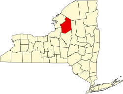
Leyden is a town in Lewis County, New York, United States. The population was 1,785 at the 2010 census. [4] The town is in the southern part of the county and is north of Rome.

Contents

History

Settlement began around 1794.

Leyden was formed from the town of Steuben (in Oneida County) in 1797. Leyden formed part of a tract called the "Inman Triangle".

The town of Leyden gave up much of its territory to form new towns such as Watson (1821) and Lewis (1852). Leyden was also partitioned to form the towns of Brownville (Jefferson County in 1802) and Boonville (Oneida County in 1805), and part of the town of Wilna (Jefferson County in 1813). Port Leyden in the town was a port on the former Black River Canal.

The town is named after the Dutch city Leiden. [5]

Geography

According to the United States Census Bureau, Leyden has a total area of 33.5 square miles (87 km2), of which 33.3 square miles (86 km2) are land and 0.2 square miles (0.52 km2), or 0.66%, are water. [6]

The Black River marks the eastern town line, and the southern town boundary is the border of Oneida County.

New York State Route 12 and New York State Route 12D are principal north-south highways in the town. NY-12 runs closer to the Black River.

Demographics

Historical population
CensusPop.
1820 1,203
1830 1,50224.9%
1840 2,43862.3%
1850 2,253−7.6%
1860 1,859−17.5%
1870 2,04810.2%
1880 1,933−5.6%
1890 1,624−16.0%
1900 1,6290.3%
1910 1,613−1.0%
1920 1,515−6.1%
1930 1,482−2.2%
1940 1,5192.5%
1950 1,6226.8%
1960 1,7155.7%
1970 1,677−2.2%
1980 1,660−1.0%
1990 1,7968.2%
2000 1,792−0.2%
2010 1,785−0.4%
2016 (est.)1,772 [2] −0.7%
U.S. Decennial Census [7]

As of the census [8] of 2000, there were 1,792 people, 676 households, and 488 families residing in the town. The population density was 53.8 people per square mile (20.8/km2). There were 807 housing units at an average density of 24.2 per square mile (9.4/km2). The racial makeup of the town was 99.05% White, 0.22% African American, 0.11% Native American, 0.17% from other races, and 0.45% from two or more races. Hispanic or Latino of any race were 0.17% of the population.

There were 676 households, out of which 37.0% had children under the age of 18 living with them, 55.0% were married couples living together, 12.3% had a female householder with no husband present, and 27.8% were non-families. 23.7% of all households were made up of individuals, and 9.9% had someone living alone who was 65 years of age or older. The average household size was 2.61 and the average family size was 3.07.

In the town, the population was spread out, with 28.9% under the age of 18, 7.5% from 18 to 24, 30.1% from 25 to 44, 21.4% from 45 to 64, and 12.2% who were 65 years of age or older. The median age was 35 years. For every 100 females, there were 98.2 males. For every 100 females age 18 and over, there were 96.2 males.

The median income for a household in the town was $29,489, and the median income for a family was $33,512. Males had a median income of $27,424 versus $20,250 for females. The per capita income for the town was $14,252. About 13.9% of families and 19.0% of the population were below the poverty line, including 23.5% of those under age 18 and 17.5% of those age 65 or over.

Communities and locations in Leyden

Notable people

Related Research Articles

<span class="mw-page-title-main">Lewis County, New York</span> County in New York, United States

Lewis County is a county located in the U.S. state of New York. As of the 2020 census, the population was 26,582, making it the fourth-least populous county in New York. Its county seat is Lowville. The county is named after Morgan Lewis, the Governor of New York when the county was established.

<span class="mw-page-title-main">Mentz, New York</span> Town in New York, United States

Mentz is a town in Cayuga County, New York, United States. The population was 2,378 at the 2010 census. The town is in the central part of the county, north of Auburn.The town's name is derived from Mainz, in Germany.

<span class="mw-page-title-main">Schuyler, New York</span> Town in Herkimer County, New York, US

Schuyler is a town in Herkimer County, New York, United States. The population was 3,420 at the 2010 census. The town is in the western part of Herkimer County and is east of Utica.

<span class="mw-page-title-main">Winfield (town), New York</span> Town in New York, United States

Winfield is a town in Herkimer County, New York, United States. The population was 2,086 at the 2010 census. The town is named after General Winfield Scott and is in the southwestern corner of the county, south of Utica.

Wilna is a town in Jefferson County, New York, United States. The population was 6,427 at the 2010 census. The town is on the eastern side of the county and is east of Watertown.

Lewis is a town in Lewis County, New York, United States. The population was 854 at the 2010 census. The town is named after its county, which is named after former governor, Morgan Lewis.

Lyonsdale is a town in Lewis County, New York, United States. The population was 1,227 at the 2010 census. The town is named after its principal community and its founder Caleb Lyon.

Port Leyden is a village in Lewis County, New York, United States. The population was 672 at the 2010 census. The name is derived from the village's early history as a port on the Black River Canal.

<span class="mw-page-title-main">Floyd, New York</span> Town in New York, United States

Floyd is a town in Oneida County, New York, United States. The population was 3,819 at the 2010 census. The town is named after William Floyd, a signer of the Declaration of Independence.

Forestport is a town in Oneida County, New York, United States. The population was 1,535 at the 2010 census.

<span class="mw-page-title-main">Sangerfield, New York</span> Town in New York, United States

Sangerfield is a town in Oneida County, New York, United States. The population was 2,561 at the 2010 census. The town is named after Jedediah Sanger, an early settler.

<span class="mw-page-title-main">Whitestown, New York</span> Town in New York, United States

Whitestown is a town in Oneida County, New York, United States. The population was 18,667 at the 2010 census. The name is derived from Judge Hugh White, an early settler. The town is immediately west of Utica and the New York State Thruway passes across the town. The offices of the town of Whitestown are in the Village of Whitesboro.

<span class="mw-page-title-main">Plainfield, New York</span> Town in New York, United States

Plainfield is a town in Otsego County, New York, United States. The population was 915 at the 2010 census.

<span class="mw-page-title-main">Brewerton, New York</span> Census-designated place in New York, United States

Brewerton is a census-designated place (CDP) in the town of Cicero in Onondaga County and the town of Hastings in Oswego County in the U.S. state of New York. It lies at the west end of Oneida Lake at its outlet into the Oneida River. The population was 4,029 at the 2010 census. Maps of the 19th century indicate that this area was once known as Fort Brewerton, while Brewerton meant the Cicero portion.

<span class="mw-page-title-main">Greene, New York</span> Town in New York, United States

Greene is a town in Chenango County, New York, United States. The population was 5,604 at the 2010 census. The town is named after General Nathanael Greene. It is located in the southwestern corner of the county and contains a village, also named Greene. The town and village are northeast of Binghamton. Greene was founded in 1792, but commenced in 1798.

<span class="mw-page-title-main">Newport, New York</span> Town in New York, United States

Newport is a town in Herkimer County, New York, United States. The population was 2,302 at the 2010 census. The town, located on the western edge of the county, contains the village of Newport. The town is northeast of Utica.

Brownville is a town in Jefferson County, New York, United States. The population was 6,263 at the 2010 census, up from 5,839 in 2000. The town is named after Jacob Brown, an early settler and leader.

<span class="mw-page-title-main">Boonville, New York</span> Town in New York, United States

Boonville is a town in Oneida County, New York, United States. The town is in the northeastern section of the county. The population was 4,555 at the 2010 census. The town includes a village, also called Boonville. The town and village are named after Gerrit Boon, an agent of the Holland Land Company. The current mayor is Judith Dellerba.

<span class="mw-page-title-main">Bridgewater, New York</span> Town in New York, United States

Bridgewater is a town in Oneida County, New York, United States. The population was 1,522 at the 2010 census.

<span class="mw-page-title-main">Vernon, New York</span> Town in New York, United States

Vernon is a town in Oneida County, New York, United States. The population was 5,408 at the 2010 census.

References

  1. "2016 U.S. Gazetteer Files". United States Census Bureau. Retrieved Jul 5, 2017.
  2. 1 2 "Population and Housing Unit Estimates" . Retrieved June 9, 2017.
  3. U.S. Geological Survey Geographic Names Information System: Leyden, New York
  4. "Total Population: 2010 Census DEC Summary File 1 (P1), Leyden town, New York". data.census.gov. U.S. Census Bureau. Retrieved May 27, 2020.
  5. Gannett, Henry (1905). The Origin of Certain Place Names in the United States. U.S. Government Printing Office. p.  186.
  6. "U.S. Gazetteer Files: 2019: Places: New York". U.S. Census Bureau Geography Division. Retrieved May 27, 2020.
  7. "Census of Population and Housing". Census.gov. Retrieved June 4, 2015.
  8. "U.S. Census website". United States Census Bureau . Retrieved 2008-01-31.
  9. Welker, Robert H. (1950). "Bailey, Florence Augusta Merriam". In Garraty, John A.; James, Edward T. (eds.). Dictionary of American Biography. Vol. Supplement Four. New York, NY: Charles Scribner's Sons. pp. 41–42.
  10. Minnesota State Law Library-Wallace B. Douglas Archived 2014-01-05 at the Wayback Machine