Denmark, New York

Last updated

Denmark, New York
USA New York location map.svg
Red pog.svg
Denmark
Location in New York
Usa edcp location map.svg
Red pog.svg
Denmark
Location in the United States
Coordinates: 43°53′55″N75°36′24″W / 43.89861°N 75.60667°W / 43.89861; -75.60667
Country United States
State New York
County Lewis
Area
[1]
  Total51.05 sq mi (132.21 km2)
  Land50.60 sq mi (131.06 km2)
  Water0.45 sq mi (1.15 km2)
Elevation
[2]
1,073 ft (327 m)
Population
 (2010)
  Total2,860
  Estimate 
(2016) [3]
2,844
  Density56.20/sq mi (21.70/km2)
Time zone UTC-5 (Eastern (EST))
  Summer (DST) UTC-4 (EDT)
ZIP code
13631
Area code 315
FIPS code 36-049-20214
GNIS feature ID978896 [2]
Website Town of Denmark

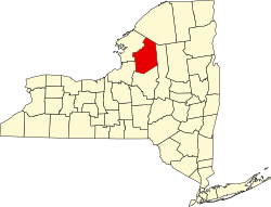
Denmark is a town in Lewis County, New York, United States, named after the Kingdom of Denmark in northern Europe. [4] The population was 2,860 at the 2010 census. [5] The town is on the northwestern border of Lewis County and lies east of Watertown.

Contents

History

The town of Denmark was first settled around 1800. [6]

The town was formed in 1807 from the town of Harrisburg.

Notable people

Geography

According to the United States Census Bureau, the town has a total area of 51.0 square miles (132 km2), of which 50.6 square miles (131 km2) are land and 0.4 square miles (1.0 km2) (0.84%) are water. [9]

The northwestern town line is the border of Jefferson County, and the Black River forms the eastern town boundary. The Deer River, running through the northern part of the town, is a tributary of the Black River.

Both New York State Route 12 and New York State Route 26 run in a northwest to southeast direction through the town, paralleling the Black River. New York State Route 410 passes across the southeastern corner of the town.

Demographics

Historical population
CensusPop.Note
1820 1,745
1830 2,27030.1%
1840 2,3885.2%
1850 2,82418.3%
1860 2,559−9.4%
1870 2,109−17.6%
1880 2,2044.5%
1890 2,2753.2%
1900 2,193−3.6%
1910 1,889−13.9%
1920 1,9050.8%
1930 1,9874.3%
1940 1,9920.3%
1950 2,1548.1%
1960 2,2142.8%
1970 2,3596.5%
1980 2,4483.8%
1990 2,71811.0%
2000 2,7471.1%
2010 2,8604.1%
2016 (est.)2,844 [3] −0.6%
U.S. Decennial Census [10]

According to the census [11] of the year 2000, there were 2,747 people, 977 households, and 753 families in the town of Denmark. The population density was 54.3 inhabitants per square mile (21.0/km2). There were 1,149 housing units at an average density of 22.7 per square mile (8.8/km2). The racial makeup of the town was 96.76% White, 0.51% African American, 0.25% Native American, 0.18% Asian, 0.04% Pacific Islander, 0.84% from other races, and 1.42% of two or more races. Hispanic or Latino of any race were 1.82% of the population.

There were 977 households, out of which 37.7% had children under the age of 18 living with them, 65.1% were married couples living together, 7.0% had a female householder with no husband present, and 22.9% were non-families. 17.7% of all households were made up of singles, and 7.8% had someone living alone who was 65 years of age or older. The average household size was 2.79 and the average family size was 3.15.

In the town, the population was spread out, with 28.7% under the age of 18, 9.6% from 18 to 24, 30.5% from 25 to 44, 21.4% from 45 to 64, and 9.8% who were 65 years of age or older. The median age was 33 years. For every 100 females, there were 103.5 males. For every 100 females age 18 and over, there were 98.5 males.

The median income for a household in the town was $38,696, and the median income for a family was $45,046. Males had a median income of $33,147 versus $22,375 for females. The per capita income for the town was $14,960. About 7.9% of families and 12.4% of the population were below the poverty line, including 17.3% of those under age 18 and 10.3% of those aged 65 or more.

Communities and locations in Denmark

Related Research Articles

<span class="mw-page-title-main">Chenango, New York</span> Town in New York, United States

Chenango is a town in Broome County, New York, United States. The population was 10,983 at the 2020 census.

<span class="mw-page-title-main">Black Brook, New York</span> Town in New York, United States

Black Brook is a town in Clinton County, New York, United States. The population was 1,497 at the 2010 census. It is named after a stream that flows through the town.

Dickinson is a town in Franklin County, New York, United States. The population was 823 at the 2010 census. The town was named after Philemon Dickinson, a brigadier general of the New Jersey militia during the American Revolutionary War.

<span class="mw-page-title-main">Columbia, New York</span> Town in New York, United States

Columbia is a town in Herkimer County, New York, United States. As of the 2010 census, the town population was 1,580. The town is at the southern border of the county and is southeast of Utica.

Pamelia is a town in Jefferson County, New York, United States. The population was 3,160 at the 2010 census, up from 2,897 in 2000. The town was named for Pamelia Williams, wife of landowner and developer General Jacob J. Brown.

Copenhagen is a village in Lewis County, New York, United States. The village is situated between Watertown and Lowville. The population was 631 at the 2020 census. The village is named after Copenhagen, the capital of Denmark.

Harrisburg is a rural small town in Lewis County, New York, United States. The population was 437 at the 2010 census. The town is in the northwestern part of the county, northwest of Lowville, the county seat.

Pinckney is a town in Lewis County, New York, United States. The population was 329 at the 2010 census. The town is named after Thomas Pinckney of South Carolina.

<span class="mw-page-title-main">Forestport, New York</span> Town in New York, United States

Forestport is a town in Oneida County, New York, United States. The population was 1,535 at the 2010 census.

<span class="mw-page-title-main">Richland, New York</span> Town in New York, United States

Richland is a town in the northeastern part of Oswego County, New York, United States. The population was 5,718 at the 2010 census.

<span class="mw-page-title-main">Brasher, New York</span> Town in New York, United States

Brasher is a town in St. Lawrence County, New York, United States. The population was 2,512 at the 2010 census. The town is named after Philip Brasher, an original landowner.

<span class="mw-page-title-main">Fowler, New York</span> Town in New York, United States

Fowler is a town in St. Lawrence County, New York, United States. The population was 2,202 at the 2010 census.

Lawrence is a town in St. Lawrence County, New York, United States. The population was 1,715 at the 2020 census. The town is named after William Lawrence, an early land owner.

Enfield is a town in Tompkins County, New York, United States. The population was 3,401 at the 2020 census.

<span class="mw-page-title-main">Norwich (town), New York</span> Town in New York, United States

Norwich is a town in Chenango County, New York, United States. The population was 3,998 at the 2010 census.

<span class="mw-page-title-main">Altona, New York</span> Town in New York, United States

Altona is a town in Clinton County, New York, United States. The population was 2,887 at the 2010 census. The town was named after the Altona, Hamburg, district of Germany. The town contains a hamlet also called Altona.

<span class="mw-page-title-main">Little Falls (town), New York</span> Town in New York, United States

Little Falls is a town in Herkimer County, New York, United States. The population was 1,587 at the 2010 census. The town is named after falls and rapids on the Mohawk River nearby.

Brownville is a town in Jefferson County, New York, United States. The population was 6,263 at the 2010 census, up from 5,839 in 2000. The town is named after Jacob Brown, an early settler and leader.

<span class="mw-page-title-main">Milford, New York</span> Town in New York, United States

Milford is a town in Otsego County, New York, United States. The population was 3,044 at the 2010 census. Within town is the village of Milford. The town is northeast of the City of Oneonta.

<span class="mw-page-title-main">Unadilla, New York</span> Town in New York, United States

Unadilla is a town in Otsego County, New York, United States. As of the 2010 census, the town had a population of 4,392. The name is derived from an Iroquois word for "meeting place". Unadilla is located in the southwestern corner of the county, southwest of Oneonta. The village of Unadilla is located in the southern part of the town. The mayor of Unadilla is Jason Cotten.

References

  1. "2016 U.S. Gazetteer Files". United States Census Bureau. Retrieved July 5, 2017.
  2. 1 2 U.S. Geological Survey Geographic Names Information System: Denmark, New York
  3. 1 2 "Population and Housing Unit Estimates" . Retrieved June 9, 2017.
  4. Gannett, Henry (1905). The Origin of Certain Place Names in the United States. Govt. Print. Off. pp.  104.
  5. "Total Population: 2010 Census DEC Summary File 1 (P1), Denmark town, New York". data.census.gov. U.S. Census Bureau. Retrieved May 26, 2020.
  6. A history of Lewis County, in the State of New York; page 85, "Denmark"
  7. "Chester Hazen, Wisconsin Historical Society". Archived from the original on March 4, 2016. Retrieved October 24, 2012.
  8. Minnesota Legislators: Past & Presnt-Albert Clark Wedge
  9. "U.S. Gazetteer Files: 2019: Places: New York". U.S. Census Bureau Geography Division. Retrieved May 27, 2020.
  10. "Census of Population and Housing". Census.gov. Retrieved June 4, 2015.
  11. "U.S. Census website". United States Census Bureau . Retrieved January 31, 2008.