Croghan (village), New York

Last updated

Croghan, New York
Croghan 1.JPG
Local grocery store and traditional soda fountain on Main Street, Croghan
USA New York location map.svg
Red pog.svg
Croghan
Usa edcp location map.svg
Red pog.svg
Croghan
Coordinates: 43°53′40″N75°23′28″W / 43.89444°N 75.39111°W / 43.89444; -75.39111
Country United States
State New York
County Lewis
Towns Croghan, New Bremen
Area
[1]
  Total0.43 sq mi (1.12 km2)
  Land0.43 sq mi (1.12 km2)
  Water0.00 sq mi (0.00 km2)
Elevation
[2]
840 ft (260 m)
Population
 (2020)
  Total639
  Density1,472.35/sq mi (568.66/km2)
Time zone UTC-5 (Eastern (EST))
  Summer (DST) UTC-4 (EDT)
ZIP code
13327
Area code 315
FIPS code 36-19070
GNIS feature ID2391629 [2]
Website www.croghanny.org

Croghan is a village in Lewis County, New York, United States. Its population was 618 at the 2010 census. [3]

Contents

The village is situated mainly in the southern part of the town of Croghan, with a small part in New Bremen. The town and the village were both named after George Croghan, a soldier in the War of 1812.

The village slogan, which reflects Croghan's proximity to the Adirondack Mountains, is "In the Foothills of the Adirondacks". [4]

History

The village was once a booming region for the lumber industry. During the late 19th century, one particularly influential member of the local community was millionaire lumber baron Theodore B. Basselin, whose estate sat on the corner of Main Street and Bank Street. His mansion remains there to this day. [5] Basselin is buried in a private family plot along Main Street, next to the village library, which once served as the opera house.

Croghan survived two major fires in the early 1900s, the first of which claimed the lives of two small children. The fire started next to where Stumps Tavern now sits along Main and Mechanic and engulfed most of the village, even burning down the massive Catholic church and divinity school.

The village was a center of the pure maple syrup industry before a microburst in the mid-1990s which brought extremely high winds, destroying many of the older, larger trees.

Croghan is popular with avid outdoorsmen from throughout the country who visit the area in the summer for fishing and camping, in the fall for hunting, and in the winter for sledding.

Geography

Croghan is located northeast of the center of Lewis County at the junction of New York State Routes 126 and 812. [6] It is primarily in the southern part of the town of Croghan, but a small portion of the village crosses into the town of New Bremen to the south.

According to the United States Census Bureau, the village has a total area of 0.42 square miles (1.1 km2), all land. [7]

The Beaver River, a tributary of the Black River, flows through the village. Croghan is 10 miles (16 km) northeast of the county seat, Lowville.

Adjacent communities

Kirschnerville is to the east of Croghan, New Bremen to its south; Beaver Falls is down the Beaver River to the west, and Belfort up the river to the northeast.

Demographics

Historical population
CensusPop.Note
1880 445
1910 621
1920 6464.0%
1930 73213.3%
1940 8019.4%
1950 772−3.6%
1960 8216.3%
1970 765−6.8%
1980 703−8.1%
1990 664−5.5%
2000 6650.2%
2010 618−7.1%
2020 6393.4%
U.S. Decennial Census [8]

As of the census [9] of 2000, there were 665 people, 284 households, and 178 families residing in the village. The population density was 1,525.7 inhabitants per square mile (589.1/km2). There were 323 housing units at an average density of 741.1 per square mile (286.1/km2). The racial makeup of the village was 98.65% White, 0.60% Black or African American, 0.15% Native American, 0.45% Asian, and 0.15% from two or more races. Hispanic or Latino of any race were 0.45% of the population.

There were 284 households, out of which 28.5% had children under the age of 18 living with them, 49.6% were married couples living together, 9.5% had a female householder with no husband present, and 37.3% were non-families. 33.8% of all households were made up of individuals, and 21.5% had someone living alone who was 65 years of age or older. The average household size was 2.34 and the average family size was 3.06.

In the village, the population was spread out, with 26.3% under the age of 18, 8.4% from 18 to 24, 23.3% from 25 to 44, 19.8% from 45 to 64, and 22.1% who were 65 years of age or older. The median age was 39 years. For every 100 females, there were 86.8 males. For every 100 females age 18 and over, there were 83.5 males.

The median income for a household in the village was $26,304, and the median income for a family was $37,969. Males had a median income of $27,969 versus $22,500 for females. The per capita income for the village was $14,183. About 6.7% of families and 10.8% of the population were below the poverty line, including 12.4% of those under age 18 and 21.4% of those age 65 or over.

Places of interest

The American Maple Museum, located on Main Street, was formerly the Father Leo Memorial School. [10]

Related Research Articles

<span class="mw-page-title-main">Lewis County, New York</span> County in New York, United States

Lewis County is a county located in the U.S. state of New York. As of the 2020 census, the population was 26,582, making it the fourth-least populous county in New York. Its county seat is Lowville. The county is named after Morgan Lewis, the Governor of New York when the county was established.

<span class="mw-page-title-main">Maple Park, Illinois</span> Village in Illinois, United States

Maple Park is a village in DeKalb and Kane counties in the U.S. state of Illinois. The population was 1,433 at the 2020 census, up from 1,310 at the 2010 census. Maple Park was formerly known as Lodi.

<span class="mw-page-title-main">Baldwin Township, Delta County, Michigan</span> Civil township in Michigan, United States

Baldwin Township is a civil township of Delta County in the U.S. state of Michigan. As of the 2010 census, the township population was 759, slightly up from 748 at the 2000 census.

<span class="mw-page-title-main">Millward Township, Aitkin County, Minnesota</span> Township in Minnesota, United States

Millward Township is a township in Aitkin County, Minnesota, United States. The population was 72 as of the 2010 census.

<span class="mw-page-title-main">Webb, New York</span> Town in New York, United States

Webb is the northernmost town in Herkimer County, New York, United States. As of the 2010 census it had a population of 1,807.

<span class="mw-page-title-main">Castorland, New York</span> Village in New York, United States

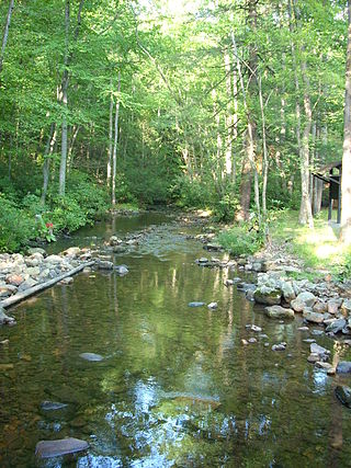
Castorland is a village in Lewis County, New York, United States; it is north of Lowville and southeast of Carthage. The population was 360 in 2019.

Diana is a town in Lewis County, New York, United States. The population was 1,709 at the 2010 census. The town is on the northeastern border of the county and is located northeast of Watertown. The northwestern section of Diana is in the Fort Drum military reservation.

Harrisville is a hamlet and former village in Lewis County, New York, United States. The community is now a census-designated place. The population was 628 at the 2010 census.

Lyonsdale is a town in Lewis County, New York, United States. The population was 1,227 at the 2010 census. The town is named after its principal community and its founder Caleb Lyon.

New Bremen is a town in Lewis County, New York, United States. The population was 2,706 at the 2010 census. The town is named after the German city of Bremen.

Watson is a town in Lewis County, New York, United States. The population was 1,881 at the 2010 census. The town is named after early landowner James Watson. The town is at the eastern border of the county and is east of Lowville, the county seat.

<span class="mw-page-title-main">Pitcairn, New York</span> Town in New York, United States

Pitcairn is a town in St. Lawrence County, New York, United States. The population was 846 at the 2010 census. The name is from that of Joseph Pitcairn, an early landowner and diplomat.

<span class="mw-page-title-main">New Bremen, Ohio</span> Village in Ohio, United States

New Bremen is a village in Auglaize County, Ohio, United States. The population was 3,034 at the 2020 census. It is included in the Wapakoneta, Ohio Micropolitan Statistical Area. The village is adjacent to Minster to the south.

<span class="mw-page-title-main">Beaver, Ohio</span> Village in Ohio, United States

Beaver is a village in Pike County, Ohio, United States. The population was 442 at the 2020 census.

<span class="mw-page-title-main">Lewis Township, Union County, Pennsylvania</span> Township in Pennsylvania, United States

Lewis Township is a township in Union County, Pennsylvania, United States. The population was 1,456 at the 2020 census. Sand Bridge State Park, a Pennsylvania state park, is in Lewis Township along Pennsylvania Route 192.

<span class="mw-page-title-main">Ruby, South Carolina</span> Town in South Carolina, United States

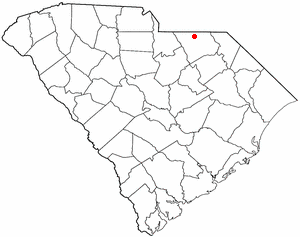
Ruby is a town in Chesterfield County, South Carolina, United States. The population was 360 at the 2010 census.

<span class="mw-page-title-main">Maple Plain, Wisconsin</span> Town in Wisconsin, United States

Maple Plain is a town in Barron County in the U.S. state of Wisconsin. The population was 803 at the 2010 census.

<span class="mw-page-title-main">Croghan, New York</span> Town in New York, United States

Croghan is a town in Lewis County, New York, United States. The population was 3,093 at the 2010 census. The town is in the northern part of the county and located northeast of the county seat, Lowville. The town contains a village also named Croghan, a small part of which is located in the adjacent town of New Bremen. Both the village and town are locally pronounced \Krō-gun\.

<span class="mw-page-title-main">Lowville (village), New York</span> Village in New York, United States

Lowville is a village in Lewis County, New York, United States. As of the 2010 census it had a population of 3,470. The village is in the Black River Valley, between the foothills of the Adirondack Mountains and the Tug Hill Plateau, in an area often referred to as the North Country. It is located in the center of Lewis County, in the southeastern part of the similarly named town of Lowville.

<span class="mw-page-title-main">Remsen (village), New York</span> Village in New York, United States

Remsen is a village in Oneida County, New York, United States. The population was 508 at the 2010 census.

References

  1. "ArcGIS REST Services Directory". United States Census Bureau. Retrieved September 20, 2022.
  2. 1 2 U.S. Geological Survey Geographic Names Information System: Croghan (village), New York
  3. "Total Population: 2010 Census DEC Summary File 1 (P1), Croghan village, New York". data.census.gov. U.S. Census Bureau. Retrieved May 29, 2020.
  4. "Village of Croghan". Lewis County Industrial Development Agency. Archived from the original on March 23, 2008. Retrieved March 10, 2008. In the Foothills of the Adirondacks
  5. "Theodore B. Basselin". Syracuse University. Archived from the original on February 17, 2006. Retrieved March 10, 2008. Theodore B. Basselin is gone, but his memory is present in the little village of Croghan.
  6. "US Gazetteer files: 2010, 2000, and 1990". United States Census Bureau. February 12, 2011. Retrieved April 23, 2011.
  7. "U.S. Gazetteer Files: 2019: Places: New York". U.S. Census Bureau Geography Division. Retrieved May 29, 2020.
  8. "Census of Population and Housing". Census.gov. Retrieved June 4, 2015.
  9. "U.S. Census website". United States Census Bureau . Retrieved January 31, 2008.
  10. "American Maple Museum". Lewis County Industrial Development Agency. Archived from the original on May 9, 2008. Retrieved March 10, 2008. The former Leo Memorial School was acquired in 1980...