Diana, New York

Last updated
Diana, New York
USA New York location map.svg
Red pog.svg
Diana
Location in New York
Usa edcp location map.svg
Red pog.svg
Diana
Location in the United States
Coordinates: 44°6′4″N75°21′9″W / 44.10111°N 75.35250°W / 44.10111; -75.35250 Coordinates: 44°6′4″N75°21′9″W / 44.10111°N 75.35250°W / 44.10111; -75.35250
Country United States
State New York
County Lewis
Area
[1]
  Total140.83 sq mi (364.75 km2)
  Land137.10 sq mi (355.08 km2)
  Water3.73 sq mi (9.67 km2)
Elevation
873 ft (266 m)
Population
 (2010)
  Total1,709
  Estimate 
(2016) [2]
1,704
  Density12.43/sq mi (4.80/km2)
Time zone UTC-5 (Eastern (EST))
  Summer (DST) UTC-4 (EDT)
ZIP code
13648
Area code 315
FIPS code 36-049-20555
GNIS feature ID978902 [3]

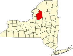
Diana is a town in Lewis County, New York, United States. The population was 1,709 at the 2010 census. [4] The town is on the northeastern border of the county and is located northeast of Watertown. The northwestern section of Diana is in the Fort Drum military reservation.

Contents

History

The town of Diana was established from part of the town of Watson in 1830. In 1841, part of the town was used to help establish the town of Croghan. It was named after the Roman goddess Diana. [5]

The Alpina Archeological District and Lewisburg Archeological District were added to the National Register of Historic Places in 1995. [6]

Notable person

Geography

According to the United States Census Bureau, the town has a total area of 140.8 square miles (365 km2), of which 137.1 square miles (355 km2) are land and 3.7 square miles (9.6 km2), or 2.63%, are water. [8]

Part of the Fort Drum Military Reservation is in the northwestern reaches of the town.

The northeastern town line is the border of St. Lawrence County, and the eastern town line is the border of Herkimer County. The eastern part of the town is in the Adirondack Park.

New York State Route 3 passes across the town and links with New York State Route 812 south of Remington Center. The highways run conjointly near the northeastern town line.

The Indian River, part of the Oswegatchie River watershed, flows out the western side of Diana.

Demographics

Historical population
CensusPop.
1830 309
1840 883185.8%
1850 9709.9%
1860 1,48352.9%
1870 1,77819.9%
1880 2,02613.9%
1890 2,39518.2%
1900 2,083−13.0%
1910 2,2799.4%
1920 2,181−4.3%
1930 2,080−4.6%
1940 1,871−10.0%
1950 1,717−8.2%
1960 1,641−4.4%
1970 1,6490.5%
1980 1,7093.6%
1990 1,7432.0%
2000 1,660−4.8%
2010 1,7093.0%
2016 (est.)1,704 [2] −0.3%
U.S. Decennial Census [9]

As of the census [10] of 2000, there were 1,661 people, 642 households, and 473 families residing in the town. The population density was 12.1 people per square mile (4.7/km2). There were 1,206 housing units at an average density of 8.8 per square mile (3.4/km2). The racial makeup of the town was 97.11% White, 0.06% African American, 1.14% Native American, 0.48% Asian, 0.06% Pacific Islander, 0.06% from other races, and 1.08% from two or more races. Hispanic or Latino of any race were 0.54% of the population.

There were 642 households, out of which 32.7% had children under the age of 18 living with them, 63.4% were married couples living together, 6.5% had a female householder with no husband present, and 26.2% were non-families. 21.0% of all households were made up of individuals, and 10.0% had someone living alone who was 65 years of age or older. The average household size was 2.59 and the average family size was 3.00.

In the town, the population was spread out, with 25.8% under the age of 18, 7.3% from 18 to 24, 26.5% from 25 to 44, 27.8% from 45 to 64, and 12.5% who were 65 years of age or older. The median age was 38 years. For every 100 females, there were 95.6 males. For every 100 females age 18 and over, there were 98.4 males.

The median income for a household in the town was $33,900, and the median income for a family was $39,563. Males had a median income of $35,450 versus $21,813 for females. The per capita income for the town was $15,916. About 8.8% of families and 12.1% of the population were below the poverty line, including 15.5% of those under age 18 and 9.9% of those age 65 or over.

Communities and locations in Diana

Related Research Articles

<span class="mw-page-title-main">Venice, New York</span> Town in New York, United States

Venice is a town in Cayuga County, New York, United States. The population was 1,368 at the 2010 census. The town is in the southern part of Cayuga County and is south of Auburn.

<span class="mw-page-title-main">Ellenburg, New York</span> Town in New York, United States

Ellenburg is a town in Clinton County, New York, United States. The population was 1,743 at the 2010 census. The town is named after the daughter of the principal proprietor. Ellenburg is on the western border of the county and is northwest of Plattsburgh. The southern part of the town is situated in the Adirondack Park.

<span class="mw-page-title-main">Litchfield, New York</span> Town in New York, United States

Litchfield, is a town in Herkimer County, New York, United States. The population was 1,513 at the 2010 census. The town is named after Litchfield, Connecticut, the source of some early settlers of the city.

<span class="mw-page-title-main">Natural Bridge, New York</span> Census-designated place in New York, United States

Natural Bridge is a hamlet and census-designated place (CDP) in Jefferson County, New York, United States. As of the 2010 census it had a population of 365.

Harrisville is a hamlet and former village in Lewis County, New York, United States. The community is now a census-designated place. The population was 628 at the 2010 census.

New Bremen is a town in Lewis County, New York, United States. The population was 2,706 at the 2010 census. The town is named after the German city of Bremen.

Watson is a town in Lewis County, New York, United States. The population was 1,881 at the 2010 census. The town is named after early landowner James Watson. The town is at the eastern border of the county and is east of Lowville, the county seat.

Forestport is a town in Oneida County, New York, United States. The population was 1,535 at the 2010 census.

<span class="mw-page-title-main">Clifton, New York</span> Town in New York, United States

Clifton is a town in St. Lawrence County, New York, United States. The population was 675 at the 2020 census. The town takes its name from a mining company.

<span class="mw-page-title-main">De Kalb, New York</span> Town in New York, United States

DeKalb is a town in St. Lawrence County, New York, United States. The population was 2,434 at the 2010 census. The town is named after American general Baron de Kalb, a German officer serving under George Washington.

<span class="mw-page-title-main">De Peyster, New York</span> Town in New York, United States

DePeyster is a town in St. Lawrence County, New York, United States. The population was 998 at the 2010 census. The name is taken from that of one of the land owners of the region, Frederic de Peyster, grandfather of John Watts de Peyster.

<span class="mw-page-title-main">Fine, New York</span> Town in New York, United States

Fine is a town in St. Lawrence County, New York, United States. The population was 1,512 at the 2010 census. The town is named after Judge John Fine, a businessman involved in settling the town.

<span class="mw-page-title-main">Fowler, New York</span> Town in New York, United States

Fowler is a town in St. Lawrence County, New York, United States. The population was 2,202 at the 2010 census.

<span class="mw-page-title-main">Oswegatchie, New York</span> Town in New York, United States

Oswegatchie is a town in St. Lawrence County, New York, United States. The population was 4,397 at the 2010 census. The name reportedly means "Black Water". It is on the northern border of the county and is adjacent to the city of Ogdensburg.

<span class="mw-page-title-main">Pitcairn, New York</span> Town in New York, United States

Pitcairn is a town in St. Lawrence County, New York, United States. The population was 846 at the 2010 census. The name is from that of Joseph Pitcairn, an early landowner and diplomat.

<span class="mw-page-title-main">Plattsburgh (town), New York</span> Town in New York, United States

Plattsburgh is a town in Clinton County, New York, United States. The population was 11,886 at the 2020 census. The town is named after Zephaniah Platt, an early land owner, and it surrounds the separate and more populous city of the same name. The town is in the eastern part of the county, in the North Country region of the state of New York. The region's airport, Plattsburgh International Airport, is located in the southern part of the town.

Antwerp is a town in Jefferson County, New York, United States. The population was 1,846 at the 2010 census. The town is named after Antwerp in Belgium, the home of one of the early investors in the town.

<span class="mw-page-title-main">Croghan (town), New York</span> Town in New York, United States

Croghan is a town in Lewis County, New York, United States. The population was 3,093 at the 2010 census. The town is in the northern part of the county and located northeast of the county seat, Lowville. The town contains a village also named Croghan, a small part of which is located in the adjacent town of New Bremen. Both the village and town are locally pronounced \Krō-gun\.

<span class="mw-page-title-main">Gouverneur, New York</span> Town in New York, United States

Gouverneur is a town in St. Lawrence County, New York, United States. As of the 2020 census, the population was 3,526. That down from 7,085 in 2010. The town is named after statesman and landowner Gouverneur Morris.

<span class="mw-page-title-main">New York State Route 812</span> State highway in the North Country of New York, USA

New York State Route 812 (NY 812) is a state highway in the North Country of New York in the United States. The southern terminus of the route is at an intersection with NY 12 and NY 26 in the Lewis County village of Lowville. Its northern terminus is at the Canada–United States border in Ogdensburg, where it crosses the Ogdensburg–Prescott International Bridge and connects to Highway 16 in Ontario. While most of NY 812 passes through rural areas of the North Country, the route also serves several villages and small communities. The GPS services company Geotab has named it the quietest highway in New York due to its low traffic counts.

References

  1. "2016 U.S. Gazetteer Files". United States Census Bureau. Retrieved Jul 5, 2017.
  2. 1 2 "Population and Housing Unit Estimates" . Retrieved June 9, 2017.
  3. U.S. Geological Survey Geographic Names Information System: Diana, New York
  4. "Total Population: 2010 Census DEC Summary File 1 (P1), Diana town, New York". data.census.gov. U.S. Census Bureau. Retrieved May 27, 2020.
  5. Gannett, Henry (1905). The Origin of Certain Place Names in the United States. Govt. Print. Off. pp.  106.
  6. "National Register Information System". National Register of Historic Places . National Park Service. March 13, 2009.
  7. "Lake Bonaparte Conservation Club". Archived from the original on 2016-03-15. Retrieved 2016-03-15.
  8. "U.S. Gazetteer Files: 2019: Places: New York". U.S. Census Bureau Geography Division. Retrieved May 27, 2020.
  9. "Census of Population and Housing". Census.gov. Retrieved June 4, 2015.
  10. "U.S. Census website". United States Census Bureau . Retrieved 2008-01-31.