Pinckney, New York | |
---|---|
Coordinates: 43°50′3″N75°47′16″W / 43.83417°N 75.78778°W Coordinates: 43°50′3″N75°47′16″W / 43.83417°N 75.78778°W | |
Country | United States |
State | New York |
County | Lewis |
Area | |
• Total | 41.12 sq mi (106.49 km2) |
• Land | 40.97 sq mi (106.12 km2) |
• Water | 0.14 sq mi (0.37 km2) |
Elevation | 1,480 ft (451 m) |
Population (2010) | |
• Total | 329 |
• Estimate (2016) [2] | 323 |
• Density | 7.88/sq mi (3.04/km2) |
Time zone | UTC-5 (Eastern (EST)) |
• Summer (DST) | UTC-4 (EDT) |
FIPS code | 36-049-57925 |
GNIS feature ID | 979367 [3] |
Pinckney is a town in Lewis County, New York, United States. The population was 329 at the 2010 census. [4] The town is named after Thomas Pinckney of South Carolina. [5]
The town is on the western border of the county and is southeast of Watertown.
The community was first settled circa 1804. The town of Pinckney was formed in 1808 from the towns of Harrisburgh and Rodman (then called "Harrison" in Jefferson County).
Early settlers were mostly farmers, who later changed to dairy and cheese production due to the snowy climate.
According to the United States Census Bureau, the town has a total area of 41.1 square miles (106 km2), of which 41.0 square miles (106 km2) are land and 0.1 square miles (0.3 km2), or 0.34%, are water. [6]
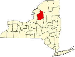
The western part of the town is surrounded on three sides by Jefferson County.
New York State Route 177 is an east–west highway in the town.
The Deer River flows northward through the southeastern part of Pinckney.
Historical population | |||
---|---|---|---|
Census | Pop. | %± | |
1820 | 507 | — | |
1830 | 783 | 54.4% | |
1840 | 907 | 15.8% | |
1850 | 1,208 | 33.2% | |
1860 | 1,393 | 15.3% | |
1870 | 1,149 | −17.5% | |
1880 | 1,152 | 0.3% | |
1890 | 1,004 | −12.8% | |
1900 | 934 | −7.0% | |
1910 | 806 | −13.7% | |
1920 | 688 | −14.6% | |
1930 | 646 | −6.1% | |
1940 | 613 | −5.1% | |
1950 | 439 | −28.4% | |
1960 | 357 | −18.7% | |
1970 | 319 | −10.6% | |
1980 | 305 | −4.4% | |
1990 | 323 | 5.9% | |
2000 | 319 | −1.2% | |
2010 | 329 | 3.1% | |
2016 (est.) | 323 | [2] | −1.8% |
U.S. Decennial Census [7] |
As of the census [8] of 2000, there were 319 people, 120 households, and 81 families residing in the town. The population density was 7.8 people per square mile (3.0/km2). There were 219 housing units at an average density of 5.3 per square mile (2.1/km2). The racial makeup of the town was 96.55% White, 1.25% African American, 0.63% Native American, 0.31% Asian, and 1.25% from two or more races. Hispanic or Latino of any race were 0.94% of the population.
There were 120 households, out of which 35.0% had children under the age of 18 living with them, 57.5% were married couples living together, 7.5% had a female householder with no husband present, and 31.7% were non-families. 20.8% of all households were made up of individuals, and 5.8% had someone living alone who was 65 years of age or older. The average household size was 2.66 and the average family size was 3.16.
In the town, the population was spread out, with 27.3% under the age of 18, 6.9% from 18 to 24, 29.8% from 25 to 44, 26.0% from 45 to 64, and 10.0% who were 65 years of age or older. The median age was 38 years. For every 100 females, there were 103.2 males. For every 100 females age 18 and over, there were 121.0 males.
The median income for a household in the town was $36,146, and the median income for a family was $35,417. Males had a median income of $28,750 versus $23,929 for females. The per capita income for the town was $13,733. About 9.6% of families and 14.0% of the population were below the poverty line, including 22.1% of those under age 18 and 14.7% of those age 65 or over.
Chenango is a town in Broome County, New York, United States. The population was 11,252 at the 2010 census.
Triangle is a town in Broome County, New York, United States. The population was 2,946 at the 2010 census. The town's primary settlement is the village of Whitney Point.
Dayton is a town in Cattaraugus County, New York, United States. The population was 1,886 at the 2010 census. The town is on the western border of Cattaraugus County.
Venice is a town in Cayuga County, New York, United States. The population was 1,368 at the 2010 census. The town is in the southern part of Cayuga County and is south of Auburn.
Smithville is a town in Chenango County, New York, United States. The population was 1,330 at the 2010 census. The town is at the western border of Chenango County, west of the city of Norwich.
Taylor is a town in Cortland County, New York, United States. The town is in the eastern part of the county and is east of Cortland. The population was 523 at the 2010 census. The town is named after General Zachary Taylor, later the 12th president of the United States.
Concord is a town in Erie County, New York, United States. The population was 8,494 at the 2010 census. The town is believed to be named after Concord, Massachusetts, by early settlers from New England.
Columbia is a town in Herkimer County, New York, United States. As of the 2010 census, the town population was 1,580. The town is at the southern border of the county and is southeast of Utica.
Manheim is a town in Herkimer County, New York, United States. The population was 3,334 at the 2010 census. The town name is derived from Mannheim in Baden, Germany.
Schuyler is a town in Herkimer County, New York, United States. The population was 3,420 at the 2010 census. The town is in the western part of Herkimer County and is east of Utica.
Adams Center is a hamlet and census-designated place (CDP) in the town of Adams in Jefferson County, New York, United States. The population was 1,492 during the 2020 decennial census.
Pamelia is a town in Jefferson County, New York, United States. The population was 3,160 at the 2010 census, up from 2,897 in 2000. The town was named for Pamelia Williams, wife of landowner and developer General Jacob J. Brown.
Rodman is a town in Jefferson County, New York, United States. The population was 1,176 at the 2010 census. The name is derived from a public official, Daniel Rodman.
Harrisburg is a town in Lewis County, New York, United States. The population was 437 at the 2010 census. The town is in the northwestern part of the county, northwest of Lowville, the county seat.
Kirkland is a town in Oneida County, New York, United States. The population was 10,315 at the 2010 census. The town is named after Samuel Kirkland, a missionary among the Oneidas.
Starkey is a town in Yates County, New York, United States. The population was 3,573 at the 2010 census. The town is in the southeastern section of the county and is south of Geneva.
North Collins is a town in Erie County, New York, United States. The population was 3,523 at the 2010 census. The name is derived from its parent town, Collins.
Little Falls is a town in Herkimer County, New York, United States. The population was 1,587 at the 2010 census. The town is named after falls and rapids on the Mohawk River nearby.
Adams is a town in Jefferson County, New York, United States. Named after President John Adams, the town had a population of 5,143 at the 2010 census. The town contains a village also named Adams. The village and town are south of Watertown.
Fabius is a town in Onondaga County, New York, United States. The population was 1,964 at the 2010 census. The classical name of the town was assigned by a clerk interested in the classics.