Martinsburg, New York

Last updated
Martinsburg, New York
Martinsburgh [1]
Martinsburg Town Hall.jpg
Town Hall
USA New York location map.svg
Red pog.svg
Martinsburg
Usa edcp location map.svg
Red pog.svg
Martinsburg
Coordinates: 43°43′57″N75°28′55″W / 43.73250°N 75.48194°W / 43.73250; -75.48194
Country United States
State New York
County Lewis
Area
[2]
  Total76.03 sq mi (196.93 km2)
  Land75.68 sq mi (196.02 km2)
  Water0.35 sq mi (0.91 km2)
Elevation
1,857 ft (566 m)
Population
 (2010)
  Total1,433
  Estimate 
(2016) [3]
1,429
  Density18.88/sq mi (7.29/km2)
Time zone UTC-5 (Eastern (EST))
  Summer (DST) UTC-4 (EDT)
ZIP code
13404
Area code(s) 315
FIPS code 36-049-45854
GNIS feature ID979202 [1]
Website www.townofmartinsburg.org

Martinsburg is a town in Lewis County, New York, United States. The population was 1,433 at the 2010 census. [4] The town is named after its founding father, General Walter Martin.

Contents

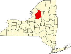
Martinsburg is in the west-central part of the county, south of Lowville, the county seat.

History

Settlers began arriving around 1801. Martinsburg was established from part of the town of Turin in 1803. When it was formed the town name was spelled "Martinsburgh". In 1819, the town was augmented by more of Turin.

The community of Martinsburg in the town was the county seat for Lewis County until 1864, when it moved to Lowville. The town hall in Martinsburg, built in 1812, is the site of the first county court session, held the same year. In 1839, it was the site of the only execution in the county.

The Gen. Walter Martin House and Martinsburg Town Hall are listed on the National Register of Historic Places. [5]

Notable people

Geography

According to the United States Census Bureau, the town has a total area of 76.0 square miles (196.9 km2), of which 75.7 square miles (196.0 km2) are land and 0.3 square miles (0.9 km2), or 0.46%, are water. [6]

The eastern town line is the Black River. The western part of Martinsburg is on the Tug Hill Plateau.

New York State Route 12 and New York State Route 26 are north-south highways through the town, with NY-12 being the more easterly route.

Demographics

Historical population
CensusPop.
1820 1,497
1830 2,38259.1%
1840 2,272−4.6%
1850 2,67717.8%
1860 2,8556.6%
1870 2,282−20.1%
1880 2,3864.6%
1890 1,982−16.9%
1900 1,845−6.9%
1910 1,546−16.2%
1920 1,5661.3%
1930 1,86018.8%
1940 1,363−26.7%
1950 1,3871.8%
1960 1,4695.9%
1970 1,5163.2%
1980 1,494−1.5%
1990 1,358−9.1%
2000 1,249−8.0%
2010 1,43314.7%
2016 (est.)1,429 [3] −0.3%
U.S. Decennial Census [7]

At the 2000 census, [8] there were 1,249 people, 473 households and 347 families residing in the town. The population density was 16.5 per square mile (6.4/km2). There were 627 housing units at an average density of 8.3 per square mile (3.2/km2). The racial makeup of the town was 98.00% White, 0.48% African American, 0.48% Native American, 0.24% from other races, and 0.80% from two or more races. Hispanic or Latino of any race were 0.48% of the population.

There were 473 households, of which 34.9% had children under the age of 18 living with them, 61.3% were married couples living together, 7.2% had a female householder with no husband present, and 26.6% were non-families. 22.8% of all households were made up of individuals, and 8.2% had someone living alone who was 65 years of age or older. The average household size was 2.64 and the average family size was 3.11.

28.3% of the population were under the age of 18, 7.8% from 18 to 24, 28.9% from 25 to 44, 22.3% from 45 to 64, and 12.7% who were 65 years of age or older. The median age was 36 years. For every 100 females, there were 103.4 males. For every 100 females age 18 and over, there were 103.2 males.

The median household income was $31,902 and the median family income was $35,978. Males had a median income of $26,705 compared with $20,682 for females. The per capita income for the town was $13,894. About 7.9% of families and 11.9% of the population were below the poverty line, including 18.3% of those under age 18 and 9.6% of those age 65 or over.

Communities and locations in Martinsburg

Related Research Articles

<span class="mw-page-title-main">Lewis County, New York</span> County in New York, United States

Lewis County is a county located in the U.S. state of New York. As of the 2020 census, the population was 26,582, making it the fourth-least populous county in New York. Its county seat is Lowville. The county is named after Morgan Lewis, the Governor of New York when the county was established.

Lewis, Essex County, New York Town in Essex County, New York, US

Lewis is a town in Essex County, New York, United States. The population was 1,382 at the 2010 census. The town is named after Morgan Lewis, the governor of New York at the time the town was established.

Adams Center is a hamlet and census-designated place (CDP) in the town of Adams in Jefferson County, New York, United States. The population was 1,492 during the 2020 decennial census.

Denmark is a town in Lewis County, New York, United States, named after the Kingdom of Denmark in northern Europe. The population was 2,860 at the 2010 census. The town is on the northwestern border of Lewis County and lies east of Watertown.

Harrisburg is a town in Lewis County, New York, United States. The population was 437 at the 2010 census. The town is in the northwestern part of the county, northwest of Lowville, the county seat.

Harrisville is a hamlet and former village in Lewis County, New York, United States. The community is now a census-designated place. The population was 628 at the 2010 census.

Lewis is a town in Lewis County, New York, United States. The population was 854 at the 2010 census. The town is named after its county, which is named after former governor, Morgan Lewis.

Lyons Falls is a village in Lewis County, New York, United States. The population was 566 at the 2010 census. The village is on the border of the towns of West Turin and Lyonsdale. It is at the junction of state Routes 12 and 12D, approximately 14 miles (23 km) south of Lowville, the county seat.

Lyonsdale is a town in Lewis County, New York, United States. The population was 1,227 at the 2010 census. The town is named after its principal community and its founder Caleb Lyon.

Montague is a town in Lewis County, New York, United States. The population was 78 at the 2010 census. The town is named after Mary Montague Pierpont, the daughter of the original owner.

New Bremen is a town in Lewis County, New York, United States. The population was 2,706 at the 2010 census. The town is named after the German city of Bremen.

Osceola is a town in Lewis County, New York, United States. The population was 229 at the 2010 census. The town is named for the Seminole fighter Osceola.

Port Leyden is a village in Lewis County, New York, United States. The population was 672 at the 2010 census. The name is derived from the village's early history as a port on the Black River Canal.

Watson is a town in Lewis County, New York, United States. The population was 1,881 at the 2010 census. The town is named after early landowner James Watson. The town is at the eastern border of the county and is east of Lowville, the county seat.

Pitcairn, New York Town in New York, United States

Pitcairn is a town in St. Lawrence County, New York, United States. The population was 846 at the 2010 census. The name is from that of Joseph Pitcairn, an early landowner and diplomat.

Lowville, Wisconsin Town in Wisconsin, United States

Lowville is a town in Columbia County, Wisconsin, United States. The population was 987 at the 2000 census. The unincorporated community of Lowville is located in the town.

<span class="mw-page-title-main">Croghan (town), New York</span> Town in New York, United States

Croghan is a town in Lewis County, New York, United States. The population was 3,093 at the 2010 census. The town is in the northern part of the county and located northeast of the county seat, Lowville. The town contains a village also named Croghan, a small part of which is located in the adjacent town of New Bremen. Both the village and town are locally pronounced \Krō-gun\.

Lowville (village), New York Village in New York, United States

Lowville is a village in Lewis County, New York, United States. As of the 2010 census it had a population of 3,470. The village is in the Black River Valley, between the foothills of the Adirondack Mountains and the Tug Hill Plateau, in an area often referred to as the North Country. It is located in the center of Lewis County, in the southeastern part of the similarly named town of Lowville.

Lowville is a town in Lewis County, New York, United States. The population was 4,982 at the 2010 census. The town is near the center of the county and is southeast of the city of Watertown. The town of Lowville contains a village also named Lowville, which is the county seat. The town is named after Nicholas Low, an early landowner. Low was of Dutch descent, and had emigrated with his wife and three small children from a rural village outside Amsterdam in 1778. Despite popular folk etymology, the name Lowville has nothing to do with its low elevation or the lowing cattle of the many nearby dairy farms.

Turin is a town in Lewis County, New York, United States. The population was 761 at the 2010 census. Turin has a village, also named Turin. The town is south of Lowville, the county seat, and north of Rome.

References

  1. 1 2 U.S. Geological Survey Geographic Names Information System: Martinsburg, New York
  2. "2016 U.S. Gazetteer Files". United States Census Bureau. Retrieved Jul 5, 2017.
  3. 1 2 "Population and Housing Unit Estimates" . Retrieved June 9, 2017.
  4. "Total Population: 2010 Census DEC Summary File 1 (P1), Martinsburg town, New York". data.census.gov. U.S. Census Bureau. Retrieved May 27, 2020.
  5. 1 2 "National Register Information System". National Register of Historic Places . National Park Service. July 9, 2010.
  6. "U.S. Gazetteer Files: 2019: Places: New York". U.S. Census Bureau Geography Division. Retrieved May 27, 2020.
  7. "Census of Population and Housing". Census.gov. Retrieved June 4, 2015.
  8. "U.S. Census website". United States Census Bureau . Retrieved 2008-01-31.

Coordinates: 43°44′15″N75°28′11″W / 43.73750°N 75.46972°W / 43.73750; -75.46972