Sullivan County, New York

Last updated

Sullivan County
Shallow Stream in Rock Hill, NY.jpg
Stream in the hamlet of Rock Hill
Flag of Sullivan County, New York.jpg
Sullivan County, New York seal.png
Map of New York highlighting Sullivan County.svg
Location within the U.S. state of New York
New York in United States.svg
New York's location within the U.S.
Coordinates: 41°43′N74°46′W / 41.72°N 74.76°W / 41.72; -74.76
CountryFlag of the United States.svg United States
StateFlag of New York.svg  New York
Founded1809
Named for John Sullivan
Seat Monticello
Largest villageMonticello
Area
  Total997 sq mi (2,580 km2)
  Land968 sq mi (2,510 km2)
  Water29 sq mi (80 km2)  2.9%
Population
 (2020)
  Total78,624 [1]
  Density81.2/sq mi (31.4/km2)
Time zone UTC−5 (Eastern)
  Summer (DST) UTC−4 (EDT)
Congressional district 19th
Website sullivanny.us

Sullivan County is a county in the U.S. state of New York. As of the 2020 census, the population was 78,624. [2] The county seat is Monticello. [3] The county's name honors Major General John Sullivan, who was labeled at the time as a hero in the American Revolutionary War in part due to his successful campaign against the Iroquois (see Sullivan Expedition). The county is part of the Hudson Valley region of the state.

Contents

The county was the site of hundreds of Borscht Belt hotels and resorts, which had their heyday from the 1920s through the 1970s.

In 2010, the state's center of population was at the southern edge of Sullivan County. [4]

History

John Sullivan, general in the Continental Army, delegate in the Continental Congress, Governor of New Hampshire, and namesake of Sullivan County Major General John Sullivan, a distinguished officer in the Continental Army (NYPL NYPG94-F149-419970).jpg
John Sullivan, general in the Continental Army, delegate in the Continental Congress, Governor of New Hampshire, and namesake of Sullivan County

When the Province of New York established its first twelve counties in 1683, the present Sullivan County was part of Ulster County. In 1809, Sullivan County was split from Ulster County. [5]

In the late 19th century, the Industrial Revolution and the advent of factories driven by water power along the streams and rivers led to an increase in population attracted to the jobs. [6] Hamlets enlarged into towns. As industry restructured, many of those jobs left before the middle of the twentieth century. The economy changed again after that, shifting to a more tourist-based variety and benefiting from resorts established by European Jewish immigrants and their descendants in what became called the Borscht Belt of the 20th century. Resort hotels featured a wide variety of entertainers, some nationally known. At the beginning of this period, visitors traveled to the area by train, and later by automobile. [7] The area's natural resources also provided a setting for numerous summer camps frequented by the children of immigrants and their descendants.

Geography

Swan Lake Swan Lake in Upstate New York.png
Swan Lake
New York State Route 17 (Future Interstate 86) in Liberty SR 17 NY.jpg
New York State Route 17 (Future Interstate 86) in Liberty
Hamlet of Grahamsville Grahamsville, NY.jpg
Hamlet of Grahamsville

According to the U.S. Census Bureau, the county has a total area of 997 square miles (2,580 km2), of which 968 square miles (2,510 km2) is land and 29 square miles (75 km2) (2.9%) is water. [8]

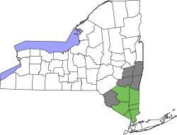
Sullivan County is in the southern part of New York State, southeast of Binghamton and southwest of Albany. It is separated from Pennsylvania along its southwest boundary by the Delaware River.

The county, which starts about 70 miles northwest of New York City, is in the Catskill Mountains. Its northeastern corner is within the Catskill Park.

The highest point in the county is a 3,118-foot (950 m) peak unofficially known as Beech Mountain, near Hodge Pond, a subsidiary summit to Mongaup Mountain [9] across the Ulster County line. The lowest point is along the Delaware River. [10]

Adjacent counties

Demographics

Historical population
CensusPop.Note
1810 6,108
1820 8,90045.7%
1830 12,36438.9%
1840 15,62926.4%
1850 25,08860.5%
1860 32,38529.1%
1870 34,5506.7%
1880 32,491−6.0%
1890 31,031−4.5%
1900 32,3064.1%
1910 33,8084.6%
1920 33,163−1.9%
1930 35,2726.4%
1940 37,9017.5%
1950 40,7317.5%
1960 45,27211.1%
1970 52,58016.1%
1980 65,15523.9%
1990 69,2776.3%
2000 73,9666.8%
2010 77,5474.8%
2020 78,6241.4%
U.S. Decennial Census [11]
1790-1960 [12] 1900-1990 [13]
1990-2000 [14] 2010-2020 [2]
Hamlet of Callicoon Central Callicoon.JPG
Hamlet of Callicoon

As of the 2000 census, [15] there were 73,966 people, 27,661 households, and 18,311 families residing in the county. The population density was 76 people per square mile (29 people/km2). There were 44,730 housing units at an average density of 46 per square mile (18/km2). The racial makeup of the county was 85.31% White, 8.51% Black or African American, 0.27% Native American, 1.12% Asian, 0.04% Pacific Islander, 2.89% from other races, and 1.87% from two or more races. 9.25% of the population were Hispanic or Latino of any race. 16.6% were of German, 13.9% Irish, 12.5% Italian, 7.3% American and 6.2% English ancestry according to 2000 census. 86.6% spoke English, 7.4% Spanish and 1.0% German as their first language. A small population of Russians, late twentieth-century immigrants, live in the villages. There are a few persons in Sullivan and nearby counties who are of mixed Dutch and Mohawk or Lenni-Lenape ancestry in this region of upstate New York, the legacy of indigenous peoples in the region and the New Netherlands colonial era in the 17th century.[ citation needed ]

There were 27,661 households, out of which 31.30% had children under the age of 18 living with them, 50.10% were married couples living together, 11.40% had a female householder with no husband present, and 33.80% were non-families. 27.90% of all households were made up of individuals, and 11.40% had someone living alone who was 65 years of age or older. The average household size was 2.50 and the average family size was 3.05.

In the county, the population was spread out, with 24.90% under the age of 18, 7.30% from 18 to 24, 28.10% from 25 to 44, 25.40% from 45 to 64, and 14.30% who were 65 years of age or older. The median age was 39 years. For every 100 females, there were 103.60 males. For every 100 females age 18 and over, there were 102.80 males.

The median income for a household in the county was $36,998, and the median income for a family was $43,458. Males had a median income of $36,110 versus $25,754 for females. The per capita income for the county was $18,892. About 11.60% of families and 17.40% of the population were below the poverty line, including 21.60% of those under age 18 and 10.70% of those age 65 or over.

2020 census

Sullivan County Racial Composition [16]
RaceNum.Perc.
White (NH)52,69167.01%
Black or African American (NH)6,0697.72%
Native American (NH)1740.2%
Asian (NH)1,5692.0%
Pacific Islander (NH)100.01%
Other/Mixed (NH)4,1045.22%
Hispanic or Latino 14,00717.81%

National protected area

Government and politics

Sullivan County is a swing county, backing the national winner in all but three presidential elections from 1952 to the present. In 2004, Republican George W. Bush defeated Democrat John Kerry by a margin of 49.47% to 48.55%, or a difference of 285 votes. [17] In 2008, however, it was won by Democrat Barack Obama over Republican John McCain by a margin of 54% to 45%. [18] The margin remained virtually the same in 2012, as Obama won the county again over Republican Mitt Romney by 54-44%. [19] But then, in 2016, the county swung to Republican Donald Trump over Democrat Hillary Clinton by a margin of 53% to 42%. [20] In 2020, the county didn't back the winner nationally for the first time since 2000. Incumbent Republican President Donald Trump won the county with 54% of the votes that year compared to the national winner Democrat Joe Biden's 45%. [21]

There are thirty-six town and village courts in Sullivan County. [22]

Legislative authority is vested in the county legislature which consists of nine members, each elected from single member districts. Currently, there are five Democrats and four Republicans.

Sullivan County Legislature
DistrictLegislatorTitleParty
1 Matt McPhillipsMajority LeaderDemocratic
2 Nadia RajszChairDemocratic
3 Brian McPhillipsDemocratic
4 Nicholas Salomone, Jr.Minority LeaderRepublican
5 Catherine ScottDemocratic
6 Luis AlvarezDemocratic
7 Joseph PerrelloRepublican
8 Amanda WardRepublican
9 Terry Blosser-BernardoRepublican
United States presidential election results for Sullivan County, New York [23]
Year Republican Democratic Third party
No.%No.%No.%
2020 18,66553.87%15,48944.71%4921.42%
2016 15,93153.18%12,56841.96%1,4564.86%
2012 12,70544.71%15,26853.73%4421.56%
2008 13,90044.58%16,85054.04%4331.39%
2004 15,31949.47%15,03448.55%6131.98%
2000 12,70344.53%14,34850.29%1,4775.18%
1996 9,32133.00%15,05253.29%3,87113.71%
1992 11,39636.02%13,71743.36%6,52220.62%
1988 15,71357.00%11,63542.20%2200.80%
1984 18,03763.09%10,47536.64%780.27%
1980 15,08955.44%9,55335.10%2,5769.46%
1976 13,70948.79%14,18950.50%1980.70%
1972 17,03563.24%9,84736.55%560.21%
1968 11,65748.17%10,86044.88%1,6816.95%
1964 8,00632.31%16,72867.52%410.17%
1960 13,74454.37%11,48645.44%490.19%
1956 15,84563.94%8,93736.06%00.00%
1952 14,92663.26%8,42135.69%2471.05%
1948 11,25353.20%7,65436.19%2,24510.61%
1944 11,25855.82%8,83643.81%730.36%
1940 11,87754.64%9,78545.01%760.35%
1936 9,75748.83%9,90849.58%3171.59%
1932 8,29444.79%9,65652.15%5673.06%
1928 10,33161.27%6,20736.81%3231.92%
1924 7,73456.85%4,05729.82%1,81313.33%
1920 8,02964.45%3,62329.08%8066.47%
1916 4,34053.05%3,65944.73%1822.22%
1912 3,03937.56%3,86447.75%1,18914.69%
1908 4,59352.52%3,91144.72%2422.77%
1904 4,45254.37%3,58243.74%1551.89%
1900 4,39353.92%3,62544.49%1301.60%
1896 4,58958.35%3,07339.08%2022.57%
1892 3,66448.28%3,56747.00%3584.72%
1888 3,86049.66%3,75748.33%1562.01%
1884 3,33245.31%3,60749.05%4155.64%

Education

Public school districts

Higher education

Transportation

Sullivan County has services provided by Short Line to New York City. It also has some local service provided by the county itself, as well as community organizations. [24] [25] [26]

Sullivan County International Airport is located in Bethel and is used frequently for general aviation purposes.

Major roadways

Tourism

Sullivan County has been a popular vacation spot since the 19th century, with mountain climbing, boating, and other outdoor activities, as well as the Monticello Raceway being among the attractions. The majority of the tourism occurs in the summer months. It was the site of the hundreds of resort complexes of the Borscht Belt (with their golf courses, social events, and entertainers), between the 1920s and 1970s.

Borscht Belt hotels, bungalow colonies, summer camps, and kuchaleyns (a Yiddish name for self-catered boarding houses). The bungalows usually included "a kitchen/living room/dinette, one bedroom, and a screened porch" with entertainment being simple: bingo or a movie. [27] The kuchaleyns were also visited often by middle and working-class Jewish New Yorkers. Because of the many Jewish guests, this area was nicknamed the Jewish Alps and "Solomon County" (a modification of Sullivan County) by many people who visited there. [28]

Many famous comedians tested their material and performed regularly at Borscht Belt hotels, including Milton Berle, Mel Brooks, and Henny Youngman. Eddie Fisher performed often at Grossinger's, where in 1955 he married Debbie Reynolds.

By the late 1950s, many began closing with most gone by the 1970s, but some major resorts continued to operate, a few into the 1990s. Grossinger's Catskill Resort Hotel closed in 1986 [29] and the Concord Resort Hotel struggled to stay open until 1998. [30] By that time, the business owed millions in back taxes to Sullivan County, but the property was sold "for $10.5 million" and a new resort was eventually built. [31] [32]

Sullivan County was the site of the 1969 Woodstock Festival located at the present-day Bethel Woods Center for the Arts. During the period August 15–18, 1969, approximately 500,000 people gathered in Sullivan County's Town of Bethel at Max Yasgur's farm to attend the Woodstock Festival. The entertainers included The Who; the Grateful Dead; Jefferson Airplane; The Band; Canned Heat; Joan Baez; Arlo Guthrie; Crosby, Stills, Nash and Young; Janis Joplin; Santana; Sly and the Family Stone; Blood, Sweat and Tears; Jimi Hendrix; and Richie Havens. The state and the town of Bethel council subsequently passed laws prohibiting future mass event types of festivals. In 2019, a 50th celebration of Woodstock was organized: "Sullivan County ... finally embracing the ultimate symbol of peace and love, the 1969 Woodstock festival". [33] The Woodstock 50 festival, scheduled for August, was canceled months earlier so it did not take place. [34] The Bethel Woods Center for the Arts did organize of weekend of "low-key" concerts. [35]

Bethel Woods Center for the Arts, which also includes a museum of the sixties and Woodstock, holds many concerts and other events throughout the year.

Other notable cultural destinations include the CAS Arts Center, a multi-arts exhibit space and education center run by the Catskill Art Society in Livingston Manor, New York, the NaCl Theatre, a professional regional theater company focusing on experimental work in Highland Lake, and the Delaware Valley Arts Alliance (DVAA) which serves as the Arts Council for Sullivan County and is located in Narrowsburg. DVAA offers two art galleries, performing arts and cultural programming, grant opportunities for artists and nonprofits, the Big Eddy Film Festival, and Riverfest.

Communities

Village of Wurtsboro WurtsburoNY.JPG
Village of Wurtsboro
Monticello Raceway in Monticello Monticello-raceway.jpg
Monticello Raceway in Monticello

Towns

Villages

Census-designated places

Hamlets

Notable people

See also

Related Research Articles

<span class="mw-page-title-main">Ulster County, New York</span> County in New York, United States

Ulster County is a county in the U.S. state of New York. It is situated along the Hudson River. As of the 2020 census, the population was 181,851. The county seat is Kingston. The county is named after the Irish province of Ulster. The county is part of the Hudson Valley region of the state.

<span class="mw-page-title-main">Bethel, New York</span> Town in New York, United States

Bethel is a town in Sullivan County, New York, United States. The population was estimated at 3,959 in 2020. The town received worldwide attention after it served as the location of Woodstock in 1969, which was originally planned for Wallkill, New York, but was relocated to Bethel after Wallkill withdrew.

<span class="mw-page-title-main">Fallsburg, New York</span> Town in New York, United States

Fallsburg is a town in Sullivan County, New York, United States. The town is in the eastern part of the county. The population was 14,192 at the 2020 census. It is not to be confused with the hamlet of Fallsburg which bears a similar name and is within the town of Fallsburg.

<span class="mw-page-title-main">Monticello, New York</span> Village in Sullivan County, New York

Monticello is a village located in Thompson, Sullivan County, within the Catskills region of New York, United States. The population was 7,173 at the 2020 census. It is the seat for the town of Thompson, and the county seat of Sullivan County. The village was named after the residence of Thomas Jefferson.

<span class="mw-page-title-main">South Fallsburg, New York</span> CDP and hamlet in New York, United States

South Fallsburg is a hamlet and census-designated place in Sullivan County, New York, United States. South Fallsburg is located within the Town of Fallsburg at 41°42′59″N74°37′49″W.

<span class="mw-page-title-main">Catskill Mountains</span> Mountains in southeastern New York State, U.S.

The Catskill Mountains, also known as the Catskills, are a physiographic province and subrange of the larger Appalachian Mountains, located in southeastern New York. As a cultural and geographic region, the Catskills are generally defined as those areas close to or within the borders of the Catskill Park, a 700,000-acre (2,800 km2) forest preserve protected from many forms of development under New York state law.

<span class="mw-page-title-main">Borscht Belt</span> Cultural region of United States

The Borscht Belt, or Yiddish Alps, is a colloquial term for the mostly defunct summer resorts of the Catskill Mountains in parts of Sullivan, Orange, and Ulster counties in the U.S. state of New York, straddling both Upstate New York and the northern edges of the New York metropolitan area.

Grossinger's Catskill Resort Hotel was a resort in the Catskill Mountains in the Town of Liberty, near the village of Liberty, New York. It was a kosher establishment that catered primarily to Jewish clients from New York City. Under the direction of hostess Jennie Grossinger, it became one of the largest Borscht Belt resorts. After decades of activity and notable guests, it closed in 1986. Most of the buildings on site had been demolished by 2018, however a few remained in decrepit condition, and were destroyed in a fire in 2022.

<span class="mw-page-title-main">Bethel Woods Center for the Arts</span> Performing arts center and museum

The Bethel Woods Center for the Arts is an amphitheatre, performing arts center and museum located at the site of the 1969 Woodstock Music & Art Fair in Bethel, New York. Located approximately 90 miles (140 km) from New York City, the 800-acre (3.2 km2) site includes a 15,000-seat outdoor concert venue, a 1,000-seat outdoor terrace stage, an intimate 440-seat indoor hall, and the Museum at Bethel Woods. Concerts run June through September and feature many types of music genres.

White Lake is a hamlet in the town of Bethel, Sullivan County, New York, United States, on the southeastern shore of a lake of the same name. It was the closest community to the Woodstock Music and Art Fair in 1969.

<span class="mw-page-title-main">Concord Resort Hotel</span> Former resort in New York, United States

The Concord Resort Hotel ) was a resort in the Borscht Belt of the Catskills, known for its large resort industry in the 1950s, 1960s and 1970s. Located in Kiamesha Lake, New York, United States, the Concord was the largest resort in the region and was also one of the last to finally close in 1998, long after the others closed. At the Concord, there were over 1,500 guest rooms and a dining room that sat 3,000; the resort encompassed some 2,000 acres (8.1 km2). The resort was a kosher establishment, catering primarily to Jewish vacationers from the New York City area, and it was more lavish in decor and activities than comparable large Catskill resorts.

<span class="mw-page-title-main">Kutsher's Hotel</span> Resort in Thompson, New York

Kutsher's Hotel and Country Club in Thompson, Sullivan County, near Monticello, New York, was the longest running of the Borscht Belt grand resorts in the Catskill Mountains region of New York. While the region was open to any and all visitors, the Borscht Belt was so named due to the largely Jewish-American clientele that made the Catskills the primary vacation destination for Jews in the northeastern United States.

<span class="mw-page-title-main">Loch Sheldrake, New York</span> CDP & hamlet in New York, United States

Loch Sheldrake is a hamlet and census-designated place (CDP) in the Town of Fallsburg, New York, United States, in Sullivan County. The zip code for Loch Sheldrake is 12759.

Hurleyville is a hamlet in the Town of Fallsburg in Sullivan County, New York, United States. The town lies along County Road 104 and was originally developed because it was on the main route between the Villages of Liberty and Monticello, New York. The zip code for Hurleyville is 12747.

Woodbourne is a hamlet in the town of Fallsburg in Sullivan County, New York, United States.

<span class="mw-page-title-main">Woodstock, New York</span> Town in New York, United States

Woodstock is a town in Ulster County, New York, United States, in the northern part of the county, northwest of Kingston. It lies within the borders of the Catskill Park. The population was 6,287 at the 2020 census, up from 5,884 in 2010.

<span class="mw-page-title-main">Brown's Hotel (Catskills)</span> Resort in upstate New York

Brown's Hotel was a nationally known resort complex located in the Borscht Belt area of upstate New York, in the Catskill Mountains. It was one of the largest and most elaborate establishments of its kind during an era when the entire region prospered as a tourist destination. From the 1940s to the 1980s, the hotel was a popular vacation destination for many upper-middle-class families living in the New York City metropolitan area. Jewish-American families were welcomed and even catered to specifically by the hotels in the Borscht Belt during a time period when anti-semitism was prevalent in the hospitality industry. Filling a niche, the area quickly became a mecca for Jewish-American families. Brown's Hotel was located in the hamlet of Loch Sheldrake in the Town of Fallsburg, Sullivan County, New York.

Marisa Scheinfeld is an American artist, photographer and educator currently living in New York. Marisa's work is highly motivated by her interest in ruins and the histories embedded within them. Her projects have taken her from the United States to Israel, Poland, the Czech Republic, Slovakia and India. Her photographic projects and books are among the collections of Yeshiva University Museum, Lynn Kroll, The Simon Wiesenthal Center in Los Angeles, CA, The La Jolla Athenaeum in La Jolla, CA, The Magnes Collection of Jewish Art and Life The Edmund and Nancy K. Dubois Library at the Museum of Photographic Arts in San Diego, CA and The International Raoul Wallenberg Foundation in New York, NY.

<span class="mw-page-title-main">Raleigh Hotel (South Fallsburg, New York)</span>

The Raleigh Hotel is a resort hotel in South Fallsburg, New York, within the Borscht Belt region of the Catskill Mountains.

References

Notes
  1. "US Census 2020 Population Dataset Tables for New York". United States Census Bureau. Retrieved January 2, 2022.
  2. 1 2 "U.S. Census Bureau QuickFacts: Sullivan County, New York". United States Census Bureau. Retrieved January 2, 2022.
  3. "Find a County". National Association of Counties. Retrieved June 7, 2011.
  4. "Centers of Population by State: 2010". United States Census Bureau. Retrieved April 5, 2014.
  5. "Sullivan County, NY - History & Nostalgia Gallery". Hudson Valley Sojourner. Retrieved February 8, 2022.
  6. Administrator (June 11, 2016). "Sullivan Life". www.scnyhistory.org. Retrieved February 8, 2022.
  7. Roberts, Sam (May 25, 2017). "Guides for Exploring New York". The New York Times. ISSN   0362-4331 . Retrieved February 8, 2022.
  8. "2010 Census Gazetteer Files". United States Census Bureau. August 22, 2012. Archived from the original on May 19, 2014. Retrieved January 7, 2015.
  9. "Beech Mountain - Peakbagger.com". www.peakbagger.com. Retrieved October 1, 2019.
  10. "Sullivan County". www.dianebutlerrealestate.com. Retrieved May 19, 2020.
  11. "U.S. Decennial Census". United States Census Bureau. Retrieved January 7, 2015.
  12. "Historical Census Browser". University of Virginia Library. Retrieved January 7, 2015.
  13. "Population of Counties by Decennial Census: 1900 to 1990". United States Census Bureau. Retrieved January 7, 2015.
  14. "Census 2000 PHC-T-4. Ranking Tables for Counties: 1990 and 2000" (PDF). United States Census Bureau. Retrieved January 7, 2015.
  15. "U.S. Census website". United States Census Bureau . Retrieved January 31, 2008.
  16. "P2 HISPANIC OR LATINO, AND NOT HISPANIC OR LATINO BY RACE – 2020: DEC Redistricting Data (PL 94-171) – Sullivan County, New York".
  17. "Dave Leip's Atlas of U.S. Presidential Elections - State Data".
  18. "Dave Leip's Atlas of U.S. Presidential Elections - State Data".
  19. "President - Live Election Results - NYTimes.com". The New York Times. ISSN   0362-4331 . Retrieved January 17, 2023.
  20. "Dave Leip's Atlas of U.S. Presidential Elections - State Data".
  21. "Dave Leip's Atlas of U.S. Presidential Elections - State Data".
  22. Sullivan County Evaluation (PDF), National League of Defenders Association, January 2009, p. 8, archived from the original (PDF) on July 27, 2011
  23. Leip, David. "Dave Leip's Atlas of U.S. Presidential Elections". uselectionatlas.org. Retrieved April 19, 2018.
  24. "Bus Stops, Fares & Transfers". Archived from the original on November 11, 2013. Retrieved December 19, 2013.
  25. County, Sullivan. "Sullivan County > Departments > Transportation". www.co.sullivan.ny.us. Retrieved April 19, 2018.
  26. http://www.coachusa.com/CoachUsaAssets/files/98/HudsonSL.pdf [ bare URL PDF ]
  27. "Borscht Belt staff reminisce about the glory days of the Jewish Alps and their part in making it happen".
  28. Stone, Emily (October 29, 2013). Did Jew Know?: A Handy Primer on the Customs, Culture & Practice of the Chosen People. Chronicle Books. ISBN   9781452129570 via Google Books.
  29. "Ruins of Grossinger's Resort". Atlas Obscura.
  30. "The Bygone Era of the Jewish Catskills Resorts". blogs.timesofisrael.com.
  31. "For seniors". Times Herald-Record.
  32. "Finally it's here: Sullivan's casino opening Thursday". Times Herald-Record. Middletown, NY. February 7, 2018. Retrieved March 9, 2021.
  33. "50 years later, Sullivan County shows love for Woodstock festival".
  34. "Woodstock 2019: Bethel Woods ready for party 50 years in making". Poughkeepsie Journal.
  35. Bloom, Steve (August 19, 2019). "Woodstock Gets a Low-Key 50th Party With Ringo, Santana and That Album Cover Couple".

Further reading