
Sullivan County is a county in the U.S. state of New York. As of the 2020 census, the population was 78,624. The county seat is Monticello. The county's name honors Major General John Sullivan, who was labeled at the time as a hero in the American Revolutionary War in part due to his successful campaign of genocide against the Iroquois.
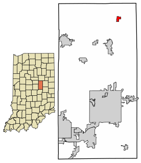
Summitville is a town in Van Buren Township, Madison County, Indiana, United States. It is part of the Anderson, Indiana Metropolitan Statistical Area. The population was 967 at the 2010 census.

Bethlehem is a town in Albany County, New York, United States. The town's population was 33,656 at the 2010 census. Bethlehem is located immediately to the south of the City of Albany. Bethlehem includes the following hamlets: Delmar, Elsmere, Glenmont, North Bethlehem, Selkirk, Slingerlands, and South Bethlehem. U.S. Route 9W passes through the town. The town is named after the biblical Bethlehem.

Wappinger, officially the Town of Wappinger, is a town in Dutchess County, New York, United States. The town is located in the Hudson River Valley region, approximately 60 miles (97 km) north of Midtown Manhattan, on the eastern bank of the Hudson River. The population was 28,216 at the 2020 census. The name is derived from the Wappinger Native Americans who inhabited the area. Wappinger comprises three-fourths of the incorporated Village of Wappingers Falls, several unincorporated hamlets such as Chelsea, Diddell, Hughsonville, Middlebush, Myers Corners, New Hackensack, and Swartwoutville, and a number of neighborhoods.
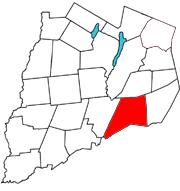
Maryland is a town in Otsego County, New York, United States. The population was 1,897 at the 2010 census. It was named for the U.S. state of the same name. The Town of Maryland is on the county's southern border. It is northeast of the City of Oneonta.
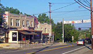
Mamakating is a town in the southeastern section of Sullivan County, New York, United States. The population was 12,655 at the 2020 census.
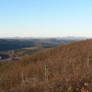
Wurtsboro is a village located on U.S. Route 209 in the town of Mamakating in Sullivan County, New York, United States, near its junction with New York State Route 17. The population was 1,124 at the 2020 census. Since 1927 the area has been served by Wurtsboro-Sullivan County Airport.

Accord is a hamlet and census-designated place (CDP) in Ulster County, New York, United States. Accord is located in the eastern part of the Town of Rochester along US 209. Accord is the seat of town government.

Esopus is a town in Ulster County, New York, United States. The population was 9,041 at the 2010 census. The town was named after the local indigenous tribe and means "small river" in English. They were one of the Lenape (Delaware) bands, belonging to a people who ranged from western Connecticut through lower New York, western Long Island, and parts of New Jersey and Pennsylvania along the Delaware River. The town is on the west bank of the Hudson River south of the city of Kingston. Its center is in Port Ewen. US Route 9W passes along the eastern side of the town.

Hardenburgh is a town located in the western part of Ulster County, New York, United States. The population was 215 at the 2010 census. The town is located inside the Catskill Park.

Kerhonkson is a hamlet and census-designated place (CDP) in Ulster County, New York, United States. The population was 1,684 at the 2010 census.
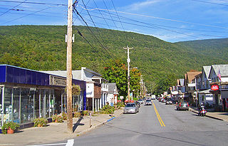
Phoenicia is a hamlet of Shandaken in Ulster County, New York, United States. The population was 309 at the 2010 census, making it the highest populated community in the town. The village center is located just off Route 28 at its junction with Route 214 and is nestled at the base of three peaks, Mount Tremper, Romer Mountain, and Sheridan Mountain. The community sits at the confluence of the Esopus Creek and Stony Clove Creek. A popular getaway for New Yorkers, the hamlet has frequented many tourism guides as among the best vacation towns in the greater New York City area.

Shandaken is a town on the northern border of Ulster County, New York, United States, northwest of Kingston, New York. As of the 2010 census, the town had a total population of 3,085. The name is believed to be from an Esopus phrase for "land of rapid waters."
Deposit is a town in Delaware County, New York, United States. As of the 2010 census, the town's population was 1,712.

The Delaware and Hudson Canal was the first venture of the Delaware and Hudson Canal Company, which would later build the Delaware and Hudson Railway. Between 1828 and 1899, the canal's barges carried anthracite coal from the mines of Northeastern Pennsylvania to the Hudson River and thence to market in New York City.
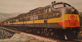
The New York, Ontario and Western Railway, more commonly known as the O&W or NYO&W, was a regional railroad with origins in 1868, lasting until March 29, 1957, after which it was ordered liquidated by a US bankruptcy judge. It was the first notable U.S. railroad with its mainline entirely abandoned.
New York State Route 443 (NY 443) is an east–west state highway in the Capital District of New York in the United States. The route begins at an intersection with NY 30 in the town of Schoharie and ends 33.44 miles (53.82 km) later at a junction with U.S. Route 9W (US 9W) and US 20 in the city of Albany. It ascends the Helderberg Escarpment in the towns of Berne and New Scotland. Within the town of Bethlehem and the city of Albany, NY 443 is known as Delaware Avenue.

Chelsea is a hamlet of the Town of Wappinger in Dutchess County, New York, United States. It is located on the Hudson River in the southwestern corner of the town. It takes the ZIP Code 12512 and is in the 845 telephone area code, and has its own fire district.

The abandoned NYO&W Port Ben station is located at 24 Towpath Road in the Town of Wawarsing, New York, United States. It is a Tudor Revival style building erected in the early 20th century by the New York, Ontario and Western Railway (O&W). The station was on the O&W's division between Summitville on the O&W main line and Kingston.

Greenwich is a town in the southwestern part of Washington County, New York, United States. The town is located on the western border of the county. The population was 4,896 at the 2000 census. It is part of the Glens Falls Metropolitan Statistical Area. Greenwich features several homes that were a part of the Underground Railroad.


