Handsome Eddy, New York

Last updated

Handsome Eddy is a hamlet in Sullivan County, New York, in the United States. [1]

Sullivan County, New York County in the United States

Sullivan County is a county in the U.S. state of New York. As of the 2010 census, the population was 77,547. The county seat is Monticello. The county's name honors Major General John Sullivan, who was a hero in the American Revolutionary War.

United States Federal republic in North America

The United States of America (USA), commonly known as the United States or America, is a country composed of 50 states, a federal district, five major self-governing territories, and various possessions. At 3.8 million square miles, the United States is the world's third or fourth largest country by total area and is slightly smaller than the entire continent of Europe's 3.9 million square miles. With a population of over 327 million people, the U.S. is the third most populous country. The capital is Washington, D.C., and the largest city by population is New York City. Forty-eight states and the capital's federal district are contiguous in North America between Canada and Mexico. The State of Alaska is in the northwest corner of North America, bordered by Canada to the east and across the Bering Strait from Russia to the west. The State of Hawaii is an archipelago in the mid-Pacific Ocean. The U.S. territories are scattered about the Pacific Ocean and the Caribbean Sea, stretching across nine official time zones. The extremely diverse geography, climate, and wildlife of the United States make it one of the world's 17 megadiverse countries.

It has frequently been noted on lists of unusual place names. [2]
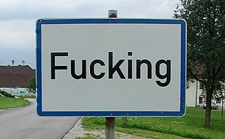
Place names considered unusual Wikimedia list article

Unusual place names are names for cities, towns, and other regions which are considered non-ordinary in some manner. This can include place names which are also swear words, inadvertently humorous or highly charged words, as well as place names of unorthodox spelling and pronunciation, including especially short or long names.

Related Research Articles

Jacksonville, West Virginia Unincorporated community in West Virginia, United States

Jacksonville is an unincorporated community in Lewis County, West Virginia, United States. Its altitude is 1,079 feet (329 m), and it is located at 38°53′27″N80°29′31″W.

Wawayanda Creek river in the United States of America

Wawayanda Creek is the name of Pochuck Creek above its confluence with the tributary Black Creek.

Modena, New York hamlet in New York, United States

Modena is a hamlet in Ulster County, New York, United States. It is located in the northwestern corner of the town of Plattekill, centered at the junction of the US 44/NY 55 concurrency and NY 32.

Kingsville, Ohio human settlement in United States of America

Kingsville is a census-designated place in central Kingsville Township, Ashtabula County, Ohio, United States. Although it is unincorporated, it has a post office, with the ZIP code of 44048. It lies at the intersection of State Routes 84 and 193, less than one mile northwest of Interstate 90.

Krumville is a small hamlet in Ulster County, New York, on the border of Olivebridge and Rondout. It lies at an elevation of 774 feet above sea level.

Black Meadow Creek is a 9.7-mile-long (15.6 km) tributary of the Otter Kill in Orange County, New York, in the United States. Via the Otter Kill, it is part of the Moodna Creek watershed, flowing onward to the Hudson River, in one of New York State's most biodiverse natural areas. Home to 13 species of salamander as well as to New York's largest population of the Northern Cricket Frog, the state's only listed "Endangered" frog species, the creek area is considered by biologists to be one of the state's herpetological "hot spots". Black Meadow Creek has several confirmed bald eagle nests along its length.

Oro Loma, California Unincorporated community in California, United States

Oro Loma is an unincorporated community in Fresno County, California. It is located 13 miles (21 km) west of Firebaugh, at an elevation of 174 feet.

Dwaarkill is a populated place in Ulster County, New York. The name was collected by the United States Geological Survey between 1976 and 1980 and entered into the Geographic Names Information System on January 23, 1980.

Casperkill river in the United States of America

The Casperkill is a creek in both the town and city of Poughkeepsie, Dutchess County, New York. It flows 11.6 miles (18.7 km) from Peach Hill Park to the Hudson River. Combined with its only major tributary, the Fonteyn Kill, it forms a 12 sq mi (31 km2) subwatershed. It lies entirely within the British royal grant of 1685 known as the Rombout Patent.

Kayan is an unincorporated community in Northumberland County, in the U.S. state of Virginia.

Back Brook is a tributary of Pike Run in Somerset County, New Jersey in the United States. It is located on the east side of Sourland Mountain.

Columbus is an unincorporated community in Johnson County, in the U.S. state of Missouri.

Del Muerto, Arizona Census-designated place in Arizona, United States

Del Muerto is a census-designated place (CDP) in Apache County, Arizona, United States. The population was 329 at the 2010 census.

Eddy is an unincorporated community in LaGrange County, Indiana, in the United States.

Eddy, Illinois Unincorporated community in Illinois, United States

Eddy is an unincorporated community in Lake County, in the U.S. state of Illinois. Eddy is located at 42°27′41″N87°53′54″W.

Boeuf Creek is a stream in Franklin and Gasconade counties in the U.S. state of Missouri. Boeuf Creek is a tributary to the Missouri River. Alternate names include Buffalo Creek, Beef Creek, Boeuse Creek, Riviere au Boeuf and variations.

Coldenham is a hamlet in Orange County, in the U.S. state of New York.

Scotts Corner is a hamlet in Orange County, in the U.S. state of New York.

New Vernon is a hamlet in Orange County, in the U.S. state of New York.

South Centerville is a hamlet in Orange County, in the U.S. state of New York.

References

Coordinates: 41°26′34″N74°53′27″W / 41.44278°N 74.89083°W / 41.44278; -74.89083

Geographic coordinate system Coordinate system

A geographic coordinate system is a coordinate system that enables every location on Earth to be specified by a set of numbers, letters or symbols. The coordinates are often chosen such that one of the numbers represents a vertical position and two or three of the numbers represent a horizontal position; alternatively, a geographic position may be expressed in a combined three-dimensional Cartesian vector. A common choice of coordinates is latitude, longitude and elevation. To specify a location on a plane requires a map projection.