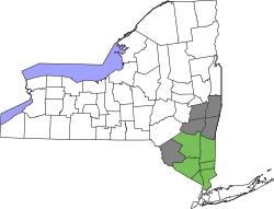
Greene County, New York

Last updated

Greene County
GreeneCountyCourtHouse.jpg
The Greene County Court House in Catskill, NY
GreeneCountyFlag.png
GreeneCountySeal.png
Map of New York highlighting Greene County.svg
Location within the U.S. state of New York
New York in United States.svg
New York's location within the U.S.
Coordinates: 42°17′N74°08′W / 42.29°N 74.13°W / 42.29; -74.13
CountryFlag of the United States.svg United States
StateFlag of New York.svg  New York
FoundedMarch 3, 1800
Named for Nathanael Greene
Seat Catskill
Largest villageCatskill
Area
  Total
658 sq mi (1,700 km2)
  Land647 sq mi (1,680 km2)
  Water11 sq mi (30 km2)  1.7%
Population
 (2020)
  Total
47,931 [1]
  Density74.1/sq mi (28.6/km2)
Time zone UTC−5 (Eastern)
  Summer (DST) UTC−4 (EDT)
Congressional district 19th
Website www.greenegovernment.com

Greene County is a county located in the U.S. state of New York. As of the 2020 census, the population was 47,931. [2] Its county seat is Catskill. [3] The county's name is in honor of the American Revolutionary War general Nathanael Greene. [4] The county is part of the Capital District region of the state.

Contents

History

Nathanael Greene, commander in the Southern Campaign of the Revolutionary War and namesake of Greene County. Nathanael Greene by John Trumbull 1792.jpeg
Nathanael Greene, commander in the Southern Campaign of the Revolutionary War and namesake of Greene County.

On March 25, 1800, Greene County was created by the partitioning of Albany (360 Square Miles) and Ulster (270 Square Miles) counties, producing a county of 630 square miles (1,600 km2). [5]

On April 3, 1801, 90 square miles (230 km2) of land was transferred from Delaware and Ulster counties, raising the total area to 720 square miles (1,900 km2). This transferred Prattsville, Vly Mountain, Halcott Center, Bushnellsville, Highmount, Shandaken, Lanesville, and Pine Hill within Greene County. [6]

On May 26, 1812, Greene County lost 20 square miles (52 km2) to Ulster County, lowering the total area to 690 square miles (1,800 km2), reassigning Pine Hill, Highmount, and Shandaken to Ulster County. [7]

On April 15, 1814, the county borders were re-surveyed, and the line adjusted with no change in area. [8]

On April 17, 1822, the border was again surveyed, with no change in area, but Palenville was found to be inside Greene County. [9]

On April 23, 1823, the border was again resurveyed, and the Hudson River border with Columbia County realigned accordingly. [10]

On March 3, 1836, 30 square miles (78 km2) of area was lost to Schoharie County, reducing the total area to 660 square miles (1,700 km2), and reassigning Manorkill, producing the Greene County that exists today. [11]

Geography

According to the U.S. Census Bureau, the county has a total area of 658 square miles (1,700 km2), of which 647 square miles (1,680 km2) is land and 11 square miles (28 km2) (1.7%) is water. [12] Greene County is located in southeast central New York State, just west of the Hudson River and south of Albany.

The northern and eastern regions are mostly low-lying flatlands. Along the Hudson River the lowest elevation is at sea level. The southern and western areas rise sharply into the Catskill Mountains.

Catskill Park takes up much of the south central region. The park contains some of the tallest peaks south of the Adirondacks. For example, the highest elevation is Hunter Mountain, at approximately 4,040 feet (1,230 m) above sea level; In addition, there are many picturesque waterfalls in the park such as the famed, Kaaterskill Falls.

The entirety of Greene County is in the 19th Congressional District, and is represented by Republican Marc Molinaro.

Adjacent counties

National protected area

Demographics

Kaaterskill High Peak from Upper Red Hook, NY.jpg
Kaaterskill High Peak in the Town of Hunter
Thomas Cole from Camel's Hump in winter.jpg
Thomas Cole Mountain in Greene County.
Historical population
CensusPop.Note
1800 12,584
1810 19,53655.2%
1820 22,99617.7%
1830 29,52528.4%
1840 30,4463.1%
1850 33,1268.8%
1860 31,930−3.6%
1870 31,832−0.3%
1880 32,6952.7%
1890 31,598−3.4%
1900 31,478−0.4%
1910 30,214−4.0%
1920 25,796−14.6%
1930 25,8080.0%
1940 27,9268.2%
1950 28,7452.9%
1960 31,3729.1%
1970 33,1365.6%
1980 40,86123.3%
1990 44,7399.5%
2000 48,1957.7%
2010 49,2212.1%
2020 47,931−2.6%
U.S. Decennial Census [13]
1790-1960 [14] 1900-1990 [15]
1990-2000 [16] 2010-2020 [2]
Kaaterskill Falls is in Greene County Kaaterskill Falls.jpg
Kaaterskill Falls is in Greene County

2020 Census

Greene County Racial Composition [17]
RaceNum.Perc.
White (NH)39,49482.4%
Black or African American (NH)2,1594.5%
Native American (NH)1000.21%
Asian (NH)5001.04%
Pacific Islander (NH)30.01%
Other/Mixed (NH)2,5665.4%
Hispanic or Latino 3,1096.5%

2000 census

As of the census [18] of 2000, there were 48,195 people, 18,256 households, and 12,067 families residing in the county. The population density was 74 inhabitants per square mile (29/km2). There were 26,544 housing units at an average density of 41 units per square mile (16/km2). The racial makeup of the county was 90.76% White, 5.53% Black or African American, 0.28% Native American, 0.54% Asian, 0.02% Pacific Islander, 1.52% from other races, and 1.36% from two or more races. 4.31% of the population were Hispanic or Latino of any race. 18.8% were of Irish, 17.8% Italian, 17.5% German, 8.6% American and 6.9% English ancestry according to Census 2000. 92.3% spoke English, 2.8% Spanish, 1.5% German and 1.3% Italian as their first language.

There were 18,256 households, out of which 29.2% had children under the age of 18 living with them, 51.2% were married couples living together, 10.3% had a female householder with no husband present, and 33.9% were non-families. 27.9% of all households were made up of individuals, and 12.2% had someone living alone who was 65 years of age or older. The average household size was 2.42 and the average family size was 2.97.

In the county, the population was spread out, with 23.00% under the age of 18, 9.5% from 18 to 24, 27.0% from 25 to 44, 24.8% from 45 to 64, and 15.7% who were 65 years of age or older. The median age was 39 years. For every 100 females there were 106.5 males. For every 100 females age 18 and over, there were 108.2 males.

The median income for a household in the county was $36,493, and the median income for a family was $43,854. Males had a median income of $35,598 versus $25,346 for females. The per capita income for the county was $18,931. About 8.6% of families and 12.2% of the population were below the poverty line, including 15.7% of those under age 18 and 10.4% of those age 65 or over.

As of the 2010 census, the racial makeup of the county was 90.3% White, 5.7% African American, 0.3% Native American and 0.8% Asian. Hispanic or Latino people of any race were 4.9% of the population. [19]

Politics

United States presidential election results for Greene County, New York [20]
Year Republican Democratic Third party(ies)
No.%No.%No.%
2024 14,70257.79%10,43641.02%3021.19%
2020 14,27156.64%10,34641.07%5772.29%
2016 13,07359.29%7,40533.58%1,5727.13%
2012 11,17454.06%9,03043.69%4642.25%
2008 12,05953.99%9,85044.10%4261.91%
2004 12,99658.02%8,93339.88%4692.09%
2000 11,33253.72%8,48040.20%1,2836.08%
1996 8,71243.29%8,25141.00%3,16115.71%
1992 9,39044.31%6,92432.67%4,87723.01%
1988 11,87461.46%7,26537.61%1800.93%
1984 14,15070.50%5,85829.19%620.31%
1980 11,28657.88%6,48833.28%1,7248.84%
1976 11,37059.02%7,74040.18%1540.80%
1972 14,31372.96%5,26026.81%450.23%
1968 10,95460.87%5,49930.56%1,5448.58%
1964 7,84243.82%10,03456.07%180.10%
1960 11,87864.84%6,44135.16%10.01%
1956 14,26278.91%3,81121.09%00.00%
1952 12,90774.07%4,50425.85%150.09%
1948 10,56666.52%4,95531.20%3622.28%
1944 9,80765.10%5,23134.73%260.17%
1940 10,15361.10%6,42538.67%380.23%
1936 9,06056.41%6,74441.99%2561.59%
1932 7,33451.43%6,79447.64%1330.93%
1928 9,52966.71%4,44031.08%3162.21%
1924 7,50361.56%3,95132.42%7346.02%
1920 6,32361.50%3,49834.02%4614.48%
1916 3,64949.06%3,62248.70%1672.25%
1912 2,71136.29%3,64748.82%1,11314.90%
1908 4,19150.42%3,71144.64%4114.94%
1904 4,52752.27%3,84544.39%2893.34%
1900 4,39549.32%4,26947.90%2482.78%
1896 4,54053.46%3,68843.43%2643.11%
1892 3,91447.63%3,77145.89%5326.47%
1888 4,46048.27%4,49448.64%2863.10%
1884 4,16747.56%4,15247.39%4425.05%

Greene County is considered a Republican stronghold. It was one of only eleven counties in New York that did not vote for Bill Clinton in 1996, a strong year for Democrats. It supported John McCain by a margin just under ten points in 2008 over Barack Obama, another Democratic year. In 2012, 54.1 percent of the county's voters chose Republican challenger Mitt Romney, and 43.7 percent chose Democratic incumbent Obama, despite it being again a Democratic year. In 2016, 59 percent of the county's voters chose Donald Trump while 34 percent chose Hillary Clinton. It has not supported a Democrat for president since 1964, and before that it previously did so in 1912.

In some elections, certain towns in Greene County have had a plurality that have voted Democratic, though the county remains very Republican.

Communities

Towns

Villages

Census-designated places

Hamlets

Notable people

See also

Related Research Articles

<span class="mw-page-title-main">Delaware County, New York</span> County in New York, United States

Delaware County is a county located in the US state of New York. As of the 2020 United States census, the population was 44,308. The county seat is Delhi. The county is named after the Delaware River, which was named in honor of Thomas West, 3rd Baron De La Warr, appointed governor of Virginia in 1609. The county is part of the Southern Tier region of the state.

<span class="mw-page-title-main">Ashland, Greene County, New York</span> Town in New York, United States

Ashland is a town in Greene County, New York, United States. The population was 682 in the 2020 US census, down from 784 in the 2010 census. Ashland is in the northwestern part of the county.

<span class="mw-page-title-main">Halcott, New York</span> Town in New York, United States

Halcott is a town in Greene County, New York, United States. The population was 249 in 2020, down from 258 at the 2010 census. The town is in the southwestern corner of the county.

<span class="mw-page-title-main">Lexington, New York</span> Town in New York, United States

Lexington is a town in Greene County, New York, United States. The population was 770 at the 2020 census. The town is in the southwestern part of Greene County.

<span class="mw-page-title-main">Prattsville (town), New York</span> Town in New York, United States

Prattsville is a town in Greene County, New York, United States. The town is in the northwestern part of the county. As of the 2020 census, the population was 774.

<span class="mw-page-title-main">Denning, New York</span> Town in New York, United States

Denning is an isolated town in Ulster County, New York, United States. The population was 493 at the 2020 census. The town is named after an early landowner, William Denning. Denning is located in the western part of the county, deep inside the Catskill Mountains. The location of the town in the Catskill State Park accounts in part for its low population.

<span class="mw-page-title-main">Olive, New York</span> Town in New York, United States

Olive is a town in Ulster County, New York, United States. The town is west of Kingston, New York, and is inside the Catskill Park. The population was 4,226 at the 2020 census.

<span class="mw-page-title-main">Shandaken, New York</span> Town in New York, United States

Shandaken is a town on the northern border of Ulster County, New York, United States, northwest of Kingston, New York. As of the 2020 census, the town had a total population of 2,866. The name is believed to be from an Esopus phrase for "land of rapid waters."

Cairo is a hamlet and census-designated place (CDP) in the town of Cairo in Greene County, New York, United States. The population of the CDP was 1,368 at the 2020 census, out of 6,644 people in the entire town.

<span class="mw-page-title-main">Cairo, New York</span> Town in New York, United States

Cairo is a town in Greene County, New York, United States. The population was 6,644 at the 2020 census. It is the third largest town in the county. The town is in the southern part of the county, partly in the Catskill Park. The town contains a hamlet, also named Cairo.

<span class="mw-page-title-main">Catskill (village), New York</span> Village in New York, United States

Catskill is a village and county seat of Greene County, New York, United States. The population was 3,745 at the 2020 census, down from 4,081 at the 2010 census, down from 4,392 in 2000. The village is in the northeastern part of the town of Catskill.

<span class="mw-page-title-main">Catskill (town), New York</span> Town in New York, United States

Catskill is a town in the southeastern section of Greene County, New York, United States. The population was 11,298 at the 2020 census, the largest town in the county. The western part of the town is in the Catskill Park. The town contains a village, also called Catskill. The village of Catskill has a well-defined Main Street. There is a public boat launch on the Hudson River called Dutchman's Landing.

Coxsackie is a village in Greene County, New York, United States. The population was 2,746 at the 2020 census.

<span class="mw-page-title-main">Coxsackie, New York</span> Town in New York, United States

Coxsackie is a town in Greene County, New York, United States. The population in the 2020 census was 8,382, a decrease from the 2010 census. It is the second-largest town in Greene County after Catskill. The name of the town is said to be derived from a Native American term, but it has various translations.

<span class="mw-page-title-main">Hunter (village), New York</span> Village in New York, United States

Hunter is a village in Greene County, New York, United States. The population was 429 at the 2020 census. The village is in the northwestern part of the town of Hunter on New York State Route 23A.

<span class="mw-page-title-main">Hunter, New York</span> Town in New York, United States

Hunter is a town located in Greene County, New York, United States. The population was 3,035 at the time of the 2020 census. The town contains two villages, one named Hunter on the west, and the second called Tannersville, as well as a number of hamlets such as Haines Falls, Platte Clove, Lanesville and Edgewood. Additionally, there are three residential parks location within town limits: Onteora Park, Twilight Park and Elka Park. The town is on the southern border of Greene County and abuts the towns of Woodstock and Saugerties, located in Ulster County.

<span class="mw-page-title-main">Windham (town), New York</span> Town in New York, United States

Windham is a town in Greene County, New York, United States. The population was 1,708 at the 2020 census. The town was probably named for the town or county of Windham, Connecticut, as many of its earliest settlers came from that state as well as other parts of New England. The town has two nicknames: "Land in the Sky" and "Gem of the Catskills".

<span class="mw-page-title-main">New York State Route 23A</span> State highway in Greene County, New York, US

New York State Route 23A (NY 23A) is an east–west state highway in Greene County, New York, in the United States. It serves as a 34.56-mile (55.62 km) alternate route of NY 23 through the northern Catskill Mountains. The route passes several of the Catskill High Peaks, including Hunter Mountain, before dropping into the Hudson Valley via Kaaterskill Clove and ending at an intersection with U.S. Route 9W (US 9W) in the village of Catskill. NY 23A was assigned in the mid-1920s and has not been changed since. A portion of the route through Kaaterskill Clove was closed for several months in 2006 after landslides triggered by heavy rains damaged the route.

Prattsville is a hamlet and census-designated place (CDP) in the town of Prattsville, Greene County, New York, United States. The population of the CDP was 384 at the 2020 census, out of a total population of 774 in the town in 2020.

<span class="mw-page-title-main">Batavia Kill (Schoharie Creek tributary)</span> River in New York, United States

Batavia Kill is a 21-mile-long (34 km) tributary of Schoharie Creek, that flows across the towns of Windham, Ashland and Prattsville in the U.S. state of New York. Its waters reach the Hudson River via Schoharie Creek and the Mohawk River. Since it drains into the Schoharie upstream of Schoharie Reservoir, it is part of the New York City water supply system. From the source to Maplecrest, Batavia Kill drains the northern slopes of the Blackhead Mountains, which include Thomas Cole Mountain, Black Dome, and Blackhead Mountain, the fourth-, third-, and fifth-highest peaks in the Catskills, respectively.

References

  1. "US Census 2020 Population Dataset Tables for New York". United States Census Bureau. Retrieved January 2, 2022.
  2. 1 2 "U.S. Census Bureau QuickFacts: Greene County, New York". United States Census Bureau. Retrieved January 3, 2022.
  3. "Find a County". National Association of Counties. Archived from the original on May 31, 2011. Retrieved June 7, 2011.
  4. Gannett, Henry (1905). The Origin of Certain Place Names in the United States. Govt. Print. Off. p. 143.
  5. New York. Laws of New York., 1800, 23rd Session, Chapter 51; Page 493
  6. New York. Laws of New York., 1801, 24th Session, Chapter 123, Page 290.
  7. New York. Laws of New York.1812, 35th Session, Chapter 46, Page 382.
  8. New York. Laws of New York.1814, 37th Session, Chapter 211, Page 275.
  9. New York. Laws of New York.1822, 45th Session, Chapter 243, Page 257.
  10. New York. Laws of New York.1823, 46th Session, Chapter 251, Page 377.
  11. New York. Laws of New York.1836, 59th Session, Chapter 31, Page 33.
  12. "2010 Census Gazetteer Files". United States Census Bureau. August 22, 2012. Archived from the original on May 19, 2014. Retrieved January 4, 2015.
  13. "U.S. Decennial Census". United States Census Bureau. Retrieved January 4, 2015.
  14. "Historical Census Browser". University of Virginia Library. Archived from the original on August 11, 2012. Retrieved January 4, 2015.
  15. "Population of Counties by Decennial Census: 1900 to 1990". United States Census Bureau. Archived from the original on February 19, 2015. Retrieved January 4, 2015.
  16. "Census 2000 PHC-T-4. Ranking Tables for Counties: 1990 and 2000" (PDF). United States Census Bureau. Archived (PDF) from the original on December 18, 2014. Retrieved January 4, 2015.
  17. "P2 HISPANIC OR LATINO, AND NOT HISPANIC OR LATINO BY RACE – 2020: DEC Redistricting Data (PL 94-171) – Greene County, New York".
  18. "U.S. Census website". United States Census Bureau . Retrieved January 31, 2008.
  19. American Fact Finder, U.S. Census, 2010, Greene County, New York, https://factfinder.census.gov/faces/tableservices/jsf/pages/productview.xhtml?src=CF Archived June 11, 2013, at the Wayback Machine Archived April 11, 2015, at the Wayback Machine
  20. Leip, David. "Dave Leip's Atlas of U.S. Presidential Elections". uselectionatlas.org. Archived from the original on March 23, 2018. Retrieved May 1, 2018.
  21. Who Was Who in America, Historical Volume, 1607-1896. Chicago: Marquis Who's Who. 1963.

Further reading

42°17′N74°08′W / 42.29°N 74.13°W / 42.29; -74.13