Hunter, New York

Last updated

Hunter, New York
Mary on the Mountain.jpg
Mary of the Mountain Church in Hunter
Greene County NY Hunter town highlighted.svg
Location in Greene County and the state of New York.
New York in United States (US48).svg
Location of New York in the United States
Coordinates: 42°12′31″N74°12′50″W / 42.20861°N 74.21389°W / 42.20861; -74.21389
CountryUnited States
State New York
County Greene
Government
   Town supervisor Sean Mahoney
   Town council
Members
  • Dolph J. Semenza
  • David Kukle
  • Raymond W. Legg
  • Ernest Reale
Area
[1]
  Total90.21 sq mi (233.65 km2)
  Land89.89 sq mi (232.82 km2)
  Water0.32 sq mi (0.83 km2)
Population
 (2020)
  Total3,035
Time zone UTC-5 (EST)
  Summer (DST) UTC-4 (EDT)
ZIP code
12442
Area code 518
FIPS code 36-039-36178

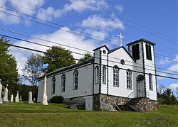
Hunter is a town located in Greene County, New York, United States. The population was 3,035 at the time of the 2020 census. [2] [3] The town contains two villages, one named Hunter on the west, and the second called Tannersville, as well as a number of hamlets such as Haines Falls, Platte Clove, Lanesville and Edgewood. Additionally, there are three residential parks location within town limits: Onteora Park, Twilight Park and Elka Park. The town is on the southern border of Greene County and abuts the towns of Woodstock and Saugerties, located in Ulster County.

Contents

History

Haines Falls Railroad Station ca. 1900 Haines corners station.jpg
Haines Falls Railroad Station ca. 1900

The town was formed on January 27, 1813 from the town of Windham, but was then called "Edwardsville". The name of "Hunter" was assumed in 1814, named after John Hunter. [4] Afterwards, the town lost some territory to Saugerties in 1814 and to Jewett in 1849.

The area became a popular tourism destination in the late 19th and early 20th centuries. It was served by the Ulster and Delaware Railroad, which brought tourists to resort towns throughout the Catskill Mountains.

Geography

Perspective map and list of landmarks published in 1890 by L.R Burleigh Hunter, N.Y. LOC 75694784.jpg
Perspective map and list of landmarks published in 1890 by L.R Burleigh

According to the United States Census Bureau, the town has a total area of 90.7 square miles (235.0 km2), of which 90.4 square miles (234.3 km2) is land and 0.3 square miles (0.7 km2, or 0.31%) is water.

The southern town line and part of the eastern town boundary are the border of Ulster County. The town is in the Catskill Mountains and the Catskill Park. Many of the Catskill High Peaks, including Hunter Mountain, a 4040 foot mountain that is the highest in the county and the second-highest in the Catskills (after Slade Mountain), are in the town.

Demographics

Historical population
CensusPop.Note
1820 1,025
1830 1,96091.2%
1840 2,0193.0%
1850 1,849−8.4%
1860 1,698−8.2%
1870 1,524−10.2%
1880 1,88223.5%
1890 2,43629.4%
1900 2,78814.4%
1910 2,699−3.2%
1920 2,309−14.4%
1930 2,299−0.4%
1940 2,166−5.8%
1950 2,028−6.4%
1960 1,799−11.3%
1970 1,742−3.2%
1980 2,25229.3%
1990 2,116−6.0%
2000 2,72128.6%
2010 2,7320.4%
2020 3,03511.1%
U.S. Decennial Census [5] [6]

As of the census [7] of 2000, there were 2,721 people, 1,074 households, and 644 families residing in the town. The population density was 30.1 inhabitants per square mile (11.6/km2). There were 2,840 housing units at an average density of 31.4 per square mile (12.1/km2). The racial makeup of the town was 96.95% White, 0.59% Black or African American, 0.11% Native American, 0.15% Asian, 0.04% Pacific Islander, 0.33% from other races, and 1.84% from two or more races. Hispanic or Latino of any race were 2.09% of the population.

There were 1,074 households, out of which 26.6% had children under the age of 18 living with them, 43.8% were married couples living together, 10.1% had a female householder with no husband present, and 40.0% were non-families. 34.2% of all households were made up of individuals, and 12.5% had someone living alone who was 65 years of age or older. The average household size was 2.25 and the average family size was 2.88.

In the town, the population was spread out, with 26.2% under the age of 18, 6.0% from 18 to 24, 23.8% from 25 to 44, 27.9% from 45 to 64, and 16.2% who were 65 years of age or older. The median age was 41 years. For every 100 females, there were 102.8 males. For every 100 females age 18 and over, there were 101.8 males.

The median income for a household in the town was $33,382, and the median income for a family was $42,200. Males had a median income of $35,532 versus $22,188 for females. The per capita income for the town was $18,496. About 11.1% of families and 19.5% of the population were below the poverty line, including 24.0% of those under age 18 and 16.5% of those age 65 or over.

Communities and locations in the town of Hunter

Points of interest

Notable people

Related Research Articles

<span class="mw-page-title-main">Greene County, New York</span> County in New York, United States

Greene County is a county located in the U.S. state of New York. As of the 2020 census, the population was 47,931. Its county seat is Catskill. The county's name is in honor of the American Revolutionary War general Nathanael Greene.

<span class="mw-page-title-main">Roxbury, New York</span> Town in New York, United States

Roxbury is a town in Delaware County, New York, United States. The population was 2,247 at the 2020 census. The town is at the eastern end of the county.

<span class="mw-page-title-main">Halcott, New York</span> Town in New York, United States

Halcott is a town in Greene County, New York, United States. The population was 249 in 2020, down from 258 at the 2010 census. The town is in the southwestern corner of the county.

<span class="mw-page-title-main">Jewett, New York</span> Town in New York, United States

Jewett is a town centrally located in Greene County, New York, United States. The population was 879 at the 2020 census. The town is named for Freeborn G. Jewett, justice of the New York Supreme Court.

<span class="mw-page-title-main">Lexington, New York</span> Town in New York, United States

Lexington is a town in Greene County, New York, United States. The population was 770 at the 2020 census. The town is in the southwestern part of Greene County.

<span class="mw-page-title-main">Prattsville (town), New York</span> Town in New York, United States

Prattsville is a town in Greene County, New York, United States. The town is in the northwestern part of the county. As of the 2020 census, the population was 774.

Tannersville is a village in Greene County, New York, United States. The village is in the north-central part of the town of Hunter on Route 23A. The population was 568 at the 2020 census.

<span class="mw-page-title-main">Berlin, New York</span> Town in New York, United States

Berlin is a town in Rensselaer County, New York, United States. The population was 1,880 at the 2010 census. The town is named after Berlin in Germany, although natives pronounce the name differently, with the accent on the first syllable.

<span class="mw-page-title-main">Hoosick, New York</span> Town in New York, United States

Hoosick is a town in Rensselaer County, New York, United States. The population was 6,711 at the 2020 census. It was named from the Hoosic River.

<span class="mw-page-title-main">Lumberland, New York</span> Town in New York, United States

Lumberland is a town in Sullivan County, New York, United States. The population was 2,243 at the 2020 census.

<span class="mw-page-title-main">Denning, New York</span> Town in New York, United States

Denning is an isolated town in Ulster County, New York, United States. The population was 493 at the 2020 census. The town is named after an early landowner, William Denning. Denning is located in the western part of the county, deep inside the Catskill Mountains. The location of the town in the Catskill State Park accounts in part for its low population.

<span class="mw-page-title-main">Olive, New York</span> Town in New York, United States

Olive is a town in Ulster County, New York, United States. The town is west of Kingston, New York and is inside the Catskill Park. The population was 4,226 at the 2020 census.

<span class="mw-page-title-main">Rochester, Ulster County, New York</span> Town in New York, United States

Rochester is a town in Ulster County, New York, United States. The population was 7,272 at the 2020 census. It is an interior town located near the center of Ulster County. The northwestern part of the town is in the Catskill Park.

<span class="mw-page-title-main">Wawarsing, New York</span> Town in New York, United States

Wawarsing is a town in Ulster County, New York, United States. The population was 12,771 at the 2020 census. The name Wawarsing was once believed to mean "a place where the streams wind" in the Lenape language, referring to the geography in the hamlet of Wawarsing. Specifically, the joining of the Ver Nooy Kill and the Rondout Creek at Port Ben. The name Wawarsing was used by the Lenape to designate the current hamlet and the fields to the north and south of it for at least six miles in both directions. It is the only Lenape name known to refer to an exact location in Ulster County.

<span class="mw-page-title-main">Johnsburg, New York</span> Town in New York, United States

Johnsburg is a town in the northwestern corner of Warren County, New York, United States. It is part of the Glens Falls Metropolitan Statistical Area. The town population was 2,143 at the 2020 census. The town is named after John Thurman, an early settler and founder. Johnsburg is the largest town in Warren County by area.

Andes is a town in Delaware County, New York, United States. The population was 1,114 at the 2020 census.

Greenville is a hamlet and census-designated place (CDP) in the town of Greenville, in Greene County, New York, United States. The population of the CDP was 688 at the 2020 census,out of a total 3,741 people in the town as a whole.

<span class="mw-page-title-main">Hunter (village), New York</span> Village in New York, United States

Hunter is a village in Greene County, New York, United States. The population was 429 at the 2020 census. The village is in the northwestern part of the town of Hunter on New York State Route 23A.

<span class="mw-page-title-main">Windham (town), New York</span> Town in New York, United States

Windham is a town in Greene County, New York, United States. The population was 1,708 at the 2020 census. The town was probably named for the town or county of Windham, Connecticut, as many of its earliest settlers came from that state as well as other parts of New England. The town has two nicknames: "Land in the Sky" and "Gem of the Catskills".

Cape Vincent is a town in Jefferson County, New York, United States. The population was 2,765 at the 2020 census.

References

  1. "2016 U.S. Gazetteer Files". United States Census Bureau. Retrieved July 5, 2017.
  2. "Geographic Identifiers: 2010 Demographic Profile Data (G001): Hunter town, Greene County, New York". American Factfinder. U.S. Census Bureau. Retrieved December 29, 2016.[ dead link ]
  3. U.S. Census Bureau, 2020 census results. https://www.census.gov/search-results.html?searchType=web&cssp=SERP&q=Hunter%20town,%20Greene%20County,%20New%20York
  4. Eno, Joel (1916). "A tercentennial history of the towns and cities of New York; their origin, dates and names 1614-1914". Proceedings of the New York State Historical Association. 15 via JSTOR.
  5. "Census of Population and Housing". Census.gov. Retrieved June 4, 2015.
  6. U.S. Census Bureau, 2020 census results. https://www.census.gov/search-results.html?searchType=web&cssp=SERP&q=Hunter%20town,%20Greene%20County,%20New%20York
  7. "U.S. Census website". United States Census Bureau . Retrieved January 31, 2008.
  8. "Official website of Camp Loyaltown". Archived from the original on March 16, 2013. Retrieved May 8, 2013.