Niskayuna, New York

Last updated

Niskayuna, New York
Niskayuna Town Hall.JPG
Niskayuna town hall
Schenectady County New York incorporated and unincorporated areas Niskayuna highlighted.svg
Location in Schenectady County and the state of New York
USA New York location map.svg
Red pog.svg
Niskayuna, New York
Usa edcp location map.svg
Red pog.svg
Niskayuna, New York
Coordinates: 42°48′1″N73°52′51″W / 42.80028°N 73.88083°W / 42.80028; -73.88083
CountryUnited States
State New York
County Schenectady
Government
  Type Town board
  Town SupervisorJaime Puccioni
Area
[1]
  Total15.04 sq mi (38.95 km2)
  Land14.15 sq mi (36.65 km2)
  Water0.89 sq mi (2.31 km2)
Elevation
404 ft (123 m)
Population
 (2020)
  Total23,278
  Density1,645.09/sq mi (635.14/km2)
Time zone UTC-5 (Eastern (EST))
  Summer (DST) UTC-4 (EDT)
ZIP code
12309
Area code 518
FIPS code 36-51264
GNIS feature ID0979279
Website www.niskayuna.org

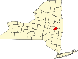
Niskayuna is a town in Schenectady County, New York, United States. The population was 23,278 at the 2020 census. [2] The town is located in the southeast part of the county, east of the city of Schenectady, and is the easternmost town in the county.

Contents

History

The Town of Niskayuna was created on March 7, 1809, from the town of Watervliet, with an initial population of 681. The town's name was derived from early patents to Dutch settlers: Nis-ti-go-wo-ne or Co-nis-tig-i-one, both derived from the Mohawk language. The 19th-century historians Howell and Munsell mistakenly identified Conistigione as an Indian tribe, but they were a band of Mohawk people known by the term for this location. The original meaning of the words translate roughly as "extensive corn flats", as the Mohawk for centuries cultivated maize fields in the fertile bottomlands along today's Mohawk River. [3] They were the easternmost of the Five Nations of the Iroquois Confederacy.

Among the Mohawk chiefs who lived in the area were Ron-warrigh-woh-go-wa (meaning in English the great fault finder or grumbler), Ka-na-da-rokh-go-wa (a great eater), Ro-ya-na (a chief), As-sa-ve-go (big knife), and A-voon-ta-go-wa (big tree). Of these, Ron-warrigh-woh-go-wa strongly objected to selling communal lands to the whites. He ensured that the Mohawk retained the rights of hunting and fishing on lands they deeded to the Dutch and other whites. He was reported to have said that "after the whites had taken possession of our lands, they will make Kaut-sore [literally spoon-food or soup] of our bodies." He generally aided the settlers during the mid-18th century against the Canadians in the French and Indian War, the North American front of the Seven Years' War. [4]

L to R: Governor David Paterson in Niskayuna with town Supervisor Landry and Senator Chuck Schumer at microphone, c. 2000s SchumerPatersonLandryNiskayuna.jpg
L to R: Governor David Paterson in Niskayuna with town Supervisor Landry and Senator Chuck Schumer at microphone, c.2000s

The first European settlers of the town were Dutch colonists who chose to locate outside the manor of Rensselaerwyck to avoid the oversight of the patroons and the trading government of New Netherland. Harmon Vedder obtained a patent for some land in 1664, soon after the founders in 1661 gained land in what developed as the village and city of Schenectady. [5] The traders of Fort Orange retained their monopoly, forbidding the settlers in the Schenectady area from fur trading. They developed mostly as farmers.

Among the early settlers were the ethnic Dutch Van Brookhoven, Claase, Clute, Consaul, Groot, Jansen, Krieger (Cregier), Pearse, Tymerson, Vedder, Van Vranken, and Vrooman families. Captain Martin Cregier, the first burgomaster of New Amsterdam, later settled in Niskayuna; he died in 1712. [5]

Following the Revolutionary War, Yankee settlers entered New York, settling in the Mohawk Valley and to the west. The Erie Canal of 1825 and later enlargements brought increased traffic and trade through the valley. During the 19th and 20th centuries, industries developed along the Mohawk River, especially concentrated in Schenectady in this county. Farming continued in outlying areas. The headquarters of General Electric and Westinghouse Electric developed in the city of Schenectady, which became a center of broad-reaching innovation in uses of electricity and a variety of consumer products.[ citation needed ]

After World War II, the Knolls Atomic Power Laboratory was opened in 1946 in Niskayuna, under a contract between General Electric and the US government. In 1973, the General Electric Engineering Development Center moved from downtown Schenectady to River Road in Niskayuna. Today, it is one of the two world headquarters of GE Global Research with the other in Bangalore, India. Due to high-level scientific and technological jobs associated with these businesses, Niskayuna has a high level of education among its residents and a high per capita income of towns in the capital area.

The following sites in the town are listed on the National Register of Historic Places: [6] George Westinghouse Jones House, Niskayuna Railroad Station, Niskayuna Reformed Church, and Rosendale Common School.

Geography

The northern and eastern town lines are defined by the Mohawk River with Saratoga County, New York, on the opposite bank. The south town line is the town of Colonie in Albany County. Lock 7 of the Erie Canal is located in the town. The town is bordered by the city of Schenectady to the west.

According to the United States Census Bureau, the town has a total area of 15.1 square miles (39.0 km2), of which 14.2 square miles (36.7 km2) is land and 0.89 square miles (2.3 km2), or 5.92%, is water. [7]

Niskayuna previously received the designation of Tree City USA, [8] though it is not listed on the current Tree City USA roster. [9]

Demographics

Historical population
CensusPop.Note
1820 516
1830 446−13.6%
1840 69355.4%
1850 78313.0%
1860 7890.8%
1870 1,10540.1%
1880 990−10.4%
1890 1,0405.1%
1900 1,32727.6%
1910 1,90743.7%
1920 3,14965.1%
1930 4,93156.6%
1940 6,34828.7%
1950 9,44248.7%
1960 14,03248.6%
1970 17,87927.4%
1980 17,471−2.3%
1990 19,0489.0%
2000 20,2956.5%
2010 21,7817.3%
2020 23,2786.9%
U.S. Decennial Census [10]

As of the census [11] of 2020, there were 23,278 people, 7,285 single family homes,1,415 apartments, and a small number of town houses and condominiums. The population density was 1,438.3 inhabitants per square mile (555.3/km2). There were 8,046 housing units at an average density of 570.2 per square mile (220.2/km2). The town's population was 51.7% female and 48.3% male. The racial makeup of the town was 90.7% White, 6.0% Asian, 1.9% African-American, and 1.6% "Other." [12]

There were 7,787 households, out of which 36.2%[ citation needed ] had children under the age of 18 living with them, 64.2% were married couples living together, 7.6% had a female householder with no husband present, and 25.6% were non-families. 22.1% of all households were made up of individuals, and 11.5% had someone living alone who was 65 years of age or older. The average household size was 2.56 and the average family size was 3.02.

In the town, the population was spread out, with 26.1% under the age of 18, 4.2% from 18 to 24, 25.4% from 25 to 44, 27.1% from 45 to 64, and 17.1% who were 65 years of age or older. The median age was 42 years. For every 100 females, there were 93.3 males. For every 100 females age 18 and over, there were 87.8 males.

The median income for a household in the town was $93,800, and the median income for a family was $94,539. Males had a median income of $59,738 versus $39,692 for females. The per capita income for the town was $33,257. The Town has many residents who commute about fifteen miles to work in Albany, the capital of New York State.[ citation needed ]

Niska Day

Since 1980, the annual community holiday "Niska-Day" (or Nisky-Day) is traditionally celebrated on the first Saturday after the third Friday in May. The festival begins in the early morning with a family foot race. This is followed by a parade and a fair. The day concludes with fireworks (weather permitting). Community groups pick a new theme each year (e.g., in 2007: "Niska-unity"). The town has the goal of bringing the families together for a celebration to help them recognize and appreciate their shared identity as residents of the town of Niskayuna. It takes place at the Craig Elementary School soccer fields. [13]

The celebration was established in 1980 by the Niskayuna Community Action Program (N-CAP), responding to a school district report on mental health needs, to reinforce shared community identification. Unlike many municipalities, the town of Niskayuna does not sponsor an official observation of the Fourth of July. [14] "Niska-Day" serves as the local substitute. [15]

Communities and locations

Notable people

Literary references

Herman Melville, in his novel Moby Dick, refers to a sailor on the ship Jeroboam who, according to a story relayed by Stubb, the second mate on the Pequod, "had been originally nurtured among the crazy society of Neskyeuna Shakers, where he had been a great prophet.”

Niskayuna appears in a driving montage in The Simpsons episode "D'oh Canada." [26]

Notes

  1. "2016 U.S. Gazetteer Files". United States Census Bureau. Retrieved July 5, 2017.
  2. "Profile of General Population and Housing Characteristics: 2010 Demographic Profile Data (DP-1): Niskayuna town, Schenectady County, New York". United States Census Bureau . Retrieved July 3, 2012.
  3. Horatio Gates Spafford, LL.D. A Gazetteer of the State of New-York, Embracing an Ample Survey and Description of Its Counties, Towns, Cities, Villages, Canals, Mountains, Lakes, Rivers, Creeks and Natural Topography. Arranged in One Series, Alphabetically: With an Appendix… (1824), at Schenectady Digital History Archives, selected extracts, accessed 28 December 2014
  4. George Rogers Howell and John H. Munsell (1886). "History of the Township of Niskayuna". History of the County of Schenectady, N.Y., from 1662 to 1886. New York City, NY: W.W. Munsell.
  5. 1 2 Austin A. Yates (1902). "Towns of the County". Schenectady County, New York: Its History to the Close of the Nineteenth Century. New York History Company., selected chapters available online
  6. "National Register Information System". National Register of Historic Places . National Park Service. March 13, 2009.
  7. "Geographic Identifiers: 2010 Demographic Profile Data (G001): Niskayuna town, Schenectady County, New York". United States Census Bureau . Retrieved July 3, 2012.
  8. "Tree City USA, NY Department of Environmental Conservation".
  9. "Arbor Day Foundation listing of current "Tree City USA" winners".
  10. "Census of Population and Housing". Census.gov. Retrieved June 4, 2015.
  11. "U.S. Census website". United States Census Bureau . Retrieved January 31, 2008.
  12. "Archived copy". Archived from the original on October 7, 2003. Retrieved March 15, 2006.{{cite web}}: CS1 maint: archived copy as title (link)
  13. "The History of Niska-Day" . Retrieved May 21, 2009.
  14. "Website for the Town of Niskayuna" . Retrieved May 21, 2009.
  15. "It's not the Fourth of July yet...it's Niska-Day!". Spotlight News. Retrieved May 21, 2009.
  16. Nash, Indiana (June 22, 2017). "Q&A with Brian Chesky: Co-founder of Airbnb and Nisky grad class of '99". Daily Gazette. Retrieved June 30, 2021.
  17. Rightmyer, Jack (August 22, 2019). "Niskayuna's Kate Fagan walked away from ESPN to focus on family". Times Union. Retrieved April 28, 2021.
  18. Buell, Bill (October 6, 2013). "Niskayuna's Ivar Giaever recalls the morning he got word of winning the Nobel Prize". Daily Gazette. Retrieved April 28, 2021.
  19. "[Da:인터뷰①] '기린즈' 이가은×허윤진 "미래 알 수 없지만 같이 데뷔하길"".
  20. ""The Phantom of the Opera" at Niskayuna High School". February 16, 2017.
  21. Haymes, Greg (September 6, 2013). "STEVE KATZ REMEMBERS "TEENAGE BARN"". Nippertown. Retrieved April 28, 2021.
  22. Bump, Bethany (April 17, 2013). "graduate wins Pulitzer Prize". Daily Gazette. Retrieved April 28, 2021.
  23. "Review: Dirty Honey, led by Niskayuna native's powerful vocals, impresses in SPAC performance". dailygazette.com. September 15, 2021. Retrieved December 6, 2021.
  24. Molloy, Tim (June 24, 1998). "Actress Maureen O'Sullivan Dies". Associated Press. Retrieved April 22, 2021.
  25. Campbell, Jon (January 13, 2021). "Andrew Yang is running for New York City mayor. His roots are in the Hudson Valley". Lohud. Retrieved April 22, 2021.
  26. "Niskayuna and Upstate-NY makes the Simpsons just not in a woohoo kind of way". April 28, 2019. Retrieved May 29, 2020.

Related Research Articles

<span class="mw-page-title-main">Albany County, New York</span> County in New York, United States

Albany County is a county in the state of New York, United States. Its northern border is formed by the Mohawk River, at its confluence with the Hudson River, which is to the east. As of the 2020 United States Census, the population was 314,848. The county seat and largest city is Albany, which is also the state capital of New York. As originally established by the English government in the colonial era, Albany County had an indefinite amount of land, but has had an area of 530 square miles (1,400 km2) since March 3, 1888. The county is named for the Duke of York and of Albany, who became James II of England.

<span class="mw-page-title-main">Schenectady, New York</span> City in New York, United States

Schenectady is a city in Schenectady County, New York, United States, of which it is the county seat. As of the 2020 census, the city's population of 67,047 made it the state's ninth-most populous city and the twenty-fifth most-populous municipality. The city is in eastern New York, near the confluence of the Mohawk and Hudson rivers. It is in the same metropolitan area as the state capital, Albany, which is about 15 miles (24 km) southeast.

<span class="mw-page-title-main">Schenectady County, New York</span> County in New York, United States

Schenectady County is a county in the U.S. state of New York. As of the 2020 census, the population was 158,061. The county seat is Schenectady. The name is from a Mohawk language word meaning "on the other side of the pine lands," a term that originally applied to Albany.

<span class="mw-page-title-main">Clifton Park, New York</span> Town in New York, United States

Clifton Park is a suburban town in Saratoga County, New York, United States. According to the United States Census Bureau, the 2020 population was 38,029. The name is derived from an early land patent. The town is in the southern part of Saratoga County, approximately 12 miles (19 km) north of Albany, 7 miles (11 km) northeast of Schenectady, and 10 miles (16 km) south of Saratoga Springs.

<span class="mw-page-title-main">Glenville, New York</span> Town in New York, United States

Glenville is a town in Schenectady County, New York, United States. It was incorporated in 1821 from Schenectady. As of the 2020 census, the town population was 29,326.

<span class="mw-page-title-main">Colonie, New York</span> Town in New York, United States

Colonie is a town in Albany County, New York, United States. It is the most-populous suburb of Albany, and is the third-largest town in area in Albany County, occupying approximately 11% of the county. Several hamlets exist within the town. As of the 2020 census, the town had a total population of 85,590.

<span class="mw-page-title-main">Rotterdam, New York</span> Town in New York, United States

Rotterdam is a town in Schenectady County, New York, United States. The population was 30,523 at the 2020 census.

Rexford is a hamlet in Saratoga County, New York, United States, located on the north bank of the Mohawk River. Rexford is in the Town of Clifton Park, near the southwestern town line. Its boundaries, like those of neighboring Alplaus, are unofficial and necessarily ambiguous. To the south, it is bounded by the Mohawk River and Grooms Road and to the west, Alplaus and the Schenectady County line. Route 146 and Vischer's Ferry Road, are probably a reasonable delineations of its northern and eastern boundaries. The ZIP Code is 12148.

Boght Corners is a hamlet in the town of Colonie in northern Albany County, New York, United States, that straddles U.S. Route 9. The corners that give the hamlet its name are found at the intersection of Route 9 and Boght Road, near the Boght Community Fire District's station. The community is served by the North Colonie Central School District. Boght Hills Elementary School is located within the hamlet.

Verdoy, formerly known as Watervliet Center, is a hamlet of the town of Colonie in Albany County, New York, United States. Much of Verdoy is in the Airport Noise Overlay District due to its immediate proximity to Albany International Airport's main north/south runway, which was recently extended by 1,300 feet to the north, moving it even closer to Verdoy. The former Troy & Schenectady Branch of the New York Central Railroad runs along Verdoy's northern border with the Mohawk River; it is now part of the Mohawk Hudson Hike/Bike Trail.

<span class="mw-page-title-main">New York State Route 146</span> State highway in New York, US

New York State Route 146 (NY 146) is a state highway in the Capital District of New York in the United States. It extends for 43 miles (69 km) from Gallupville at NY 443 to near Mechanicville at U.S. Route 4 (US 4) and NY 32. NY 146 is a major thoroughfare in the city of Schenectady, just outside Albany. Most of the route follows an east–west alignment; however, the middle third of the route between Guilderland and Clifton Park runs in a more north–south manner in order to serve Schenectady. At one time, NY 146 had three spur routes; only one—NY 146A—still exists.

<span class="mw-page-title-main">New York State Route 914T</span> State highway in Schenectady County, New York, US

New York State Route 914T (NY 914T) is an unsigned reference route designation for the portion of Balltown Road south of Union Street in Schenectady, New York, in the United States. The route is a short two-lane highway just east of the city limits, running from NY 5 to its intersection with Union Street where NY 146 meets. East of Balltown Road, Union Street is maintained by the New York State Department of Transportation as unsigned NY 911G; however, there are no markers to this effect. Balltown Road is nearly north–south with very few turns. It eventually reaches the town of Ballston in Saratoga County.

Central Avenue, in Albany, New York, is an 18 km stretch in Albany County, of the 26 km Albany-Schenectady Turnpike, which runs from Lark Street in the city of Albany, westward through the towns of Colonie, New York and Niskayuna, New York, to the city of Schenectady, New York. In the city of Albany it is called Central Avenue, in Colonie it is known as Central Avenue or Albany Schenectady Road, and in Schenectady County it is called State Street. The entire route is also called Route 5.

The Niskayuna Central School District is a public school district located in Niskayuna, New York. It has a total enrollment of 4,312 students in grades K–12 in 8 schools. The district superintendent was Susan Kay Salvaggio until 2014. After that, Dr. Cosimo Tangorra became the superintendent and is the current superintendent. Then Until Salvaggio was superintendent Kevin. S. Baughman held the prestigious note of being the second-highest school administrator in the State of NY, making over $200,000, nearly double the salary of the Governor. The district primarily serves the Town of Niskayuna, but also covers a small section of the Town of Colonie, the Alplaus area of the Town of Glenville and the Rexford area of the Town of Clifton Park, both north of the Mohawk River.

<span class="mw-page-title-main">Mohawk-Hudson Bike-Hike Trail</span>

The Mohawk-Hudson Bike-Hike Trail (MHBHT) is a 97-mile (156 km) trail in New York's Mohawk Valley and Capital District regions. It is also the easternmost segment of the Erie Canalway Trail, as well as a portion of the Empire State Trail.

Watervliet was a town that at its height encompassed most of present-day Albany County and most of the current town of Niskayuna in neighboring Schenectady County, in the state of New York, United States. Just prior to its dissolution, the town encompassed the current towns of Colonie and Green Island and the city of Watervliet.

Lisha Kill is a hamlet in the town of Colonie, Albany County, New York, United States. Lisha Kill lies on New York Route 5 in the western section of the town. The hamlet received its name from the creek of the same name, Lisha Kill, kill being Dutch for creek or stream. The stream is also referred to as Lisha's Kill and received its name from a local legend about a Native American woman who is buried along its banks.

<span class="mw-page-title-main">Niska Isle</span>

Niska Isle, despite its name, is not an island, but a peninsula in the town of Niskayuna, New York. Niska Isle is along the Mohawk River's south shore, with a back bay and swamp that surrounds it to the south.

Mohawk River State Park is a 105-acre (0.42 km2) undeveloped state park in the town of Niskayuna in Schenectady County, New York. The park is located adjacent to the Mohawk River.

<span class="mw-page-title-main">Aqueduct, New York</span> Hamlet in Niskayuna, Schenectady County, New York

Aqueduct is a hamlet in the Town of Niskayuna, Schenectady County, New York, United States. Its center is at the south end of the bridge of New York State Route 146 over the Mohawk River, that connects Schenectady County to the south and Saratoga County to the north. It was formerly a transportation hub. Alexander's Bridge across the Mohawk antedated the Aqueduct. A new Route 146 steel highway bridge, with board pavement, parallel to the Aqueduct was built in the early 20th century. A Schenectady trolley line ended there, the line also serving Luna Park, just over the river in Rexford. There was, in Aqueduct, a staffed station of the Troy & Schenectady Railroad, which operated from 1841 to 1932.