Related Research Articles

Arthur Kill is a tidal strait between Staten Island, a borough of New York City, and Union and Middlesex counties in New Jersey in the United States. It is a major navigational channel of the Port of New York and New Jersey.

The Catskill Mountains, also known as the Catskills, are a physiographic province of the larger Appalachian Mountains, located in southeastern New York. As a cultural and geographic region, the Catskills are generally defined as those areas close to or within the borders of the Catskill Park, a 700,000-acre (2,800 km2) forest preserve forever protected from many forms of development under New York state law.

Bristol Beach State Park is a 242-acre (0.98 km2) undeveloped state park located on the Hudson River in the town of Saugerties in Ulster County, New York. The park was initially formed in 1967, and is managed by the Palisades Interstate Park Commission.
Saugerties, New York derives its name from Holland Dutch, Zager's Killetje. Zager, and Kill meaning creek or stream, with the suffix "t j e" to indicate small or little. The sawmill was on the Esopus Creek. It can refer to the following Ulster County, New York communities:

Esopus Creek is a 65.4-mile-long (105.3 km) tributary of the Hudson River that drains the east-central Catskill Mountains in the U.S. state of New York. From its source at Winnisook Lake on the slopes of Slide Mountain, the Catskills' highest peak, it flows across Ulster County to the Hudson at Saugerties. Many tributaries extend its watershed into neighboring Greene County and a small portion of Delaware County. Midway along its length, it is impounded at Olive Bridge to create Ashokan Reservoir, the first of several built in the Catskills as part of New York City's water supply system. Its own flow is supplemented 13 miles (21 km) above the reservoir by the Shandaken Tunnel, which carries water from the city's Schoharie Reservoir into the creek.

New York State Route 402 (NY 402) was a state highway located within the village of Tivoli in Dutchess County, New York, in the United States. It was assigned in the early 1930s and served as a connector between NY 9G and what was once a ferry landing on the Hudson River west of the village. Although the ferry service linking Tivoli and the village of Saugerties was shut down in the 1940s, NY 402 continued to exist until 1980. On April 1 of that year, ownership and maintenance of the highway was transferred to Dutchess County as part of a highway maintenance swap between the county and the state of New York. The highway became part of an extended County Route 78 (CR 78), which had begun at the junction of NY 9G and NY 402 prior to the swap.
The Moordener Kill is a 15.5-mile-long (24.9 km) tributary to the Hudson River that flows through southwestern Rensselaer County, New York, in the United States.

The Poesten Kill is a 26.2-mile-long (42.2 km) creek in upstate New York located entirely in Rensselaer County, which flows westerly from its source at Dyken Pond in the town of Berlin to its mouth at the Hudson River in the city of Troy. It has been used historically as a source of water for local inhabitants and farmers and became even more important as a source of water power during the Industrial Revolution, during which many mills and factories sprung up along its banks.

Catskill Creek is a 46.0-mile-long (74.0 km) tributary of the Hudson River that drains the northeastern Catskill Mountains of the U.S. State of New York. From its source at Franklinton Vlaie in Schoharie County it flows southeast through parts of Albany County and Greene County to its mouth at the village of Catskill on the Hudson River.

Saugerties is a village in Ulster County, New York, United States.

Saugerties is a town in Ulster County, New York, United States. The population was 19,482 at the 2010 census. The Town of Saugerties contains the Village of Saugerties in the northeast corner of Ulster County. Part of the town is inside Catskill Park.

The Normans Kill is a 45.4-mile-long (73.1 km) creek in New York's Capital District located in Schenectady and Albany counties. It flows southeasterly from its source in the town of Duanesburg near Delanson to its mouth at the Hudson River in the town of Bethlehem. In the town of Guilderland, the stream is dammed to create the Watervliet Reservoir, a drinking water source for the city of Watervliet and the Town of Guilderland. A one megawatt hydrolectric plant at the dam provides power to pump water to the filtration plant.

The Roeliff Jansen Kill is a major tributary to the Hudson River. Roeliff Jansen Kill was the traditional boundary between the Native American Mahican and Wappinger tribes.

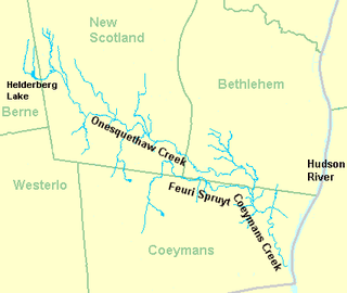
Coeymans Creek is a 7.3-mile-long (11.7 km) tributary of the Hudson River in Albany County, New York in the United States.

Hannacrois Creek is a 20.9-mile-long (33.6 km) tributary to the Hudson River in the U.S. state of New York. From its source in Westerlo it flows through Dunbar Hollows and over Dickinson Falls to the Alcove Reservoir. It then passes through Coeymans Hollow and just into Greene County to its mouth at the Hudson River in Coeymans, New York.

Kinderhook Creek is a 49.0-mile-long (78.9 km) tributary to Stockport Creek, an inlet of the Hudson River in the United States. From its source in Hancock, Massachusetts, the creek runs southwest through the Taconic Mountains into Rensselaer County, New York, and then into Columbia County. It flows through the towns of Stephentown, New Lebanon, Nassau, Chatham, Kinderhook and Stuyvesant to its mouth at Stockport Creek in the town of Stockport.
The Wynants Kill is a 15.8-mile-long (25.4 km) stream which has its source at Glass Lake near Averill Park, New York, and terminates at the Hudson River at Troy, New York.

The Verkeerder Kill, sometimes Verkeerderkill and locally shortened to Kaidy Kill is an 8-mile-long (13 km) stream in Ulster County, New York, United States. It rises on the Shawangunk Ridge, in the town of Wawarsing, and flows southwards through the town of Shawangunk, toward the Shawangunk Kill, itself a major tributary of the Wallkill River. Ultimately it is a part of the Hudson River's watershed.

The Maritje Kill is a tributary of the Hudson River in Hyde Park, New York. Its source is three miles northeast of the village of Hyde Park, and it enters the Hudson at the Hyde Park campus of the Culinary Institute of America (CIA). The river's name uses an old Dutch version of the given name Marietje, meaning "little Mary". It is one of two major waterways in Hyde Park, and flows north to south through the town.

The Saw Kill is a 14.3-mile-long (23.0 km) tributary of the Hudson River, called the Metambesem by the Algonquin people of the area and sometimes called Sawkill Creek today. It rises in the town of Milan and drains a 22-square-mile (57 km2) area of northwestern Dutchess County, New York, that includes most of the town of Red Hook to the west and part of Rhinebeck to Red Hook's south.
References
- ↑ U.S. Geological Survey Geographic Names Information System: Sawyer Kill
- ↑ U.S. Geological Survey. National Hydrography Dataset high-resolution flowline data. The National Map, accessed October 3, 2011
- ↑ Old Dutch Place Names from www.ancestry.com.