Southeast, New York

Last updated

Southeast, New York
Town of Southeast
Bog Brook Reservoir.jpg
Bog Brook Reservoir
Southeast, NY Seal.png
Putnam County New York incorporated and unincorporated areas Southeast highlighted.svg
Location of Southeast, New York
Coordinates: 41°24′N73°36′W / 41.400°N 73.600°W / 41.400; -73.600
Country United States
State New York
County Putnam
Area
[1]
  Total34.98 sq mi (90.60 km2)
  Land31.73 sq mi (82.19 km2)
  Water3.25 sq mi (8.41 km2)
Elevation
338 ft (103 m)
Population
 (2020)
  Total18,058
  Estimate 
(2022)[ citation needed ]
Increase2.svg 18,118
  Density572.51/sq mi (221.05/km2)
Time zone UTC-5 (Eastern (EST))
  Summer (DST) UTC-4 (EDT)
ZIP code
10509
Area code 845
FIPS code 36-68924
GNIS feature ID0979507
Website www.southeast-ny.gov

Southeast is a town in Putnam County, New York, United States, so named for its location in the southeastern corner of the county. The population was 18,058 at the 2020 census. [2] The town as a whole is informally referred to as Brewster, the town's principal settlement;[ according to whom? ] the latter is also an incorporated village within the town's borders. Interstate 84, Interstate 684, U.S. Route 202, US Route 6, and NY 22 are the primary routes through the town.

Contents

History

A 1799 map of Connecticut which shows The Oblong. From Low's Encyclopaedia. LowsCTmap.jpeg
A 1799 map of Connecticut which shows The Oblong. From Low's Encyclopaedia.

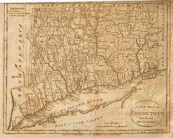
The first settler arrived circa 1730. The area first exploited was called "The Oblong," and was outside of the land claimed by the Philipse Patent. Due to a border dispute between New York and Connecticut, the area between the undisputed border of New York and the undisputed border of Connecticut was an approximately 4-mile-wide (6 km) area which ran the full north-south dimension along the state line, in what are now Westchester, Putnam, Dutchess, and Columbia Counties. This was called the Oblong. Land was sold in this area, both by the governor of New York and the King of England for Connecticut, with conflicting deeds. The boundary was settled in New York's favor by the 1731 Treaty of Dover.

A small portion of the Oblong, namely the portion in the Philipse Patent (now Putnam County), was alternately known as Southeast as it was the southeasternmost town in Dutchess County. It consisted of the four-mile-wide section of land along the Connecticut border, going the full north-south dimension of what is now Putnam County, i.e. the eastern part of the current town of Patterson, and the eastern part of the current town of Southeast. The western parts of those two current towns were part of the large Phillipse Patent which had not yet been divided into towns.

The most heavily settled areas of the "Oblong" version of Southeast were the "city" of Frederickstown, now the hamlet of Patterson, and the area called Sodom. This version of Southeast was founded in 1788, and formed the southeast corner of Dutchess County. In 1795, Frederickstown, the town that had been Southeast's neighbor, was divided into the present towns of Carmel, Kent, and Patterson, the latter two known at first as "Frederick" and "Franklin", and at the same time, Southeast lost its northern half to Patterson, and expanded to the west to become the shape it is now. Putnam County split from Dutchess in 1812. The most densely populated area in the town today is the village of Brewster.

Post offices

The first "South East" post office was established in 1797, when the town was still a municipality in Dutchess County. [3] On June 12, 1812, the county of Putnam was established from six Dutchess County towns: Carmel, Kent, Patterson, Philipstown, Putnam Valley and Southeast. [4] These two dates provide a frame of reference for the dates of operation of each Southeast post office.

Before the establishment of centralized post offices, local offices were established in general stores, railroad depots and other public venues in densely populated areas. In Southeast, there were nine individual post offices, each with distinctive postmarks: [5]

By September 1968, the last of these local offices was closed, and the only post office for the town of Southeast and village of Brewster was located at 20 Main Street with the postmark "Brewster, New York 10509". [5] In the 1990s this USPS branch relocated to 3 Mount Ebo Road in the Doansburgh section of Southeast, no longer in the village of Brewster, but retained the "Brewster 10509" name and ZIP code.

Geography

Interstates 84 and 684 meet in Southeast Interstate 684 - New York - 4290005865.jpg
Interstates 84 and 684 meet in Southeast

According to the United States Census Bureau, the town has a total area of 35.0 square miles (91 km2), of which 32.1 square miles (83 km2) is land and 2.9 square miles (7.5 km2), or 8.35%, is water. The town contains several reservoirs that supply New York City.

The eastern town line borders Fairfield County, Connecticut, and the southern town boundary borders northern Westchester County.

The windmill at Tilly Foster Farm Windmill 800.jpg
The windmill at Tilly Foster Farm

Metro-North Railroad's Brewster station and Southeast station serve the town, and are located on the Harlem Line. From Southeast, express trains to Grand Central Terminal take about 80 minutes.

Demographics

Historical population
CensusPop.Note
1820 1,909
1830 2,0427.0%
1840 1,910−6.5%
1850 2,0798.8%
1860 2,35013.0%
1870 2,075−11.7%
1880 3,50068.7%
1890 4,08216.6%
1900 2,843−30.4%
1910 3,28215.4%
1920 3,260−0.7%
1930 3,5037.5%
1940 4,05315.7%
1950 4,3888.3%
1960 6,84456.0%
1970 9,90144.7%
1980 11,41615.3%
1990 14,92730.8%
2000 17,31616.0%
2010 18,4046.3%
2020 18,058−1.9%
U.S. Decennial Census [6]

As of the census of 2020, there were 18,058, 7,058 households, and 6,516 families residing in the town. The racial makeup of the town was 71.95% White, 0.027% African American, 0.69% Native American, 2.65% Asian, 0.04% Pacific Islander, 10.3% from other races, and 11.6% from two or more races. Hispanic or Latino of any race were 0.239% of the population. [2]

There were 6,516 households, out of which 22.0% had children under the age of 18 living with them, 59.6% were married couples living together, 23.5% had a female householder with no husband present, and 13.4% had a male householder with no wife present. 77.1% of all households were made up of individuals, and 17.3% had someone living alone who was 65 years of age or older. The average household size was 2.77 and the average family size was 3.18. [2]

Tilly Foster Farm Tilly Foster Farm 2004.JPG
Tilly Foster Farm

In the town, the population was spread out, with 27.1% under the age of 18, 22.0% from 18 to 24, 78.0% from 25 to 64, and 17.3% who were 65 years of age or older. The median age was 41.9 years. [2]

The median income for a household in the town was $104,167, and the median income for a family was $119,232. About 5.2% of the population were below the poverty line, including 5.8% of those under age 18 and 2.6% of those age 65 or over. [2]

Government

Southeast is governed by a town board. Southeast town hall is located on New York State Route 22 in Brewster, New York. Law enforcement services for Southeast are provided by the New York State Police and the Putnam County sheriff's office. The village of Brewster has its own police department.

Communities and locations in Southeast

Notable people

Related Research Articles

<span class="mw-page-title-main">Dutchess County, New York</span> County in New York, United States

Dutchess County is a county in the U.S. state of New York. As of the 2020 census, the population was 295,911. The county seat is the city of Poughkeepsie. The county was created in 1683, one of New York's first twelve counties, and later organized in 1713. It is located in the Mid-Hudson Region of the Hudson Valley, north of New York City.

<span class="mw-page-title-main">Putnam County, New York</span> County in New York, United States

Putnam County is a county located in the U.S. state of New York. As of the 2020 census, the population was 97,668. The county seat is Carmel. Putnam County was formed in 1812 from Dutchess County and is named for Israel Putnam, a hero in the French and Indian War and a general in the American Revolutionary War.

<span class="mw-page-title-main">Milan, New York</span> Town in New York, United States

Milan is a town in Dutchess County, New York, United States. The town is in the northern part of the county and is very rural. As of the 2020 census it had a population of 2,245, slightly down from 2,370 in 2010. Milan is located approximately 90 miles (140 km) north of New York City, 60 miles (97 km) south of Albany, and 150 miles (240 km) west of Boston. It is bordered by Rhinebeck and Red Hook to the west, Pine Plains to the east, Stanford to the southeast, Clinton to the south, and Gallatin to the north by Columbia County. The only major route in the town is the historic Taconic State Parkway, though NY 199 serves as the main local thoroughfare.

<span class="mw-page-title-main">North East, New York</span> Town in New York, United States

North East is a town in Dutchess County, New York, United States. The population was 3,031 at the 2020 census. The town is in the northeastern corner of the county. U.S. Route 44 crosses the town.

Lebanon is a town in Madison County, New York state, United States. The population was 1,332 at the 2010 census. The town is believed to be named after Lebanon, Connecticut.

<span class="mw-page-title-main">Carmel, New York</span> Town in New York, United States

Carmel is a town in Putnam County, New York, United States. As of the 2020 United States census, the town had a population of 33,576.

<span class="mw-page-title-main">Kent, New York</span> Town in New York, United States

Town of Kent is a town in Putnam County, New York, United States. The population was 12,900 at the 2020 census. The name is that of an early settler family. The town is in the north-central part of the Putnam County. Many of the lakes are reservoirs for New York City.

<span class="mw-page-title-main">Patterson, New York</span> Town in New York, United States

Patterson is a town in Putnam County, New York, United States. The town is in the northeastern part of the county. Interstate 84 passes through the southwestern section of the town. The population was 11,541 at the 2020 census. The town is named after early farmer Matthew Paterson. The reason Patterson was spelled with two "t"s was due to the looseness with which Paterson spelled his own last name.

<span class="mw-page-title-main">Philipstown, New York</span> Town in New York, United States

Philipstown is a town located in the western part of Putnam County, New York, United States. The population was 9,831 at the 2020 census.

<span class="mw-page-title-main">Peach Lake, New York</span> CDP in New York, United States

Peach Lake is a hamlet located mostly in the town of Southeast in Putnam County, New York, United States; a portion of the CDP is in the town of North Salem in Westchester County. As of the 2010 census, the population was 1,629.

<span class="mw-page-title-main">Pawling (town), New York</span> Town in New York, United States

Pawling is a town in Dutchess County, New York, United States. Its population was 8,012 at the 2020 census. The town is named after Catherine Pauling, the daughter of Henry Beekman, who held the second largest land patent in the county. The town is in the southeastern part of the county, and contains a village of the same name.

<span class="mw-page-title-main">Interstate 684</span> Interstate Highway in New York and Connecticut

Interstate 684 (I-684) is a 28.47-mile (45.82 km) auxiliary Interstate Highway in the state of New York in the United States. There is also a short portion in Connecticut with no junctions. The highway connects I-84 with I-287 and the Hutchinson River Parkway, primarily serving commuter traffic to and from the northern suburbs of the New York metropolitan area. Most of the route is in northern Westchester County. The route of the highway was originally designated as part of I-87 from 1968 to 1970. The first section of the roadway opened to traffic in October 1968, and the final segment was completed in December 1974.

<span class="mw-page-title-main">New York State Route 55</span> State highway in southern New York, US

New York State Route 55 (NY 55) is a 122.45-mile-long (197.06 km) east-west state highway in southern New York, running from the Pennsylvania state line at the Delaware River in Barryville to the Connecticut state line at Wingdale. It is the only other state highway beside NY 7 to completely cross the state, from border to border, in an east–west direction, although NY 17 does so and is partially east–west. It also forms a concurrency when it joins US 44 for 33 miles (53 km).

<span class="mw-page-title-main">New York State Route 292</span> Highway in New YorkState highway in New York, US

New York State Route 292 (NY 292) is a short 7.58-mile-long (12.20 km) state highway in the Hudson Valley of New York in the United States, bridging Putnam and Dutchess counties. The southern terminus of the route is at an intersection with NY 311 in the town of Patterson, and the northern terminus is at a junction with NY 55 in the town of Pawling. NY 292 traverses mostly rural areas as it heads northwestward through Patterson and Pawling. Along the way, NY 292 passes along the southern and western edges of Whaley Lake.

<span class="mw-page-title-main">New York State Route 311</span> State highway in Putnam County, New York, US

New York State Route 311 (NY 311) is a state highway located entirely within Putnam County, New York, in the United States. It begins at NY 52 in Lake Carmel, and intersects Interstate 84 (I-84) shortly thereafter. It crosses NY 164 and NY 292 as it heads into the northeastern part of the county, finally curving east to reach its northern terminus at NY 22 just south of the Dutchess County line. The route passes several historical sites.

<span class="mw-page-title-main">New York State Route 312</span> State highway in Putnam County, New York, US

New York State Route 312 (NY 312) is a short state highway connecting U.S. Route 6 (US 6) and NY 22 within the town of Southeast in Putnam County, New York. It allows indirect access to the village of Brewster from Interstate 84 (I-84), and is often heavily used by local residents at rush hour in preference to the more complicated nearby access to I-684. The western terminus of the route is at US 6 roughly 2 miles (3.2 km) northwest of Brewster, and the eastern is in the hamlet of Sears Corners.

<span class="mw-page-title-main">East Branch Reservoir</span> Reservoir in Putnam County, New York

East Branch Reservoir, is a reservoir in the town of Southeast, New York, near the village of Brewster. Part of the New York City water supply system, it was formed by impounding the East Branch of the Croton River. Forming part of the Croton Watershed, it was placed into service in 1891, and lies some 35 miles (56 km) north of the city, in the southeast corner of Putnam County.

The Great Swamp in eastern Putnam and Dutchess counties is one of the largest wetlands in the U.S. state of New York.

<span class="mw-page-title-main">East Branch Croton River</span> River in the U.S. state of New York

The East Branch Croton River is a tributary of the Croton River in Dutchess, Putnam, and Westchester counties in the state of New York. It lies within the Croton River watershed and is part of the New York City water supply system's Croton Watershed.

<span class="mw-page-title-main">Philipse Patent</span> British royal patent for land on the Hudson River

The Philipse Patent was a British royal patent for a large tract of land on the east bank of the Hudson River about 50 miles north of New York City. It was purchased in 1697 by Adolphus Philipse, a wealthy landowner of Dutch descent in the Province of New York, and in time became today's Putnam County.

References

  1. "2016 U.S. Gazetteer Files". United States Census Bureau. Retrieved July 5, 2017.
  2. 1 2 3 4 5 "Explore Census Data". data.census.gov. Retrieved April 27, 2022.
  3. The History of Putnam County, New York. 1886. Reprinted by the Landmarks Preservation Committee of the Southeast Museum, Brewster, New York 1975
  4. The History of Putnam County, N.Y.; with an enumeration of its towns, villages, rivers, creeks, lakes, ponds, mountains, hills and geological features, local traditions and short biographical sketches of early settlers, etc. by William J. Blake, Esq., counselor-at-law ; New York 1849
  5. 1 2 New York Postal History: The Post Offices and First Postmaster from 1775 to 1980 by John L. Kay and Chester M. Smith, Jr., American Philatelic Society, 1982
  6. "Census of Population and Housing". Census.gov. Retrieved June 4, 2015.
  7. Kozinn, Allan (August 8, 2003). "Julius Baker, Principal Flutist Of Philharmonic, Dies at 87". The New York Times.
  8. "Juilliard | the Juilliard Journal Online". Archived from the original on May 15, 2008. Retrieved May 25, 2009.