
Fultonville is a village in Montgomery County, New York, United States. The village is named after Robert Fulton, inventor of the steamboat.

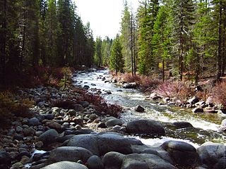
The Clavey River is a tributary of the Tuolumne River in the Sierra Nevada, located in the Stanislaus National Forest and Tuolumne County, California. The river is 31.3 miles (50.4 km) long, and is one of the few undammed rivers on the western slope of the Sierra. Via the Tuolumne River, the Clavey is part of the San Joaquin River watershed.

Canadarago Lake is a 1,917-acre (7.76 km2) lake located in Otsego County, New York and is the source of Oaks Creek. The Village of Richfield Springs is located at the lake's northern end. It is the second largest lake in Otsego County, lying to the west of and parallel to the larger Otsego Lake. The lake's name is also spelled "Candajarago Lake" or "Caniadaraga Lake".

Honeoye Creek is a tributary of the Genesee River in western New York in the United States. The name Honeoye is from the Seneca word ha-ne-a-yah, which translates to "lying finger", or "where the finger lies". The name refers to the local story of a Native American who had his finger bitten by a rattlesnake and therefore cut off his finger with a tomahawk.

Oil Creek is a 46.7-mile (75.2 km) tributary of the Allegheny River in Venango and Crawford counties in the U.S. state of Pennsylvania. It has a drainage area of 319 square miles (830 km2) and joins the Allegheny at Oil City. Attractions along the river include the Drake Well Museum and Oil Creek State Park. The stream was named after the oil that was found along its banks before the historic oil strike by Edwin Drake in Titusville, which Oil Creek flows through. Oil Creek is popular with canoeists and fishers. The creek is rated as a beginners creek for those interested in learning how to safely use canoes and kayaks. Oil Creek is a cold water fishery with bass and trout living in its waters.
New York State Route 30A (NY 30A) is a 34.86-mile-long (56.10 km) state highway in the Capital District of New York in the United States. It serves as a westerly alternate route of NY 30 from near the Schoharie County village of Schoharie to the Fulton County hamlet of Riceville, 1 mile (1.6 km) south of the village of Mayfield. While NY 30 heads generally north–south between the two locations and passes through Amsterdam, NY 30A veers west to serve the villages of Fonda and Fultonville and the cities of Johnstown and Gloversville. Along the way, it connects to several major east–west highways, including U.S. Route 20 (US 20) in Esperance and the New York State Thruway in Fultonville.
New York State Route 334 (NY 334) is a north–south state highway in the Mohawk Valley region of New York in the United States. It extends for 5.96 miles (9.59 km) from an intersection with NY 5 in the village of Fonda to a junction with NY 67 in the town of Johnstown. The highway is two lanes wide for its entire length, with the exception of a long climbing lane northbound leaving the hamlet of Sammonsville, located 1.5 miles (2.4 km) southwest of NY 67.

The Fonda, Johnstown and Gloversville Railroad (FJ&G) was formerly a 132-mile steam engine and electric interurban railroad that connected its namesake towns in east central New York State to Schenectady, New York. It had a successful and profitable transportation business from 1870 until the 1980s carrying workers, salesmen, and executives of the very large number of glove manufacturing companies in the area to the New York Central (NYC) station at Schenectady. From here they could catch trains south to New York City (NYC) or west to Chicago. It also handled freight and had freight interchange with both the New York Central and the Delaware and Hudson railroads. Passenger business declined starting before the Great Depression and particularly during it. Following a determined and expensive effort to recapture passenger business by acquiring five ultra modern high-speed Bullet interurban cars in 1932, the FJ&G abandoned passenger service in 1938. Freight business continued on for a few more decades, was later taken over by the Delaware and Otsego Railroad management and then eventually abandoned.

Oaks Creek is a river that drains Canadarago Lake, which is situated in the north central region of Otsego County, New York. The creek begins by the Hamlet of Schuyler Lake and flows southeast approximately 9.32 miles (15.00 km), dropping only 105 feet (32 m) in elevation, before converging with the Susquehanna River south of the Village of Cooperstown, by the Hamlet of Index. From the source to Oaksville the creek flows along Panther Mountain. Fly Creek is a main tributary, that converges with Oaks Creek south of the Hamlet of Fly Creek.
Otsquago Creek is a river that enters the Mohawk River in Fort Plain, New York. Otsquago is a Mohawk Indian word meaning 'under the bridge,' probably referring to an early bridge of felled trees along the creek, a way of making small bridges. It is also referred to as Otsquage on old maps, which is an Indian word for 'healing waters'.

The Canajoharie Creek is a river that flows into the Mohawk River in the Village of Canajoharie in the U.S. State of New York. The name "Canajoharie" is a Mohawk language term meaning "the pot that washes itself", referring to the "Canajoharie Boiling Pot", a 20-foot (6.1 m) wide and 10-foot (3.0 m) deep pothole in the Canajoharie Creek, just south of the village of Canajoharie. Bowmans Creek is one main tributary that enters the creek east of the Hamlet of Sprout Brook. The other main tributary is Brimstone Creek which enters the creek north-northwest of the Village of Ames.

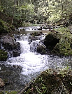
Flat Creek is a river in Schoharie and Montgomery counties in the state of New York. It begins east of Sharon Springs and flows in a general northward direction before flowing into the Mohawk River in Sprakers. Flat Creek Falls, also known as Sprakers Falls, is located on the creek by Sprakers. The indians referred to the creek as Onogerreah, and the mouth of the creek as Utlogowanke.
The Nowadaga Creek basin drains portions of the towns of Danube, Stark, and Little Falls, as well as a small portion of the town of Warren, in southern Herkimer County before converging with the Mohawk River in Indian Castle, New York. The drainage basin is approximately 49 percent forested. The creek has an average slope of 1.7 percent over its entire stream length of 10.0 miles. On a 1790 land patent map it is spelled "Inchanando Creek".
Fulmer Creek is an 11.5-mile-long (18.5 km) river that flows into the Mohawk River in Mohawk, New York. The creek derives its name from the "Fulmer" family, who bought land through the Burnetsfield patent of 1725, in which lands on the present village site were granted out.
Moyer Creek starts at Wheelock Pond near Jerusalem Hill, New York. Past Gulph, New York Moyer Creek follows a deep ravine, the Frankfort Gorge, south towards Frankfort, New York before converging with the Mohawk River in Frankfort, New York. The headwaters of Moyer Creek rise within a half mile of the source of the Unadilla River which is the most northerly headwater source of the Susquehanna and the closest to the Mohawk River.
Kayaderosseras Creek also called Kaniatarósera'as Stream flows into the Mohawk River near Fort Johnson, New York.
Cobleskill Creek starts at Pine Mountain west of West Richmondville and flows east-northeast before converging with Schoharie Creek in Central Bridge, New York. The creek flows through the villages of Richmondville and Cobleskill.
Dinkey Creek is a large stream in the southern Sierra Nevada, in Fresno County, California. The creek is 29.2 miles (47.0 km) long, flowing undammed in a southerly direction through the Sierra National Forest. It is a tributary of the North Fork Kings River, in turn part of the Kings River system which drains into the de-watered Tulare Lake bed.

