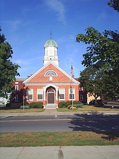
Caroga is a town in Fulton County, New York, USA. The population was 1,205 at the 2010 census. The town was named after a local creek.

The West Branch Delaware River is one of two branches that form the Delaware River. It is approximately 90 mi (144 km) long, and flows through the U.S. states of New York and Pennsylvania. It winds through a mountainous area of New York in the western Catskill Mountains for most of its course, before joining the East Branch along the northeast border of Pennsylvania with New York. Midway or so it is empounded by the Cannonsville Dam to form the Cannonsville Reservoir, both part of the New York City water supply system for delivering drinking water to the City.

Oaks Creek is a river that drains Canadarago Lake, which is situated in the north central region of Otsego County, New York. The creek begins by the Hamlet of Schuyler Lake and flows southeast approximately 9.32 miles (15.00 km), dropping only 105 feet (32 m) in elevation, before converging with the Susquehanna River south of the Village of Cooperstown, by the Hamlet of Index. From the source to Oaksville the creek flows along Panther Mountain. Fly Creek is a main tributary, that converges with Oaks Creek south of the Hamlet of Fly Creek.

Hayden Creek is a river in Otsego County, in the U.S. State of New York. It begins northeast of the Hamlet of Springfield Center and flows generally southward before flowing into Otsego Lake south of the Hamlet of Springfield Center.

Cripple Creek is a river in southern Herkimer County and northern Otsego County in the state of New York. It begins at the outlet of Weaver Lake near Warren and flows through Young Lake before flowing into Otsego Lake south of Springfield, New York. Was formally called Lawyers Creek.

The Canajoharie Creek is a river that flows into the Mohawk River in the Village of Canajoharie in the U.S. State of New York. The name "Canajoharie" is said to be a Mohawk language term meaning "the pot that washes itself," referring to the "Canajoharie Boiling Pot," a 20 feet (6.1 m) wide and 10 feet (3.0 m) deep pothole in the Canajoharie Creek, just south of the Village of Canajoharie. Bowmans Creek is one main tributary that enters the creek east of the Hamlet of Sprout Brook. The other main tributary is Brimstone Creek which enters the creek north-northwest of the Village of Ames.
The Nowadaga Creek basin drains portions of the towns of Danube, Stark, and Little Falls, as well as a small portion of the town of Warren, in southern Herkimer County before converging with the Mohawk River in Indian Castle, New York. The drainage basin is approximately 49 percent forested. The creek has an average slope of 1.7 percent over its entire stream length of 10.0 miles. On a 1790 land patent map it is spelled "Inchanando Creek".
Moyer Creek starts at Wheelock Pond near Jerusalem Hill, New York. Past Gulph, New York Moyer Creek follows a deep ravine, the Frankfort Gorge, south towards Frankfort, New York before converging with the Mohawk River in Frankfort, New York. The headwaters of Moyer Creek rise within a half mile of the source of the Unadilla River which is the most northerly headwater source of the Susquehanna and the closest to the Mohawk River.
Crum Creek also called Cathatachua Creek flows into the Mohawk River in East Creek, New York.
Cayadutta Creek flows into the Mohawk River near Fonda, New York. The Indian meaning of Cayadutta is "rippling waters" or "shallow water running over stones". This stream has commercial and historical importance as the cities of Johnstown and Gloversville lie on its banks.
Kayaderosseras Creek also called Kaniatarósera'as Stream flows into the Mohawk River near Fort Johnson, New York.
Dove Creek flows into the Mohawk River near Amsterdam, New York.
Bunn Creek flows into the Mohawk River in Amsterdam, New York.
North Chuctanunda Creek flows into the Mohawk River in Amsterdam, New York. Variant names include Chucttonaneda Creek, Jutalaga, North Chaughtanoonda Creek, North Chuctenunda Creek, and Ouctanunda Creek.
Degraff Creek flows into the Mohawk River in Amsterdam, New York.
Chaughtanoonda Creek flows into the Mohawk River in Hoffmans, New York.

East Caroga Lake is located in the Town of Caroga by Caroga Lake, New York. The lake provides excellent warm water fishing and rainbow trout fishing. The lake is connected to West Caroga Lake by a small channel. Origin of the name, "Caroga" is derived from the once nearby Indian Village known as "Caroga".

West Caroga Lake is located in the Town of Caroga by Caroga Lake, New York. The lake is known for excellent warm water fishing, but it also offers the only location to fish for splake in the county. The lake is connected to East Caroga Lake by a small channel. Origin of the name, "Caroga" is derived from the once nearby Indian Village known as "Caroga".

Sprite Creek is a river in Fulton County and Herkimer County in the U.S. State of New York. It begins at Canada Lake northwest of the Hamlet of Caroga Lake, and flows through Lily Lake before converging witn the East Canada Creek northeast of the Village of Dolgeville.
Peck Creek flows into the Caroga Creek near Northbush, New York.


