Warwick, New York

Last updated

Warwick, New York
Town of Warwick
Warwick, NY, town hall.jpg
Warwick Town Hall
Warwick, New York (Town) Flag.png
Warwick, New York (Town) Seal.png
Orange County New York incorporated and unincorporated areas Warwick highlighted.svg
Location in Orange County and the state of New York
USA New York location map.svg
Red pog.svg
Warwick, New York
Location within the state of New York
Usa edcp location map.svg
Red pog.svg
Warwick, New York
Warwick, New York (the United States)
Coordinates: 41°15′40″N74°21′19″W / 41.26111°N 74.35528°W / 41.26111; -74.35528
CountryFlag of the United States.svg  United States
State Flag of New York.svg  New York
County Orange
Incorporated1789
Government
  Town SupervisorJesse Dwyer
Area
[1]
  Total104.87 sq mi (271.61 km2)
  Land101.29 sq mi (262.33 km2)
  Water3.58 sq mi (9.28 km2)
Elevation
538 ft (164 m)
Population
 (2020)
  Total32,027
  Density310/sq mi (120/km2)
Time zone UTC−5 (EST)
  Summer (DST) UTC−4 (EDT)
ZIP Code
10990
Area code 845
FIPS code 36-78366 [2]
GNIS feature ID0979600 [3]
Website www.townofwarwick.org

Warwick is a town in the southwestern part of Orange County, New York, United States. Its population was 32,027 at the 2020 census. The town contains three villages (Florida, Greenwood Lake, and Warwick) and eight hamlets (Amity, Bellvale, Edenville, Little York, Wisner, New Milford, Pine Island, and Sterling Forest).

Contents

History

Warwick station, c. 1910 Warwick NY.png
Warwick station, c. 1910

In the early 1700s, one of the original patent holders, Benjamin Aske, named his land "Warwick", presumably after an area of England near his original ancestral home. He began to sell it off to settlers in 1719. His first parcel of land, 100 acres, was sold to Lawrence Decker. Other familiar family names of the Valley appeared in subsequent years. The European population of the valley grew rapidly from 1730 to 1765, and the previously existing populations of indigenous native people declined as forests and land were cleared for pasture and were re-organized. By the start of the American Revolution, almost all of the native population had disappeared in various ways. [4] The region has been referred to as Warwick since the early eighteenth century, but a governmental form for a town named Warwick was officially created in 1788. [5]

During the American War for Independence, Warwick was the site of a Continental Army encampment. The Hudson River Chain was forged at Sterling Iron Works in Warwick, preventing the British Navy from sailing up the Hudson River. In 1783, George Washington traveled through Warwick, stopping at Baird's Tavern and spending the night in the home of John Hathorn.

Perspective map of Warwick from 1887 with list of landmarks by L.R. Burleigh Warwick, N.Y. 1887. LOC 75694866.tif
Perspective map of Warwick from 1887 with list of landmarks by L.R. Burleigh

Warwick is situated along a freight rail line, which, as it did with many other towns in Orange County (such as Goshen, Middletown, and Newburgh), contributed to the growth of the area. The nineteenth-century writer and naturalist Henry William Herbert, writing as Frank Forrester, popularized the area with his 1845 book, "The Warwick Woodlands". [6] Today, the town of Warwick is a rural community with many agricultural pursuits that stimulate its economy.[ citation needed ]

Geography

View of the Warwick Valley from Mt. Peter Bellvale, NY - Warwick Valley Panorama.jpg
View of the Warwick Valley from Mt. Peter

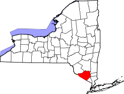
The town of Warwick comprises much of the southern tip of Orange County. It borders the townships of Vernon and West Milford to the south, both in the state of New Jersey. To its north, Warwick is bordered by Chester via Sugar Loaf, Orange County's oldest hamlet, antedating both Warwick and Chester, and which was part of Warwick until the mid-nineteenth century. To its east, Warwick is bordered by the town of Tuxedo, home of the New York Renaissance Faire, and the hamlet of Tuxedo Park.

According to the United States Census Bureau, the town is the second largest township in New York State and has a total area of 104.9 square miles (271.6 km2), of which 101.7 square miles (263.3 km2) is land and 3.2 square miles (8.3 km2) (3.04%) is water. Greenwood Lake is Orange County's largest lake, and it is bisected by the border between New Jersey (to the south) and New York (on its north). Glenmere Lake, an extremely critical endangered species habitat, is bisected by Warwick and Chester.

Warwick is served by Warwick Municipal Airport and two regional state highways, New York State Route 17A (NY 17A) and NY 94. The Appalachian Trail passes through Warwick, which has been designated an Appalachian Trail Community. [7]

Climate

MonthJanFebMarAprMayJunJulAugSepOctNovDecYear
Mean daily maximum °F (°C)35
(2)
38
(3)
47
(8)
61
(16)
70
(21)
78
(26)
83
(28)
81
(27)
75
(24)
63
(17)
51
(11)
40
(4)
60
(16)
Mean daily minimum °F (°C)17
(−8)
18
(−8)
26
(−3)
37
(3)
47
(8)
55
(13)
60
(16)
59
(15)
51
(11)
40
(4)
31
(−1)
23
(−5)
39
(4)
Average precipitation inches (mm)3.1
(79)
2.6
(66)
3.6
(91)
4.0
(100)
4.0
(100)
4.4
(110)
3.8
(97)
4.3
(110)
4.2
(110)
3.7
(94)
3.6
(91)
3.4
(86)
44.7
(1,134)
Average snowfall inches (cm)12.2
(31)
9.4
(24)
6.7
(17)
1.2
(3.0)
0.0
(0.0)
0.0
(0.0)
0.0
(0.0)
0.0
(0.0)
0.0
(0.0)
0.0
(0.0)
1.6
(4.1)
7.8
(20)
38.9
(99.1)
Average precipitation days (≥ 0.01 in)76889978767789
Mean daily daylight hours 9.510.512.013.014.515.015.014.012.511.010.09.512.2
Source: NOAA/Google [8]

Demographics

Historical population
CensusPop.Note
1820 4,506
1830 5,01311.3%
1840 5,1132.0%
1850 4,902−4.1%
1860 4,628−5.6%
1870 5,73623.9%
1880 5,699−0.6%
1890 6,0005.3%
1900 6,4036.7%
1910 7,14111.5%
1920 7,4624.5%
1930 8,0177.4%
1940 9,36916.9%
1950 9,8284.9%
1960 12,55127.7%
1970 16,95635.1%
1980 20,97623.7%
1990 27,19329.6%
2000 30,76413.1%
2010 32,0654.2%
2020 32,027−0.1%
U.S. Decennial Census [9]

As of the census [2] of 2000, there were 30,764 people, 10,868 households, and 7,955 families residing in the town. The population density was 302.6 inhabitants per square mile (116.8/km2). There were 11,818 housing units at an average density of 116.2 per square mile (44.9/km2). The racial makeup of the town was 91.06% White, 4.51% Black or African American, 0.31% Native American, 0.85% Asian, 0.05% Pacific Islander, 1.60% from other races, and 1.61% from two or more races. Hispanic or Latino of any race were 6.47% of the population.

There were 10,868 households, of which 38.5% had children under the age of 18 living with them, 61.7% were married couples living together, 8.6% had a female householder with no husband present, and 26.8% were non-families. 22.0% of all households were made up of individuals, and 9.1% had someone living alone who was 65 years of age or older. The average household size was 2.74 and the average family size was 3.25.

In the town, the population was spread out, with 27.2% under the age of 18, 5.6% from 18 to 24, 31.3% from 25 to 44, 24.6% from 45 to 64, and 11.3% who were 65 years of age or older. The median age was 38 years. For every 100 females, there were 100.7 males. For every 100 females age 18 and over, there were 98.2 males.

Education

The Warwick Valley Central School District serves as the public school system for Warwick residents and residents of the southern portion of the town of Chester. The Greenwood Lake Union Free School District serves the residents of Greenwood Lake, with the GWL Elementary School and GWL Middle School; students have a choice of Chester Academy or Warwick Valley High School for their high school education. The Florida NY Union Free School District serves the residents of Florida, NY, with Golden Hill Elementary School and S.S.Seward Institute.

Festivals

Applefest is an annual outdoor festival attracting as many as 35,000 people each year in October. [10]

The Hudson Valley Jazz Festival, originally named the Warwick Valley Jazz Festival, takes place during the summer. [11] [12]

The annual George Washington Celebration is a tradition that celebrates when the Founding Father, Gen. George Washington, came to Warwick and enjoyed a grog with his men in Baird's Tavern. This free community-wide tradition takes place in July, and is carried on by the Historical Society of the Town of Warwick, also known as the Warwick Historical Society, a nonprofit organization dedicated to Warwick since its inception in 1906. George Washington Day is a fun-filled community tradition with free public historic property tours throughout the afternoon. [13]

Transportation

Warwick is served by the 196 and 197 buses to Manhattan (operated by New Jersey Transit). It is also served by the Warwick inter-municipal bus. [14] [15]

Communities and locations in the town of Warwick

Notable people

See also

Related Research Articles

<span class="mw-page-title-main">Orange County, New York</span> County in New York, United States

Orange County is a county located in the U.S. state of New York. As of the 2020 census, the population was 401,310. The county seat is Goshen. This county was first created in 1683 and reorganized with its present boundaries in 1798. The county is part of the Hudson Valley region of the state.

<span class="mw-page-title-main">Florida, Orange County, New York</span> Village in New York, United States

Florida is a village in Orange County, New York, United States. The population was 3,049 as of the 2020 census. It is part of the Poughkeepsie-Newburgh-Middletown Metropolitan Statistical Area as well as the larger New York–Newark–Bridgeport, NY-NJ-CT-PA Combined Statistical Area. The village is located in the town of Warwick, with two small northern portions in the town of Goshen. Florida is at the convergence of Routes 17A and 94.

<span class="mw-page-title-main">Greenwood Lake, New York</span> Village in New York, United States

Greenwood Lake is a village in Orange County, New York, United States, in the southern part of the town of Warwick. As of the 2020 census, the population of the village was 2,994. It is part of the Poughkeepsie–Newburgh–Middletown, NY Metropolitan Statistical Area as well as the larger New York–Newark–Bridgeport Combined Statistical Area.

<span class="mw-page-title-main">Tuxedo, New York</span> Town in New York, United States

Tuxedo is a town located in Orange County, New York, United States, along the Ramapo River. As of the 2020 census, the town had a total population of 3,811. The town is in the southeastern part of the county in the Ramapo Mountains. New York State Route 17 and the New York State Thruway pass through the town. The name is derived from a Lenape word tucseto, which has several known meanings.

<span class="mw-page-title-main">Schodack, New York</span> Town in New York, United States

Schodack is a town in Rensselaer County, New York, United States. The population was 12,965 at the 2020 census. The town name is derived from the Mahican word, Escotak. The town is in the southwestern part of the county. Schodack is southeast of Albany, New York.

<span class="mw-page-title-main">Chester, Orange County, New York</span> Town in New York, United States

Chester is a town in Orange County, New York, United States. The population was 12,646 at the 2020 census. Chester contains a village, also called Chester.

<span class="mw-page-title-main">Goshen, New York</span> Town in New York, United States

Goshen is a town in Orange County, New York, United States. The population was 14,571 at the 2020 census. The town is named after the Biblical Land of Goshen. It contains a village also called Goshen, which is the county seat of Orange County. The town is centrally located in the county.

<span class="mw-page-title-main">Warwick (village), New York</span> Village in New York, United States

Warwick is a village in Orange County, New York, United States, in the southeastern section of the town of Warwick. The village's population was 6,652 at the time of the 2020 census. It is part of the New York–Newark–Bridgeport, NY-NJ-CT-PA Combined Statistical Area.

Sterling Forest, New York is a hamlet in the Town of Warwick, Orange County. It is served by an active United States post office of the same name. It is situated on the eastern shore of Greenwood Lake, at the New Jersey state line. Part of the hamlet extends into West Milford Township, Passaic County, New Jersey. The hamlet grew up around the terminal station of the Montclair and Greenwood Lake Railway, later called the New York and Greenwood Lake Railway, and later the Greenwood Lake division of the Erie Railroad. The railroad reached this point around 1875, with the station located at the state line in New Jersey. The depot complex originally contained the Sterling Forest, New Jersey post office. The post office was moved to the New York side of the line in 1926, where it continues to operate. Rail service ceased in 1935.

<span class="mw-page-title-main">Greenwood Lake</span> Reservoir, natural lake in New York / Passaic County, New Jersey

Greenwood Lake is an interstate lake approximately seven miles (11 km) long, straddling the border of New York and New Jersey. It is located in the Town of Warwick and the Village of Greenwood Lake, New York and West Milford, New Jersey. It is the source of the Wanaque River.

<span class="mw-page-title-main">New York State Route 17A</span> State highway in Orange County, New York, US

New York State Route 17A (NY 17A) is a state highway in southern New York in the United States, entirely within Orange County. Its western terminus is located in the village of Goshen at a junction with NY 17, and its eastern terminus is at another intersection with NY 17 located in Southfields. It runs concurrently with NY 94 from Warwick to Florida. It serves mainly to connect Warwick with the rest of the county. While it is an east–west route, many sections run in a more north–south orientation. Its circuitous route allows it to offer much scenery to drivers.

<span class="mw-page-title-main">New York State Route 94</span> State highway in Orange County, New York, US

New York State Route 94 (NY 94) is a state highway entirely within Orange County in southern New York. The western terminus is at the New York–New Jersey state line, where it continues as New Jersey's Route 94 for another 46 miles (74 km) to Columbia, New Jersey. Its eastern terminus is located at U.S. Route 9W (US 9W) in New Windsor. From Warwick to Florida, NY 94 is concurrent with NY 17A. The entirety of NY 94 is known as the 94th Infantry Division Memorial Highway.

<span class="mw-page-title-main">New York State Route 210</span> State highway in Orange County, New York, US

New York State Route 210 (NY 210) is a state highway in Orange County, New York, in the United States. It runs north from the New Jersey state line—where it continues south as Passaic County Route 511 (CR 511)—along the west shore of Greenwood Lake to the eponymous village of Greenwood Lake, where it ends at a junction with NY 17A. It was once much longer, as it originally extended east along NY 17A and CR 106 in Orange and Rockland counties to Stony Point when it was assigned as part of the 1930 renumbering of state highways in New York. The route was truncated to its current length in 1982. Prior to becoming NY 210 in 1930, the road alongside Greenwood Lake was part of NY 55, a route connecting New Jersey to Goshen, in the 1920s.

<span class="mw-page-title-main">County Route 106 (Rockland County, New York)</span> Highway in Rockland County, New York

County Route 106 (CR 106) is a 7.8-mile (12.6 km) east–west county route in Rockland County, New York, in the United States. It serves as an eastward continuation of Kanawauke Road, extending from the Orange County line to U.S. Route 9W (US 9W) and US 202 in Stony Point via Harriman State Park. CR 106 intersects with several county highways in Rockland County along the way. The route was only one of two in Rockland County to keep its numbering from Orange County, with the other being CR 72. CR 106 had one spur route, CR 106A, which was recently decommissioned.

<span class="mw-page-title-main">Black Dirt Region</span> Fertile agricultural area in New Jersey, USA

The Black Dirt Region is located in southern Orange County, New York and northern Sussex County, New Jersey. It is mostly located in the western section of the Town of Warwick, centered on the hamlet of Pine Island. Some sections spill over into adjacent portions of the towns of Chester, Goshen and Wawayanda in New York and parts of Wantage and Vernon, New Jersey. Before the region was drained, around 1880 by the Polish and Volga German immigrants through drainage culverts and the construction of the Delaware and Hudson Canal, it was a densely-vegetated marsh known as the "Drowned Lands of the Wallkill".

<span class="mw-page-title-main">Pine Island, New York</span> Hamlet in the town of Warwick, New York, USA

Pine Island is a hamlet in the town of Warwick in Orange County, New York, United States. It is the largest community in the Black Dirt Region, which is famous for its "black dirt onions." It gets its name from its slight elevation over the surrounding land. In the days before the nearby Wallkill River was rerouted to control flooding, it would often be an actual island for a period in the spring.

<span class="mw-page-title-main">Warwick Valley High School</span> High school in Warwick, NY, United States

Warwick Valley High School (WVHS) is located on Sanfordville Road outside the Village of Warwick, New York, United States. It educates students in grades 9 through 12 in the Warwick Valley Central School District, which covers most of the village and town of Warwick, including the hamlet of Pine Island. Students in those portions of the town near the village of Florida and the village of Greenwood Lake attend other high schools. A referendum to send students from the latter community to WVHS failed in 2007.

Amity is a hamlet in the town of Warwick, New York, United States. It is located between Edenville and Pine Island, near the New Jersey state line. Amity is served by the Amity Station of the Pine Island Fire Department. The Amity Presbyterian Society was founded in 1796 and, after 213 years, celebrated its last service on April 26, 2009. The church, located on Newport Bridge road near Amity Road, became home to Vision Community Church until December 2010. Vision moved to the Park Avenue Elementary school in Warwick, NY after the Amity property was put up for sale.

<span class="mw-page-title-main">Kiryas Joel-Poughkeepsie-Newburgh metropolitan area</span> Metropolitan statistical area in New York, United States

The Kiryas Joel-Poughkeepsie-Newburgh, NY Metropolitan Statistical Area, as defined by the United States Office of Management and Budget, is an area consisting of two counties in New York's Hudson Valley, with the municipalities of Kiryas Joel, Poughkeepsie, and Newburgh as its principal cities. As of the 2020 census, the MSA had a population of 679,221. The area was centered on the urban area of Poughkeepsie-Newburgh. Prior to July 2023, it was known as the Poughkeepsie-Newburgh-Middletown, NY Metropolitan Statistical Area; whereupon it was renamed to its current name, to reflect population changes among its largest municipalities.

<span class="mw-page-title-main">Bellvale, New York</span> Hamlet in New York, United States

Bellvale is a wooded hamlet in the town of Warwick in Orange County, New York, United States. Situated in the morning shadow of Bellvale Mountain along New York State Route 17A, Bellvale was the site of an iron forge destroyed by British Army soldiers in 1750; many of its homes and other structures date from before American independence. While close to New York City, its location in the Warwick Valley has prevented suburban development.

References

  1. "2016 U.S. Gazetteer Files". United States Census Bureau. Retrieved July 5, 2017.
  2. 1 2 "U.S. Census website". United States Census Bureau . Retrieved January 31, 2008.
  3. "US Board on Geographic Names". United States Geological Survey. October 25, 2007. Retrieved January 31, 2008.
  4. A Short History of the Warwick Valley - Dr. Richard Hull's History of Warwick. S. Gardner, July 1999. albertwisnerlibrary.org. Retrieved November 2019.
  5. U.S. Geological Survey Geographic Names Information System: Town of Warwick; retrieved, March 26, 2014
  6. Merritt, Jim (December 1996). "The Exile". Field & Stream .
  7. "Warwick to Mark Appalachian Trail Community Day". New York–New Jersey Trail Conference. June 30, 2012.
  8. "NOAA/Google" . Retrieved November 28, 2022.
  9. "Census of Population and Housing". Census.gov. Retrieved June 4, 2015.
  10. "Celebrate annual Applefest in Warwick next week". Times Herald-Record. Middletown, NY. October 1, 2009. Retrieved April 18, 2011.
  11. Sparks, Leonard (August 29, 2010). "Warwick hosts its 1st jazz festival". Times Herald-Record. Middletown, NY. Retrieved April 18, 2011.
  12. "Press". Hudsonvalleyjazzfest.org. Retrieved October 10, 2012.
  13. Visit www.warwickhistory.org for information.
  14. Countywide map transitorange.info
  15. Town Services/Bus Schedules townofwarwick.org Archived December 3, 2013, at the Wayback Machine
  16. Norton, E., Jehovah's Witnesses new world HQ nearly complete, Warwick Advertiser, published June 9, 2016, accessed July 26, 2022
  17. Kennedy, Randy. "Robert Whitman, Cutting-Edge Performance Artist, Dies at 88", The New York Times , January 20, 2024. Accessed January 21, 2024. "Robert Whitman, a pioneer of performance and multimedia art whose work tapped into primitive, nonverbal human ritual while also anticipating the fractured nature of 21st-century digital existence, died on Friday at his home in Warwick, N.Y., in the Hudson Valley. He was 88."

[1]

  1. Greenwood Lake history, Chronogram magazine, October 26, 2023: https://www.chronogram.com/hv-towns/greenwood-lake-the-liquid-playground-turns-100-19299566